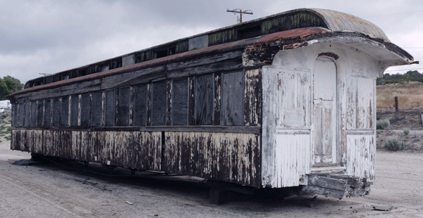
Rail Car
Summary
I walked from Campo to Mount Hood, Oregon, often paralleling the PCT. On a separate page, I list some maps that will helped me find interesting routes (Maps of the Pacific Crest Corridor).

Rail Car
Saturday, April 25, 2015
Don, Gene, and I drove to Campo, California, and visited the train museum, including a train ride west to the Mexican border. I then visited with Billygoat and Squatch at ADZPCTKO. Rain began in late afternoon and continued through the night.
Camp: ADZPCTKO
Maps: THSDBABDSP

Locomotive Steam Valves
Sunday, April 26, 2015
Judy, Dana and I ascended Los Pinos Peak and enjoyed the view from near the fenced off fire tower. After Mexican food in Campo I walked down Hauser Creek Road to .6 miles east of Salazar Canyon, and returned a mile upstream before camping. I saw a memorial to some Marines who had died fighting a fire in 1943 and remains of an old concrete flume. I missed the old campground I think is down there. There was a 14" Alligator Lizard and many Bats.
Miles: 16
Camp: Cottonwood Canyon
Maps: THSDBABDSP
Route: Corral Canyon Road, Los Pinos Road, Espinosa Trail - Hauser Canyon Trail / Road
Hauser Canyon Flume History
I found an article in the March 25, 1914 issue of Engineering and Contracting announcing that bids would be solicited within a few months for a seven mile conduit from the mouth of Hauser Canyon and leading in an easterly direction. The ditch was to be lined with 2-4" of concrete, with a few wooden trestles carrying steel flume. The drop of over 300' between Hauser Canyon and Pine and Cottonwood Creeks was to be made with 5-15' falls, as building a relatively flat ditch and hydroelectric plant was considered impractical considering the intermittant water flow. A survey with contours as little as 1' in places was in process, with the whole project under Department of Water Hydraulic Engineer H. A. Whitney.
The ditch began at the mouth of the bedrock canyon descending from the Lake Morena Dam, and continued as far down Hauser Canyon as I walked.
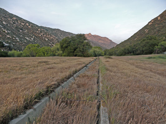
Hauser Canyon Flume
Monday, April 27, 2015
I saw a Rattlesnake, Alligator Lizards, Quail, and Red Tail Hawks. There were mine tunnels, ore cart rails, and much quartz at the Pacific Mine. The view from Morena Butte was excellent. Though I walked through the Corral Canyon area, I saw only one ATV. He made enough noise and dust for 10, though. I removed a small tick.
Miles: 31 47
Camp: Espinosa Trail
Maps: THSDBABDSP
Route: Cottonwood Canyon, Hauser Canyon, PCT, Pacific Mine, Morena Butte, 17s04\6 Skye Valley Road, Bronco Flats, Stokes Valley, Corte Madera Road Skye Valley is blocked by gates / no trespass signs.
Tuesday, April 28, 2015
Water was flowing in both crossings of Pine Creek and in Nelson Creek.
Pine Creek Flume History
The never finished flume in Pine Canyon was built circa 1895 to move water from a reservoir in Pine Valley over the divide to King Creek, a tributary of the San Diego River.
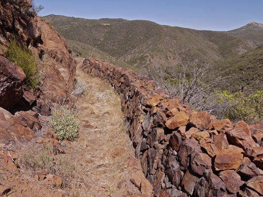
Pine Creek Flume
Two Turkey Vultures began circling over me during a lunch break. Perhaps my smell after days of hiking in hot sun and rain was just too tempting. I thought the omen was over when they flew off, but they gathered up a couple of friends and returned. But I wasn't ready to be lunch just yet...
When I called my parents, I heard someone had gone into their garage in the night, found a pair of loppers, and sliced through a copper water pipe. And left the water spraying all over. Then some nice person went in the garage, found the right valve, and stopped the big leak. Now my parents need to hire a plumber to seal up the pipes...
Miles: 24 71
Motel: Pine Valley
Maps: THSDBABDSP
Route: Espinosa Trail, Secret Canyon Trail
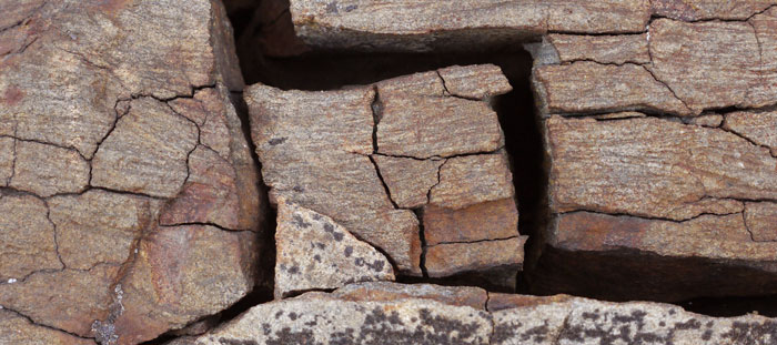
Cracked Rock
Wednesday, April 29, 2015
Pine Valley Creek was flowing well along much of the Noble Canyon Trail. There were many good campsites. I've seen many V22 Ospreys on this trip. I saw a Rattlesnake and a Garter Snake. I saw two clusters of San Diego Woolly Sunflowers. The first was a few hundred plants within 50 yards of a gps point. The second was atop Garnet Peak, a few thousand plants in perhaps a circle between two gps points. I think Woollies thrive on north facing slopes a few years after a fire. It would be interesting to verify this if I can get the fire burn area data. A few scattered Woollies grew all along today's PCT section. Good weather is predicted for ten days or so.
Miles: 24 95
Camp: Beyond Pioneer Mail, old highway grade
Maps: THSDBABDSP
Route: Roads, Noble Canyon Trail, PCT
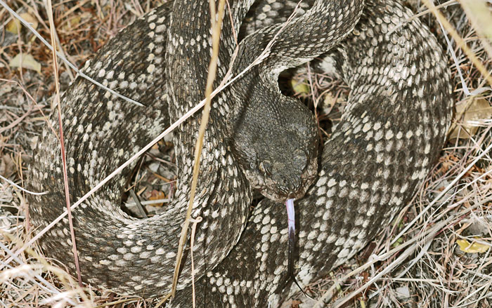
Rattlesnake
Thursday, April 30, 2015
I saw a Horned Lizard. One cluster of Woolly Sunflowers extended 50 yards around a gps point and had about 200 plants. The patch east of Rodriguez Spur Fire Tank, which I observed on previous hikes, was down to about 8 living plants. There was water at the Solar Well, Rodriguez Spur Fire Tank, and Scissors Crossing Cache.
Miles: 26 121
Camp: Beyond Scissors Crossing
Maps: THSDBABDSP
Route: PCT, spur to Solar Well, PCT, MVTT, PCT
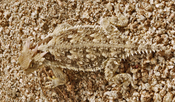
Horned Lizard
Friday, May 1, 2015
I saw a black and white banded glossy King Snake. I took a picture of some old dirt roads descending from the Volcan Ridgeline. Perhaps one will someday be part of the San Dieguito River Trail. I found an excellent avocado on the trail. Bummer for some other hiker, but not for me! There were many gallons in the cache and perhaps a quart a minute of flow into the Barrel Springs trough. Small frogs were singing and swimming in the trough
Miles: 25 146
Camp: Beyond Barrel Springs
Maps: THSDBABDSP
Route: PCT, spur to cache

Santa Ysabel Assistencia Stained Glass
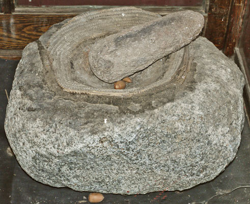
A Basket Hopper fixed to a Mortero by Asphalt
Santa Ysabel Assistencia Museum
Saturday, May 2, 2015
I walked into Warner Springs by about 9am and enjoyed a great shower and laundry. The volunteer who staffs the community center for the hikers was sick and no one knew why the center was closed or whether it might open. Things looked up when Linda, who bakes a huge batch of cookies about daily for the hikers, showed up. She explained everything and took a few of us up the road for pizza. We brought 4 pizzas back, which I think was a slice for about everyone. Linda told me a little bit about the Saint Francis Chapel in Warner Springs, and that hitching to the Santa Ysabel Assistencia would be a simple route down highway 79. So I visited both as part of my missions pilgrimage.
Miles: 13 159
Camp: Agua Caliente Canyon, a couple miles past the second hughway 79 crossing.
Maps: THSDBABDSP
Route: PCT, 4 rides, CRHT, PCT
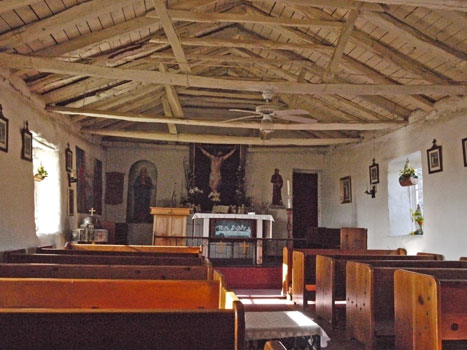
Saint Francis Chapel
Sunday, May 3, 2015
From Lost Valley Spring, I proceded north on the CRHT on old dirt roads. Until I joined the road to the hill just west, the old, rutted road had recently been used by hikers, horses, and a couple of vehicles. Beyond the hill access, it was heavily tracked by ATVs. Where the CRHT turned west (1 track, well used by hikers and horses), I turned east on old dirt roads, some out of use and fading, and ascended the drainage to return to the PCT at Chihuahua Valley Road. Along the way I found a flowing creek and an old camp with stone stoves and a piped trough, still dripping. Per Trail Angel Mike, this may be Comb's Camp. Comb mined in the area, and a peak near the PCT is named after him. Many thanks to Mike for an excellent lunch of chicken, hot dog, rice, beans, watermellon, strawberries, orange, and chorizo taco. I saw two garter snakes, both very fast. At Mike's I met Amanda/Rainbow, who I knew from the Florida Trail. Water was flowing well in upper Agua Caliente Creek. Lost Valley Spring was flowing but the water stunk and had larvae and floaties. See above, and gps, for two water sources.
Miles: 19 178
Camp: Just north of the San Diego - Riverside County Line.
Maps: THSDBABDSP
Route: PCT, CRHT, old roads, cross country, PCT
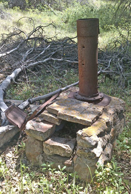
Stove at Combs Camp
Monday, May 4, 2015
I saw a Rosy Boa, and later, a Blue Jay jumped off the ground and caught a moth. There was water in the guzzler, the two Anza caches, and a few places north of 74. I didn't check Tule Spring. Clouds, virga, and a litle rain made the morning interesting. Some locals had a good looking topo / trail map of the Santa Rosa and San Jacinto National Monument. They advised me that both the PCT and the Cedar Springs / Jo Pond Trail were closed north of their junction for fire damage. I was later told sand has slid down completely covering the PCT on steep slopes in the Mountain Fire burn area.
Miles: 24 202
Camp: A mile south of the Tunnel / Live Oak Springs Trails, at Pimlico Road.
Maps: THSDBABDSP, WPSBM
Route: PCT
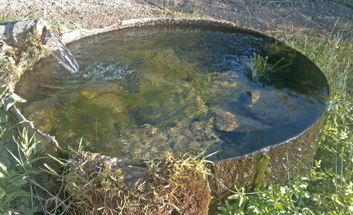
Live Oak Spring
Tuesday, May 5, 2015
Live Oak Spring was flowing 2 gallons per minute. There was some scuzzy water in bedrock creekbed potholes. I didn't find Agua Bonita Spring, but was told later it is west / up out of the creekbed. I saw a Horned Lizard, a Garter Snake, and many century plants just starting to bloom. Live Oak Spring Trail was overgrown east of the spring and petered out halfway down. I cross countried down to Palm Canyon Trail, and had a long, hot, dry trek to the Indian Palm Oasis. The ranger there told me they had decided not to encourage PCT hikers to bypass the fire closure this way because the hiking area there is focused on short day hikes, and doesn't have camping, water, etcetera, for backpackers. The Trading Post has Snacks and soda for a couple dollars each but no potable water. The ranger gave me a ride to a motel in town and much useful advice. There is a 40% chance of thunder and rain Friday the 8th, but the weather otherwise is clear for ten days.
Miles: 18 220
Camp: Motel, Palm Springs.
Maps: WPSBM
Route: PCT, Live Oak Spring Trail, Palm Canyon Trail
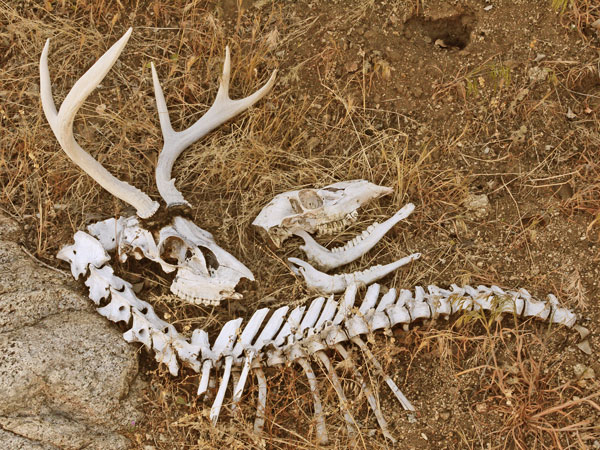
Deer Bones
Wednesday, May 6, 2015
I began ascending the east face of the San Jacintos. The trail ascends 8000' in perhaps 10 miles, so is often quite steep. At some point I realized I would get to the ranger station too late to get a permit and too tired to enjoy the top of the range, so I made an early camp and spent a lazy afternoon.
Miles: 8 228
Camp: Cactus to Clouds Trail
Maps: WPSBM
Route: Lykken Trail, Cactus to Clouds Trail
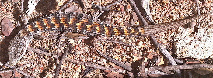
Alligator Lizard
Thursday, May 7, 2015
I summited San Jacinto, seeing no one until Wellman Divide. There was water in the creek on ascent, and snow patches down quite low. Manzanita were in bloom. Icy clouds climbing the range from the west formed rime ice up to a half inch wide and an eighth inch thick. Some blew down from trees. It was quite cold from Fuller Ridge onward.
Miles: 20 248
Camp: Black Mountain Scenic Area
Maps: WPSBM
Route: Cactus to Clouds Trail, Round Valley Trail, Peak Trail, Deer Springs Trail, PCT
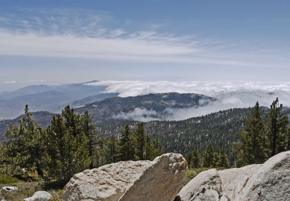
Clouds to West of San Jacinto Hogback
Friday, May 8, 2015
1½" of snow fell overnight and continued falling through the morning. This, the most poorly designed and built section of the PCT, was not improved by slippery snow covering loose rock and overgrowing scratchy bushes. But pizza for a late lunch was great.
Miles: 17 265
Camp: Ziggy and The Bear's
Maps: WPSBM
Route: PCT
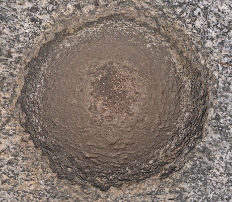
Mortero
Saturday, May 9, 2015
It sprinkled a bit in the morning. Perhaps the Venturi between the Gorgonios and Jacintos was squeezing out the worst of the weather. Dark grey storms started just west of Ziggy and The Bear's place, but it was mostly clear to the east. I socialized and drank hot coffee until 8am before deciding the weather would be fine and heading out.
I left the PCT at the Canyon View Loop ??? Trail and ended up on the road to the Wildlands Conservancy visitor center. Apparently a couple of billionaires have bought up vast amounts of checkerboard land in southern California and are working to conserve it and educate kids about wild lands. I followed an old road up the north side of Whitewater Canyon and then cross countried to the PCT ford of the creek.
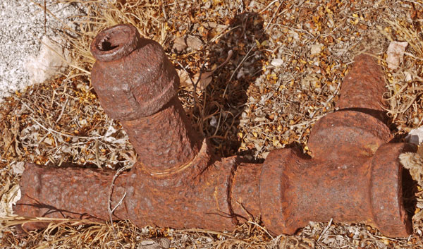
Iron Pipe
After following the PCT to West Fork Mission Creek, I followed the signed trail down canyon to the Rockhouse, part of the same conservancy. Formerly a concrete, roofless ruin, it is now a very nice river cobble exterior meeting house with a matching bathroom. This may have been the site of one of the remote Spanish Missions. Further down canyon, near the gate, are ruins of cabins and pools once used as a Hollywood getaway. I followed a road up the main fork of Mission Creek, finding aqueduct ruins including concrete pipes, a sedimentation tank, and the intake. Further up canyon, the road was blocked by private property, so I returned to the PCT.
Miles: 24 289
Camp: Mission Creek, Section 22, Frogs Singing
Maps: WPSBM
Route: See Above.
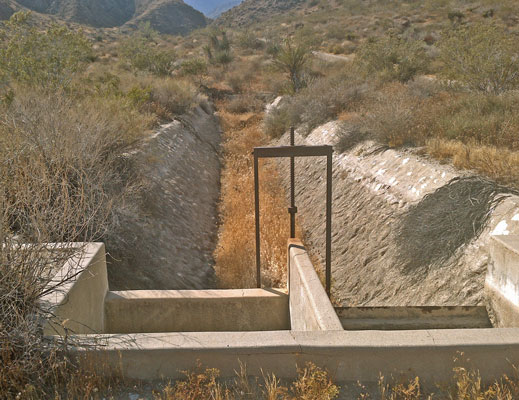
Mission Canyon Ditch
Sunday, May 10, 2015
I left the PCT at Mission Springs and began a route to Big Bear skirting the east edge of the USFS San Gorgonio Wilderness (The BLM wilderness I left this morning.). My route was much more lush than the PCT. I saw Steller's Jays, Blue Birds, a Garter Snake, and a couple of Snow Plants. There was plenty of water in creeks, and some scouring rushes.
Miles: 22 311
Camp: North of Highway 38
Maps: WPSBM
Route: PCT, 1N05, Aspen Grove Trail, Santa Ana River Trail 2e03, 1n04 Front Line Road
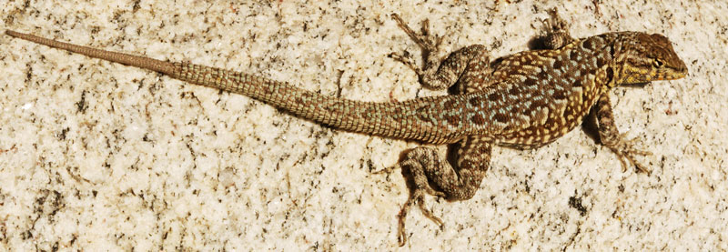
Lizard
Monday, May 11, 2015
I continued on dirt roads over the ridge into Big Bear and resupplied. the views of the San Gorgonio Range were excellent. A Wilderness Permit is required even to dayhike there, but I'll have to go sometime. Road 1e32 Bristlecone Trail comes all the way to town.
Miles: 20 331
Camp: Motel, Big Bear
Maps: WPSBM
Route: 1n04 Front Line Road, Radford Road 2n06, Sugarlump Road 2n21, Ski Resort, Town Roads
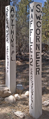
Mine Claim Corners
Tuesday, May 12, 2015
There were many new mining claims along 3n16, as well as exploration trenches and a couple of mines with large tailing piles. I saw fresh prints of Black Bears Ursus americanus, and many fresh snake tracks. Older tracks of Mule Deer Odocoileus hemionus and Coyote Canis latrans were common. An 8" red, black, and white banded California Mountain Kingsnake Lampropeltis zonata had been squashed on Coxey Road. A few ephemeral springs flowed across roads, there was a full dam and trough just west of Big Pine Flat, and there were a dozen gallons cached at the PCT and Van Dusen Canyon Road. I met and thanked the trail angel who maintains that cache.
Miles: 22 353
Camp: Coxey Meadow
Maps: WPSBM
Route: Van Dusen Canyon Road, Holcomb Valley / Big Pine Flats Road 3n16, Coxey Road 3n14
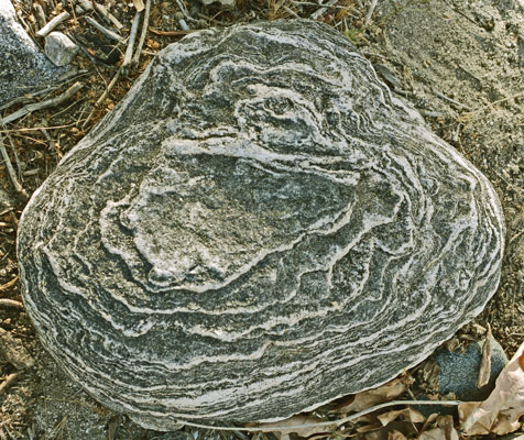
Layered Stone
Wednesday, May 13, 2015
Coxey Creek Trail had much motorcycle damage. Deep Creek Hot Springs offered the usual hot soak, plus a gal walking a slack line back and forth across the creek. The views were excellent from old, closed, dirt Highway 173, where I saw a marker from its former temporary use as a PCT reroute. I saw a rattlesnake, a rat snake, a rosy boa, and a horned lizard.
Miles: 25 378
Camp: Near the piped spring before Grass Valley Creek
Maps: WPSBM
Route: Coxey Creek Trail, Devil's Hole, PCT, Deep Creek Hot Springs, trail west, Highway 173, PCT
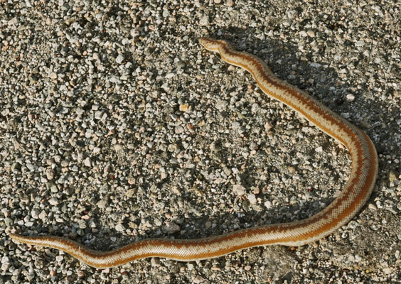
Rosy Boa
Thursday, May 14, 2015
Drizzle, rain, hail, and brisk, cold rains were intermittant all day. I left the PCT beyond the Cedar Springs / Silverwood Lake Dam to walk 2n47 along Cleghorn Ridge. The views were excellent, and included the PCT back to Mojave Forks Dam and forward to the ridge before the badlands, as well as Silverwood Lake, Hesperia, and much other surrounding land. The road just east of Silverwood Lake would also have excellent views if walked from Arrowhead. From the PCT I had walked up that road to the earthen dam, which has a pit toilet, and from which people are allowed to fish. Though I wanted to walk over Cleghorn Mountain, 5,333', it was in the clouds, so I returned to the PCT when it first crossed 2n47. I and many other bone chilled hikers were happy to end the day at Cajon Junction / I15 with fast food, motel rooms, and a hot tub.
Miles: 378
Camp: Cajon Junction
Maps: WPSBM
Route: 2n47 along Cleghorn Ridge, PCT
Friday, May 15 - Wednesday, June 10, 2015
I left the PCT from Cajon Junction to care for my parents in San Diego for a few weeks.
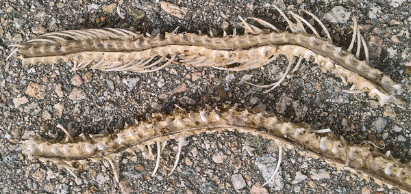
Rosy Boa
| Some Locations | |||
|---|---|---|---|
| Name | Comment | Latitude °North |
Longitude °East |
| LosPinosMountain | 32.734477 | -116.577584 | |
| +Roads Saddle | 32.740782 | -116.577875 | |
| +Roads toSpurMeadow | 32.741471 | -116.582010 | |
| +Road Kernan | 32.728311 | -116.539929 | |
| HauserGate | 32.655327 | -116.523183 | |
| +Roads | 32.657098 | -116.527374 | |
| +NHauserRoad MineRoad | 32.659109 | -116.532859 | |
| +NHauserCreekRoad PCT | 32.661693 | -116.545786 | |
| ConfluenceCottonwoodHauserFlow | 32.672556 | -116.567773 | |
| +HauserRoadOldConcreteFlume | 32.672357 | -116.574857 | |
| ConcreteBuildingFoundation | 32.673036 | -116.577557 | |
| TurnaroundHauserRoad | 32.677523 | -116.601084 | |
| PacificMine? | DSC00483 | 32.664200 | -116.535646 |
| +PacificMineTrail PCT | 32.665602 | -116.535849 | |
| MorenaButte3891 GreatView | 32.674096 | -116.543645 | |
| +TrToMorenaButte3891Views PCT | 32.666077 | -116.534969 | |
| +PCT trNorthWest | 32.668298 | -116.533622 | |
| +MorenaButteTrail MorenaResRd | 32.673488 | -116.534325 | |
| +Roads | 32.679029 | -116.539375 | |
| +17S04 LosPinosRoad Gate | ToLakeMorenaDam | 32.692723 | -116.552680 |
| +17S04 ATV1Wrangler | BroncoFlats | 32.693250 | -116.554489 |
| +17S04 ATV5 | 32.695828 | -116.566139 | |
| +SkyeValleyRd17s04/6 CorralCnR | StokesValley | 32.703645 | -116.597083 |
| +SkyeVlyRd TrSouth | 32.704946 | -116.602042 | |
| +Roads Gate | 32.715306 | -116.615397 | |
| +CorteMaderaRd 17S04 Gate | PrivateSkyeValleyLandToWest | 32.727254 | -116.621092 |
| +CorteMaderaRoad EspinosaTrail | 32.754206 | -116.619720 | |
| +EspinosaTr FlaggedTrNorth | 32.755580 | -116.639868 | |
| +EspinosaTr SecretCynPineVlyCr | 32.753902 | -116.646824 | |
| NobleCanyonSouthTrailhead | PitsTrashHandPumpWaterTrailerParking | 32.849776 | -116.522701 |
| +NobleCanyonTr TrailSouth | 32.843819 | -116.516601 | |
| +NobleCreekTrail TrailWest | CampsitePineValleyCrPools,FlowUpstream | 32.863422 | -116.510907 |
| >NobleCynTr MineTunnel Campsite | PineValleyCrFlowsNearby | 32.866333 | -116.497858 |
| +NobleCynTr5e04 TrNorth FloPVC | 32.868889 | -116.494614 | |
| +NobleCynTr LagunaMeadowsRoad | 32.896745 | -116.481152 | |
| +LagunaMeadowsRoad NobleCanyTr | Asphalt1Lane | 32.904206 | -116.476356 |
| WoolySunflowers PCT | 32.917238 | -116.455695 | |
| GarnetPeakWoolySunflowers | Top | 32.925754 | -116.458733 |
| WooleySunf GarnetPkTr | 32.924987 | -116.460562 | |
| Woolies 200plants | 32.939305 | -116.483480 | |
| SummitCafePizza | StoreJustNorth | 33.350532 | -116.737631 |
| SantaYsabelMission | Water, Museum, Church, Graveyard | 33.130865 | -116.677768 |
| SaintFrancisChapelMission | Water, Restrooms, CRHT | 33.285813 | -116.636536 |
| +PCT trToLostValleyRoad | 33.326328 | -116.633472 | |
| +LostValleyRd TrToPCT | 33.325579 | -116.633946 | |
| LostValleySpringCRHTLostVlyRd | 33.344303 | -116.636916 | |
| CRHT CNF/BLM Boundary | 33.349316 | -116.637918 | |
| CRHT BLM/PrivateBoundary | DSC00494 | 33.350192 | -116.637125 |
| +CRHT LongHaulHillTrail | DSC00495 | 33.352073 | -116.636497 |
| +CRHT RoadWestToHill4750 | South:foot,horse,littleVehicleTraffic North:ATVtrl | 33.354121 | -116.636284 |
| CRHT 6x6BYP | 33.358688 | -116.637242 | |
| +CRHT turnsWNWoffRoadOn1track | 33.361866 | -116.637324 | |
| BlockedRoadHikerHorseGate | 33.361513 | -116.635524 | |
| +Roads Y | 33.360875 | -116.634033 | |
| +Road TrailDownstreamInCreekbd | 33.370635 | -116.620912 | |
| FlowInEnyeartCreek | 33.372398 | -116.619840 | |
| ConcreteTroughDrippingPipe | 33.373100 | -116.613182 | |
| +Roads Turn | 33.375267 | -116.609583 | |
| +PCT PimlicoCanyonRoadDisused | Camp | 33.611932 | -116.564305 |
| +PCT Trail Gate | 33.623447 | -116.564076 | |
| +PCT TrailToLiveOakSpring | 33.623073 | -116.564002 | |
| +PalmCynTr4e01 DutchCharlieTr | DSC00502 | 33.637976 | -116.505135 |
| +LiveOakSprTr PalmCynTr | Picsign DSC00503 | 33.641857 | -116.508099 |
| +PflmCynTr4e01 AguaBonitaSprTr | DidntFindSpring | 33.664961 | -116.515556 |
| +Trail Road | 33.667869 | -116.513383 | |
| RiteAid AFewGroceries | 33.817514 | -116.546493 | |
| NorthLykkenTrailhead RamonStre | CactusToCloudsTrail | 33.815895 | -116.555748 |
| +DirtRoad CactusToCloudsTrail | 33.816413 | -116.556247 | |
| +TrailToMuseumTrailhead | 33.826013 | -116.558911 | |
| CactusToClouds4450 | 33.815929 | -116.589286 | |
| Rescue2 5300 | DSC00507 | 33.819002 | -116.607202 |
| Rescue1 2500 | DSC00506 | 33.820844 | -116.569004 |
| +CactusToCloudsTr Trail Pic508 | HeadEastThroughSignedGrubbsNotchToPalmSprings | 33.811559 | -116.637150 |
| RangerStation | 33.812586 | -116.642102 | |
| +PCT CanyonViewLoop | 33.988113 | -116.666892 | |
| +WhitewaterCynRd TrailCVLoop | 33.980757 | -116.653927 | |
| +RoadTrail WhitewaterCr5wide | 33.983287 | -116.652678 | |
| +PCT TrailEast | 34.020739 | -116.662458 | |
| +PCT WForkMissionCrTr Stonehou | 34.023383 | -116.659475 | |
| Stonehouse BelowConfluence | 34.016615 | -116.628122 | |
| Gate | 34.032627 | -116.639221 | |
| +Roads | 34.036679 | -116.645023 | |
| Gate | 34.035306 | -116.647461 | |
| +PCT MissionCreekRoad | 34.039275 | -116.652267 | |
| +Roads 1N05 | 34.124506 | -116.765282 | |
| AspenGroveTrailhead | 34.147703 | -116.789976 | |
| +Road UnmarkedGoodTrail | 34.147614 | -116.788845 | |
| +AspenGrFishCrTr HeartBarTrail | SantaAnaRiver | 34.152163 | -116.786198 |
| +Trails 2e03 trToFishCreek | 34.155424 | -116.800869 | |
| +Trails 2e03 | 34.155800 | -116.803156 | |
| +TrailsAtCreek | 34.153499 | -116.810019 | |
| +2E03 Trail | 34.159776 | -116.811339 | |
| +2E03 Trail | 34.161240 | -116.812092 | |
| +SantaAnaRiverTr2e03 Road | 34.165612 | -116.824787 | |
| +Highway38 1n04 | 34.170595 | -116.826023 | |
| +1n04 1n45 Y | 34.183163 | -116.858961 | |
| +1N45 1n04 Y | 34.184429 | -116.864648 | |
| +1N04 Road | 34.195462 | -116.908992 | |
| +1N04 2n06 ConverseFlatsRoad | 34.194716 | -116.911795 | |
| +RadfordRd2n06 7oaksTr0e01 | ToGrandViewPointPerGPSmap | 34.202965 | -116.904447 |
| +RadfordRd2n06 SugarlumpRd2n21 | 34.212118 | -116.872737 | |
| +ClubViewDr DirtRd1e32bristlec | 34.234095 | -116.866182 | |
| +PCT VanDusenCanyonRoad | WaterCache CreekNear | 34.288783 | -116.883254 |
| +VanDusenCynRd3n09 HolcombVlyR | HolcombValleyRoad3N16 | 34.301071 | -116.894094 |
| +3N16 2n09 PicSign | DSC00524 | 34.304776 | -116.910099 |
| +3N16 3n12 | 34.309660 | -116.927362 | |
| +BigPineFlatRoad3n16 Roads + | 34.319984 | -116.946890 | |
| +3N16 3n17 ATVGreenStickerWest | 34.327858 | -116.960593 | |
| +3N16 RoadNorth | 34.325681 | -116.978140 | |
| +3N16 3n14 Turn BigPineFlat | 34.319929 | -117.010309 | |
| +CoxeyRd3n14 HawesRanchRd3n41 | 34.323626 | -117.058074 | |
| +CoxeyRd3n14 CoxeyCreekRoad | 34.334497 | -117.069047 | |
| +CoxeyCreekRoad Trail | 34.328933 | -117.105101 | |
| Warm Spring? per GPSmap | 34.340858 | -117.169790 | |
| +CoxeyCrRd 2w01toDevilsHole | 34.324893 | -117.120575 | |
| +CoxeyCrTr2w01 PCT 3N34Dto3n34 | Sign 2milesEastCoxeyCrTrTo3n59 | 34.301141 | -117.128459 |
| +PCT WillowCreekTrail | 34.330937 | -117.162485 | |
| +PCT TrailWest | 34.339976 | -117.179961 | |
| +Steep, Switchback Trails | 34.336547 | -117.184557 | |
| +Hwy173TrToDeepCreekHotSprings | 34.318362 | -117.195957 | |
| +PCT Road | 34.305398 | -117.330129 | |
| +PCT Road Turn | 34.305076 | -117.328491 | |
| +DirtRoad Highway138 Parking | 34.301761 | -117.336920 | |
| +Hwy138 2n47 | 34.300550 | -117.336979 | |
| Name | Comment | Latitude °North |
Longitude °East |