Introduction to the Big Road Trip
After many years of months long hikes on very long trails, I plan to drive to various great hiking places away from the long trails and stay as many days as it takes to do the best hikes in each place. National Parks are obvious choices. I've already visited about half of the ~60 parks, and I can remember visiting about 20% of the 400+ sites managed by the National Park Service. Many are worth repeating, while others may not appeal to me. There are also jewels in State Parks, Wildlife Refuges, National Forests, and BLM Lands.
Western States
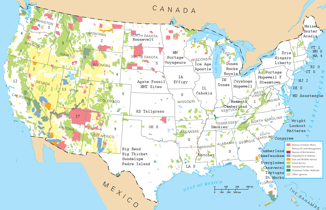
The western states have much federal land. That means virtually any spectacular site can be set aside, and that enough land can be attached to allow hiking. Hiking and camping is free and without permit challenges in the vast National Forests and BLM lands, making travel planning easy.
East of the Rockies
There is comparatively little public land east of the Rocky Mountain States. Typical National Parks are much smaller, and National Forests are much further apart. Many National or State Parks feature a house or golf course, or something else that does not interest me much, while others may be quite interesting. A road trip in the east would have to be carefully planned to hit all the sites of interest.
In the eastern half of the northern tier states, and along the east coast and gulf coast are many great places to canoe or kayak. Separate trips for hiking and boating might be better for security at trailheads and put ins, and to avoid mildewing gear between paddles.
48 States Map Above
I needed to make the map above to understand where the sites most interesting to me are. Using it, I would plan zig zag routes to target the most interesting sites, while also visiting other sites along the way. This type of planning is very necesary in the east, and much less so in the west.

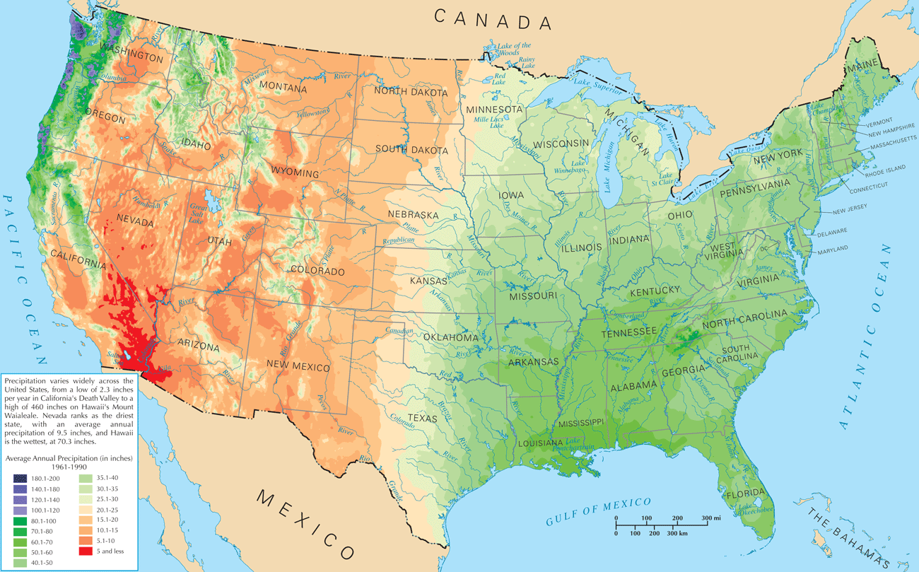
Rivers and Precipitation Map
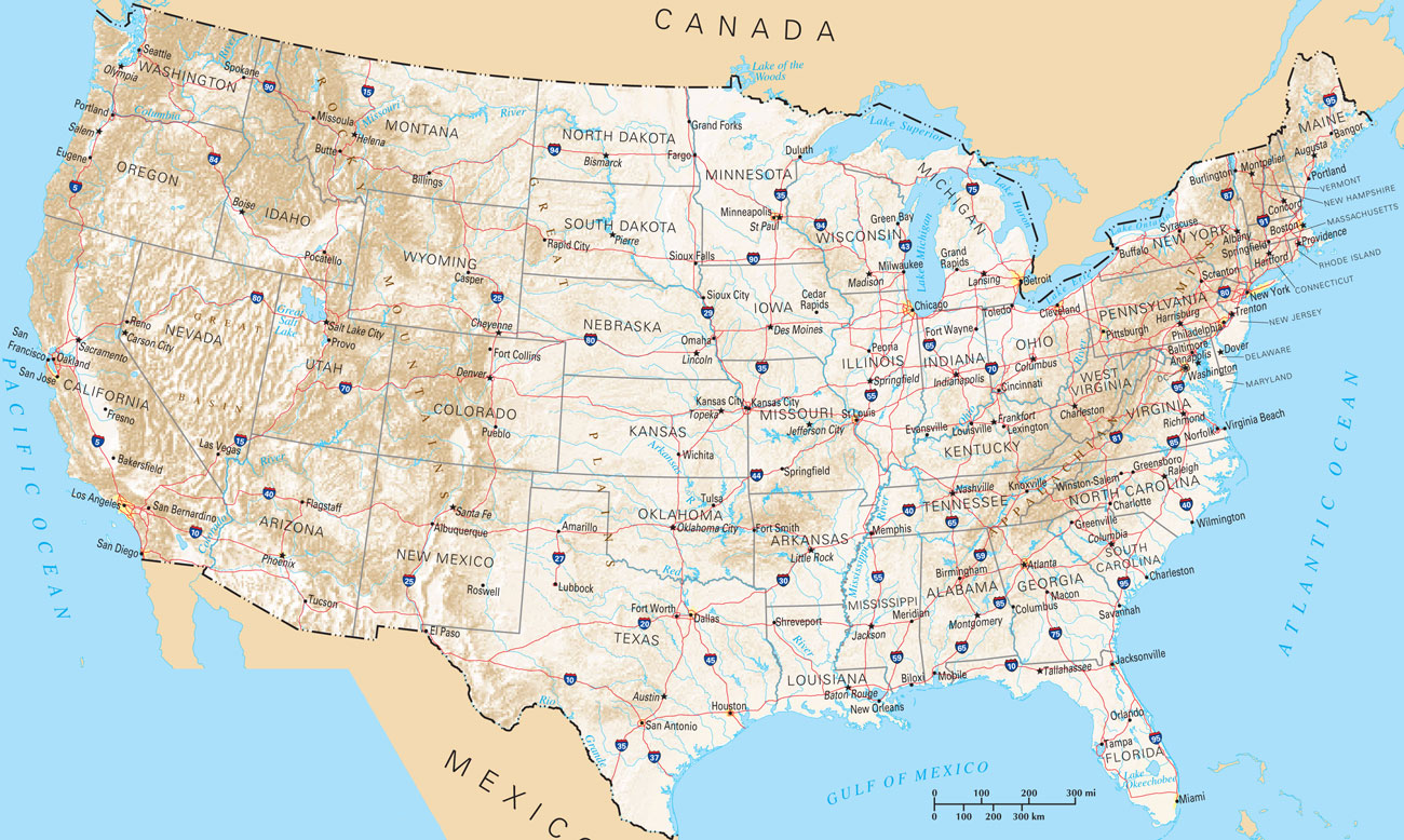
The map above orients me to the location of all major rivers and drainages of the US. It also shows the typical annual rainfall, which drastically influences the ecosystem type. It, the map of federal land management agencies at the top, and the cities and highways map at the bottom were sourced from the National Atlas.
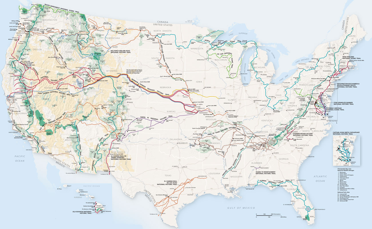
National Parks and Trails
The National Park System's map below is included mostly because it shows the National Historic Trails. Typically, most of the length of these historic routes are not open to the public. Where roads cross them there may be kiosks explaining their significance, and where they are on public land, one might be able to walk them some distance. Significant sites may be preserved and open to the public, like buildings, springs, or wheel ruts. I plan to visit the NHTs as I travel between other sites.

