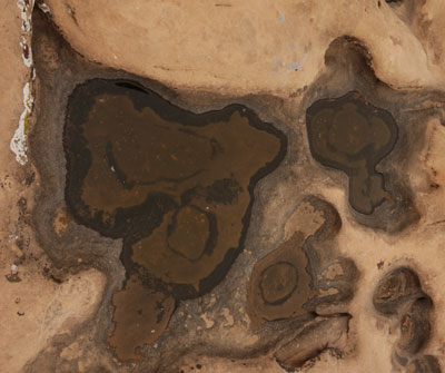
Rain Filled Potholes
It's been at least a couple of weeks since I remember signifcant rain.

Rain Filled Potholes It's been at least a couple of weeks since I remember signifcant rain. |
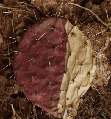
Beavertail Cactus Stem Drying |
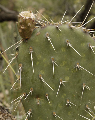
Beavertail Cactus Healthy Stem |
Tuesday, March 26, 2019
Elden Pueblo, Sunset and Wupatki National Monuments
I was pretty stir crazy after recovering in a room without much exercise for a week. My forehead seemed ok without stitches, and the rest of my scrapes were recovering well. My left hip was OK for walking around the hotel, but a huge bruise was developing. I decided the best thing for it, and the best thing for my morale, was to go do a bunch of short tourist strolls for perhaps a week, letting my hip decide how long each hike should be. A loop road trip to the South Rim of the Grand Canyon seemed perfect, as there should be many easy hikes both in and en route to Grand Canyon. I dwadled around until checkout time to keep the first day easy.
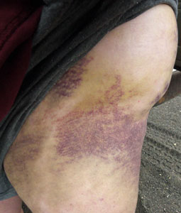
Hip Bruise Front View |
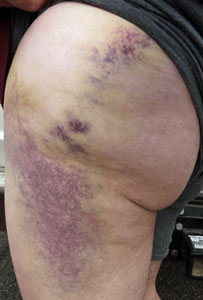
Hip Bruise Side View |
| The hip bruise was most discolored at the beginning of this trip (March 26). It started as a 4" diameter, 1½"+ thick bump of normal skin color, with bruise colors getting worse until now, then dissipating almost entirely by the 11th. By the 6th, I could roll onto it for a moment without much pain; a few days later I could sleep on it. The two dark spots 1⁄3 of the way down on the side view are probably where I hit a rock. | |
Elden Pueblo has a ten minute interpretive walk. Most interesting is a stone that was likely used to sharpen trade quantities of stone axe heads.
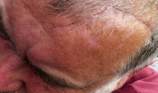
17cm Forehead Scar |
Sunset Crater NM has all sorts of volcanic debris, pumice sand, aa, basalt, etcetera. I didn't see pahoehoe, but I was just doing little loops to protect my hip. There are a few hills nearby one could climb for better views, on some future trip. The visitor center had corn cob printed lava chunks. Apparently the Indians put the corn in the molten lava, and later returned to take the imprinted solidified chunks back to the pueblos.
Wupatki NM focuses on Pueblos: not much was unique. But there was a wind cave expelling lots of cave smelling air.
I camped in Coconino NF halfway through Wupatki NM. My hip was doing well enough, but I didn't want to push it.
Miles: 3
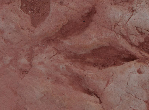
Dinosaur Print |
Wednesday, March 27, 2019
Wupatki National Monument, Dinosaur Tracks, and Grand Canyon
I visited a few more pueblos in Wupatki NM. I proceded north to a dinosaur track site on the Navajo Nation (US160 east of US89). There were lots of hand sized prints, a few inch long prints, and just a couple of much longer prints, including a Tyranosaurus Rex print over 3' long. Additionally, there were dinosaur eggs, some broken open so you could see various concentric features, such as the yolk sac. There were sort of formless dinosaur scats. South along US89 I stopped at the old bridge across the Little Colorado River.
Miles: 3 6
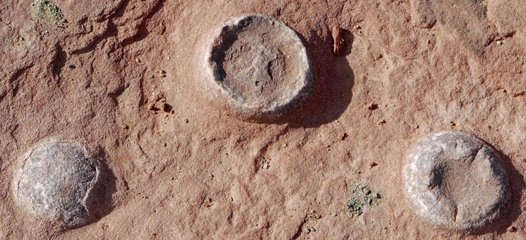
Dinosaur Eggs |
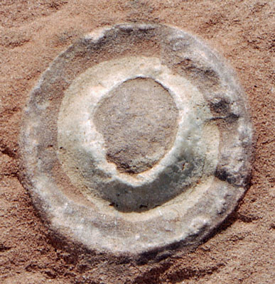
Dinosaur Egg |
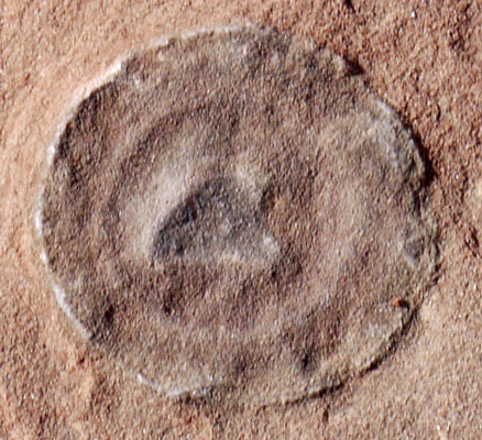
Dinosaur Egg |
Wednesday, March 27, 2019
Grand Canyon National Park
Proceding west on Arizona 64, I stopped at all sites from Desert View tower to Yaki Point, and looked around. Further west, most parking lots were beyond full, with cars in the dirt and plenty of people cruising for spots. I stopped only at Yavapai Point and its Geology Museum. I quit for the day and camped just south of the park in the Kaibab NF.
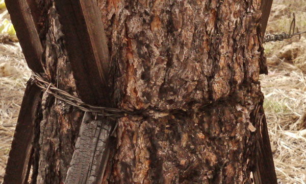
Wire Girdled Tree Padding the tree with sticks is supposed to protect from girdling, but if the tree grows long enough... |
| Grand Canyon 7½' 24k Quads | |||||||||
|---|---|---|---|---|---|---|---|---|---|
| 112° 15'W | 112°W | 111° 45' | |||||||
| 36° 15'N | Shiva Temple |
Bright Angel Point |
Walhalla Plateau |
Cape Solitude |
|||||
| 36°N | Grand Canyon |
Phantom Ranch |
Cape Royal |
Desert View |
|||||
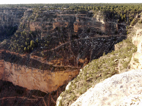
Bright Angel Trail Switchbacks Descending From Village |
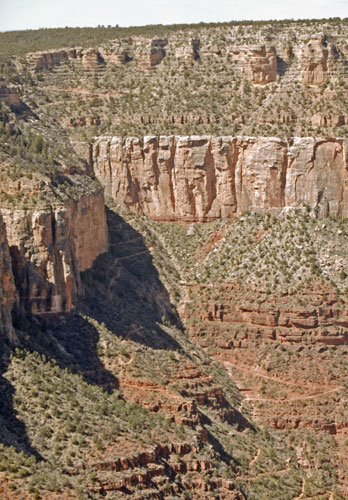
Bright Angel Trail From East of Village |
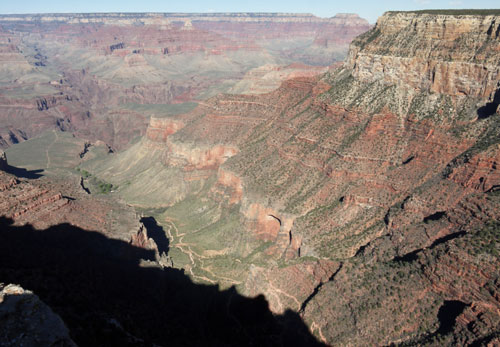
Bright Angel Trail From left - Plateau Point Trail, Trees at Indian Gardens, Trail up Valley |
Thursday, March 28, 2019
Grand Canyon National Park
Entering the park at dawn, there was no difficulty in parking within a stone's throw of the Bright Angel Trailhead. I walked 1½ miles down that to the first rest stop and then ascended, not wanting to push my luck with the hip. I took the bus to Hermit's Rest and walked 5 miles east along the easy and sometimes paved Rim Trail. It was mid afternoon, but I was wiped out, and my hip had had enough, so I camped. The previous two afternoons I was also exhausted and really feeling my hip by mid afternoon, so for three nights in a row I camped and napped by late afternoon. Quitting before the end of the day, and especially sleeping in the afternoon, are very rare for me. My excuses include altitude, always chilly breezes, odd gait from protecting my hip, and my body healing my head and hip. The hip and head are both recovering significantly each day.
Miles: 8 14
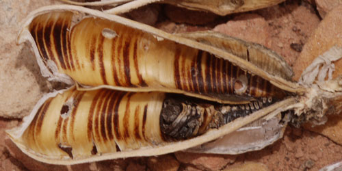
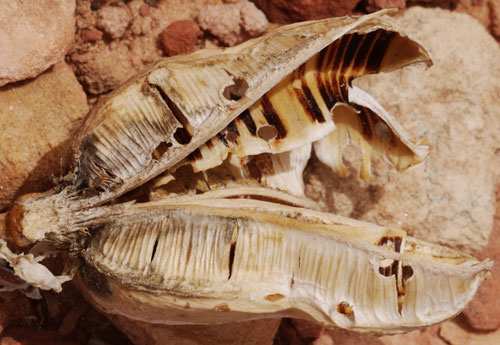
Yucca Seed Pod Note Insect Holes |
|
Friday, March 29, 2019
Grand Canyon National Park
I returned to Mojave Point, where I'd left off yesterday, and continued walking east for the rest of the Rim Trail, to Yaki Point. Through this entire rim walk, The trail system down in the canyon intrigued me. By the end, I was taking pictures of each trail segment, thinking a photo essay of the trails from various vantage points contrasted with topographic and geological maps would be interesting. Since hikers can actually and distinguish see various fairly horizontal geological layers, geologial charts and canyon views might offer a kind of visual topograpic system. I was not nearly as exhausted as I had been the last few days, so I visited the Maswik Cafeteria (OK and not too expensive, wifi non functional) the grocery store (pretty complete and not super expensive) and the laundry ($2.50 wash) and shower $2/8 minutes at Mather Campground, returning to the NF near dusk.
Miles: 8 22
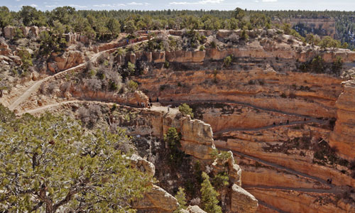
Top of South Kaibab Trail |
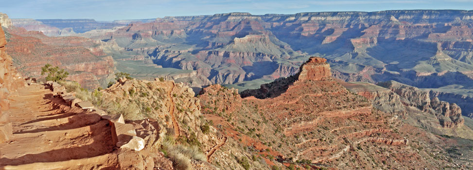
South Kaibab Trail on Ridge |
Saturday, March 30, 2019
Grand Canyon National Park
I hiked north down the South Kaibab Trail to The Tipoff, west on the Tonto Trail to Indian Garden, and south up the Bright Angel Trail. I saw perhaps a dozen people on the 4+ miles of the Tonto Trail I used. There were CCC era pipe telephone poles at The Tipoff and paralleling the Bright Angel Trail. Modern water and electric also generally follow the Bright Angel Trail. I was exhausted enough that I drove back to camp, carried a burrito into bed, ate it, and zonked out. The hike was about 14 miles, finishing with a 3200 foot ascent.
Miles: 14 36
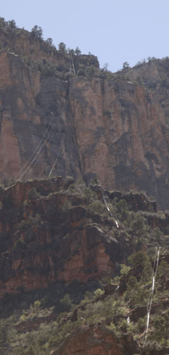
Phone Lines over Bright Angel Canyon
From Plaques in Grand Canyon Village |
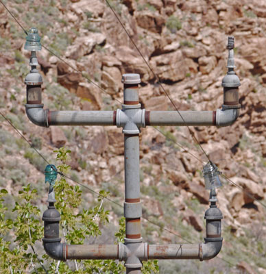
Bright Angel Telephone Pole at Tonto Trail Note 3 Different Insulators and Bend in Lines |
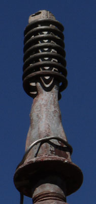
Insulator Threads are a Spring |
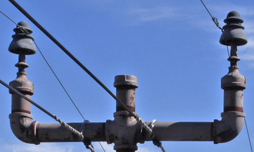
Phone Line at The Tipoff Note later lines attached to crossarms. One circuit versus two above. |
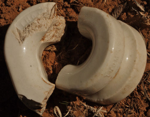
White Thomas Insulators The left insulator is not split and would have to be threaded onto the wire - old. The right, split design can be placed around already strung wire. Kaibab Plateau. I saw no wire or insulators in trees. |

No 9 Iron Wire Sleeve Splice In a snarl of wire on the ground - Kaibab Plateau. |
Sunday, March 31, 2019
Grand Canyon National Park
I hiked west along the Hermit and Dripping Springs Trail from Hermit's Rest, then looped south and east, following a fading 2 track past an old corral and joining the Old Boundary Line Road back to The Abyss Overlook. I saw no one after leaving the Hermit Trail. After an old corral, I walked into a pack of Peccaries, Javalinas. There were perhaps twenty all around me, and though they kept an eye on me, they continued to eat and stand around while I observed for a few minutes. But they all slowly wandered off when I tried getting my camera from my knapsack. Cattle tracks and scat were in the same area. There are many Mule Deer and Elk all around the rim. I heard Condors were active along the Hermit Road, but didn't see any despite the hike along the rim and stopping at each viewpoint this morning.
Miles: 12 48
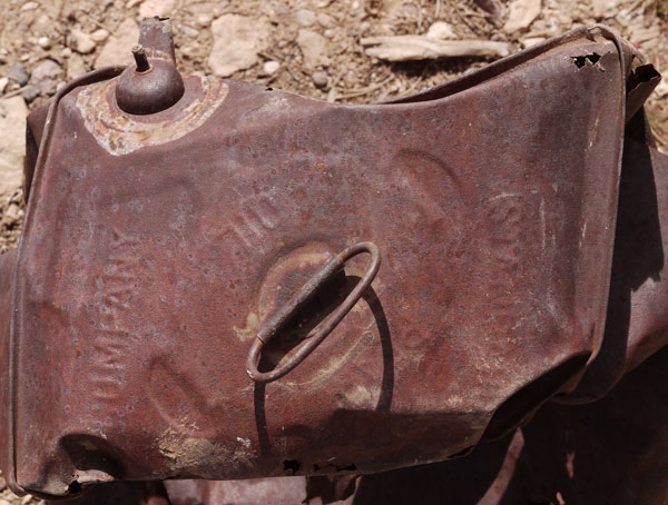
Standard Oil 5 Gallon Can with Fancy Spout |
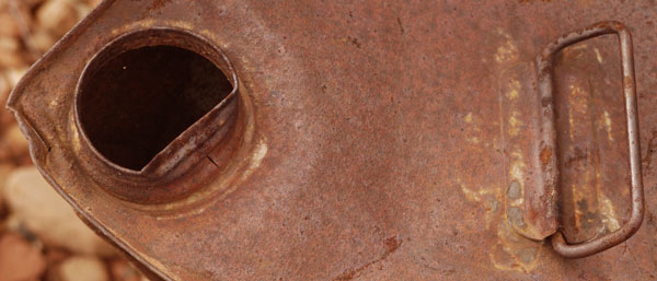
5 Gallon Can |
| The circumference of this can is made of two hand soldered sheets - very old. The inside of the threaded spout is machine rolled to seal well against a gasket. |
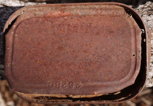
Fish Can - 252B0 Paint Barely Visible and Illegible |
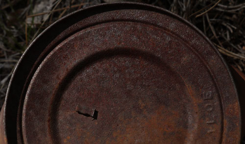
Can with Key Detatched - 1LOE |
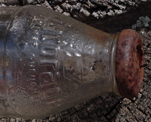
19 Ounce Glass Gatorade Bottle I can't remember seeing glass Gatorade bottles. |
Monday, April 1, 2019
Grand Canyon National Park
I walked 4 miles down the Tanner Trail from Lipan Point, seeing 6 people, including a law enforcement ranger with an overnight pack. My hip is really not complaining while hiking, but compensating for it has made the outside back of my left calf muscle ache. The hip is still tender to any poking and no where near ready to sleep on. My head is healing fine. I met a guy who said that very few people visit the Grand Canyon after Thanksgiving through February. In March improving weather and spring breaks boost visitor numbers dramatically. Winter permits are not hard to get and descending in crampons and winter pants is the price to pay for visiting the empty Grand Canyon.
Miles: 8 56
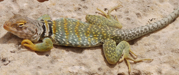
Male Collared Lizard in Mating Colors |
Tuesday, April 2, 2019
Grand Canyon National Park
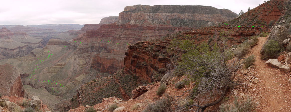
I hiked the Hermit and Boucher Trails to Yuma Point. The views and the vertical terrain were impressive. One group of 8 was on the Boucher Trail.
Miles: 12 68
| Cope Butte |
Cathedral Stairs |
Lookout Point |
Hermit Trailhead |
Santa Maria Spring |
Waldron Trail |
Dripping Springs Boucher Trails |
Dripping Springs Canyon |
Boucher Trail | |

Hermit, Waldron, and Boucher Trails | |||||||||
| ||
| Hermit and Tonto Trails | Hermit's Rest | Boucher Trail |

| ||
| Boucher Trail | Yuma Point | Tonto and Hermit Trails |
Wednesday, April 3, 2019
Grand Canyon National Park
I hiked the Hermit, Waldron, Horsethief, and Boundary Trails to The Abyss. Later, I walked to Shoshone Point. I visited the Backcountry Office. Some permits are held back for walkins. Had I applied today, I could have joined a wait list, come back each morning at 8am, and had some random backpack trip within a few days. Since I could easily entertain myself day hiking, this doesn't seem too bad to me. The other option is to reserve trips 4+ months in advance.
Miles: 10 78
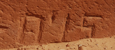
1915 Date on Hermit Trail Step |
History of Trails
Grand Canyon National Park
The Bright Angel Trail was a private toll trail well into the time tourists began to show up at the Canyon. The railroad built the Hermit Trail to avoid tolls in the early 1900s. It was once considered the best built trail in the canyon, but with much traffic and weathering, and not enough maintenance, excellent sections are few and far between. Some extant sections are shown below. The South Kaibab Trail was later built by the Park Service, also to bypass the Bright Angel Toll Trail.
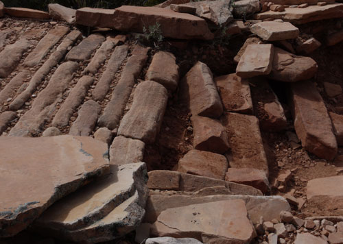
Cobble Blowout on Hermit Trail |
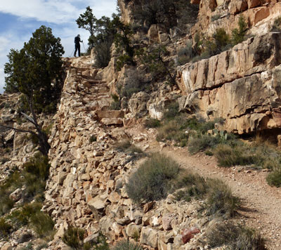
Hermit Trail Stairs and Retaining Wall |
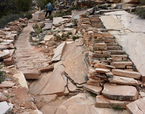
Hermit Trail Cobble, Stairs and Retaining Wall |
Thursday, April 4, 2019
Grand Canyon National Park
I hiked the Arizona Trail north and southbound from Grandview Fire Tower, and northbound from Russell Tank. I remembered nothing from my thru hike here, though my day in the canyon I remember quite well. The tower has a great view, and nearby are many interpretive signs about Dwarf Mistletoe and Ponderosa Pines.
Miles: 7 85
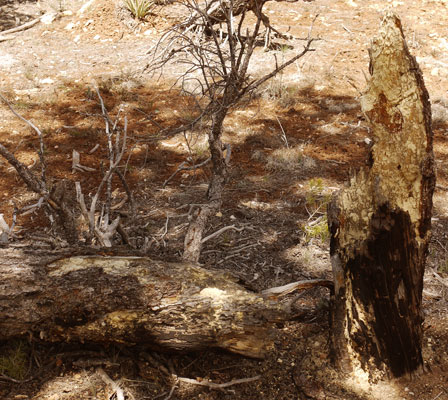
Blowdown - Sap Wood This tree broke in the trunk even though there was plenty of sap in the wood. |
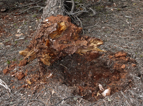
Blowdown - Rotted Roots Small rootball and tidy hole from rotted roots. |
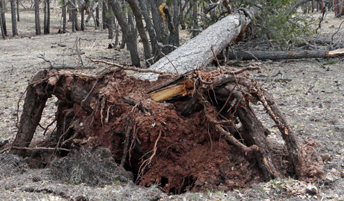
Blowdown - Healthy Tree" This healthy tree pulled its flexible roots through the soil, pulling out a large, messy rootball. |
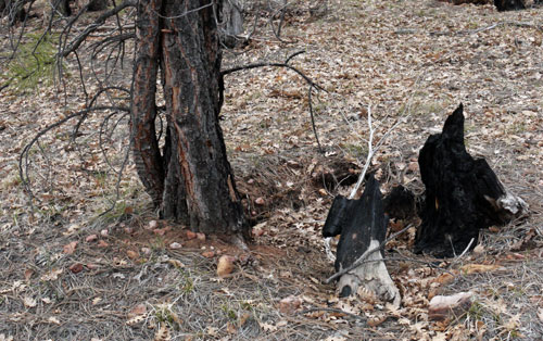
Resprout from Burned Tree Three new trunks sprouting from the old rootstock of a burned tree or stump. |
Friday, April 5, 2019
Grand Canyon National Park
I hiked east and north of Desert View Tower on Cedar Mountain Road and the Cape Solitude Trail. Cross country travel to a few viewpoints was easy. Down to Straight Canyon was a Pinyon / Juniper / Sage ecosystem, with mostly sage sparse enough for cross country walking further north. On some future trip, I could carry a few days worth of water and camp in the junipers at the head of Straight Canyon. Stands of juniper a little later might also make good camps. Cape Solitude, overlooking the Little Colorado confluence, would then be a 20+ mile day hike on fast hiking old 2 tracks. Later I walked to Lomaki and Citadel Pueblos in Wupatki NM.
Miles: 11 96
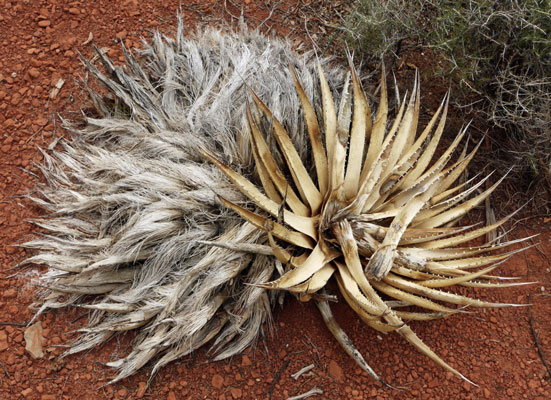
Century Plant - Dried and Fiberous |
Saturday, April 6, 2019
Sunset Crater Volcanic National Monument
I walked up Doney Peak for sunrise, up Lenox Crater, and up to the lookout tower on O'Leary Peak. Views were great except the tops of the San Francisco peaks were in the clouds. There were moments of drizzle and corn snow, and an isolated storm to the east dumped a lot of rain on a small area. I noticed many lightning scars along the switchbacking road up O'Leary, and was always ready to split at the first sign of thunder or lightning, but none came.
Miles: 12 108
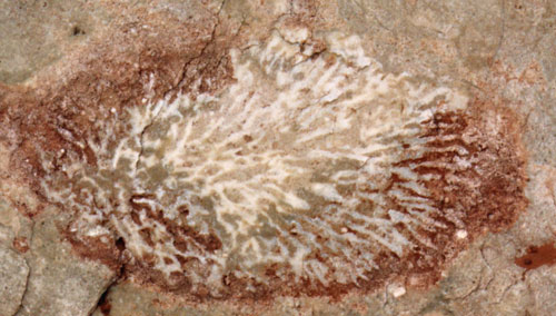
Fossil |
| There are many fossils in the sedimentary layers of Grand Canyon. It would be fun to have some sort of fossil guide since the layers are fairly easy to identify, and each layer would have certain common fossils. |
Sunday, April 7, 2019
Sunset Crater Volcanic National Monument
Walnut Canyon National Monument
I walked the Lava Flow Trail, then headed for Walnut Canyon. A couple of short trails to see the cliff dwellings there finished this trip, and I headed for Flagstaff.
Miles: 3 111
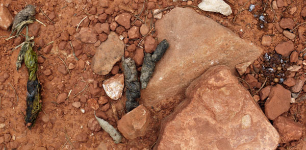
Three Scats Animals sometimes return to the same spot and poop many times. Here one animal has left one scat each containing grassy material, meat and fur, and seeds / fruit. |
Sunday, April 7 - Sunday, April 14, 2019
Although the walking has helped my hip tremendously, I felt it best to rest it a while. I wanted to get the website caught up. And I had caught a cold. A week in Flagstaff seemed like a good idea. A few days to recover from the cold, and a few more to get pictures on the website completed the week.
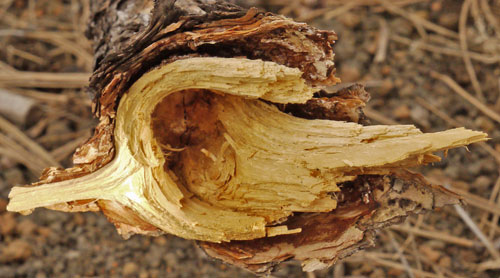
Wood Grain at Tree Branch |