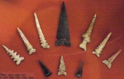
Arrowheads
In addition to plenty of typical points, these especially wicked looking arrowheads were displayed.
Sunday, February 10, 2019
I travelled south from Flagstaff on Arizona 89. There was a foot of snow until I started dropping elevation before Sedona. In the Redrocks Country there was plenty of ice and it was chilly. Most facilities were closed, but I hiked a while at Midgley Bridge. The area was quite pretty and I hope to return in the spring.
Sunday, February 10, 2019
The main feature here is a partially reconstructed Sinagua apartment block on a hill near the Verde River. The Spanish called the San Francisco Peaks Range the Sierra Sinagua, and the people are named as living near the range, but there is plenty of water near the settlements I visited. The small museum had some atypical aritifacts. I learned later that there is a marsh trail connecting to an Audubon important birding area, but I missed it.

Arrowheads In addition to plenty of typical points, these especially wicked looking arrowheads were displayed. |
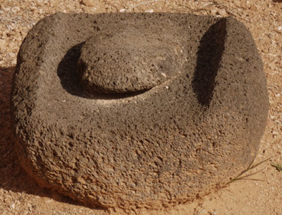
Metate There were lots of big, heavily worn Metetates. |
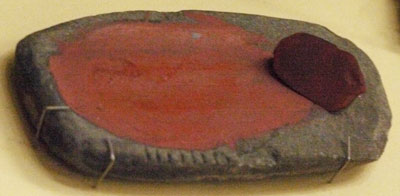
Pigment Metate There were several small morteros and metates for pigments. |
Pigment Morter |
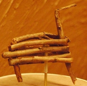
Stick Animal |
Sunday, February 10, 2019
There is an impressive limestone sinkhole with a spring flowing 1.5 million gallons / day. There are cliff dwellings in the sinkhole wall and other pueblo style builings scattered around. A natural tunnel channels the 74°F sinkhole spring water to lower ground near the ?? River. From here an extensive irrigation ditch system for corn, beans, squash, and cotton started. The ditches lined themselves with travertine, calcium carbonate, precipitating from the spring water. The water also has high arsenic levels.
Sunday, February 10, 2019
More cliff dwellings.
Monday, February 11, 2019
More cliff dwellings. There were sandstone metates of the same form used at Tuzigoot. The foamy lava metates at Tuzigoot would be incredibly agressive at grinding food, quickening preparation. Also, sandstone might leave more sand in the food than the lava would. Abrasive grit left in food shortened the life of teeth in Indians, thus ultimately might shorten the life of the Indians. I would guess that where suitable lava was available, it would be the preferred stone for metates.
I hiked the Arizona National Scenic Trail thru in 2012, plus sections in 2012 and 2013. In this section I revisit the trail and its towns.
Sunday, February 10, 2019
I visited the trail near Pine, thinking I might camp but finding enough ice and mud to reconsider. I descended to Payson, visiting the largest Walmart I've ever seen. Thank God I don't usually have so many choices: I'd never be able to leave. I stayed in the same motel I'd used once before when I came down to buy new boots.
Monday, February 11, 2019
At Roosevelt Dam I visited viewpoints east and west of the dam and walked the old roads southeast of the dam. At Superior, I hiked an old roadbed of US60, now the LOST (Legends of Superior Trail) to the Queen Creek Tunnels. There are picturesque bridges, limestone and volcanic ash geology, and mining ruins to see. There were some drill holes about 20" diameter, perhaps big enough for a geologist to crawl inside. I camped near Picketpost Butte.
Tuesday, February 12, 2019
I climbed Picketpost, a 3½ hour round trip. I then spent several hours at Boyce Thompson Arboretum on their meandering web of trails.
Tuesday, February 12, 2019
I saw this 4 story Indian dwelling. Later, I camped in the Coronado National Forest near Oracle.
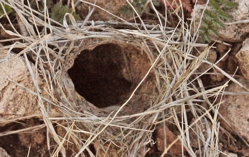
Wolf Spider Hole Lycosa Wolf Spiders hunt at night, and in a flashlight beam, they have a blue green eye shine. |
Wednesday, February 13, 2019
I wandered 11+ miles on the bajada web of trails in the southwest side of the east (Rincon Mountains) district of Saguaro National Park between Mica View and Steel Tank. There was flowing water in several ravines. I was told this is a high water year and desert wildflower displays ought to be very good in all desert areas. I walked within a couple feet of a rabbit and saw some Cactus Wren nests. Woodpecker and flicker holes in Saguaro were common. I camped in the Coronado National Forest at Papago Well to the south of the park.
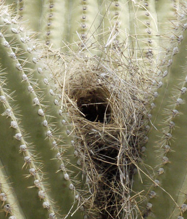
Cactus Wren Nest |
Thursday, February 14, 2019
I walked to petroglyphs in the west district of Saguaro National Park at Signal Hill and at Mam-A-Gah. With rain threatening, I decided against climbing to the peaks.
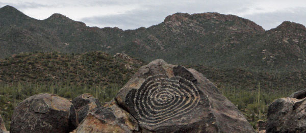
Petroglyph |
Suburbia borders both the east and west units of the park.
I was told that car camping and hiking are fine in BLM's Ironwood Forest National Monument, but one must be careful to stay on BLM lands, which are interspersed with lands belonging to many other owners. W Silverbell Road was particularly recommended. The monument was declared to protect the Ironwood, which was being exploited out of existence as firewood.
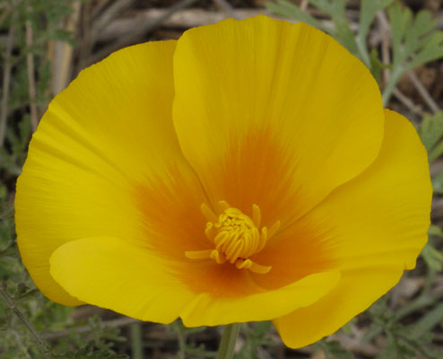
Poppy |
Thursday, February 14, 2019
I spent about 5 hours seeing most of the stuff. I think a whole day could be spent productively. There is food on site. There are dollar stores and cheap gas north and south of the National and Tucson Mountain Parks.
Friday, February 15, 2019
I arrived just before the park opened and was able to get both tours (Rotunda / Throne Room and Big Room) without reservations. This cave is outstanding not only for the beauty, quality, and quantity of its speliothems but also for the great job the park has done in keeping the cave unspoiled by visitors.
One factoid touted a few times is that after a rain, it takes about a week before increased dripping occurs inside the cave. The cave is under a small hill, so a week of travel seems like a long time to me. I'll have to think about the geology and hydrology.
I walked the Foothills Trail, 3 miles. I camped in the Coronado National Forest Whetstone Range on French Joe Road, just south of the state park.

Sunrise |
|
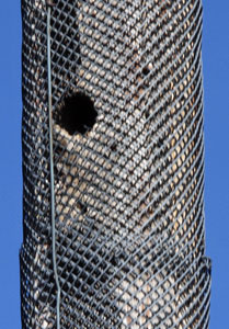
Woodpecker Hole Even wrapped in mesh, Woodpeckers drill into utility poles. |
|
Saturday, February 16, 2019
Coronado Cave is vandalized in every possible way, with graffiti, broken speliothems, trash, etcetera. There were some nice formations. I also walked the Windmill Trail, the ? Peak Trail, and the ? trail. There is a shuttle from the Visitor Center to Montezuma Pass at 8:30 Thursday - Sunday so you can walk from Montezuma Pass to the Mexican Border on the Arizona Trail, then down to the Visitor Center. I camped to the west in the National Forest. The hiking there was quite impacted by smuggling and 4WD traffic. I was stopped by the Border Patrol twice on the way out the next morning.
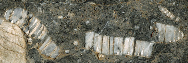
Crinoid Fossil |
Sunday, February 17, 2019
The trail (3 miles round trip) has interpretive signs for a mining cabin, the Butterfield Stage Station and emigrant road, a cemetary, and early and later versions of the fort.
Sunday, February 17, 2019
I walked the Massai and Sugarloaf trails towards the top of the park, and camped in the national forest to the south. It was bitterly cold.
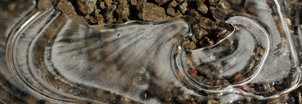
Ice |
Monday, February 18, 2019
I walked most of the rest of the trails in the monument. Typical of CCC trails, they were wide and well built. There was water in a few creeks. The focus of the monument is on the rhyolite hoodoos, eroded spires of rocks, with plenty of balaced rocks too. The caldera which produced the ash which formed the rhyolite is just to the south in the national forest, and is where I camped. There is a 9 am shuttle from the visitor center to the Echo Canyon Trailhead so you can walk downhill one way.
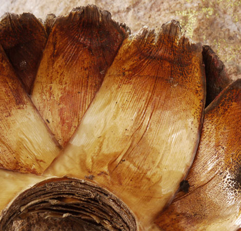
Yucca |
I downloaded an excellent Chiricahua National Monument USGS geology paper and map which I should read before visiting again.
Guide to the Volcanic Geology of Chiricahua National Monument and Vicinity, Cochise County, Arizona
John S. Pallister, Edward A. du Bray, and Douglas B. Hall
1997
With rain and snow predicted through noon tomorrow, I motelled to the north in Willcox. I was quite ready for a shower and laundry anyway. With a 60% chance of showers Thursday, a 100% chance of rain Friday, then good weather predicted for 10 days, the next few days will have the added focus of avoiding slimy roads and trails where possible.
| Where I Walked | ||
|---|---|---|
| Massai Trail | .5 | |
| Sugarloaf Trail | 1.8 | Fire Lookout, View |
| Lower Rhyolite Canyon Trail | 3.0 | |
| Sarah Deming Trail | 1.6 | |
| Heart of Rocks Loop | 1.1 | |
| Big Balanced Rock Trail | 1.0 | |
| Mushroom Rock Trail | 1.2 | |
| Hailstone Trail | .8 | |
| Upper Rhyolite Canyon Trail | 1.1 | |
| Natural Bridge Trail | 4.8 | |
| Total | 16.9 | |
The hailstones were once though to have accreted from white hot ash like hail, but later???
Tuesday, February 19, 2019
The left front tire developed a slow sidewall leak. I bought a 12 Volt air pump, and lived with it for a few days.
Tuesday - Wednesday, February 19 - 20, 2019
I had 1½ days of good weather, and I was feeling a bit sick. But I walked from most of the trailheads to most of the notable destinations. There were three ecosystems: fairly sparse brush with little wildlife covering most of the refuge, deep dry washes with many small birds in the brush, and the cottonwood / flowing water ecosystem within a few hundred yards of the river, which has a fairly high wildlife concentration. Paths run most of the length of the area: hiking them all might take a few days. Biking would also be a reasonable approach. Backpacking is possible with a resonably priced permit.
It was snowing Thursday and Friday, so I took some rest days in a motel in Sierra City. Sierra City has all services at good prices. The weekly motel rate is 10% cheaper than Flagstaff, and the rooms are much nicer. Six inches of now fell in Sierra City, while the same storm dropped over two feet in Flagstaff. There is easily enough stuff to do near Sierra City to stay for a week
Saturday, February 23, 2019
I spent many hours getting a permanent fix for the sidewall leak in my tire, finally getting it replaced in Tucson. Tucson has all services, but the motels are all seedy and wierd. It's not a great place to stay.
Saturday, February 23, 2019
The drive from Sierra City to Tucson had up to six inches of accumulated snow along highways ??? Riparian Area?
Saturday, February 23, 2019
I had only 45 minutes until closing: it was not nearly enough to see everything. There are many ruins of the extensive workings of the mission, including a lime kiln and irrigation ditches. Nearby is a presidio in a Tubac Presidio State Park and 4 miles of walkable Anza Trail between. It might be possible to visit the next mission in the chain, Xavier? visible from the freeway.
Sunday, February 24, 2019
I had I had a headache in spite of aspirin, etcetera, so I hiked less than I would otherwise, and stayed only one day. Idling along the west and east loops, and getting out to stroll occasionally, was actually a good way to see a lot. But just driving every road took from before sunrise until sunset: a few days could be productively spent. The wildlife refuge to the west might occupy more days. There were lots of pupfish in Quito Baquito.
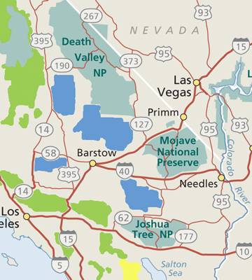
California Desert Area Map
|
Monday, February 25, 2019
The Sonny Bono Refuge 2 had a mile path to a lookout hill. There was lots of Obsidian. There were ball shaped nests. I saw many Great Egrets, Coots, and ducks. A Burrowing Owl was by a man made nest tunnel. There were some mud pots that sometimes build mud piles 8' high. Today there was just bubbling water and the mud volcano piles were dry. I'm not sure if one can hike in the state park or many other places along the Salton Sea, but it is supposed to be great for birding. There was a Picacho BLM area east of the dunes.
Tuesday, February 26, 2019
There were many flowers blooming as I drove west into the park along S22. I walked up Coyote Canyon from ? Garden to Sheep Camp.
| Animal Prints and Mud Qualities |
|---|
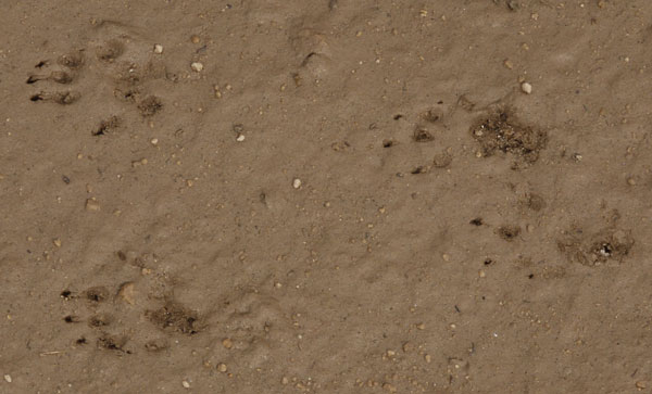
Rodent Running |
|
For all quadrupeds, there is a progression of walking styles or gaits from slow to fast. Most slowly, they walk straight ahead, moving each foot independently. In the first stage of slow running, the animal is slightly diagonal to the direction they are running. You can watch the running styles in domestic dogs if they will cooperate and run at different speeds. In the fastest type of running, like rabbits, the animal moves the front feet together, and the rear feet together, as above. On the left, the rear feet land wide enough that the front feet can swing through inside. To the right, the front feet are offset so they can be held closer to the center. Some animals don't use every gait in the series. Rabbits, for example, only hop, with groups of footprints like that above. In Coyote Canyon today, the qualities of the mud were outstanding for taking excellent animal prints. Soils were still quite wet from rains. I find conditions and prints this good only once every few years. Above, see the shapes of the claws, slightly wide, and the lobes of the toes, perfectly shaped. The heel prints peeled off the slimy clay layer, exposing wet sand below. Below, I've arranged Bobcat and Coyote Prints from relatively sandy and dry to slimy and wet muds, commenting on details. |
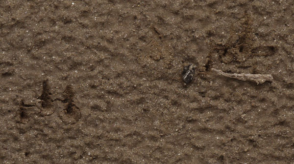
Coyote Running |
| There are no foot pad impressions. This Coyote touched the soil only with claws. The soil scratched away and cracked, but did't slime around during or after the print, as there isn't a clay layer over the sand. |
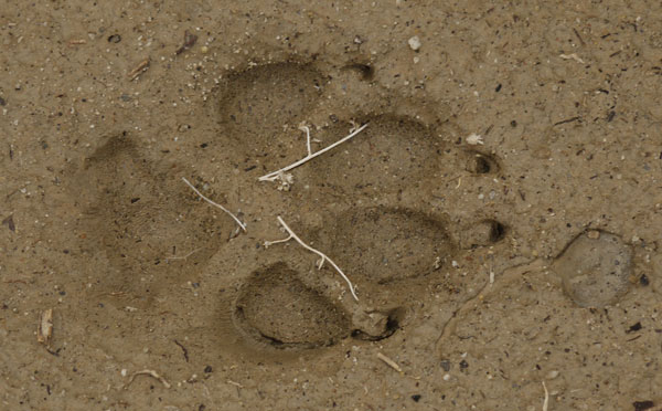
Coyote |
| This soil is a nice mix of sand and clay, without much of a slimy clay layer on the surface. The impression of the toe pads and claws is true to shape. On the second toe from the top, you can see the claw was moved to two position. At the back of the lowest toe pad, you can see a pushed back ridge, and just forward of that, a ridge where slimy clay pulled up like taffy. The texture at the back of the heel pad is a series of similar slime pull ridges. To the front of the toes, a drop of water squeezed out of the fur and made a rain drop crater and a splash trail line. |
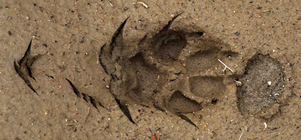
Coyote Stopping |
| Again, this is a fairly dry sand and clay mud without a top clay slime layer. The cracks in the mud are formed by the paw pushing to stop the Coyote. Heel and toe pad prints are distorted due the dynamic nature of the animal stopping. There are no slime pull up marks. Again, big drop of water from the fur has made a crater, this one with a circumferential ridge, and a sandier bottom than the surrounding soil. |
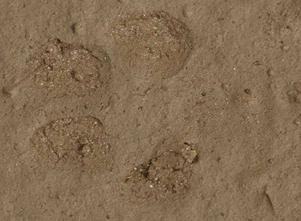
Bobcat |
| The soil is a fairly dry sand with a thin clay slime layer. The heel pad barely registered. The upper two toe pads pushed back slight mud ridges. All toe pads lifted the thin clay slime layer, exposing the sandier soil below. |
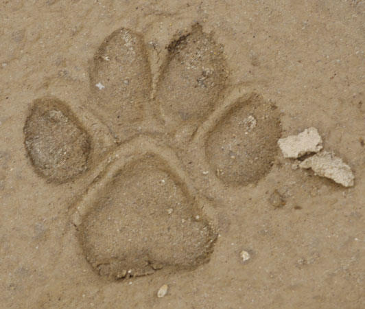
Bobcat |
| The soil is a soft mixture of sand and clay, with no slime layer. There are no pullout ridges, or other sign of a surface clay slime layer. But the soil is soft enough that a ridge has pushed up around the heel and all toe pads. The bits of mud to the right have dried, so perhaps the print has dried for a few hours. But all of today's prints were still wet and mushy. |
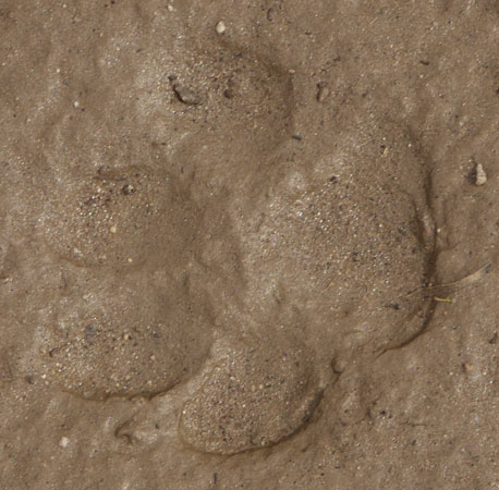
Bobcat |
| There is a thin clay layer over the sandier soil below, but the clay layer was quite wet, perhaps with a thin layer of free water on top. The clay flowed and smoothed over the impressions in the pads |
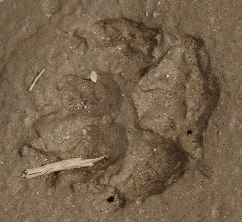
Coyote |
| The soil is mushy without a slimy clay upper layer but with enough free water to smooth out the print in the moments after it was made. The pullup ridges contain not just clay, but sand, indicating the sand and clay base layer was slimy enough for pullup ridges. There was enough free water that the details in the surface are washed out. The shapes of all the pads are somewhat distorted, with the claw impressions fairly washed out. |
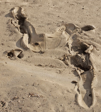
Human Slipping in Mud |
| The right foot landed in the lower right corner and slid forward and down into a muddier depression over two feet before the right leg caught and pitched over. The seams in the butt print are quite clear, as is the impression of the folded right leg. There are hand prints to the left and below the butt, and to the right of the right knee, where the guy pushed himself up. |
Wednesday, February 27, 2019
I walked to Alchoholic Pass, to Maidenhair Falls, and to many lesser sites. I drove Grapevine Canyon Road and checked ? ? springs, both flowing vs tct hike? Borrego Springs has most services at medium prices. Blair Valley had hundreds of RVs camped on every road stub. The PCT cache at Scissors Junction had been dragged up slope as the entire wash under the bridge was muddy. I picked up a bag of litter and cleaned and stashed some goodies where they could be seen.
Thursday - Saturday, February 28 - March 2, 2019
I visited my mom in Vista and my sister in Carlsbad Thursday. On Friday and Saturday I hung out with Don and Gene mostly in El Cajon. We got the seatbelt buckles replaced on the Montero to clear an old recall Friday, and ran around buying stuff Saturday. Rain kept us away from the Swap Meet. For the Montero we got jumper cables, a 120 Watt inverter, and a 27 foot 2" nylon tie strap for towing and winching.
Sunday, March 3, 2019
I hiked a short distance on Horsethief Road from the Pine Creek / Horsethief Trailhead. It was still misty and quite muddy from yesterday's rain. I moved on to Kitchen Creek Road, hiking the PCT south to the falls and north to the views east. The falls were flowing well, and there was mist and a rainbow from the storm. I saw a few runners and a day hiker, but no thru hikers.
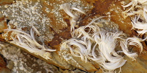
Extruded Crystals |
Sunday, March 3, 2019
I visited the BLM Yuha Desert areas north and south of I8. On the south side was an ATV area where you had to camp clustered at certain spots. There are kiosks marking the Anza route, and fossils in various areas. I need a good map. There is an El Centro BLM Office. North of I8 I walked several miles at ?? BLM Road to fossils and wind caves. Traditional BLM camp anywhere 14 day rules were posted. This area northwest of Ocotillo is just on my Tom Harrison map. Legally, you can collect several pounds of fossils for personal use, but what I found were crumbling common shells like scallops, clams, and sand dollars.

360+° Panorama from Mine Peak |
Monday, March 4, 2019
I hiked at the Dolomite mines. The east mine had pack rat nests with piles of occotillo thorns in front of rock tunnels. At the west mine mill white translucent sand and gravel lay about. I walked up to the Mine Peak triangulation station above the west mine and took a panoramic photo of most of the park. I descended southwest and walked back to the mine though badlands. There were nice flowers at various badlands overlooks. I drove 4 miles up Carrizo Gorge and camped. I walked west up an alluvial fan and canyon. There was one dead palm tree.
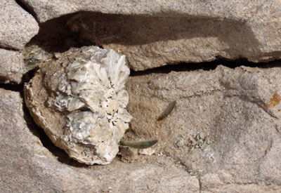
|
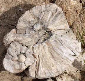
|
| This type of Fossil sat loosely in rock cavities. Like many Anza-Borrego fossils, they are delicate and crumble easily. | |
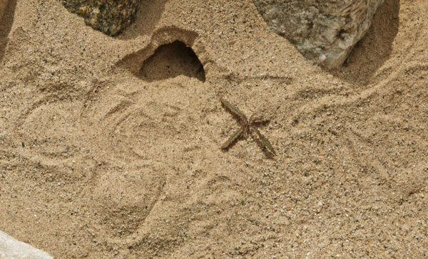
Insect Tunnel and Tracks in Sand |
| There were many of these insect tunnels, typically an inch plus wide. This one has good soil to show the tracks of the inhabitant. In many cases, the excavated soil in front of the tunnel had different pebble sizes or soil colors than the surface soil. I could dig a test pit nearby and match the soil layers to the tailings, seeing that the excavation was several inches deep. |
Tuesday, March 5, 2019
I took an all day walk south up Carrizo Gorge, seeing no other hikers. There were two miles of road which I could have driven. Below the various railroad trestles were ponds. Just a few bugs swam in the water. A hard coating, perhaps calcified algae, covered many rocks and even some soil in the streambed. Stromalites? There were Bighorn Sheep prints, scats, and bones. I ended mid day three miles as the crow flies past the road end, well beyond most other boot prints. The walk is mostly cross country, with many scratchy bush patches and with plenty of rocks to climb up. It's ten miles up / south to I8, and there are plenty of side canyons and railroad exploration options. So an overnight trip might be fun. It might be fun to visit McCain Valley before or after such a trip and see how the views might connect. It began to rain just as I returned in the evening, so I drove out of the canyon and camped atop Egg Mountain. There were excellent views of the storm and sunrise.
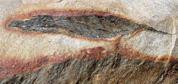
Granite Inclusion |
| Above and below, there are many very interesting inclusions in the granite of Carrizo Gorge. |
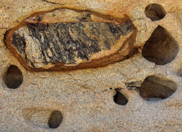
Granite Inclusion |
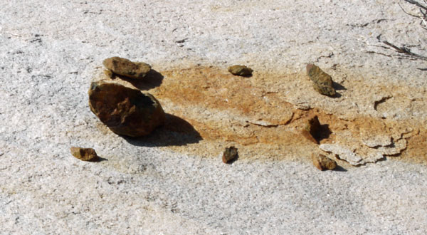
Iron Stain |
| Also in Carrizo Gorge, these stones are leaching iron and staining this granite. |
Wednesday, March 6, 2019
With plenty of mud and threatening clouds, I drove north, doing a few short hike, and moteling in Indio. The Coachella Valley / Palm Desert cities have all services, but lodging is expensive. A conversation with my sister resulted in a plan to be in San Diego at least Monday, and perhaps for the following week, to get my mom to various doctors.
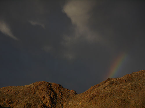
Rainbow |
Thursday - Saturday, March 7-9, 2019
Joshua Tree National Park
I took many long hikes. A few are listed below, but I found walking cross country in random spots yielded a much less disturbed environment and virtually no other hikers. Joshua Trees were in bloom, as were wildflowers in various places, especially to the south, near I10. Keys View Point was very windy and cold, and there was plenty of haze, but a panorama here would show much of the course of the Pacific Crest Trail.
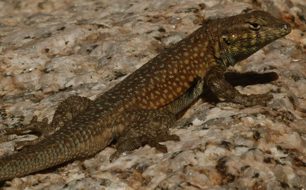
Lizard |

Sunset |
| Where I Walked | |
|---|---|
| Victory Palms Oasis | 9 |
| Porcupine Wash - Ruby Lee Well | 7 |
| Turkey Flats - Base of Pinto Mountain | 6 |
| Lost Horse Mine South Loop | 7 |
| Total | 29 |
Sunday, March 10, 2019
Santa Rosa Mountains, Pines to Palms Highway 74
I awoke before dawn, and drove up the switchbacks from the Palm Desert Cities during a nice ice crystal sunrise. The ascent is largely on BLM land: it should be possible to camp on a dirt road. There is a BLM office at the base where I might be able to gather more maps and information about the Santa Rosas, between here and the Anza Borrego Desert, an area which has long intrigued me. I stopped for various views and for a nature loop.
Sunday, March 10, 2019
Pacific Crest Trail, Pines to Palms Highway 74
I walked to the north and south of the highway on the PCT for half a day. Lots of clear water was flowing in most (usually bone dry) washes. I met a couple of day hikers and a group out for a few nights. There were no thru hikers. I hope that the trend of lots of people starting the PCT very early has started to reverse. Last year I met many thru hikers in January, February, and March. The Pacific Crest Trail Association and US Forest Service were running a quota system to limit the number of hikers leaving the south end of the trail to 50 per day to reduce the daily traffic on the PCT. This forced honest, rule following hikers to hike in winter months or in hot, late spring conditions. Southern California small mountain ranges like the San Jacintos and the San Bernadinos can easily have 10+' of snow, howling winter storms, and avalanche conditions from before December through the first half of April. Most PCT thru hikers don't have the skills or equipment to handle the winter conditions safely. Shortly after April, southern Calfornia desert and chapparral lands get much hotter while water sources dry up. This too can be dangerous to the less experienced hikers. I hope that most hikers return to starting at the Mexican Border in the second half of April.
Monday, March 11, 2019
San Diego, Vista, Carlsbad
I took my mom to appointments for an eye infection (healing well), ear wax cleaning, and foot swelling / blood pressure. Because the eye infection was responding well to antibiotics, more appointments later in the week were less likely.
Tuesday, March 12, 2019
San Diego, Vista, Carlsbad
I visited Don and Gene in San Diego and Jamul. It's always great to yack with these old engineering friends.
Since beginning to hike and live out to the Montero, I had realized that the bubbling window tint film was fatiguing to my eyes and did nothing good to the views, while the back seat was useless to me and in the way. Don had a steamer and helped me remove the film. Gene wanted me to store the seat at his place rather than risking that it might disappear, as both Gene and Don reserve the rights to own the Montero when I'm done with it. We stored the seat, and I am able to sleep stretched straight out, much more comfortable than with the seat. I can also use the passenger doors to access equipment in the back - very handy.
I am slowly developing and learning tricks to live easily in the truck. My best idea has been one plastic bin full of water bottles and another full of food. With them at the back of the truck, I'm able to cook on the bumper or load my pack for the day easily. I stack the food bin on the water bin to clear the passenger side to sleep. Forward of the bins I have a disorganized pile of too much stuff. I took everything I might need on this trip and discovered there is much I never touched. I'll reduce the load. Tools and supplies for the Montero are accumulating. Perhaps a bin for that woud keep things organized and undamaged. There's no great place for a trash can, so I bought a big cottage cheese tub. It's as big as I can handle with two hands, and the tapered shape will dump easily. I'm thinking a few holes will allow fruit peels and rinsed cans, etcetera, to dry rather than rot. We'll see. Gene showed me a few videos of how other people have adapted themselves and their cars for camping. One guy probably spent over $100 grand on every sort of winch, light, popup tent, etcetera that is available. Two others had many many bins to store all sorts of stuff. With my experience as a backpacker, I hope to live with less stuff while having more space available in my truck.

Gopher Snake |
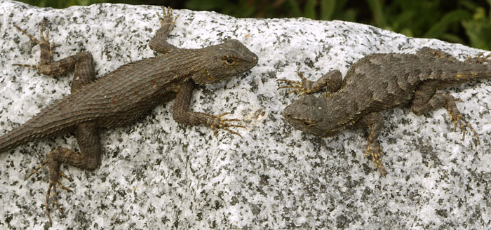
Lizards Mating |
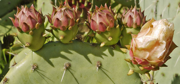
Prickly Pear Flowering |
Wednesday, March 13, 2019
San Diego, Vista, Carlsbad
I walked at Batiquitos Lagoon, San Dieguito Lagoon, and Torrey Pines State Park. The beach below the Torrey Pines bluffs has many layers of fossils, while the eroded sandstone terrain above has a super popular trail system. Yuccas were in bloom. My sister and I had dinner with my mom.
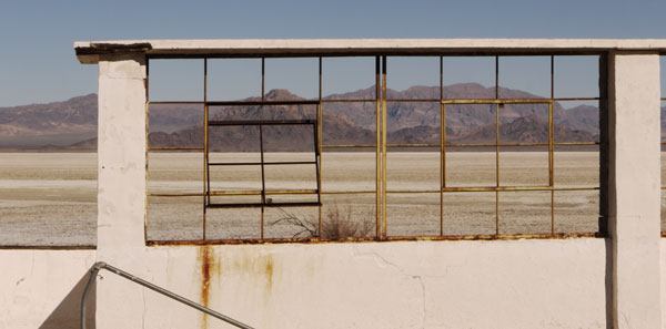
View From Zzyzx Soaking Tubs |
Thursday, March 14, 2019
Mojave National Preserve
I drove northeast very early, beating LA traffic and reaching Cajon Summit and the PCT before dawn - too early to hike. I proceded to Rainbow Basin Natural Area (BLM). The area is noteable for brightly colored soils, tilted layers, and severely eroded badland topography. I spent the morning hiking up various gullies and up to a nice viewpoint. I proceded to Zzyzx, walking around the present campus and then a little south through all sorts of junk abandoned by the resort and then the college campus. The Mojave Road and Tonopah and Tidewater Railroad berm might make good hiking for miles beyond the campus.
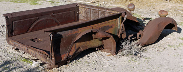
Truck |
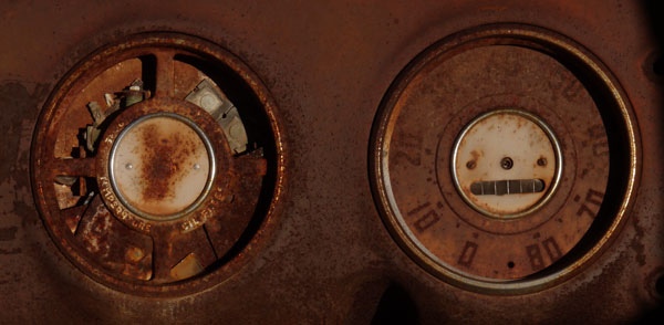
Zzyzx Dashboard Guages |
Friday, March 15, 2019
Mojave National Preserve
I woke near Oro Fino and Brannigan mines and walked cross country and on dirt roads to various mine shafts. I ran into no one, but plenty of people drive to these sites per tire tracks. Street legal vehicles can use many old mine roads. I drove a little east to volcanic cinder lands. Many hills have old roads spiraling to the top and odd cuts through the tops. Two hills and the plains between were enough for me, but it would be fun to walk up more of the hills on future trips. The Mojave has vast sand plains and small hills, so reasonable ascents bring great views.
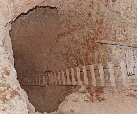
Shaft, Ladder |
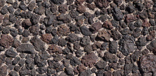
Desert Pavement Above, all sand has blown off the surface, leaving an even stone surface over a sand and gravel soil. Below, a bush slows the wind, allowing sand to collect over the desert pavement. 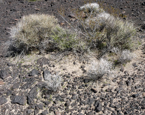
A Bush Island in Desert Pavement |

Panorama from Cinder Cone |
|
|
|
|
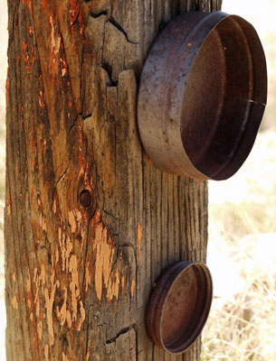
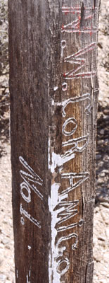
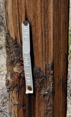
Mine Claim Monuments The Mojave is full of old claim marking posts, not exactly 4x4 posts. Most have no markings left after decades of weathering. | ||
Saturday, March 16, 2019
Mojave National Preserve
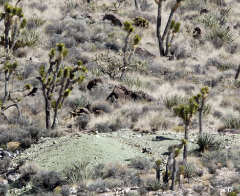
I walked a loop of Copper King, Standard Mine #2, and Evening Star mines and camped at Standard Mine #2.
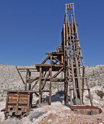
Evening Star Headworks and Mill |

Evening Star Panorama |
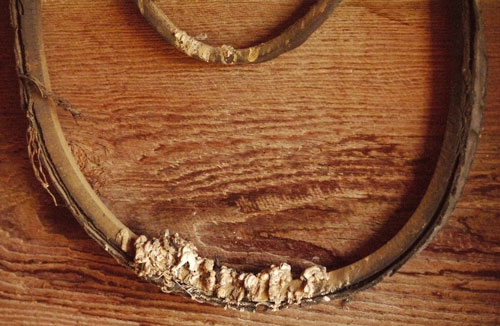
Fan Belt |
Green Ore |
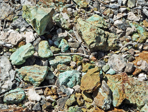
Green Ore |
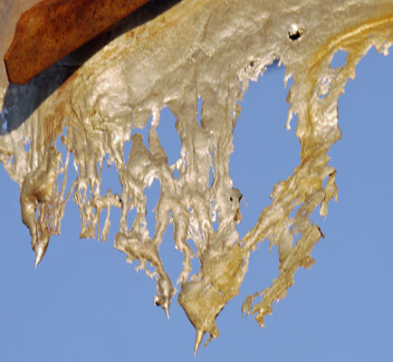
Melted Aluminum School Bus Roof |
Sunday, March 17, 2019
Mojave National Preserve
I visited Silverado Mine then drove to Kewanee Mine and looped. Morning Star Mine is an abandoned open pit mine with multi colored ores and two abandoned leach heaps. I looped again near Allured Mine.

Morning Star Mine from South |
| Most of the mines in the Mojave are hard rock tunnels. The Morning Star Mine has an open pit, to the left in the above photo, and the large flat topped piles are abandoned leach heaps. In a leach heap, crushed ore is piled over a lined pond, and chemicals are dribbled through the crushed rock. The chemicals dissolve the gold, silver, etcetera, and are recirculated from the pond to dribble through the stack again and again. |
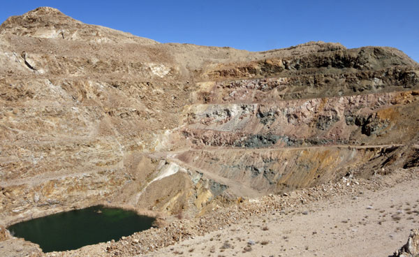
Open Pit Mine |
| This is the open pit of Morning Star Mine. |
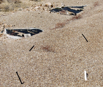
Leachate Tubes, Liner |
| The tubes once carried the leaching solution to the top of the pile to be dribbled through the ore. The top surface is a cap of gravel. In the background, the liner is in tatters from the sun and weathering, but it is probably intact where it is not exposed. |
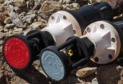
Leachate Bubblers |
| These bubblers controlled the flow of the leaching chemicals at the top of the pile. |
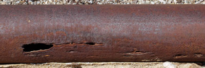
Corroded Pipe |
| This pipe once carried the leaching chemicals to the top of the pile. |
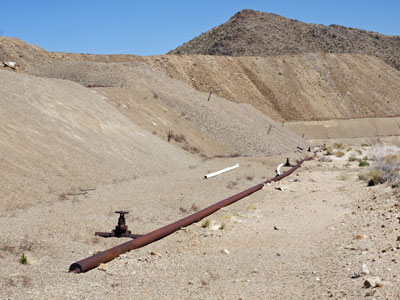
Heaps and Pipes |
| The distribution pipe and heaps. |
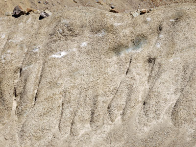
Eroding Leach Heap |
| Here the leach heap is eroding away. You can see the diagonal sand dune type lines from the piling of the ore, and the chemicals leaching out of the stack and forming white crystals. |

Water Treatment Pond |
| This pond is probably still treating any rain water that trickles through the leach heaps and ends up in the liner. |
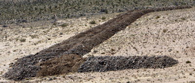
Dike |
| This dike is supposed stop all the mud should some huge rain cause the leach heap piles to collapse. |

Junk Heap |
| This junk heap includes piles of plastic tubing and bubblers that once carried the leaching chemicals. |
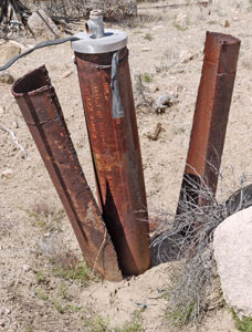
Well |
| There are many cased wells like this around the Morning Star Mine which once probably collected water to operate the mine and leach heap, and today might be sampled for ground water contamination. |

Panorama near Allured Mine |
I drove to the Mid Hills - Hole In The Wall area and camped. This area is fairly high in elevation and was once dense with Pinyon and Juniper. The 2005 Hackberry Fire seems to have killed off the Pinyon, while there are scattered single junipers or small juniper stands.
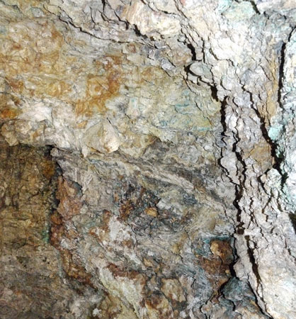
Multi Colored Shaft Ore Vein |
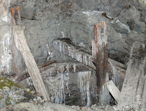
Bird Roost in a Mine Shaft |
Some thoughts on Mojave National Preserve
A few mines have very interesting ruins of mills or living quarters: Most are just holes with iron exclusion cages added for safety. The tin can dumps are fascinating. There are all sorts of hand soldered cans or other old and perhaps dateable technology. Can opener technology is also interesting. Today the middens contain mostly cans and a little glass, but probably they contained every sort of refuse and food garbage while the mines were being worked. The most interesting midden artifacts probably walk off regularly, though there are many warnings of the criminal nature of such collecting. The mines themselves were interesting but their presence
meant that there was a network of Jeep roads so one could walk easily past
the otherwise dense scratchy desert brush. My commercial plastic topo map of the park was great for picking places to walk, but each walk was on just an inch or two of the whole park map. An idea I have for all of these desert parks is to identify locales where I would be interested in walking and make cheap 1:1 letter or legal size color prints of the 7½' topo maps. Presumably, these would show more mines, old roads, topographic details, etcetera. There might also be geologic maps or other info available on the web. The national park websites of the specific park or the Harpers Ferry document archives are good places to start looking. So long as I parked or camped a half
mile or more from asphalt roads, I saw few or no others while hiking. Mojave NP does not contain many of the interesting nearby sites, research pays off in finding interesting stuff.
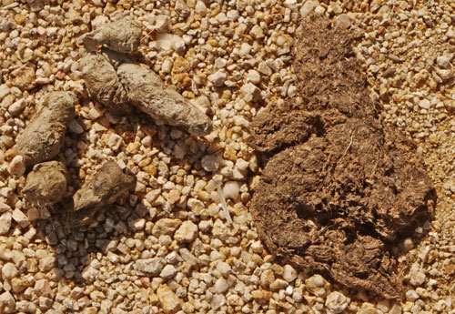
Coyote Scat |
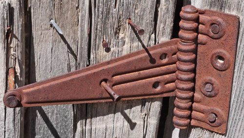
|
A Long Ago Trip to Mojave with my Dad
We took our blue Ford Pickup and 5th wheel trailer to Mojave. We hiked in the Rainbow Basin. I think from the ridge there we could see the solar array at 4 Corners or Kramer Junction. I think we found a mine on the same hike. We also camped at Mitchell Caverns, which was so windy that I didn't get out of my sleeping bag for fear it would blow off the hill and be gone. My dad, inside the trailer, couldn't sleep for all the bouncing, and couldn't decide whether he was more afraid of the trailer being blown off the hill if he stayed, or him being blown away if he moved outside. The ranger who led the tour of the caverns was excellent, giving all sorts of info and stories. I may have climbed Amboy Crater with him, since Jim didn't remember it.
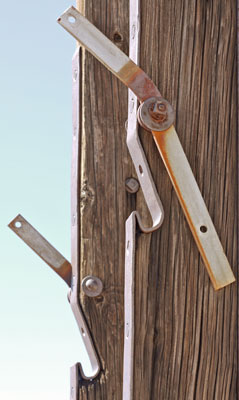
Latch |
| This type of notch in the headworks of small mine tunnels latches the mine elevator so it can't slide back down into the shaft. |
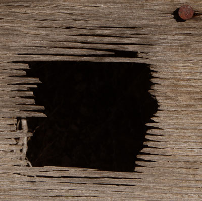
Plywood Eroding Away |
Another Mojave Trip with Jim, Christmas 2008 / Early 2009
- We visited a silver mine with several cabins, a mill, and old tunnels, plus a later era large sloped tunnel that large trucks could drive in. A vertical tunnel was so deep we couldn't hear a dropped stone hit anything for 6 seconds, which may not have been the bottom.
- We climbed the sand dunes and hear them moan.
- We visited Zzyzx, enjoying the old resort ruins.
- We visited an abandoned auto wrecking yard along US66, finding all sorts of interesting old stuff.
- We went through a lava tube.
- We saw the Kelso Depot.
- We hiked up the cinder cones and visited the cuts through the tops.
- We visited a gypsum mine.
- We drove Jim's black Toyota 4 Runner. We had problems with and empty clutch hydraulic reservoir, with a nearly flat tire, and with an even flatter spare. We found a gas station along US66, but it had no air compressor. Luckily, a semi driver overheard our problems and refilled our tire from the truck compressor.
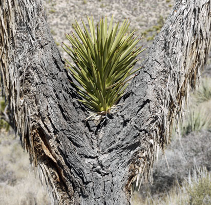
Joshua Tree Branching |

Joshua Leaf Base |
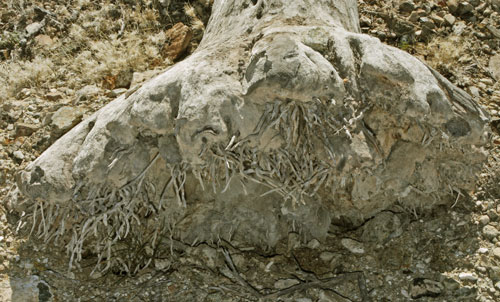
Joshua Tree Rootball |
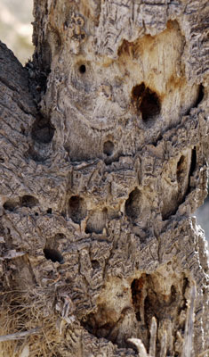
Woodpecker Feeding Holes |
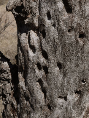
Joshua Tree Woodpecker Feeding Holes |
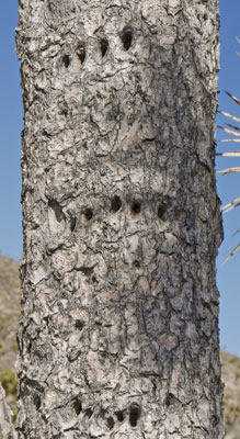
Woodpecker Feeding Holes |
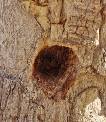
Joshua Tree Woodpecker Nest |
Monday, March 18, 2019
Mojave National Preserve
I parked a mile south of Macedonia Road at a windmill and tank, and walked up ravines to old mine ruins and can middens.
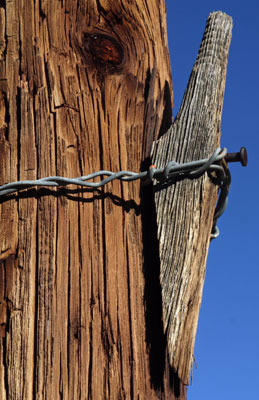
Insulator Bracket |
| 7½' Quadrangle Maps of Mojave | |||||||||||||
|---|---|---|---|---|---|---|---|---|---|---|---|---|---|
| 116° 15' | 116° | 115° 45' | 115° 30' | 115° 15' | 115° | 114° 45' | |||||||
| 35° 30' | Silurian Lake | Silurian Hills | Kingston Spring | East of Kingston Spring | Pachalka Spring | Clark Mtn | Ivanpah Lake | Desert | Mc Cullough Mtn | Highland Spring | Nelson SW | Ireteba Peaks | 35° 30' |
| Silurian Valley | North of Baker | Turquoise Mtn | Solomons Knob | Valley Wells | Mescal Range | Mineral Hill | Nipton | Crescent Peak | Hopps Well | Searchlight | Fourth of July Mtn | ||
| 35° 15' | West of Baker | Baker | Halloran Springs | Granite Spring | Cow Cove | Cima Dome | Joshua | Ivanpah | Castle Peaks | Hart Peak | Tenmile Well | Searchlight SE | 35° 15' |
| West of Soda Lake | Soda Lake North | Seventeenmile Point | Indian Spring | Marl Mtns | Cima | Mid Hills | Pinto Valley | Grotto Hills | East of Grotto Hills | West of Juniper Mine | Juniper Mine | ||
| 35° | Crucero Hill | Soda Lake South | Cowhole Mtn | Old Dad Mtn | Kelso | Hayden | Columbia Mtn | Woods Mtn | Hackberry Mtn | Signal Hill | Homer Mtn | East of Homer Mtn | 35° |
| West of Broadwell Mesa | Broadwell Mesa | West of Glasgow | Glasgow | Kelso Dunes | Fountain Peak | Colton Well | Desert Spring | Fenner Hills | Goffs | Homer | Bannock | ||
| 34° 45' | Broadwell Lake | East of Broadwell Lake | West of Budweiser Wash | Budweiser Wash | Bighorn Basin | Van Winkle Spring | West of Blind Hills | Blind Hills | Fenner | Fenner Spring | West of Flattop Mtn | Flattop Mtn | 34° 45' |
| Ludlow | Ash Hill | Siberia | East of Siberia | Brown Buttes | Van Winkle Wash | Castle Dome | Danby | Essex | Little Piute Mtns | Stepladder Mtns NW | Stepladder Mtns NE | ||
| 116° 15' | 116° | 115° 45' | 115° 30' | 115° 15' | 115° | 114° 45' | |||||||
| 36° | 60' x 30' 1:100,000 Quadrangle Maps of Mojave | 36° | |||||||||||
| Owlshead Mtns | Mesquite Lake | Boulder City | |||||||||||
| 35° | Soda Mtns | Ivanpah Lake | Davis Dam | 35° | |||||||||
| Newberry Springs | Amboy | Needles | |||||||||||
Monday, March 18, 2019
Fall and Nasty Wounds
I slipped and fell while descending a decomposing granite
slope towards Macedonia Road. I got a big painful bruise on my left hip, and various scratches on
my head and around my body. But most importantly, I got a 5" gash on my forehead. Hiking and driving out took several hours, then there were several hours in an emergency room getting cat scanned (no bone cracks, but a small
nose cartilage crack) and stitched up (17 stitches).
It was 7pm when I was released. I got some dinner and checked in at a motel.
I normally sleep from soon after sunset until soon before sunrise, but with the adrenaline of the day and no sleeping position where nothing at all hurt, I got very little sleep before midnight. I decided a shower might relax me and certainly would remove sweat and dirt from days in the desert, plus blood dried up everywhere. I discovered there was no soap in the room, but decided that getting some from the desk or my car would wake me up more. The soapless shower worked somewhat: I woke often but at least got some sleep. The hotel had a breakfast starting at 5am, and I was there not long after. I had a bunch of coffee, juice, cereal, fruit, etcetera, and got some soap from the desk. On returning to my room I slept quite soundly for a couple of hours. I took a second bath and shower, scrubbing away the desert grime. The bath was great, because because below my head there were only a couple of tiny scratches, and I could scrub and soak while leaving my head dry. Then the shower was great, because there was plenty of blood and crud dried in my fortunately very short hair. I was allowed to shower, with fresh water flowing over my wounds, but not soak the wounds. I bought my antibiotic pill prescription and triple antibiotic creme, and started on those.
Tuesday, Wednesday, March 19, 20, 2019
Fall and Nasty Wounds, Flagstaff Recovery
I drove on to Flagstaff and got a room for a week, likely two. I had enough food to just recover these two days, and recovery was substantial each day. Oddly, the head doesn't hurt much at all. I had Lidocaine injections during the cleaning and stitching. Handling the wound edge in the hospital really hurt, but the rest of the pain around my head was very little. Normal cleaning doesn't hurt except at the very left end of the scar, which was also the most painful spot at the hospital. Besides the 5" long wound, I also had scrapes and bruises on my scalp, under my eyes, and along the ridge of my nose. These are recovering well. The broken nose doesn't hurt. A bump 1-2" high rose on the outside of my left hip bone. Walking or climbing stairs hurts, but I think walking helps it heal so I go on a short walk someplace once or twice each hour. An ugly black and blue bruise is proceding down the leg from the bump, but walking is a little less painful each day.
Thursday, Friday, March 21, 22, 2019
Fall and Nasty Wounds, Flagstaff Recovery
I began to do errands, carrying stuff from the Montero to my room and sorting it, and going out for groceries Thursday, and going to the library to write this journal without the temptations of TV or sorting my stuff Friday. By Friday's shower, nearly all scabby material sloughed off my scalp, face, and body, while the stitch line looks and feels ok as I clean it or apply the ointment. While nerves reconnect, there are occasionally odd sensations on the stitch line or in the circle of which the stitch line would be one diameter. The hip bruise and bump continue to hurt while walking or if poked, but they too are recovering. Recovery overall is proceding well.
Saturday - Monday, March 23-25, 2019
Fall and Nasty Wounds, Flagstaff Recovery
I stayed mostly in my room working on the website, completing the text for the last few months, though pictures are done only here and there. I made a large photo essay of antique tin cans and glass I'd found in the desert. I'm becoming quite stir crazy and thinking of taking at least several days of hiking between Flagstaff and Grand Canyon. Only my hip complains much anymore, and it recovers a bit each day. I'm guessing a bunch of short hikes may do it some good.