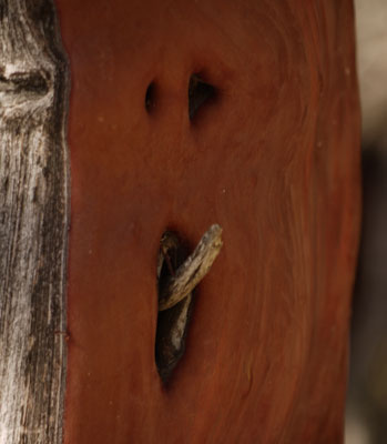
Manzanita Face
| Table of Contents | |
|---|---|
| April 19 - 24 | Horsethief / Japatul Trailhead to Warner Springs |
| May ? - 13 | Warner Springs, Trail Angel Mike's, Idyllwild |
| May 14 - 17 | Idyllwild, I10, Hillbilly's, Mesa Wind Farm, Big Bear |
| May 18 - 21 | Big Bear, Deep Creek Hot Springs, Cajon Junction, I15 |
| May 21 - 26 | Cajon Junction / I15 to Agua Dulce, Hiker Heaven |
| May 27 - 31 | Agua Dulce, Casa de Luna, Hikertown, Tehachapi |
| June 1- 12 | Tehachapi Ankle Sprain, Kennedy Meadows Healing |
| Next: | Sierras, PCT, Tahoe-Yosemite Trail |
Trip Summary
This hike is intended to start in San Diego County (Spring 2018), continue on or near / parallel to the Pacific Crest National Scenic Trail, and end near the Canadian Border (Fall 2018).
Why I Do Not Always Follow the PCT.
Since the book and movie Wild, there are so many hikers on the PCT that opportunities for solitude and wildlife viewing are limited. Additionally, my form of wanderlust demands that I explore trails to the side of the PCT which I passed and wondered about during past PCT hikes. For these reasons, I will often hike routes not on, but rather parallel to the PCT, where they seem possible and attractive to me.
Permits and Dates
Also due to crowds, long distance permits starting near the Mexican border are currently limited to 50 hikers per day. Mine allowed me to start at Scissors Junction, in the Anza Borrego Desert, on April 23rd.
Website Format Change
In the past, I wrote one or more paragraphs each day. I decided that for this trip I would write less frequently, so that each report could be longer, more coherent, and generally better writing.

Manzanita Face
Route
Gene dropped me off at the Horsethief / Japatul Trailhead. I proceeded eastward on the Espinosa Trail, noting several morteros where it crosses Pine Valley Creek. Continuing north along Secret Canyon Trail, I found Secret Canyon had water and lots of Poison Oak.
The Secret Canyon Trail ascends to a partially built historic 1895 flume intended deliver Pine Creek's water to King Creek (a tributary to the San Diego River), to the northwest. The project was abandoned after most of the pick and shovel work was done, but before most blasting for the difficult stretches. The walking is easy where the flume was completed, and tough when scrambling up and down around the steep, rocky places that were too tough to build. (Today, Pine Creek's water is diverted to San Diego from Barrett Reservoir, a few miles downstream. The modern aqueduct is sometimes visible or leaking along Highway 94.)
Two motorcyclists had stopped on Interstate 8's high and windy Pine Creek Bridge. They were shouting over the wind to each others and sometimes to me, but I understood few of the words. They seemed especially jubilant when I stopped to dunk myself in the creek.
I continued up Pine Creek Road, loading potable water at Nobel Canyon Trailhead, which also has trash, toilets, tables, and a kiosk. Miner's Road (open to 4WD), leading west from Pine Creek, to the south of Cuyamaca Rancho State Park, had active gold claims, a concrete cistern, and flowing water the full length of the bedrock creek.
I visited the Arrastra in Deer Park, but skipped the several hard rock mine tunnels there. Water was available in Pine Creek.
I followed East Mesa Fire / Deer Park Road west, Harvey Moore Trail north, and the Upper Green Valley Fire Road north along the Sweetwater River (no water). I looped back south along the Sunrise Highway to the Sunrise Trailhead, which has toilets and a solar well, where clean water flowed from the valve, but the horse trough was empty and out of repair. A trail angel there gave me a grapefruit, Crackerjacks, and cheese puffs. I loaded water for the trip to Scissors Junction, as I had heard that Rodriguez Tank was dry. (But other hikers had found the spring a half mile north of Rodriguez Tank was providing good water.)
I continued variously on Trans County Trail, California Riding and Hiking Trail, Mason Valley Truck Trail, and PCT tread to Scissors Junction, arriving mid morning somewhat dehydrated.
It was quite hot, so I decided to take a half day off by resting in the shade of the bridge until mid afternoon. I drank a quart from the well stocked water cache, and lazed for an hour. Trail Angels showed up with a barbeque and offered hot dogs with bacon, plus all sorts of fruits and vegetables. Many hikers relaxed and chatted. I couldn't have asked for a better way to spend my ½ day off. No one went up the switchbacks into the San Felipe Hills while I was under the bridge. But I looked back as I ascended, and someone seemed to start every few minutes.
The Third Gate Cache, Barrel Springs, and several creeks provided water to Warner Springs and its Community Center. There I enjoyed a bucket bath, bucket laundry, the hiker food closet store, a good hiker box, and a long distance hiker gear store in a trailer which will eventually move to Lone Pine with the PCT herd.
Miles: 86
Maps: THSDB, THCRSP
Time Off to Heal
I didn't feel well on this segment, often feeling queasy and not wanting to eat, so I hitched from Warner Springs back towards Gene's Ranch to heal for a while.
Wildlife Observations
Cougar Scat
This was a great segment for wildlife viewing. On the ascent to the Pine Creek Flume was a fairly fresh Cougar Scat. It had rained lightly the day before, and in my judgement the scat had been left less than a day before that. The cat had covered the scat with 3 scrapes from perpendicular directions, each scrape over a foot long and a little less than an inch deep. The segments were about ¾" diameter and totalled perhaps 10".
Still ascending to the flume, I found a dead opossum. Along the flume were Horned Lizards and Sacken’s Red Velvet Ants Dasymutilla sackeni (actually female wasps). I saw many more Red Velvet Ants through southern California, and some white ones in the Mojave. There were plenty of Horned and Fence Lizards through the rest of the segment.
Near the Sunrise Highway Horned Lizards were especially dense: I saw one pair mating. One was of dark brown color, the other beige.
Garter Snake Killing Lizard
In the San Felipe Hills, A Garter Snake was restraining a Lizard's body with a few coils, while choking the lizard's throat area with a tight jaw grip. This happened right in the PCT tread: I first became aware of it by seeing other hikers step off the tread to walk around the fight. The other hikers didn't understand what they were seeing or how rare seeing a snake kill prey was, so I narrated each step and suggested taking pictures. When the lizard was almost dead, but still twitching, the snake carried him off into the bushes, maintaining the tight choking jaw grip.
Later, beyond Wrightwood, at Jimmy Spring, I met Rachel again, who reminded me we had met at the snake kill, and promised to send a photo. She also reminded me that at a later break that day, while cleaning litter, I had found a good pair of Darn Tough Socks in her size, and talked her into keeping them.
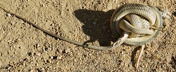
Snake Constricting Lizard
Above and Below: Dwell Cursor to Distinguish Snake from Lizard.
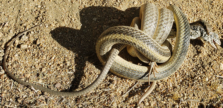
Snake Constricting Lizard
Also in San Diego County in 2018
On a previous trip I also hiked the Espinosa and Secret Canyon Trails, but continued on the Nobel Canyon Trail, and through Laguna Meadows to its Visitor Center. I continued southbound on the PCT to Lake Morena. I talked to many hikers on the PCT as early as January claiming to be throughhikers, but they will have tough times with snow.
Returning momentarily to the Laguna Visitor Center, there were mobs of tourists needing information, so many that the volunteers were swamped. So while I waited to buy a couple of maps, I answered questions. Seeing this, Linda recruited me, so I volunteered several weekend days at the vistor center until my PCT hike started. When working at the Visitor Center, I often stayed in the volunteer bunkhouse and hiked many of the trails in and near Laguna Meadows.
I hiked Kitchen Creek Road. Most of it is closed to vehicles and has excellent views. It has old asphalt paving and has no water sources, except at Cibbetts Flats. It would make an excellent loop hike with the PCT between Cibbetts Flat Campground and Laguna.
Coastal Hikes
Many times I walked near Mission Bay / Beach, by the San Dieguito River / Del Mar Racetrack, and in other salt wetlands along the coast as I travelled to visit my Mom in Vista.
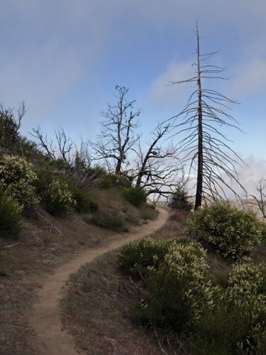
Trail
Road Trip
Gene and Don drove me to Warner Springs, stopping in Ramona for a Mexican Lunch. Dudley's was closed, but the medium grocer in Santa Ysabel would have been fine for long term resupply. We visited the Mission at Santa Ysabel and the Saint Francis Chapel in Warner Springs, as well as driving up the Camino San Ignacio to the Los Coyotes Indian Reservation, with great views of the valley. We handed out sodas and tangerines to the hikers at Warner Springs, and toured the many hiker services there. I walked out in late afternoon and camped along Agua Caliente Creek.
Wildlife
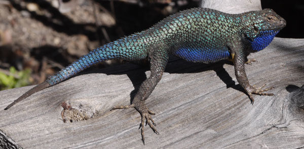
I saw a Hen Turkey with chicks, and many individual quail. There were a Gopher Snake and a Garter Snake. Many lizards were out, but only a few were in dominance displays, and just two had iridescent blue / violet backs.
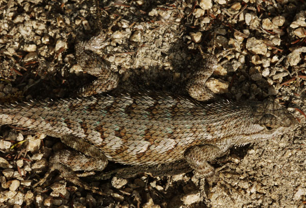
Lizard
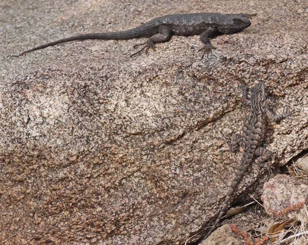
Lizards
Note Sexual Dimorphism.
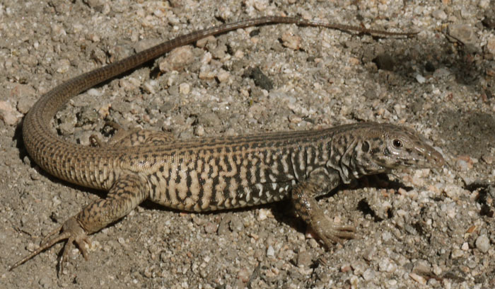
Lizard
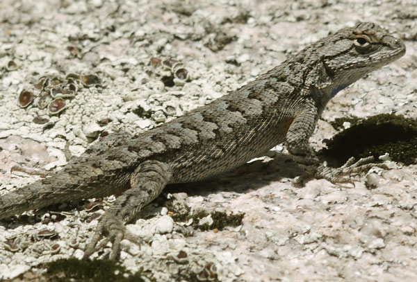
Lizard
Lizard
Note Push Up Posture and Inflated Irridescent Blue Underparts.
In profile, Horned Lizards Phrynosoma indeed look like toads (Horny Toads) sometimes, and a certain gait looks like a hop. Two who were mating earlier had different coloration, brown versus beige. I should research their sexual dimorphism.
I hadn't planned to stay long at Trail Angel Mike's, but chopped and cooked away the afternoon, preparing all the toppings for pizza, as well as a huge loaf of banana bread and a caramelized peach topping. Dinner was excellent.
Mill Stone
I later hiked with Scott / Slim, and chatted at Hiker Heaven and Kennedy Meadows South. He had volunteered at Mike's for six weeks, as well as in previous years, preparing 3 meals a day, sometimes in a brick woodfired oven he had built, for the hikers. Mike drives up several times a week with truckloads of food. Many thanks to him and his helpers for keeping this oasis open for the hikers.
PCT Dirtbags
Some hikers have been using the PCT as a way of ripping people off. One San Diego hiker walks from the Mexican border to the Riverside border several times each season, each time with a new trail name, and steals money from other hikers' packs and from the donation jars at various trail angels. Other hikers have been openly drinking and smoking pot at the Warner Springs Community Center, which is hosted on an Elementary School Campus, and causing similar problems at family campgrounds. I've heard that several federal law enforcement agents have been visiting the PCT with a list of names and pictures derived from internet postings for arrest. Good! Two guys have been travelling the PCT in a van, finding the hiker boxes and taking all the food. It hardly seems like it would be worth the gas?!?
Palm Springs Via Jo Pond Trail Idea
I descended to Cedar Springs for water from the San Jacinto Hogback / Desert Divide. There was plenty of spring water flow and a great Cedar shaded camping area there. Had I continued on the Jo Pond Trail I could have resupplied in Palm Springs and returned to the PCT via the Cactus to Clouds Trail or the Palm Springs Tramway.
I followed a PCT temporary reroute west down the Spitler Peak Trail towards Hemet Lake, then up May Valley to Idyllwild. A room there was $75, but the second night was free. I don't usually zero, but the heat had been brutal, and the offer proved too good to pass up.
|
|
| Squirrel Eaten Yucca Seed Pods | |
|---|---|
Water in the San Jacintos
There was just a little snow in north facing ravines on the San Jacintos. The springs along the PCT were flowing with meager trickles. No water was available between the San Jacinto River and the Desert Water Agency Spigot, 20 miles. (There was snow in all ravines high atop San Gorgonio as viewed from the east (tiger cages) and north (Cougar Crest Trail.)
Wildlife
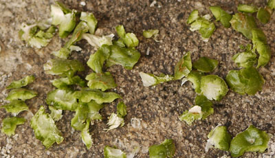
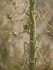
On the descent to I10, I saw 3 Rattlesnakes, a Garter Snake, and many Lizards. Snow Plants were emerging and healthy. Rodents had harvested Spanish Dagger fruits, chewing off and discarding the soft green flesh, presumably to access the seeds.
Overnight at Hillbilly's
I arrived under the I10 bridge at sunset, planning to walk past the community and camp in the desert. But Anonymous was there filling the cache and checking up on the hikers. He offered a ride to Hillbilly's place to stay overnight. Hillbilly had been an army sniper, a diplomatic security guy, and a federal narcotics agent. He was trying to arrange his marriage to a Filipina, and deciding whether to live here or in the Philippines, while also calming his own family. The stories were all interesting but could hardly scratch the surface. He assured me that hikers had only given him his trail name after carefully reviewing the décor of his house, but I was convinced after the shots of 190 proof shine and non stop drag racing on TV. Many thanks for for a very entertaining evening, meals, and a great night of sleep out of the howling winds.
Hillbilly said that 95% of 2017 hikers were dedicated pot smokers, but that 50% don't smoke in 2018.
I guess I should explain that in my 26,500+ mile hiking career, there has always been at least 15 or 20% of hikers who discreetly use pot, and that I have never had a problem with them. Since the Wild book and movie however, there seems to be great numbers of drug people vandalizing town and trail sites, annoying townspeople and trail angels, dumping out water caches, being beligerent, etcetera. I won't miss them when they're gone.
The Pink Motel seems to have burned down. When I stayed in 2003, it was a second house owned by the Middletons. There were a couple dozen ancient rusted trucks from a former extermination service, and the house was filled with a lifetime of mementos. Don showed up and apologised that he had not yet dug out the pit toilet and stocked the cupboards with food for the season's hikers, but again, we were happy just to be able to sleep out of the wind.
Ziggy and The Bear have also closed up. I was initially relieved to hear that the main cause was an issue with the lease, but was told health issues were on their way too. Many thanks to them for my stays there, and good luck with all.
I had never arrived at the Mesa Wind Farm when it was open, but got to visit on this trip. Several fridges were filled with sodas, ice cream bars, burritos, and etcetera that could be bought for a buck or two. Water and bathrooms were available. The farm is still using very old lattice tower windmills, but is going through the red tape to upgrade to modern towers and turbines.
Santa Ana Temperatures, 3 Gallon Days
This trip has been tough. High temperatures and dry, sometimes Santa Ana winds have me drinking sometimes 3 gallons a day. I think I need to plan town rests to control fatigue. After yesterday's ascent of Mission Creek, this morning's hike still seemed fatiguing. I was happy to leave the trail after the tiger cages and arrive in Big Bear for a big Mexican lunch. Past the cages, the trail is closed for a recent fire. (Actually, it was only closed for about a mile near Van Dusen Canyon Road - a little bum info from some southbounders.)
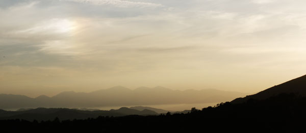
Clouds, Refracting Sun
The weather has been much more pleasant for this section: Sunny, breezy, and reasonably cool. So I've had more energy left over for the pleasures of hiking: A few swims, photographing lizards and flowers, some entertaining conversations, etcetera.
Route
I left Motel 6 westbound along the path and boardwalk towards town, northbound across the causeway, and westbound again on a very nice asphalt bike path between the highway and the north shore. After a few miles with nice views and occasional facilities with water, toilets, trash, etcetera, I turned north again on the Cougar Crest Trail and returned to the PCT for the remainder of the section. Along the Cougar Crest Trail were foundations of an old mill, many test pits, and nice view benches. About where it left Big Bear Lake is a solar observatory.
Wildlife
I saw a 2' Garter Snake, a 4' Gopher Snake, and many Lizards. A few Lizards were in mating colors or posturing. At Mojave Dam were many Raccoon and Rodent prints. There were many brilliant wildflowers.

Garter Snake

Gopher Snake
Deep Creek Hot Springs had the usual cast of crazy characters. My favorite tub with the hottest, cleanest water was as good as all my memories.
Later, a hiker told me there are very large tadpoles in the creek where it is warmed by the hot springs. I promised to look next time, but admitted that keeping one eye on wierdos probably kept me from seeing tapoles in the past.
The hiker said he was quite distracted by a naked guy with a sandwich in one hand and a large pair of shears in the other. He would stare blankly into various trees. Later, he marched away on the PCT, still nude and with the big loppers.
As I walked on the Deep Creek Flume, a helicopter flew below me down the gorge.
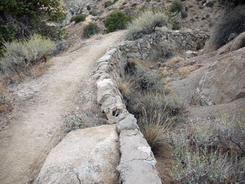
Deep Creek Flume
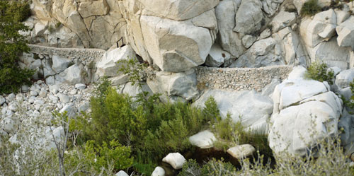
Deep Creek Flume
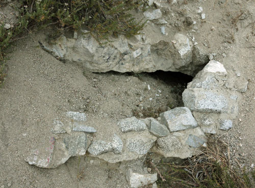
Deep Creek Flume Tunnel
Cooler Weather
Starting from the Big Bear Rim, and continuing to Agua Dulce, there has always been fog filling the Cajon Pass / I15, San Gorgonio Pass / I10, the San Bernardino CA, and the Los Angeles side of the mountains. This has kept temperatures cooler, and with the higher humidity, my water consumption was much lower. There are pretty views of the San Jacintos, the San Gorgonios, the Big Bear Rim, and the San Gabriels rising from the fog.
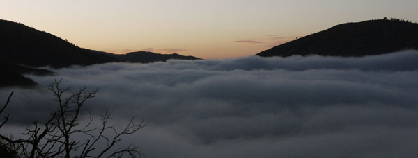
Above the Fog
The floor of the Cajon Valley and much of the ascent to the San Gabriels was in a recent burn and there were clusters of Poodle Dog Bush. Some Pine Trees were regaining their needles but looked distressed. I saw a 3" Centipede.

Centipede
Also on the ascent, I had all sorts of bad luck with the 6 quarts of water I needed to bypass dry Guffy Spring. One water bag would not stop dripping from the cap. Another punctured and started gushing water into the dirt when I set my pack down, I guess pressing a rock into it. After carefully pouring the water into another container, I managed to tip that over. Some days things just don't go well.
I first met Straight Mike descending the Spitler Peak Trail towards Apple Canyon Road, but have been meeting him on trail regularly since Big Bear. His wife Leslie / English Breakfast follows him in a van, camping in free spots and meeting him where possible. Both are cheerful and good conversationalists. They hail from northern England.
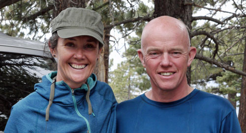
Leslie, Mike
On the ascent to Mount Baden-Powell, I noted most trees had been bent downhill by snow slides, then curved to vertical again. Lamel Spring was flowing clearly with plenty of volume, but a tube or dipper would have simplified collection.
Many earlier water sources have been low flow or dry. Even Grassy Hollow has a dry well and no spigot water. Thank God for water caches and those who maintain them. And to Leslie for a cup of coffee and a full water bottle when I run into her and Mike.
Beyond Little Jimmy Spring trees were marked for Sugar Pine Blister Rust.
Detours Off The PCT
I walked some of Jackson Flats Road to get good views of Mount Baden Powell. The Endangered Species Closure had me on Highway 2 for a few miles. A route I had previously taken around the closure is no longer recommended, as the steep radio telephone trail north from Islip Saddle is too eroded, and water sources below are off. I walked the road up Mount Waterman. I found there a Frisbee Golf Course, a ski resort, and a very old ski lift foundation using an antique car axle and wheel as a pulley. I continued west down the ridge on not much of a trail to rejoin the PCT at Three Points.
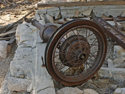
Ski Lift
While breakfasting at Mill Creek Summit Fire Station, on a cold, windy, foggy morning, a lady on a cleanup crew gave me her half finished morning coffee. Thanks!!
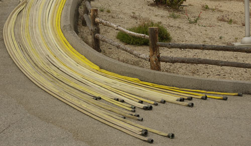
Mill Creek Fire Hoses
There were nice flowers coming into Agua Dulce. I spent $89 on groceries to Mojave! And then apparently lost my wedge of Parmesan Cheese! Mike, Leslie, and I had a nice chicken and potato salad dinner at Hiker Heaven, and Scott later gave me a stuffed bell pepper and salad left over from Donna's trail angel dinner. I was plenty hungry. The Saufley's place was as great as ever. Laundry, shower, WiFi, sewing machine for my hammock, plenty of company, etcetera. And Scott showed me I could sleep on a cot in the horse trailer.
Later, when was at Kennedy Meadows healing, the Stone Fire closed the PCT for a while near Agua Dulce, Bouquet Canyon Road, and Green Valley.
I finished my book on the origin of things and picked up The Mammoth Book of Eyewitness World War I, by Jon Lewis.
I walked out of Agua Dulce at 6am, and reached Spunky Canyon Road too late to continue to Fransisquito Road and still get to the Anderson's Casa de Luna that day. My off PCT walk into Green Valley via Spunky Canyon Road was quite pretty. I arrived late, just in time for taco salad. Terri sort of recognized me and we shared a few tales. I also did a fork dance for this year's bandana. Morning brought pancakes, fruit, coffee, photos. Night Walker had skipped up to here to recover from plantar fasciitis for a few weeks while volunteering. What a great way to stay involved in the trail while recovering and spending little money.
I saw two lizards fighting and a squirrel stuck his head out of his hole and swiveled it around almost long enough to get my camera out while descending to Lake Hughes Road. On ascent, I enjoyed the many mine tunnels. I found I was 15th in line to collect water from the low flow trailside spring, and people had been waiting a long time. Water was dribbling from several points, but each hiker was filling from just one dribble. I improvised a tool from a plastic bottle to collect several streams and speeded water collection by 4 or 5 times for the many people waiting.
I arrived at Richard Skaggs' Hiker Town, Antelope Valley, after 7pm. A van was about to head east to the store, so I climbed in. Neenach Store's burger was again giant and excellent. I added cheese doodles and soda for dinner, and cheese, fruit, yoghurt, etcetera for my pack. A shower was much appreciated, and hiker midnight followed soon after. When the couple sleeping nearby apologised in advance for waking, packing, and walking out at two AM, I said it sounded like a good idea and that I would join them.
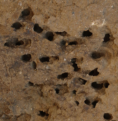
Ant Tunnels
It was actually quite a pack that assembled in the wee hours. Soon after walking out, there was a commotion. A Mojave Green Rattlesnake Crotalus scutulatus scutulatus was coiled on the PCT. The group gave it several yards space, and didn't seem to like my approaching it for a better look. Most of the group were young married couples. They were tall and fast, and left me in the dust. But they rested more, and I reached Cottonwood Creek and Tylerhorse Creek faster than most of them. I saw a snake with black and white markings, and photographed many ants. I camped in Gamble Spring Canyon. At 27 miles, this was my biggest milage day so far this year.
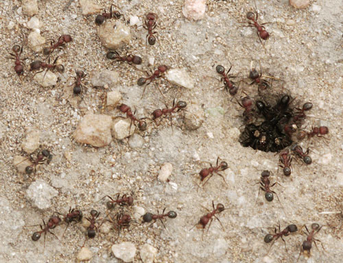
Ants
The black and white snake may have been a Mohave Shovel-nosed Snake Chionactis occipitalis occipitalis or less likely a California King Snake Lampropeltis getula californiae. I'll need to compare photos in the autumn.

Snake
Along the LA Aqueduct, I found a $20 bill. I decided this windfall should be spent on a great meal in Mojave, and spent some time dreaming. Pizza and ribs seemed like my favorite fantasies.
Coppertone (2006 PCT Through Hiker) was again providing trail magic at Tehachapi-Willow Springs Road. Many hikers poured off the trail. A great social scene developed around his van. His specialty was making root beer floats, and there was always fruit available at his trailhead angeling spots. He has angeled at several trailheads for a week each for the last half dozen years.
I had always resupplied in Mojave, but trail angels were shuttling to Tehachapi, so I tried a new place. There I found all I needed. It is spread out like Mojave, but has nicer restaurants, and many super friendly trail angels. As I was walking out of town to hitch, a lady called out from her car - "Need a ride somewhere?" Soon I was back at the PCT. And at Coppertone's spot at Tehachapi Willow Springs Road, Trail Angels were constantly picking up and dropping off hikers. Looks like Tehachapi is the spot these days.
June 1
I celebrated with a short day, slack packing a half dozen miles through the windmills from Tehachapi Willow Springs Road to Cameron Canyon Road. Then I bought several extra large pizzas, beer, etcetera, and fed any hiker who showed up at Coppertone's at dinnertime.
Mike and I ascended from Highway 58 June 2. With the extra rest, I hiked fairly fast.
June 2 Ankle Sprain and Self Evacuation
Later, when the PCT is on BLM / CA ATV route MK10, I slipped and twisted my left ankle. Something popped, but there was no crepitus or feeling of anything out of place. Swelling, pain, and a slow, limping gait resulted. I was sure I couldn't make the multiple 17+ mile long water carries of the coming section at my new slow pace. Anyway, my foot really needed several days minimum to heal, then easy trail for a while. My Verizon flip phone sometimes claimed a few bars of signal strength from several places on the ridge with views of Tehachapi or Mohave, but was never able to put a call through. My T-MOBILE smart phone found no signal. I began evacuating myself westward from the intersection of MK10 and MK13, which is marked no outlet eastward, towards Sand Canyon Road and Tehachapi.
By late morning of June Third, I ran into a lady out to do a couple hours work on a property. She said there would be little traffic anywhere along the road, and suggested I sit under a tree until her work was done. It was so hot I dozed off a few times while reading in the shade. So I was quite happy not to be limping miles down the road. She was a hiker and equestrian, as was her daughter, and the conversation on the way to Tehachapi was interesting.
I probably limped 17 miles. It would have been shorter to return via the PCT to Highway 58 (10 miles), but the road was flatter and more stable, had a pond for water, and there was the chance of being picked up earlier.
June 3 Ankle Condition
I suspect my left ankle will recover quickly because so long as I plant the foot on flat stable ground and pivot my leg in a normal gait, it really doesn't hurt much. Side loads, any rolling or twisting, or any ground instability does cause pain. The limping gait is quite slow, and uses many obscure muscles to maintain a steady, painless stance or gait. Also, even the slow limp gait winded me while ascending. Many odd muscles hurt in town. There is swelling in my lower leg and foot, and bruise discoloration especially on the outside back of my left ankle.
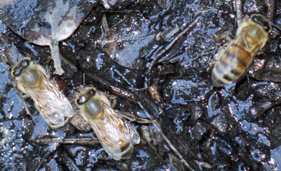
Bees Drinking from Mud
June 3 Tentative Plans
I took hiker poles from a hiker box in Tehachapi. To me they seem akward, and I've never liked or used them, but it seems better to have them when I walk out. I need to spend at least several days recovering. I registered for two nights in a cheap hotel. I need to think about starting again here, and needing to carry water long distances on a weak ankle, or skipping up to the Sierras, where snow on the north side of passes would also be hard on an ankle. In any case, I may strip all the fancy cameras, maps, etcetera from my pack and go ultralight for a while. I could either ship the gear further up the trail, or to home.
June 4 - Skip to Kennedy Meadows South
I left my Tehachapi motel room to hitch to the grocery store. I stopped and chatted with other hikers at the bakery. When I was leaving, a local trail angel asked if I needed a ride to the Highway 58 trailhead, as he was off to Kennedy Meadows to hike into Jordan Hot Springs. I explained my predicament and soon had packed up and was on the road. I arrived at the Kennedy Meadows Store by early afternoon and visited with the PCT hikers. Here I will camp within a few hundred feet of the store for several days, and when my ankle is ready, I will set a slow pace for Lone Pine. My hamburger was great, and digging through the hiker box is always fun. I found 3 books and 2 newspapers for quiet entertainment.
My ankle is still swollen and tender, but I think healing is underway. At least the need to walk on it is greatly reduced.
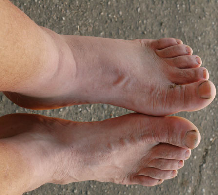
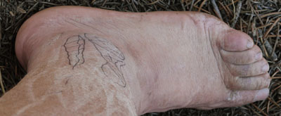
My Feet, June 3
My Foot, June 7
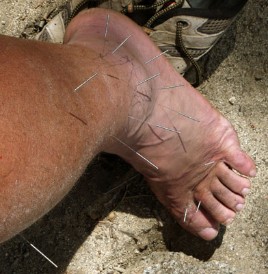
My Foot Acupunctured, June 10
June 5 - Kennedy Meadows Healing
I went to Grumpies for breakfast, and then limped over to Yogi's Triple Crown Outfitter. They wouldn't let me in!!! My left foot is too swollen and tender to wear my boots and I guess bare feet are against some rule...
I think the healing is going well.
I plan to rest a few days here, then take perhaps 4 days to Lone Pine.
June 6 - Kennedy Meadows Healing
My super hiker hunger is tapering off, and I spent much of the day in my hammock reading. It's not too hard to find best seller types of books in the hiker box or the store lending shelf. Which is good, because just sitting around is tough for me.
Swelling is down a bit in my ankle, but pain and stiffness still force slow limping. I circled and crosshatched over the areas of worst tenderness for tomorrow's pictures, with a dashed line continuing up a less affected tendon. The foot pain and people blabbing into the night wake me too often, so I'm accumulating a sleep deficit. I've had a bit of headache since arriving here, presumably due to altitude.
The food at the store grill is better and cheaper than Grumpies. A $6 hamburger is the standard lunch, with $2 chili dogs last night and a $10 barbecued chicken dinner tonight.
June 7 - Kennedy Meadows Healing
The swelling atop my left foot is decreasing: I can see some veins and tendons. In my limping I am taking longer strides.
| Kennedy Meadows / Ankle Healing Wait Books | ||
|---|---|---|
| Piers Paul Read | Alive: The Story of the Andes Survivors | 1972 snowbound Uruguayan rugby team survives months by cannibalism. |
| Stephen King | Revival | |
| Jamie Ford | Songs of Willow Frost | |
| Takashi Hiraide | The Guest Cat | |
| Colin Fletcher | The Thousand-Mile Summer | A former WWII British Marine Commando in 1958 walks from Mexico to Oregon along the east side of California with a 55 pound pack. This book, as well as Fletcher's Complete Walker and The Man Who Walked Through Time, helped set off the 1970's backpacking craze. |
| Lorenzo Carcaterra | Sleepers | |
| John Grisham | A Painted House | |
| Lee Child | Without Fail | Jack Reacher series |
| Rohinton Mistry | A Fine Balance | 1970s lower caste life in India. |
| Hampton Sides | Blood And Thunder The Epic Story of Kit Carson and the Conquest of the American West | |
|
|
|
|
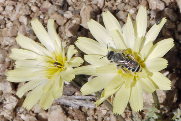
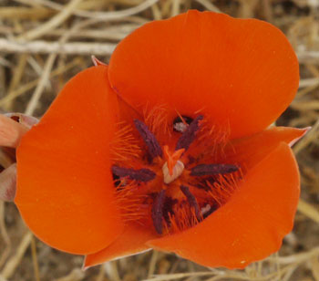
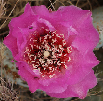
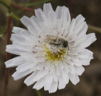
Flower
June 8
I ran into a Tincup lookalike by the name of Cameron / Waldo hiking through with his daughter Amanda. His ancestor Sarah Sutton wrote a diary while emigrating west on the Oregon Trail that is often quoted in kiosks and published in whole in Covered Wagon Women and in The Oregonian.
There is a 753.5 mile Oregon Desert Trail in the southeast quadrant of the state. From Bend it travels south, east, and north to terminate west of Boise, near the state border. Juniper / Sage and Pine are major ecosystems. Elevations range from 9,552’ in the Steens Mountains to 2,655' at Lake Owyhee State Park. Hart Mountain is included. The ODT crosses The Fremont National Recreation Trail (135 miles, AKA Southern Oregon Intertie Trail or trail #160) and the Desert NRT. The unmarked route is 9% Trail, 35% cross country, 51% unpaved / dirt roads, and 5% paved roads. Between Bend and Paisley, the 160 dryest miles, water carries may be up to 40 miles. This is a spring or fall hike. There are 16 resupply towns.
Straight Mike walked in. Scott set Mike, Leslie, and me up with a great, hot shower at a nearby ranch.
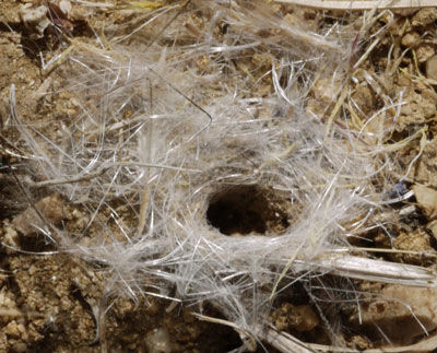
Bug Tunnel Ringed with Plant Fluff
June 9 Ankle News
PCT hiker and UK doctor Baked looked at my ankle and agreed with my assessment that my sprain wasn't too bad, was on the mend, and was no reason to end my hike.
Later, PCT hiker and 20 year acupuncture doctor August also introduced herself and examined my left ankle. She showed me several acupressure points and stretching exercises. She seemed to especially like pressing hard on the most tender areas of my ankle injury. She offered to do a more extensive massage treatment, but we would need an empty tent or room, as gusty winds were blowing lots of dust. Perhaps tomorrow the winds will calm.
Many thanks to Baked and August for their generous advice.
Stepping on uneven or unstable ground, or roll or yaw twisting, or right-left forces hurt, but typical pitch rotation and vertical or front-back loads from limping along don't hurt much. The overall pain and tenderness are decreasing, and my limp stride is increasing in length, stability, and grace. Yesterday and today the muscles on the back of the lower half of the calf tighten: A gentle pitch stretch releives the ache for a half hour or more. There is still a lot of swelling of my lower calf.
Today is Mike's birthday: We had a burger lunch on the deck of the Kennedy Meadows Store.
June 10
August gave me a full acupuncture treatment. Plus much more advice on my self treatment via warm bath, massage, stretching, acupressure, and etcetera. Many Thanks!
Leslie gave me a ride to Lone Pine. I got a room for a couple of nights. There was enough time for groceries, shower, laundry, and dinner.
In Ridgecrest I bought a compression bandage and plan to use it about half time until my left ankle is better.
Anxiety
Along the way we dropped off a German hiker In Ridgecrest. He had plenty of experience in Europe mountaineering and hiking. He was quitting the PCT because he had had constant anxiety about dangerous wild animals and other trail risks, to the extent that he just couldn't have a good time. The bears and snow in the Sierras just seemed like too much. He worried that he seemed like a wimp, so I said that no one who walked from Mexico to Kennedy Meadows could possibly be considered a wimp. I couldn't talk him out of leaving the trail, though he knew his fears were irrational. He planned to buy a car and travel in the United States for a few months. Later, on Lone Pine, I heard that he had given away his bear barrel, and its load of food, as he hiked back to Kennedy Meadows.
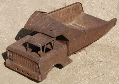
Tonka Truck
June 11 - Lone Pine
I walked around Lone Pine and retrieved my bear barrel from the post office. The clerk said it was the biggest she had ever seen. There was a small but nice museum. I talked with Larry Bird about strategies to catch up with her friends atop Mount Whitney.
Healing
My left ankle is healing slowly but surely. The pain is less every day, but the swelling around my lower calf is still a lot, and standing a long time causes uncomfortable blood pooling.
2003 - 2018 Healing Comparison
In 2003, I also rolled my left ankle. The time from injury to recovery and walking onward was May 10 through 22, 13 days. Today is day 10 (June 2 to 11). I had earlier thought that I would heal faster, as this year's injury seemed less painful and simpler. But maybe it was just as bad, and my 17 mile limping self evacuation probably worsened my injury. I still think I'm a few days from walking again.
Tentative Plan
I think in a few days I will start at Kennedy Meadows. I can walk slowly on snowless terrain there, and exit at Horseshoe Meadows, Whitney, or Kearsarge for resupply or more rest. I will start with half days, perhaps 10 miles, and continue reading a lot. I will accelerate as my foot feels better.
June 12
I mailed old maps, books, etcetera back to Gene, and my new boots, socks, future maps, and whatever I could strip from the pack forward to my brother in Bishop.
My limp is fairly fast. The swelling around the lower calf is still there. The ankle aches after walking, and the lower calf aches after standing around, which I guess pools the blood in the swollen area.
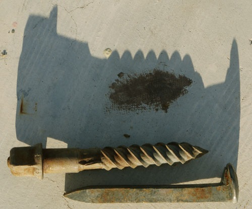
Rail Screw, Spike
Death Valley
Leslie and I visited Death Valley, stopping at Father Crowley Vista, Mesquite Flat San Dunes, Salt Creek, Harmony Borax Works, Zabriske Point, and Twenty Mule Team Canyon before camping at perhaps and old mining company trailer neighborhood east of the park. It was hot enough to sweat just standing around. At the dunes, I could feel my eyeballs drying and heating in the wind and radiation. The evening light cast nice shadows, but was harsh and hazy. The views were great. On Wednesday the 20th, we visited Zabriske Point again, Badwater, Devil's Golf Course, Artists Drive, and the Visitor Center at Furnace Creek. The early morning light produced more vibrant colors on the canyon walls. It was 110°F at 10am, with a predicted high of 122°. This was a great trip for me, as there were short hikes separated by rests in the car. My ankle handled the walks well. Thank God for the air conditioning in the van.
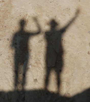
Leslie, Dan
Hi Dan
On 2 May I left Campo to hike the PCT and on 17 September I reached the Canadian border - my thru-hike is over. With a side trip to Mount Whitney, a resupply via Kearsarge Pass and a return hike back to Harts Pass, my trail miles will total over 2,700. It was a great adventure and I’m glad I got the opportunity to complete the trail.
The best part (for me) was the spring wild flowers in the desert and Sierras, but I also loved the mountain scenery in Central California and Northern Washington. I met lots of interesting and friendly people along the way (including you of course) and I was never knowingly taken advantage of or otherwise treated unkindly. America generally gets a bad press in Europe, but the Americans that Lesley and I met (quite literally almost every American we met, on and off the trail), were friendly, welcoming, honest and helpful. It’s been a remarkably (almost astonishingly) positive ‘people’ experience and one we won’t forget for a long time.
On the trail, I probably hiked about 40% of the time on my own and 60% with other people - an almost perfect balance for me. Somewhat unexpectedly, I ended my PCT adventure in a trail group of five. The group included a couple in their early thirties from Rio de Janeiro who are making a film and writing a book (both in Portuguese) about their PCT journey. Another couple (also in their early thirties) from New York who earned a bit of cash en-route doing a Coors Light beer commercial, and a much older guy from the north of England (moi) just taking a few iPhone snaps and keeping a simple personal diary! Entirely by chance we ended up coalescing into a group while hiking across Washington.
The final 11 miles from Woody Pass to the Canadian border had (thankfully) re-opened and the remaining detour (around the Holman fire) only added an extra 4 miles. I was slightly anxious about getting back into the US, so chose to walk back to Harts Pass rather than end my PCT thru-hike in Canada. This meant a further 34 miles of hiking rather than the 8 miles to Manning Park in British Columbia. Lesley walked with us from Harts Pass to the border and back again. The weather was getting colder and we had a light snow shower shortly before reaching Canada. Cold, wet shoes (and socks) in the morning wasn’t much fun, but the mountain scenery was fabulous.
Lesley and I spent a couple of days in Winthrop (near Harts Pass) staying with a PCT section hiker I met in Southern California. Warm, showered, well-fed and wearing clean clothes, we then travelled east to Glacier National Park in Montana. We drove across the park on the famous ‘Going-to-the-Sun’ Road. From Glacier we drove south-east for a look at Yellowstone and Grand Teton National Parks. It has remained cold (often freezing overnight), but the days have been clear and offered great views of the mountains, canyons, volcanic thermal features and wildlife. We exited Yellowstone to the north-east and drove over Beartooth Pass, almost 11,000 feet high and (according to Lonely Planet) one of the most scenic drives in America. We are now resting in a small town called Powell in Northern Wyoming before setting off to look up some very distant relatives in Wyoming and then heading south to see a friend in Boulder, Colorado. Then it’s back to Kansas City and home to the UK (on 16 October).
I hope you are still enjoying your PCT hike (wherever you are) and do please let me know when it ends. Hope you are well.
Regards and best wishes
Mike Cooper (Straight Mike)

Sunset
Regrets for the Section I Missed (126 miles)
Each of the springs in the Tehachapis has its own unique charm: Golden Oak, Robin Bird, Dammed, and McIver Springs each are burned into my memory. The Tehachapi mines and windmills are memorable. Beyond Walker Pass, Fox Mill is an interesting ruin, and there are many mine ruins nearby. Spanish Needle Creek has wild Roses with an intoxicating smell. But I needed to get past arid places with miles long water carries to allow my ankle to heal.