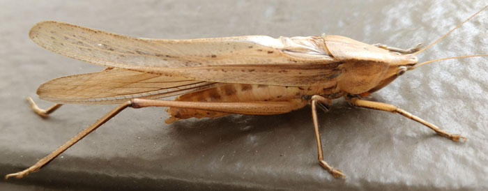
Grasshopper
Summary
This page documents my travels from the end of my 2018 PCT hike at Trout Lake, Washington, (October 3) through my visit to friends and family in San Diego, California (November ??). I travelled by Amtrak train to Alabama, and there wrote 2 presentations with my friend John. We then drove to Pennsylvania and gave the presentations on the Pinhoti and Arizona Trails at the Appalachian Long Distance Hikers Association Gathering. Returning south, we alternately worked on the Pinhoti Trail in Alabama and helped clean up after a hurricane in Georgia. Travelling west by train, I stopped a day in New Orleans, Louisiana, and then helped my mom and visited friends in San Diego, California.
| Table of Contents | ||
|---|---|---|
| October 3 - 11 | Travel, Alabama, Pennsylvania | USA |
| October 12 - 14 | ALDHA Presentations | Pennsylvania |
| October 17 - 23 | Hurricane Michael Relief | Georgia |
| October 24 - 30 | A Few Days at John's Place | Alabama |
| Oct 31 - Nov 3 | More Hurricane Michael Relief | Georgia |
| November 4 - 11 | More in Leeds, Pinhoti Maintenance | Alabama |
| November 12 -16 | New Orleans, Train to San Diego | USA South |
| November 16 -?? | San Diego | California |
Amtrak Train Travel
Wednesday, October 3, 2018
6:21 PM, Train 28, Empire Builder, Bingen-White Salmon, Washington, $305
to
Chicago, Illinois, Union Station, Friday, October 5, 3:55pm
I had a couple more meals in Trout Lake, and enjoyed chatting with the locals and four hikers who came in. I bought food for the train ride, and caught a ride down to the train station with a trail angel. We had a great pizza, and he headed home.
I boarded the train about sunset, so there was less than an hour of views of the Columbia River Gorge. After dark, there were orange walls of flame on a wildfire on the Oregon side of the river. Views Thursday included West and East Glacier, with a few inches of snow, then the plains beyond the Rockies. I arrived in Chicago an hour late, but with no problems.
Friday, October 5, 2018
8:05 PM, Train 59, City of New Orleans, Chicago Union Station, $134
to
New Orleans, Louisiana, Saturday, October 6, 2018, 3:47pm
Saturday's views included cotton fields and cypress swamps. I saw many Great Egrets, a hawk, a pelican, and a Great Blue Heron.
After reaching New Orleans, I surfed the internet and found much great information on forest service telephones, including the manual for installation of lines, another for the Army EE8 Phone, and a great history of a line in New Mexico. I'll be able to write a great feature for the website.
Sunday October 7, 2018
Amtrak Train, 20, Crescent, $47
New Orleans, Louisiana, 7:00am, Union Passenger Terminal
7 hours 15 minutes travel time to
Birmingham, Alabama, Intermodal Facility, 2:15pm
Overnight in Union Station, New Orleans
The night in the train and bus station was quite an experience. People who slept before midnight were awoken by armed security guards. Tickets were checked after the doors were locked, and I suppose a few people were ejected. The security guards kept busy dealing with a few people around the clock. At a quarter of 5, security again woke everyone.
The train loaded and left on time. The wifi to Birmingham worked all along the journey. On the earlier trains, there had been a strong wifi signal but no data came through on the Empire Builder, and no wifi on the City of New Orleans.
River to River Trail, R2R
160 miles
Along the Ohio River and to the Mississippi River
Mostly in the Shawnee National Forest in southern Illinois
Six wilderness areas
Two state parks
A national wildlife refuge
Two special management areas
A national natural landmark
Garden of the Gods recreational area (the most visited site in Shawnee National Forest)
An experimental forest
Small section of the American Discovery Trail (East West across United States)
No permits required
The ALDHA West website aldhawest.org has an extensive list of long trails.
I saw many Snowy and Great Egrets as we left New Orleans and crossed Lake Pontchartrain.
A Quote From:
1915 Telephone Construction and Maintenance on the National forests. Instructions for Forest Officers:
A one-wire line (grounded circuit) of No. 9 B. W. G.2 Best-Best galvanized-iron wire will be the standard construction on the National Forests. No other method should be used unless the permission of the district forester is first obtained.
Copper wire is of particular value where unusual construction is required, such as on very important trunk lines, on lines over 125 miles in length, on metallic circuits, etc.
BW Number 9 Galvanized iron wire weighs 314 pounds per mile, has a breaking load of 785 pounds, and is 0.148" in diameter.
I arrived in Birmingham and John took me home to Leeds. He, Sale and I caught up on many issues.

Grasshopper
Monday, October 8th, 2018 John and I worked on our Pinhoti Trail maintenance presentation for ALDHA. Later we drove to Flagg Mountain and visited Nimblewill Nomad. He was happy and well, and his work on the CCC stone and log cabins and stone fire tower really show. The locals from the surrounding valleys show up to cheer him on and pitch in with the work. TV shows from all over Alabama are airing specials. The place looks better every time I visit, and I hope the ball keeps rolling for years to come.
Tuesday, October 9th, 2018 I finished the Pinhoti maintenance and Arizona Trail presentations.
Wednesday-Thursday October 10th-11th, 2018
John, Sale, the rubber chicken, and I drove north along I81 and the Shenandoah Valley towards Pennsylvania. We stopped at Peaks of Otter and the Appalachian Trail bridge over the James River. There was a lot of rain and fog. We reached Dick and Joy's place in time for dinner and discussion until bedtime.
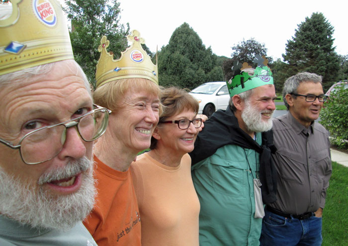
John, Sale, Joy, Dan, and Dick
Friday, after a great breakfast we drove south again to Shippensburg University, Pennsylvania, for the opening of the ALDHA Gathering, and many great conversations. Saturday, the many informative lectures continued.
On Sunday, John and I gave a presentation on the Maintenance of the Pinhoti Trail. There were a few people who had done little trail work, and a half dozen veterans. The presentation was well received, and there were many great comments and questions.
For a second presentation on the Arizona Trail I had prepared slides. But by mistake the conference program said I would be discussing the Continental Divide Trail. To further complicate things, in the evening sessions, with most attendees present, the audience was asked to correct their programs to the Arizona Trail...
So I polled my audience at the beginning of the session. About a half dozen really wanted to hear about the Arizona Trail, about 20 were there for the Continental Divide Trail, and perhaps 20 more could go either way. There didn't seem to much interest in the Grand Enchantment Trail or the Great Divide Mountain Bike Route.
I used my Arizona Trail slides and talked about common aspects of the two trails, such as water, venomous animals, permits, ecosystems, etcetera. My audience seemed enthusiastic and asked many good questions. I think things went well, in spite of the confusion about the topic.
But just in case an angry mob developed, we jumped in the car and headed south, motelling in Staunton, Virginia.
Monday, October 15th, 2018 We visited Al and Pat W and returned to Leeds.
Hurricane Michael: Background Information
Hurricane Michael, October 7 - 16, 2018, was ranked quite highly for strength. There were 48 deaths, 33 in the United States and 15 in Central America. In Albany, 24,720 electrical customers lost power, or over 90% of residents. Georgia agriculture losses are estimated at three billion dollars, one billion for timber alone, with one million acres destroyed. Cotton, peanuts, pecans, vegetables and poultry were also affected. On the drive down, large percentages of trees in pecan groves were either toppled at the roots or destroyed limb by limb. And cotton, with large bolls ready for picking, was was sopping wet and laying in the mud.
On Tuesday, we tried to get through the paperwork for me to join John on a disaster relief trip. John rarely takes a day off from work on the Pinhoti Trail, but when he does, volunteer disaster cleanup is often his excuse. John has told me many stories about cleaning mud and mold, and about cutting downed trees, after hurricanes, etcetera. It will be interesting to see what it's like.
Later, we split a tree's worth of pine wood at his daughter Elizabeth's house.
On Wednesday, we finished the sign up, and drove to Albany, Georgia. Trees were down everywhere. Some houses were surrounded by fresh stumps or broken trees. Piles of cut tree trunks over 10' high lined some streets. Hurricane Michael certainly did some serious damage...
There is a fleet of wood debris clean up trucks which each have a dumpster on the truck and another on a trailer, with a crane on the truck behind its dumpster. Some were temporarily marked 'FEMA', that agency may be paying for that part of the cleanup. The trucks will be driving around picking up the tree debris for months, and delivering it to a giant chipper. Anyone need a mountain of wood chips?? (Paper companies apparently buy some storm debris wood. Wood stove pellets and biofuel feedstock also seem like good markets.)
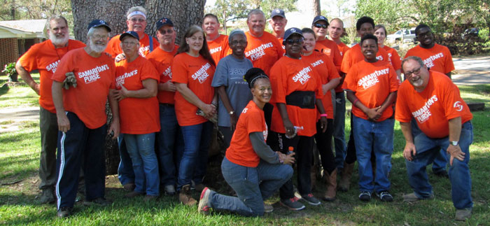
A Typical Samaritan's Purse Work Crew and Homeowner
Thursday, October 18th, 2018
After a safety orientation and being equipped with orange shirts and blue ball caps, we drove to four houses and cleaned up broken limbs and trees. Our crew was about a dozen. Our equipment was several chain saws, with associated kevlar chaps and ear / eye / head protection hardhats, and various rakes, loppers, and other hand tools. By the time we left each place, all debris was stacked six feet high by the road about the full length of the property, and the lawns were raked clean. We tarped one roof with minor holes, while a garage on the same lot with a crushed roof was left for someone else to clear, cover, and repair. The other houses were undamaged.
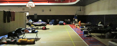
Camping in the Church Gymnasium
One church hosts us, feeding us in one hall and allowing us to sleep with our own cots or whatever in the gym. They pick up our dirty orange t-shirts in the evening and return them clean in the morning. There is a shower trailer on site.
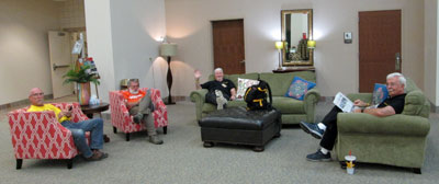
Roughing It in the Church Lobby
Friday, October 19th, 2018
We cleaned up 3 more properties. We found a bug grub 2½" long and ¾" diameter, beige in color. In the evening I played a Bible game with a half dozen others and, surprisingly, won. This being the Bible belt and a missionary work trip, no one was lacking in knowledge.
Bear Ropes
Once upon a time, near Lake Chelan, in Washington State, a tree surgeon gave me the best bear rope ever. It was a yellow polypropylene hard woven cord about 4mm in diameter, and it slid easily over bark without sawing in or leaving much of a groove. Eventually, I wore it out and was never able to figure out what to ask for to buy another one. I was talking to a tree surgeon today and asked...
The yellow rope was probably made by Sterling Rope, sterlingrope.com. There are also Dyneema Dynaglide ropes with very high tensile strength and a slippery and abrasion resistant jacket. treestuff.com carries these ropes and other tree supplies.
Later, he gave me a 70' piece of Dynaglide cord. Many Thanks!
Saturday, October 20th, 2018
With lots of Saturday volunteers, I spent a lot of time chainsawing, spotting, and directing work at 3 homes.
Sunday, October 21st, 2018
We heard a pretty funny preacher, then finished cleaning one yard, including dropping two trees that had been snapped off at 20 and 30 feet heights.
Monday, October 22nd, 2018
We had a skid steer, a tractor for moving large logs. We returned to two homes which had so many large trees down so far from the road that they hadn't been finished the first day.
Tuesday, October 23rd, 2018
John and I worked on three homes before lunch and then drove to Flagg Mountain. We visited with Nimblewill Nomad, and cooked chilli dogs and sweet potatoes in a campfire. I walked around the various CCC log cabins and across the gap to the stone fire tower. We slept in one of the cabins.
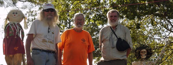
Rags, Nimblewill Nomad, Mother Nature's Son, Fashionplate Dan, Bones
The Good, the Bad, and the Ugly
or Comments on my first Samaritan's Purse Relief Work Trip
The first few days of the relief work trip there were about a dozen on each crew. Each home we visited had trees down every where, and there was plenty of work to do. People without chainsaws worked well away from those who were cutting. I really enjoyed the first half of the trip.
Then the crews got much bigger and out of control. With so many people milling around, some were always wandering right up to a running saw, or moving logs being cut. Also, one guy insisted on using a machete, which creates a large danger zone and is less efficient than using a chainsaw or lopper. We showed up at properties that had already been cleared, or only had a bit left over from a crew the previous day, so that 40+ people just stood around chatting.
There were over 1500 work orders, and we were only addressing a few per crew per day. (I think there were usually 3-4 crews each day.) There should have been a system for addressing the poorest people, the biggest messes, the blocked driveways, and the leaking roofs first. If a crew had finished most of the clean up by the end of the day, and there was nothing dangerous or in the way of the home owner, a return trip to that property should have had a lower priority than moving on to more devastated houses. We spent a great deal of time raking the lawns of rich people to perfection, while leaving worse affected people to wait...
The sleeping arrangements, showers, and food were excellent. I enjoyed the company of many nice people before and after the workday. I would happily do another relief work trip trip like this.
Wednesday, October 24th, 2018
We returned to Leeds, and attended the dinner and preaching at Mountain Brook Babtist Church.
On Thursday, Friday, and Saturday, Sale and John went to a church choir scenic train ride in the Smoky Mountains. I stayed in Leeds, doing two editing tasks for the website.
First, John had selected over 100 photos which he considered the best representative selection of Pinhoti scenes. People, trail work, scenery, whatever. Adding more pictures and his regular email reports and special research and summary reports, I think I can make up one or more pages that express John's unique and exhaustive knowledge of the Pinhoti National Recreation Trail. I got all of the pictures and text into HTML, and partially organized from south to north. I hope John will help me finish organizing it and add whatever is missing. It will be a valuable asset to people who really want to understand how trails come to be and then are maintained.
Second, I went through about seven thousand photos I took along the Pacific Crest Trail, deleting bad pictures and sorting the rest into four trail segments. I will be busy for a long time picking the good ones and editing them for the website...
Sunday, October 28th, 2018
John and I started clearing the Pinhoti Trail north of Claremont Gap. Tree shade coverage on the segment is thin, so brush and vines grow fast and thick. I ran a carbide blade weed eater for hours and was nowhere near finished. I suggested we return tomorrow to throw off all the cut branches, and carry a chainsaw and loppers through for blowdowns. Later, another day with the weed eater will be required. The section is only perhaps 2½ miles, so 3 2 man work trips seems excessive.

View from County Road 7 of Horn and Rebecca Mountains
The Pinhoti Trail runs on the west side of the ridgeline.
Monday, October 29th, 2018
John, Rick, and I again worked on the Pinhoti Trail north of Claremont Gap. I walked northbound with a chainsaw and loppers, while Rick and John walked southbound with the steel blade weed eater and one guy just throwing the cut debris off the trailbed. We finished the 2½ mile section. It still looked fairly hairy, but with the rapid growth there, cleaning it to a pristine state would have been pointless. Later, John showed me a picture of the area a year and a half ago. It had been burned down to dirt and soot. Many of the trees which shaded the area died in the fire, and are falling over the trail as blowdowns that must be cleared. The lack of shade from the dead trees makes the bushes and vines grow faster and thicker, necessitating the visits with the loppers and weedeaters.
I continued working on the web page of John's Pinhoti knowledge. I needed him to help me arrange the photos south to north. In the process, he found several more detailed lists and reports for me to add. If I can make sense of it all, it will be a very informative page.
Mary Sue dropped in after 12 hours driving from Texas to rest overnight before another dozen hours journey to northern Virginia. She talked about hiking the PCT across Oregon and Washington. Go Girl Go!!
Tuesday, October 30th, 2018
John and I drove back to Albany, Georgia. We stopped to visit the National Infantry Museum at Fort Benning. We had only an hour to spare, but the museum easily had enough displays to occupy half a day. We stayed at Sale's brother's house.
Wednesday, October 31st, 2018
We cleared trees from 4 homes. I spent most of the day spotting for a skid steer.
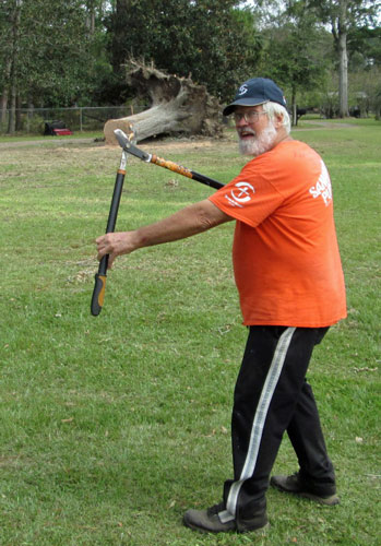
Saint John of the Loppers
Thursday, November 1st, 2018
We cleared trees from 3 homes. It began to rain fairly hard just before the regular quitting time of 3:30pm.
Friday, November 2nd, 2018
During a morning cleanup we had a drenching rain. In the afternoon I showed the homeowner a branch with three woodpecker nesting cavities. We did only two properties due to the rain. John and I drove our afternoon homeowner to the church for dinner with the volunteers.
Saturday, November 3rd, 2018
We cleared two homes.
Because the Appalachian Long Distance Hikers Association Gathering will probably be held in northwestern Massachusetts in autumn of 2019, John and I are thinking of hiking some of the New England National Scenic Trail or some of the nearby or connecting long trails. Here is my attempt to understand the system.
| 4 North-South Trail Systems in New England | |||
|---|---|---|---|
| Appalachian Trail | Sunapee Three M New England Trails |
WaPack Mid State North-South Trails |
Massachusetts Bay Circuit Trail |
| New Hampshire 161 AT miles |
Sunapee-Ragged-Kearsarge Greenway Trail, 75-mile Loop, www.srkg.com, $14 Book
Monadnock-Sunapee Greenway, Old CCC Trail, 48 miles, Map, Guide $24, msgtc.org Metacomet-Monadnock Trail 18 miles nhmmtrail.org $16 |
WaPack Trail, 21 miles, Book, Map $18 | |
| Massachusetts 91 AT miles |
Robert Frost Trail, 47 miles, parallel trail off MM, Holyoke Range, PDF Map
New England NST, 215 miles, Guide, 2 Maps $15 Appalachian Mountain Club |
Mid State Trail, 93 miles, Book $15, midstatetrail.org | Bay Circuit, 200 miles, Book, 3 Maps $20, Appalachian Mountain Club |
| Connecticut 51 AT miles |
Rhode Island North South Trail, 77 miles, Great Swamp Press Book $20, Out of Print |
||
New England National Scenic Trail, NET, 215 miles
formerly the Metacomet-Monadnock-Mattabesett Trail, 3M
The NET includes a somewhat rerouted MMM trail and a route to Long Island Sound, but not the 3M portion in New Hampshire. Northbound, a 2M and then a Monadnock Sunapee Greenway Trail continue 66 miles into New Hampshire. Another trail continues further north, the Sunapee-Ragged-Kearsarge Greenway Trail, with a 75-mile loop to Mount Kearsarge, Ragged Mountain, Bog Mountain and back to Mount Sunapee. The Robert Frost Trail crosses the New England Trail in Massachusetts a few times.
The 170 mile Cohos Trail runs from Crawford Notch on the Appalachian Trail in the White Mountain National Forest north through the Great North Woods to the Canadian border at Pittsburg, NH. One can continue on Sentier Frontalier’s trails to Mount Megantic or Mount Gosford in Quebec, Canada.
https://www.cohostrail.org/
|

|

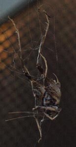
| Three Views of a Spider and Partially Eaten Grasshopper |
|---|
Sunday, November 4th, 2018
No work was scheduled for today, and our sleeping space in the gym was going to incoming volunteers, so we headed for Alabama. We cleared short sections of the Pinhoti north and south of Burgess point, then returned home to Leeds.
Monday, November 5th, 2018
John went to work on the trail crew on the Coosa Trail, while I stayed in Leeds working on the new John Calhoun corner of my website. I completed a first draft of the main page, with photos and paragraphs from various emails in roughly south to north order. But John will have to fine tune the ordering. There are also more text reports I'm coding in html.
Tuesday, November 6th, 2018
John and I worked on the Coosa Trail with Kent and Angel, Marion and Emily, Edwin and Adam. I repainted yellow blazes and scraped off old red blaze paint and narrowed blazes that had widened as the tree grew in circumference.
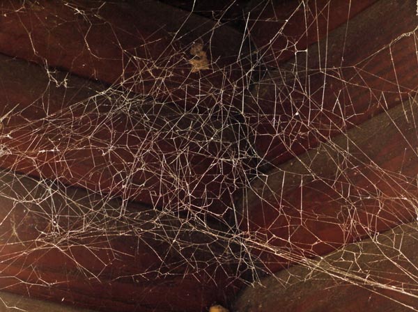
Spatial Spider Web
On Wednesday through Friday there were more Pinhoti work trips. It was often raining, foggy, etcetera. The fall colors were vibrant, with bright reds and yellows.
At Bull Gap the southbound mileage sign is missing and needs to be replaced. The southbound map in the kiosk has been stolen and needs replacement. The roadcut embankment on the southbound side has loose and missing steps. It is about 8' high and needs 10 or 12 3' timber steps, with 6" or 8" timbers, and stout rebar stakes, perhaps 18" x 5⁄8". Digging tools, drills, sledgehammers, etcetera will be required.
At Porter Gap, the maps in the kiosk were present and legible, but the northbound mileage sign is missing and needs to be replaced. There was no shortage of trash at either trailhead.
By coincidence, Preacher Pete dropped by the Porter Gap trailhead just to relive old memories at the same time Rick, John, and I showed up to survey required work and clean up litter. Pete has retired from trail work but was once a tough, efficient chainsaw man. In his youth, he dynamited the road cuts on Flagg Mountain. We held a short reunion at the nearby store and waited out the rain.
Saturday, November 10
I walked the Pinhoti Trail from Adams Gap to Cheaha State Park. Though the Wilderness Ranger program claims to maintain this section, it has been steadily accumulating blowdowns for years. In many places hikers are forced out of the permanent tread into developing use grooves. A few force hikers up or down steep slopes, and the temporary paths will cause erosion blowouts of the permanent tread. In the evening I attended a trail worker event in a private room of the Cheaha Park restaurant and finally met the legendary Mike Leonard. Mike dreamed up a trail continuing from the Appalachian Trail south to the tail end of the Appalachian Mountains when he was 17, then for his entire life doggedly pursued extensions of the Pinhoti Trail to achieve his dream.
|
| ||||||
| ||||||

View Northwest from Heaven Rocks towards Cheaha Peak and State Park. | ||||||
|
1 - At far left, fading in the distance, is Coldwater Mountain. 2 - Where the ridge first rises is the Bald Rock Area of Cheaha State Park, with the Bald Rock Lodge, the handicap boardwalk, and a trail on the sloping ridgeline connecting to the Pinhoti a little northbound from Blue Mountain Shelter, which is more or less behind this leftmost rise. 3 - The high point a little further right is Mount Cheaha, highest point in Alabama, with a CCC Stone Fire Lookout Tower, open to the public. 4 - Next is a ridgeline which descends towards the viewer. The grey spot of rock is the view or pulpit of McDill Point, where there also is easily found aircraft wreckage. 5 - The next prominence is Hernandez Peak, with state park radio towers. 6 - The low point in the long ridgeline on the west side of the Cheaha USFS Wilderness is where the Chinnabee Silent Trail and Odum Trail intersect the Pinhoti at Lower Caney Head. | ||||||
|
|
| Time | Cheaha Wilderness Walkthrough Commentary | |
|---|---|---|
| 8: | 50 | I left Adams Gap. |
| 9: | 17 | 18" straddle over blowdown forcing tread blowout. |
| 9: | 57 | 12" inch straddle over blowdown forcing tread blowout. |
| 10: | 39 | I reached the old ridge road. |
| 11: | 42 | Heaven View |
| 12: | 40 | Junction Chinabee Silent and Odum Trails |
| 13: | 33 | An 8" tree crown blowdown forces hikers to use a deepening use bypass trail. There are many more like this to north to Cheaha State Park. |
| 13: | 54 | The Pinhoti north and south of the Cave Creek Connector Trail is in poor shape, with many diverging use paths amongst the steep loose rocks and fading paint blazes. |
| 14: | 26 | 12" step under blowdown |
| 14: | 27 | Multi Trunk snarl with many 5-10" cuts required. |
| 14: | 32 | Northern Cheaha Wilderness Sign |
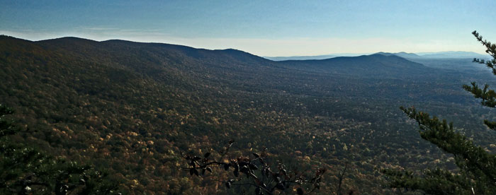
View from McDill Point
The Pinhoti runs south roughly along the pictured ridgeline.
North of McDill Point were many crown blowdowns forcing new use paths, some forcing hikers down steep slopes. There were a dozen tents set up at McDill Point, and another dozen backpackers who had not yet unpacked. All through, Adams to the park, were several stepover blowdowns per mile.
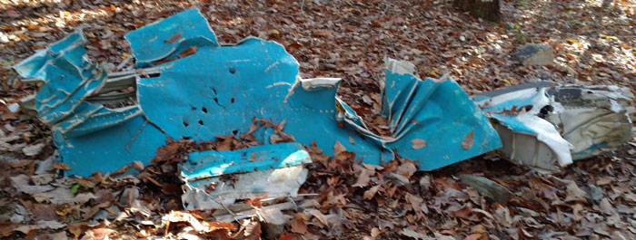
McDill Point Aircraft Wreck
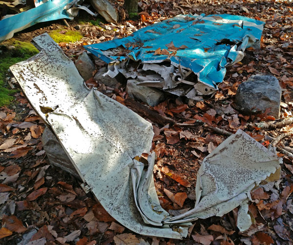
McDill Point Aircraft Wreck
I went to church and Bible study with John and Sale at Mountain Brook Baptist Church Sunday, November 11. Later, we helped Elizabeth repair the columns on her porch. I replaced the water valve for the ice maker and finished pressure washing the driveway and walks around the house. They had been pretty slippery.
On Monday, November 12, I'm on the train from Birmingham, Alabama to New Orleans, Louisiana. It's raining and will be for the length of my New Orleans visit. Many thanks to Sale and John for their kindness during my visit. John and I rewrote the Pinhoti Trail Maintenance Clubs page this morning. He suggested I include his comments on the current set of USFS Pinhoti Maps. Unfortunately, I left half a cubic foot of maps and books remaining from my Great Eastern Trail walk, a pair of sandals, and my Samaritan's Purse shirts and hat. The amount of junk Roni left there for years is a standing joke. I'll have to clean it out next trip. The Amtrak Train suffered many delays and I arrived at my New Orleans hostel pretty late.
Tuesday, November 13, 2018
New Orleans
Amtrak in most cities schedules the outgoing trains to leave a few hours after the incoming trains arrive. In New Orleans that system falls apart, with all outgoing trains leaving before the incoming passengers arrive. A few weeks ago I tried staying in the train / bus station overnight, and decided it was an experience I didn't need to repeat. In some cases it would be possible to use Greyhound or megabus.com to make quicker connections. But not this time, so I decided to try staying in New Orleans a couple of nights, to break up the journey and see the city. I stayed in a clean, friendly, noisy hostel, a 17 minute walk from Union Station, for $35/night.
It was raining, blustery, and quite chilly. I took some brisk walks, but standing around absorbing the Mississippi waterfront, the architecture, the parks, or etcetera was out of the question.
I visited the Audubon Insectarium, both a zoo and a museum of bugs. It was quite good, and different than anything I'd seen before.

Butterfly
The very first display said that insects developed when the earth's atmosphere had twice as much oxygen. Insects breath through holes in their exoskeletons (spiracles) then small tubes (tracheae). The extra oxygen allowed a dragonfly with a 30" wingspan to live 280 million years ago, the griffenfly Meganeuropsis permiana, the biggest bug known. But bugs today are limited to a few inches by the lower oxygen and by their breathing system.
I asked a keeper demonstrating millipedes and tarantulas why orb weaving spiders don't weave orbs, but rather flat spiral / radial webs, while spiders who do weave spherical webs (orbs) are not known as orb weavers. There was no satisfactory answer. But she did say that it was safe to pet millipedes in North America so long as you don't lick up a white foam containing cyanide and smelling like almonds. Good to know...
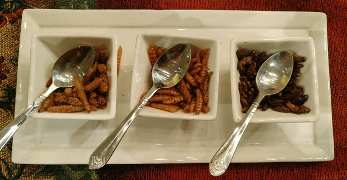
Grubs and Crickets... MMMMM!
 The museum visit included some light snacks of cooked bugs in the admission price. Roasted, spiced caterpillars and crickets actually looked like bugs, but mostly tasted of the spices they had been rolled in, whereas cookies and various dips containing bugs seemed like the normal, bug free, versions.
Wednesday, 14 November, 2018
Amtrak Sunset Train to Los Angeles
The train left New Orleans Union Station about an hour late. I read Tent Camping in Siberia by George Kennan. It is the story of an 1865-1867 telegraph route survey expedition, and a pretty good read. There were many egrets and heron through east Texas, then sage grasslands into New Mexico. In years past I started Continental Divide Trail hikes by getting off the train at Deming (Columbus border crossing) and Lordsburg (Crazy Cook), along this rail line. I ended my Great Divide Mountain Bike Route trip at the Antelope Wells border crossing and boarded the bus at Tucson. Southeast of Tucson I walked under the tracks on the Arizona Trail. I've spent plenty of time in the desert I'm watching from the train.
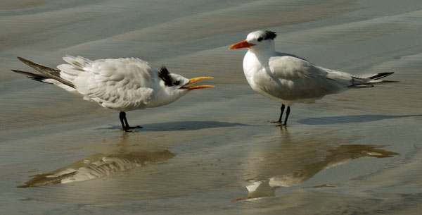
Tern Chick and Hen
The chick is begging food and displaying submission.
Friday, 16 November, 2018
We had a poorly formed plan that I would rent a car for a few days and help my mom with various things. I got off the train in Oceanside fairly early in the morning and went to the rental agency. With no reservation I had to wait until 3 pm. I shot photos on the beach and pier all day, and then had to reject the first car as having seats too high for my mom to climb into. I got to Marie's place in time for dinner and conversation.
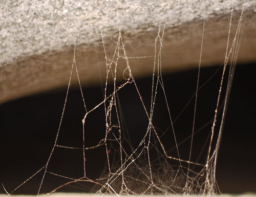
Spider Web at 11:01 AM |
| This summer I took many photos of spider webs. To get a clear image, the lighting must be perfect, with bright light on the thin silk threads, and with a dark, non distracting background. I took these two pictures 4½ hours apart, with morning and afternoon sun lighting the web differently. This web is on a rip rap sea wall, in strong, gusty breezes. It was quite difficult to find focus and avoid blur. It was possible to photograph the protected dome area only with the afternoon illumination. The single strands reaching towards the top of the photos are guy lines that hold the dome shaped room open. |
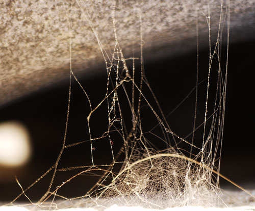
Spider Web at 15:32 PM |
On Saturday, I helped my mom with various repairs and cleaning. I took some parts of a grab bar to a dealer to see whether repair parts were available: We'll see on Monday.
My mom recently had a cornea replacement operation. The doctor had thought it ought to be a tough decision because a failed surgery could leave her even more blind, but my mom could see so little that reading or seeing any kinds of details was impossible. The operation was a great success. Her vision improved rapidly over the first few days, and will continue to sharpen for a couple of months. She can now see individual leaves on trees that were just a blur before, and she can read for a minute or so with a magnifying glass. In January, when the healing curve slows, she may be able to get glasses...
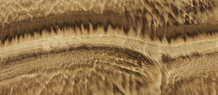
Surf Washed Sand Flow Lines
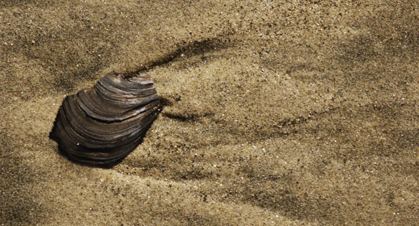
Sea Shell, Surf Washed Sand Flow Lines
On Sunday I visited Don at his boat club breakfast. I then visited Jim and helped repair a sprinkler pipe and find a route to install a 50 Amp line for his machine shop. Don, Jim, and Claudia were doing well.
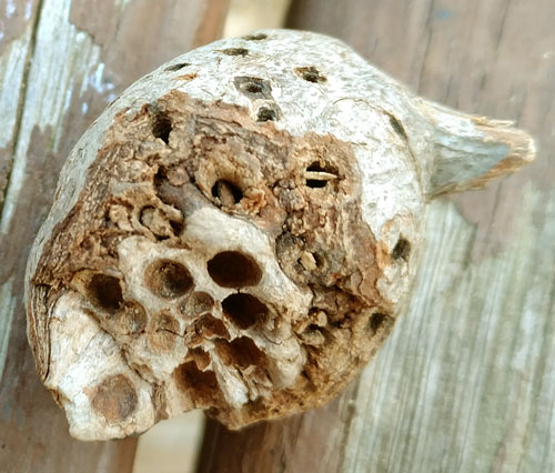
This Insect Gall has been opened by a bird or rodent to eat the grubs.
I also did some research on a replacement for my Panasonic G1 micro 4/3 camera. There are two $500 kits available. One is a Panasonic DMC G7 with a 14-42mm zoom lens. The second is a DMC GX85 (the G7 replacement)(80 in international versions) with 12-32mm and 45-150mm zoom lenses. Reviews imply each body has slight advantages over the other. Reviews on low light and higher ISO shooting sound better than the G1, but without any solid sounding numbers. I shoot at 200 on my 45-200mm lens very often: a replacement is $450 new. There are $260 parabolic mirror 300mm lenses, and expensive zoom lenses are also available to 300mm. The cameras charge their replaceable batteries via the USB port. This implies that a big, fast charging USB power bank might compete with a fast or dual camera battery charger as a way of charging quickly in towns. Spare batteries were $42. Various batteries and chargers of various brands are available.
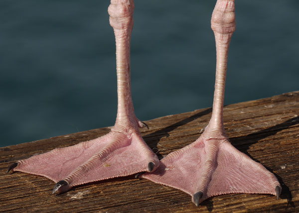
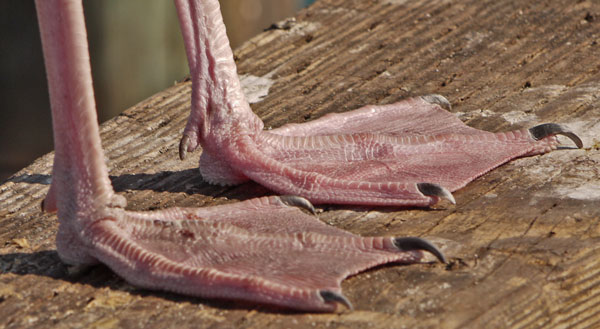
Seagull Feet, Front View |
|
The Seagull Family Laridae has 11 Genera. Note Webbing, Pronounced Heel, and Vestigial Rear Toe, which would make contact only in deep foot prints. |
Seagull Feet, Side View |
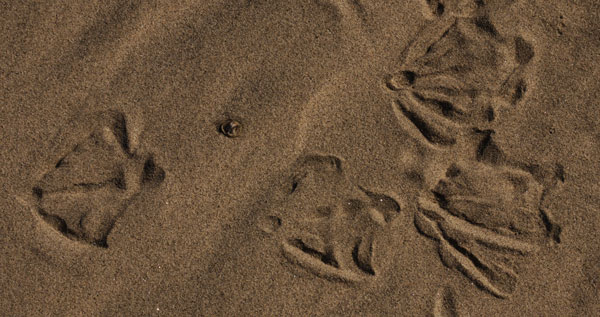
Seagull Prints in Dry Sand |
|
Note Heel, Front Toe Lobing, No Rear Toe Impression, and No Strong Front Claw Impression. This Gull walked into position and then shifted his stance a few times. |
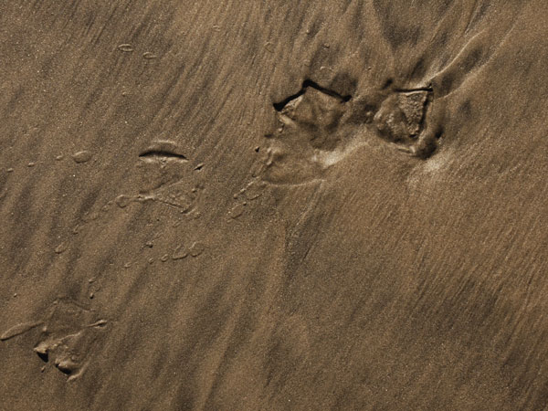
This Seagull Walked Left Moments after the Surf Wash Drained Away. |
|
The left print was flooded with details washed out, while the right foot was pulled out without standing water, leaving a tensile failure grain. The feet were wet enough to throw sand filled water drops. |
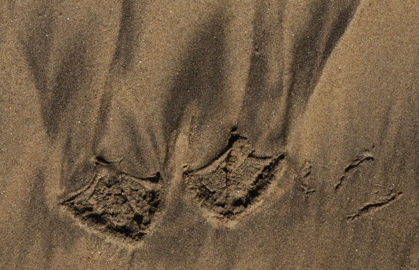
Wet Seagull Prints |
| Compared to the photo above, this gull walked away a few more moments after the surf wash drained away. All of the standing water was gone, and the sand was less wet. The grain of the sand-water mixture pulling into taffy-like peaks is more evident. Note no claw marks on left print, but present on right prints, caused by tilting the feet forward while walking. |
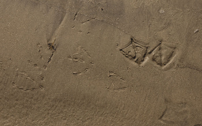
Wet Seagull Prints |
| Note the line towards the top of the photo where the surf wash dwelled a moment before draining away. The rightmost print was flooded when the gull walked, washing out most details. The adjacent drier left print shows toe lobing, claw impressions, and some tensile pullout grain. The even drier prints where the bird walked away to the left show the lobing of the toes under the webs. Only sand which is soft to an absolutely perfect consistancy can show this detail, and the detail will disappear in moments... This was a great day for seeing some really interesting foot prints. |
Monday, November 19, 2018
I helped my mom with various things most of the day, then visited the Mission San Luis Rey. Later, I visited Jim and Cindy and gave Jim my mom's TV and four boxes of cable TV stuff Marie and Roy had found.

|
|
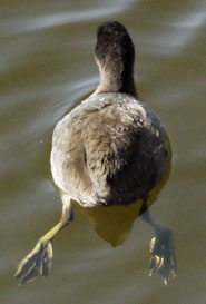
| American Coot Swimming, Fulica americana, Side View | Rear View |
Tuesday, November 20, 2018
At the San Deguito Lagoon's Grand Avenue Pier a ray with a 30" wingspan was wallowing out a hole in the sand over a foot deep and several feet wide. Perhaps over several days the deep portion of the hole moved along, leaving 30' of six inch deep trench behind, while today's work zone was about six feet long. Several smaller rays, perhaps 8" across the wings, swam in the sand clouded water and occasionally landed on the bottom momentarily. The sand the big ray's wings were churning up was drifting west on an outgoing tide. Perhaps a dozen foot long Mullet gathered to feed in the clouded stream.
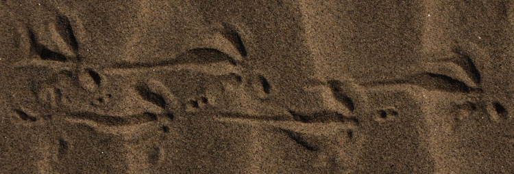
Bird Foot Print, Front Toe Dragging, Rear Toe 2 Points, Soft Dry Sand |
|
In the print above, the sand sticks to itself enough to show two points from the rear toe. The rear toe is fairly well straight aligned with the front toe. In the tracks below, little detail of the toes is preserved, because the sand is slightly drier and softer. The rear toe points inward, and is not aligned with the front toe. |

Bird Foot Print, Front Toe Dragging, Softer Drier Sand |
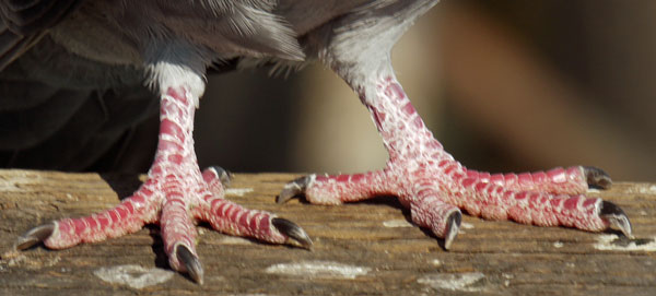
Pigeon Feet
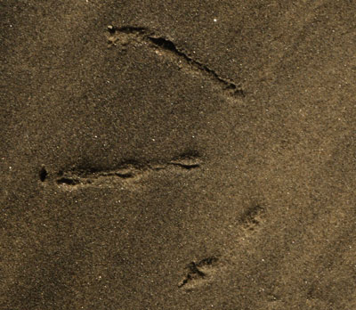
Bird Print Showing Lobing on the Toes,
Middle Toe Claw, No Heel or Rear Toe, Wet Sand
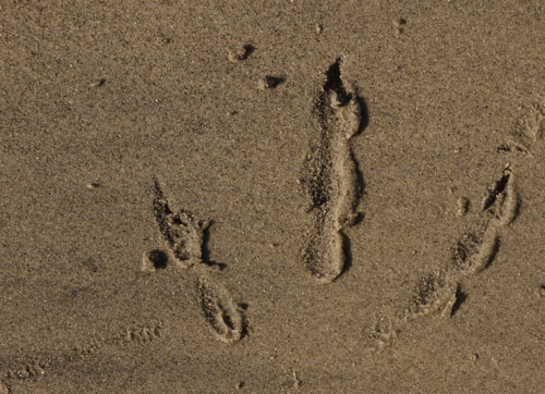
Bird Print Showing Lobing on the Toes.
This Bird Pushed Hard and Ran to the Left.
See Berm, Smear, and Sand Clumps.
I visited Gene and Russ in Jamul. All is well on the ranch. I have 15 banana boxes of stuff plus a bike and a few loose items I need to move to Flagstaff soon: three wide the boxes stack to almost 6'.
We looked at the visitor statistics for this website. It's humbling to see how much more traffic there is by bots and crawlers than by people. A small percentage of the bot traffic looks malicious, looking for back doors, etcetera. The next biggest category is by people who stayed only a few seconds. But there are plenty who stay long enough to read or view pictures. Some of my images are linked to by strange websites, and some very odd search terms return my site. Most of these automated statistics are fairly meaningless.
Useful Website Feedback
The best feedback I get is that people I rarely run into seem to know what I'm up to, and that they only could have known via the website. Occasionally someone makes a very positive comment. Once or twice a year, someone asks great questions about some obscure place I've hiked. All of these interactions tell me that those few visitors who do stay long enough to read and look at the photos are really getting some value out of all my work here. I guess that makes it worthwhile...
Gene showed me some commonalities between his LeEco Phone Charging Issues and mine. He bought a USB charger capable of delivering several Amps per channel at 5.1 Volts. With a 79% charge, my phone took 1.32 Amperes. And he showed that my phone does take charge when turned on, but only if the charger ramps up from zero to five volts. To accomplish this, he unplugs the phone connector to keep the phone from (back powering the charger!!!), then unplugs the charger from 125VAC, then plugs in the phone, then plugs in the charger. We then let my phone charge on the USB C variable voltage LeEco charger, see below.
| 80% | 6.35V | 1.63A |
| ? | 6.12V | .85A |
| 96% | 6.11V | .34A |
Wednesday, November 21st - ?, 2018
Earlier on this trip, I had tried to fix a grab bar which squeezes between the floor and the ceiling, and which my mom uses to get in and out of bed. A custom threaded tube and ring nut had been made poorly and behaved as if stripped, just ratcheting over the threads when one tried to tighten it. After a few days of asking everyone I could think of questions about parts, the manufacturer agreed it was a manufacturing defect and sent new parts. I didn't know when they would arrive, and I was running out of high priority errands. So time just sort of slowed down, and I began to read books and edit this website.