
Wood
Virginia has a 57 mile New River State Rail / Bike Trail. West Virginia's Allegheny Trail is 330 miles long. A ~200 mile Headwaters Section connects the Allegheny and Tuscarora Trails. The Tuscarora Trail, at 252 miles, is a western bypass for the Appalachian Trail, from Shenandoah NP into Pennsylvania. I skipped the New River Trail. Otherwise, my route across the Virginias used parts of these trails.

Wood
Wednesday, May 17, 2017
My last few miles on the MST and BRP had some excellent views of distant mountains from hilltop pastures. I left the Mountains to Sea Trail and the Blue Ridge Parkway about noon at Callaway Gap. Callaway Gap Road (little traffic) and 163 (fast traffic, few areas to pull over) were not great for hitching, so I walked until 3 miles from West Jefferson. There were many Christmas tree farms, and the New River looked like a nice place to paddle. But in West Jefferson I took a break for food and WIFI, and my feet sure appreciated the break too. A couple more hitches after the town walk got me to the ruins of Farmers Store, and I walked Farmers Store Road to Virginia and its Creeper Rail Trail. Quiet country roads here have nice scenes of country homes with large lawn areas. I saw a Hawk and a Raven in a brief dogfight. Later, a Redwing Blackbird in brilliant colors flew about an open pasture, which was quite a pretty show. Along 163 were several roadkilled Raccoons and a Deer.
Camp: Virginia Creeper Rail Trail, loud frog and bird song
Miles: 23 934
Map: 773, 786
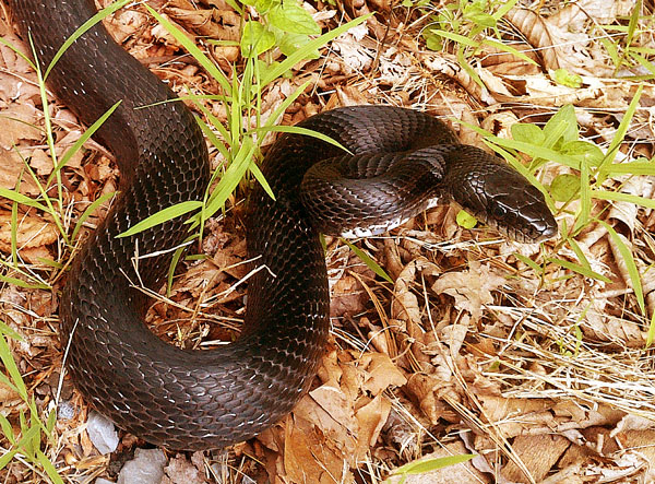
Black Rat Snake
Thursday, May 18, 2017
By noon, I had walked about ten miles west to Taylor Valley's Virginia Creeper Cafe, where I had an excellent burger, just like last year on the AT. I saw no one on the trail until quarter of ten. I saw a 5' Black Rat Snake. A Beaver swam across a pond and dove near his stick dome lodge. He had dammed a 15' diameter pond on the downstream side of a culvert under the rail trail, and flooded a much larger area on the uphill side of the trail, including the lodge area. He had felled over 100 8" trees in the area. I met Sale and John, and Sandy and Tom, in time to set camp and go to dinner.
Camp: Damascus
Miles: 17 951
Map: 773, 786
Leaves
Friday, May 19, 2017
I got my first shower and laundry with soap since Franklin. Occasional creek scrubs and clothing rinses helped, but to truly be clean and expect to stay that way for a few days felt great. I got a short buzz cut for my hair, beard, etcetera. A ministry provided a custom postcard with my portrait for my mom, with postage!! Another did sewing repairs on my hammock and sleeping bag. Dutch Apple Pie of PCT '03 offered a Sunday ride to Woods Hole Hostel, a good place for me to return to the trail. Many sample bins and a good hiker box provided a good start for the resupply I'll need to walk out. Vendor row had some interesting products and booths, and was a good place to socialize. But I met only a few people I had known before. No event vendors, and just one store in town sold Merrel Moab Ventiator boots, and not in extra wide sizes. But that will do for my walk to upstate New York. I saw a Thrush, some Crows, Canadian Geese, Mallards, and a few other Duck species.
Camp: Damascus
Miles: 2 953
Map: 773, 786
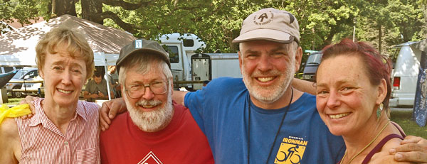
Sale, John, Dan, and Apple Pie
Saturday, May 20, 2017
John and I bought boots and groceries. A heavy rain fell towards the end of the hiker parade. Jennifer Farr Davis, with a broken AT speed record, gave a good presentation on incorporating hiking into life after thru hiking. We had a nice pot luck dinner and fire. The sky was clear enough to see stars and satelites.
Camp: Damascus
Miles: 2 955
Map: 773, 786
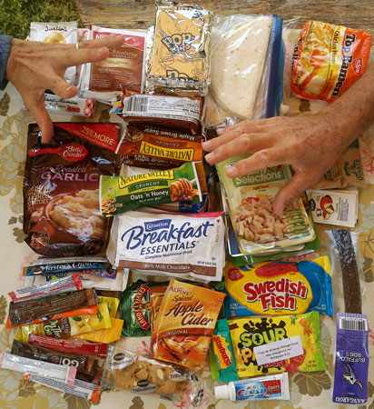
Hands Off!!!
Free Food from various Trail Days Exhibitors and Hiker Boxes
Sunday, May 21, 2017
Heavy rain fell from 4-9 am. With more rain predicted through the day, vendors and hikers began to pack and leave early. Dutch Apple Pie of PCT2003 drove me to Pearisburg, and I hiked the Appalachian Trail northbound. I had skipped a few days each of road walking, hiking the MST right next to the BRP, and hiking a bike path, all with camping issues and distracting vehicular traffic. My only regret was missing the historic shot tower. Apple Pie recommended I research the Hot Spring Trail, running parallel to the Sierra Nevada. She had many suggestions for Li and other alternative routes for the Hayduke Trail, and suggested I refer to her journal for notes. Another hiker told me there is a hiking trail from the AT in the White Mountains north to Canada, and said there is a book documenting the network of long canoe trails in Maine. Taba / Scott Ward said both the MST and the Palmetto are 50% roadwalking, and that he hikes with a skateboard to speed through the road sections. I saw an Eft (Eastern Newt Notophthalmus viridescens) and ants working on a dead caterpillar.
Camp: Beyond Groundhog Trail 65
Miles: 14 969
Map: 773, 787
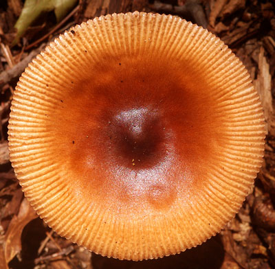
Mushroom
Monday, May 22, 2017
I was somewhat sick, with diarhea, fatigue, nausea, etcetera. The Allegheny Trail is marked thru with yellow blazes, but is often overgrown and has many blowdowns. It recieves little traffic and often has no distinct or built treadway. Blazes are sometimes covered with moss or lichen. A few times I had to go hunting for the next blazes to stay on track. I saw a couple of Turkeys, a Black Bear, a White Tail Deer, and some orange Newts.
Camp: A couple miles before Hanging Rock
Miles: 13 982
Map: 773, 787
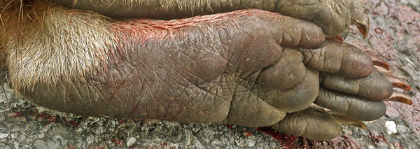
Raccoon Rear Foot
Tuesday, May 23, 2017
In the morning a cold heavy rain was falling. I decided I didn't need to be sick and doing a tough hike in cold rain, and instead to wait out the rain in my hammock. The rain poured all day, and I managed to sleep most of the time, so I stayed in bed.
Camp: A couple miles before Hanging Rock
Miles: 0 982
Map: 773, 787
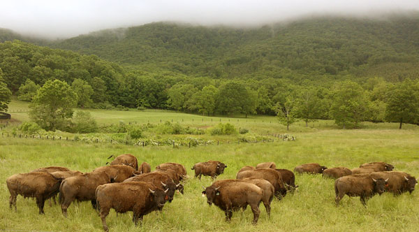
Bison
Wednesday, May 24, 2017
I saw a owl, many Red Wing Blackbirds, and a Turkey Vulture. Many Crows were fighting in groups of three or four in the woods before I descended Peters Mountain. There were many Deer, Bison on a ranch, and a mother and child Groundhogs. I had planned to hike the long roadwalk between Laurel Branch and Jerry's Run. Waiteville Road 17 was a nice country road with little traffic and nice views of farms, buffalo, deer, etcetera. Paint Bank had a store with a pizza slice and an ice cream bar. 311 was a busy 2 lane without shoulders and with few views. A mercy ride during a downpour from a local with a pretty thick accent was very informative. Very little visitation of the Peter's Mountain area I was in occurs outside a 2 week summer and one week late fall hunt season. ATV use in the area has fallen due to the many blowdowns. Despite living near the Buffalo Ranches I walked through, he had never heard of or seen anyone hiking thru on the Allegheny Trail, though he knew where and what it was. He was sure for a while I must be on the Appalachian Trail and ought to be resupplying near Catawba. He dropped me off where 159 splits from 311, but later his sister took me up to I64!! A few miles walking parallel to the freeway got me to the Allegheny Trail terminus at Jerry's Run, and I got a few miles further in soaking rain. So I camped far ahead of my plan.
Camp: A few miles north of I64
Miles: 28 1010
Map: 773, 787, Monongahela NF, The paper Allegheny Trail books are falling apart due to the rain, in spite of being used briefly and under shelter. Thankfully, I had traced the route onto the waterproof maps.
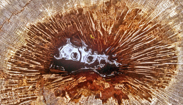
Wood
Thursday, May 25, 2017
I saw a deer, a couple of turkeys (one trying to lure me away), new bear digs and many old bear scats. An Eastern Box Turtle seemed more yellow than others I've seen. Happy surprises included a nice shelter and perhaps a mile of trail that had been recently cleared. The intermittant rain and bush water was very cold and there were many fords of swollen creeks. I camped before dropping east into a meadow out of concern for overnight flooding. Skin rashes from wet shorts are getting towards debilitating.
Camp: A few miles south of Road 14
Miles: 10 1020
Map: Monongahela NF
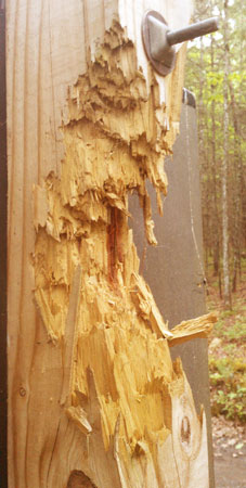
Bear Bite
Locally, Black Bears mark territory boundaries
by biting chunks out of signposts and trees.
Friday, May 26, 2017
Skies began clearing in late morning. From Road 14 I followed Meadow Creek beyond Sherwood Lake to Allegheny Mountain Trail, gaining the Headwaters Great Eastern Trail Section by nightfall. This route, at first on an easy ascending roadwalk on 14A, did wonders for my skin issues, as my shorts were able to dry without all the bushwhacking and rain. At Sherwood Lake I found potable water, trash cans, toilets, a snack and boat rental stand, and warm showers. A handout map helped with the local trail system. The Meadow Creek Trail was well maintained and clear except for some complex recent blowdowns, but there were many knee deep fords. A 2+" frog was the first I got a good look at in some time: I usually see only splashes and ripples. The Allegheny Mountain Trail is unmaintained and unmarked north of the Connector Trail, but easy enough to find and walk with reasonable cross country navigation skills. Two tiny, fuzzy Black Bear cubs treed a few feet from the trail as mom leapt east over the rocky ridge. I continued past and called out frequently so mom would know I was gone...
Camp: High Top Tower Road
Miles: 20 1040
Map: Monongahela NF, HW7, Sherwood Trail Handout
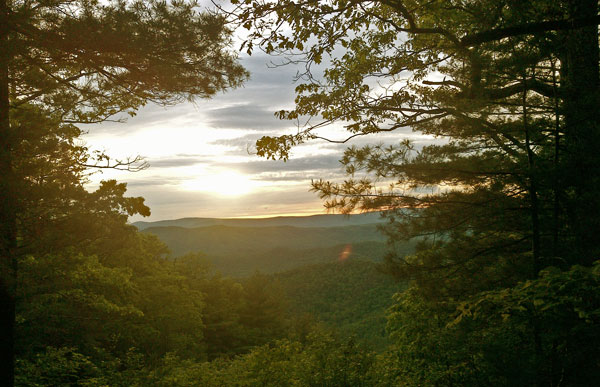
Sunset
Saturday, May 27, 2017
There was only a moment of rain today, and all rashes are below the pain threshold and are curing well. Rain is predicted overnight, and scattered showers tomorrow. We'll see... The Mountain Valley Country Store lady prepared two sausage and egg on toast sandwiches, which cured a raging hunger. She sees Great Eastern hikers occasionally. She said 8" of rain had fallen locally in May. Rivers are swollen, and I believe the observation. Today's plagues included Stinging Nettles, clouds of big flies to crawl all over me whenever I stopped, and clouds of little flies that hovered in front of my eyes while walking and needed to be shooed away frequently to avoid going crosseyed. One White Tail Deer barked before fleeing, and there were many more in Hidden Valley, where I also saw a Turkey and an Owl.
Camp: Cobbler Mountain Trail 611, Hidden Meadow
Miles: 20 1060
Map: Monongahela NF, HW7, 791w
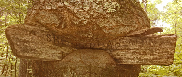
Shenandoah Sign
Sunday, May 28, 2017
I saw an 18" Garter Snake, as well as a road killed 10" Ringneck and an 8" patterned snake. There were 4" and 2" Toads. One deer bolted only when I was 25' away, and I saw several others. I heard much owl and turkey calling. I got a mercy ride in a light rain on the second long road walk. Thanks. Piney Mountain Trail 453 was part of a local network of trails that were once well built and heavily traveled, but today seem to be cleared every few years as firebreaks for controlled burns and otherwise lightly used. Shenandoah Mountain Trail seems easier to follow after Scotchtown Draft. I pulled one attached but not engorged tick from my right rear lower ribcage area.
Camp: Shenandoah Mountain Trail 447, after Scotchtown Draft
Miles: 20 1080
Map: HW6,5, 791w

Power Line
Monday, May 29, 2017
I saw a 14" Garter Snake, a deer, several toads, and pollywogs in a rain puddle. Shenandoah Mountain Trail 447 was a pleasure to walk as is was maintained, clear, and not so steep. I met a biker, the first person I've seen on a trail since the Appalachian Trail near Pearisburg. There was a spring a half mile after Scotchtown Draft, and a branch of Benson Run 150' from the trail, but this section seems otherwise dry. These sources may not have been flowing had I not walked through such biblical rain. Future hikers watch it and pack enoigh water. The Confederate Breastworks had an excellent interpretive trail. The sunset developed through several pretty orange phases.
Camp: Shenandoah Mountain Trail 447, at Jerry's Run Trail 441
Miles: 24 1104
Map: HW5,4, 791e
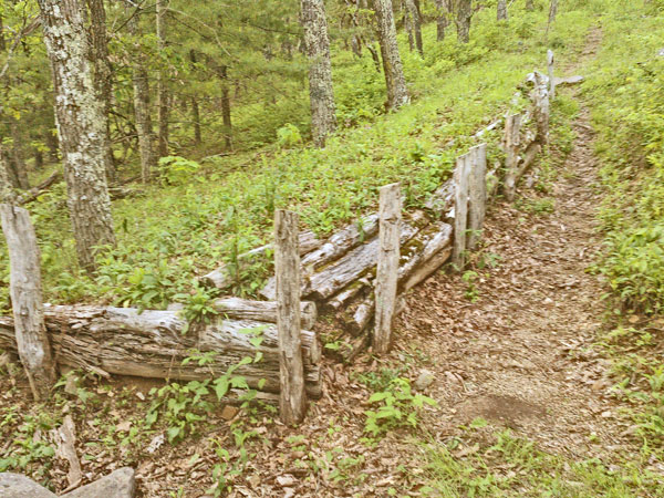
Confederate Breastworks
Tuesday, May 30, 2017
Several Grouse hens tried luring me away from their broods. A juvenile Black Bear and a Rabbit both ran off. Several Turkey Vultures were resting in grass by the trail. A local couple told me Brandywine, west on 33, has a dollar store and a grocer: I'll resupply there tomorrow. I got a cell call through to my mom. I saw a roadkilled ringneck snake and frogs.
Camp: Shenandoah Mountain Trail 1024, Several miles south of US33.
Miles: 24 1128
Map: HW,4,3, 791e

Sunset
Wednesday, May 31, 2017
I wish I had known about the stone fire tower, and had hiked the ridge road rather than the trail. I also wondered about a farm of dish antennae south of town. Two friendly hunting dogs hiked along with me for a while. I hitched west on US33 to Brandywine for supplies and pizza. It was a fine resupply town. Hitches took a while, but the drivers and townfolk were friendly and informative. Within shouting distance of the junction of Sugar Run Road 21 and US33 were a post office, a motel, a pizza place with good WIFI, a general store with a little food, and a dollar store with full resupply (no real produce at either store). The cashier thought I must be a pcking genius since my pack looked full without the cart of groceries. I explained the technique included much ramming and cramming. I saw many nicely detailed coon, dog, and deer prints. One steel pipe gate post was filled with fresh dry dog kibble. I wondered whether the owner filled it to get the dogs to always return there, or if a squirrel had stolen it from a parked truck and cached it?
Camp: German River Road 232 at 232b
Miles: 19 1147
Map: HW3,2 791e, 792w
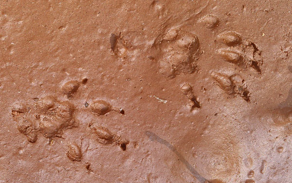
Raccoon Front Prints
Thursday, June 1, 2017
While walking down 302 near 302e, a Fox came down out of the woods and headed up the road towards me. Seeing me, he did a double take and bolted back up into the woods. Perhaps 5 minutes later, another Fox (or the same one?) was sauntering down the dirt road ahead of me. He matched my speed and kept far enough away that I could just see him 2⁄3 of the time around curves, bushes, etcetera. After a few minutes of this, he ran into a juvenile Black Bear, and both skeedadled into the woods in different directions. A local lady offered a ride to 259 and dispensed much local knowledge. In the farm country along 259 I saw a Woodchuck, Red Wing Blackbirds, and Turkey Vultures. A country store provided Chili Dogs, Onion Rings, and Ice Cream.
Camp: Great North Mountain Trail 1009 at Snyder 1015, 421, 595
Miles: 21 1168
Map: HW2 791e, 792w
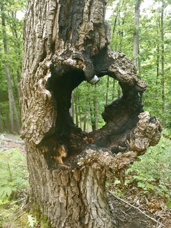
Hollow Tree?
Friday, June 2, 2017
I saw two Turkeys. High grass along the trail hid Grouse well enough that a half dozen times I walked right among a hen and chicks. A flurry of chicks flying in every direction and mom popping up and down and distress calling happened each time. There were several typical dust baths in the trail, but at one, a Grouse flew straight up in a dust cloud. The bath was extra deep, perhaps 2", and was dug into the entrance to an ant colony. Birds drive dust into their feathers to drive out mites and like creatures, and pick up ants in their beaks and comb them through their feathers, as the ants and formic acid help in the cleaning.Two ant mounds were the size and shape of grave settleing heaps, perhaps 8' x 3' x 2' high. One bear bolted up from the road, and as I passed that location, I saw her cubs descending a tree below the road. The route was entirely dry but for a rill just past the Wolf Recreation Area.
Camp: Mill Mountain Trail 1004 after Big Schloss
Miles: 21 1189
Map: HW2,1, 792w, 792e
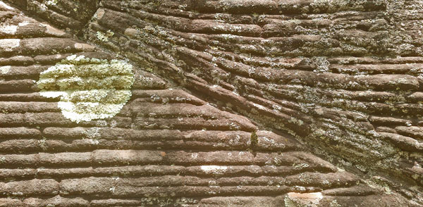
Stone
Saturday, June 3, 2017
Nothing very exciting happened. Per the Paul Gerhard Shelter log, a plane had crashed quite near and been recovered by helicopter over the past few weeks. That explained extra recent trail wear from ATVs, horses, ectetera, everywhere near the shelter.
Camp: Eagle Rock
Miles: 20 1209
Map: HW1, 792e
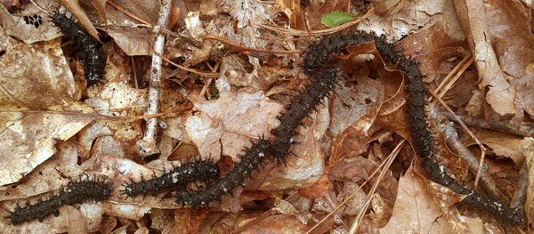
Caterpillars
Sunday, June 4, 2017
A Gopher Snake rattled his tail and posed as a rattler. A few Grouse flew off. There was a deep Turkey dust bath with tail feather impressions, a footprint, and a couple of downy chest feathers. There was no water from Waite Gap yesterday to Pinnacle Shelter and Spring at noon, so I was thirsty. But there was plenty of water afterwards. The walking was tough, with lots of unstable rock, overgrowth, and sticks and vines, some thorny, to trip me. It was hot, and every sort of flying, crawling, and biting bug was out in force. All afternoon I heard loud target shoting and gunning engines. I arrived at Barclays Run Shelter too late to make the long roadwalk to Basore Ridge Shelter, and therefore quit a little after 5. That gave me time to do many overdue housekeeping tasks.
Camp: Barclays Run Shelter
Miles: 15 1224
Map: 792e, PATC L
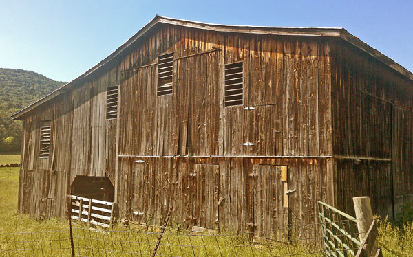
Barn
Future Hiking Ideas
Shenandoah Area
Southeast Wilderness Wander
Blue Ridge and Skyline Bike Ride |

Wood
Monday, June 5, 2017
I saw many White Tail Deer and a flock of Canada Geese. A few hours of light rain cooled things down but started some rashes. The mud took some excellent dog, deer, and tiny fawn prints. One rock had a coral fossil. A lady stopped to give me two pints of water - Many Thanks!!!
Camp: Beyond Dead Mule Trail, Sleepy Creek
Miles: 28 1252
Map: PATC L

Newt, Eft Stage
Tuesday, June 6, 2017
I saw many White Tail Deer and 2 Turtles, one with a 1¼" shell and the other 6". A 4½' Black Rat Snake disappeared while I was retrieving the camera. There were frogs, toads, pollywogs, and orange Efts. I saw Scarlet Tanagers. There were more good mud prints, including Raccoons and Bobcats. A swim and laundry rinse at Devil's Nose felt great. I didn't remember the shelter, camp, etcetera at Spruce Pine Hollow from 2016. I have a vague recollection of being lost for a short while. Perhaps I passed by it.
Camp: Dugan Hollow Shelter
Miles: 21 1273
Map: PATC L
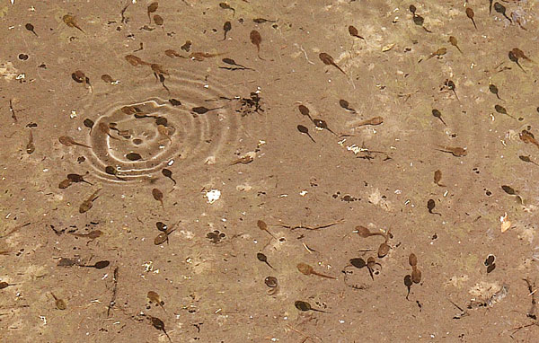
Tadpoles
Wednesday, June 7, 2017
I walked my last few miles on the Tuscarora Trail. A big Black Bear scared the living daylights out of me when he slid down from high in a tree, breaking lots of branches, and ran off up the trail. I was perhaps 50' away. I saw a Red Wing Blackbird. I resupplied in Hancock, Maryland for a week's walk to Everett, Pennsylvania. The library had good WIFI, magazines, outlets, etcetera. At the Post Office I mailed away 4 pounds 1.4 ounces of maps, guides, and gear. The pack felt substatially lighter. After laundering, though my clothes undoubtably were cleaner, they certainly didn't smell good. After all the rain on this trip, it may take more than a few washings to cure them. The forecast is for rain this afternoon, with clear weather for the following week. High temperatures start in 5 days. The Mid State Trail guidebook promises a ridge trail with often infrequent access to water. I bought a two liter bottle to replace the 1¼ liter size I've typically been carrying water in. I then headed west on the C&O Canal and Western Maryland Rail Trail towards Green Ridge State Forest and Pennsylvania's Mid State Trail. I saw many White Tail Deer, one lame / odd gait, and another a tiny fawn. There were toads, turtles, and songbirds. One thing I didn't know of had many legs and pinchers, and was 2½" long. Turkeys gobbled and frogs croaked beyond sight. A Great Blue Heron flew squawking down the Potomac River. Not much rain fell.
Camp: C&O Canal Cacapon Junction Site
Miles: 15 1288
Map: PATC L, C&O Canal NPS Handout, Western Maryland Rail Trail Handout
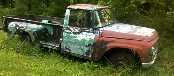
Truck