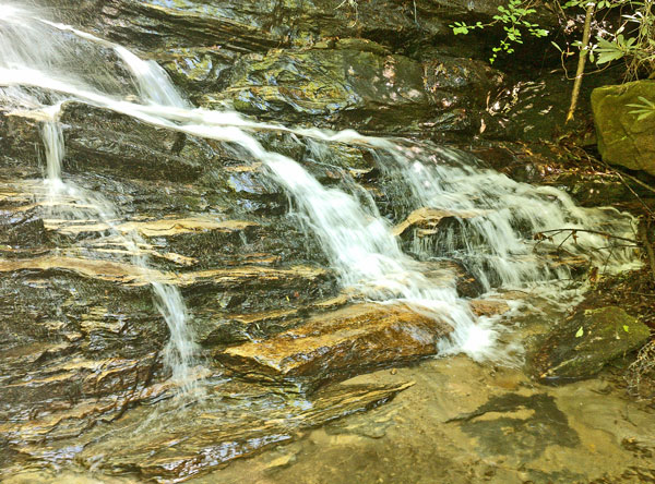
Waterfall
The ~300 mile Benton MacKaye Trail parallels the Appalachian Trail from Springer Mountain north through the Great Smoky Mountains, crossing Georgia, Tennessee and North Carolina, including eight federally designated Wilderness and Wilderness Study Areas. North Carolina's 100 mile Bartram Trail commemorates William Bartram, who explored the area in 1773 through 1777 and documented the natural history and American Indian culture. The Foothills Trail, at 76 miles in South and North Carolina, is parallel to and north of the west end of the Palmetto Trail.

Waterfall
Wednesday, April 19, 2017
Rain stopped by dawn and the sky cleared by noon. I reached the northern terminus of the Pinhoti Trail and turned north on the Benton MacKaye Trail around 2 pm. I met two gals thru hiking the BMT, and no one else. One oak tree had a recent Lighning strike, which blew out a 1" wide strip of bark, still fresh and red, helically wound around the tree and 25' long. An old cabin site had a collapsed chimney, a cellar, and broken jars and bottles.
Camp: South of the Georgia - Tennessee border
Miles: 22 372
Map: 777, 781, Chatahoochie NF
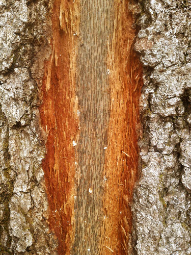
Bark Removed by Lightning
Thursday, April 20, 2017
Besides the two BMT gals, I met no one. Toilet, trash, showers, laundry, and water were much appreciated at Thunder Rock Campground on the Ocoee River. All sites had to be reserved, though no one but the host was camped???
Camp: Beyond Deep Gap
Miles: 24 396
Map: 781

Wet Grass
Friday, April 21, 2017
Big Lost Creek had a deep, humid canyon with many flowers and lush plants. There were also unique funnel shaped black mushrooms and walking was easy on the old rail bed. Reliance had a small store and post office, and a burger place, so I indulged in a nice lunch. WIFI was quirky and never worked. The Hiwassee is not yet full of rafters and kayakers as the TVA is not yet generating: Locals expect good flows about the end of May. The river was very pretty, with lots of exposed rock due to the low flow. I saw one Red Wing Blackbird, a Great Blue Heron, Canada Geese, and a Green Anole. There were many Cardinals, and several times I saw one male chasing another.
Camp: North of Appalachia Generating Station on ridge. thunderstorm and siren
Miles: 20 416
Map: 781
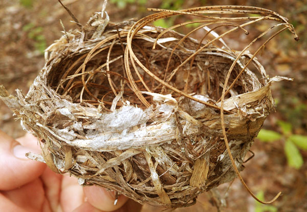
Bird Nest
Saturday, April 22, 2017
I took the John Muir Trail further up the Hiwassee after the JMT/BMT split. There were few views of the river through the vegetation, so I occasionally dropped my pack and explored. I saw an Eastern Box Turtle and a marroon snake, who was disapearing under rocks in a creek. I picked off many Ticks. I tried a while to hitch back to the BMT on Highway 68, but no one slowed. East of the highway, and beyond the old gravel highway, the JMT appears abandoned, with many blowdowns and lush growth in the trailbed. But paint blazes made the way clear. I returned to the BMT on the old highway. There was recent motorcycle damage back on the BMT. A few squirrels made daring leaps between trees high in the canopy. Other than while hitching, I saw just a few fishermen all day. Drenching rain fell as I set camp, and continued into the night. Water bounced from the ground, blew sideways, came down the ropes, and generally soaked my hammock and sleeping bag.
Camp: Northeast of Buck Bald
Miles: 20 436
Map: 781
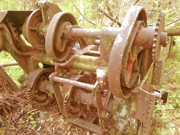
Farm Equipment
Sunday, April 23, 2017
Rain continued all day. I saw a few Turkeys.
Camp: Hazelnut Knob
Miles: 17 453
Map: 781

Garter Snake
Monday, April 24, 2017
There was little rain, but the trail was muddy and flooded often, and overcast continued until evening. I got my equipment a little drier on an hour long afternoon reading break. I saw a grouse. One fallen tree had been pecked apart by woodpeckers, and I examined it a while. There were not extensive bug tunnels or a large cavity in view, but one chip had a 3⁄16" bore through it. As I left, a large bee landed on a chip and began flexing his abdomen such that the ovipositor area travelled forward and back a little above the wood.
Camp: Beyond Gold Cove Branch
Miles: 20 473
Map: 781
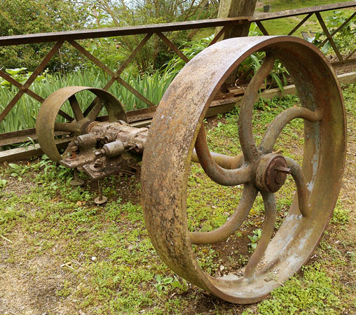
Leather Belt Pulleys
Tuesday, April 25, 2017
Morning overcast cleared by afternoon. I took the Slickrock Creek Trail 42 rather than the BMT to enjoy the deep canyon, lush riparian plants, and cascading water. Upper stretches of the trail had many tread blowouts and blowdowns. In one pleasant glen, I took a 20 minute break as two Barred Owls Strix varia repeatedly sat in nearby trees, then chased and dove at each others, always hooting oo oo oo oo-oo, and a few other vocalizations. They were always within a couple of hundred yards, sometimes much closer, and always in view through tree canopies. They paid me little attention, even when I hooted back at them. After 20 minutes, they moved far enough away that I could just barely hear them. Lower in the canyon, trails are mostly on old rail beds. I found one cast iron brake shoe, a foot long by 1½" thick by 3" wide.
Camp: Slickrock Creek Trail 42
Miles: 22 495
Map: 781 BMT should be on Hangover Ridge? 55 closed due to post fire damage/ dangerous conditions
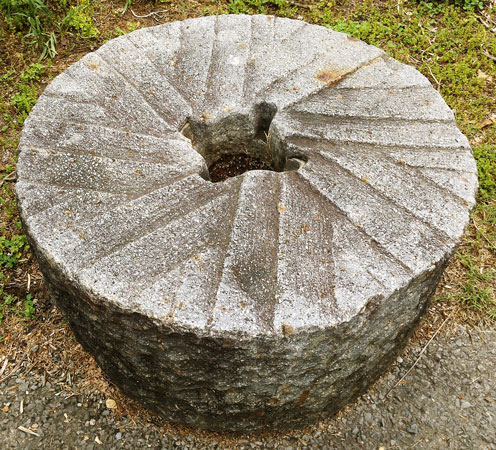
Mill Stone
Wednesday, April 26, 2017
I continued on Slickrock Creek 42 to the lake. I saw more historic iron - rails, bed parts, wedges, etcetera. There were plenty of crotch deep fords, complex blowdowns, tread blowouts, and overgrown areas. I met three brothers by the lake, ascending into one of the 'hardest trails in America'. I gave them a rundown on conditions. The Tapoco Lodge had a great burger and salad, quite a relief as my food bag runs thin. Two ladies I'd talked with earlier paid for the lunch - many thanks. The lodge accepts and ships packages for BMT hikers. I saw a 2' slender black snake, a vulture, and some Turkeys. There were 2 instances of beauty that needed a few areas of knowledge to appreciate. One stretch of the old logging rail beds still had impressions of the ties in the soil for just a few yards. The parallel bars make an aesthetic impression, but to still be there requires a special history of plant roots, soil softness, erosion, and of hikers not pounding the pattern out. Later, a fallen large tree had pulled out a rootball of layered rock. The roots had all grown in parallel planes. Slabs of rock were suspended between the root layers and spread about the ground. Both pretty and interesting in a few scientific ways. Things like this I like to find and ponder. I noticed several times this trip that where long ago axes had been used to cut bark blazes, especially cuts on both sides of trees, there is now a rectangular tunnel through the tree where the wood rotted out. Perhaps this is why paint blazes are prevalent in the east, while bark blazes are used in the west.
Camp: Yellow Creek Mountain Trail 48 new BMT waterless
Miles: 21 516
Map: 781 BMT 48, water down roads, 784, 229
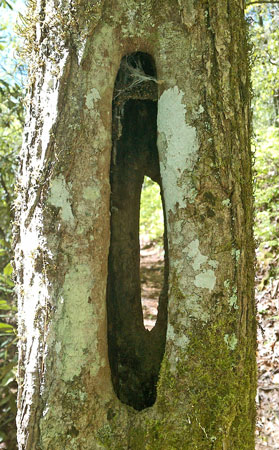
Old Axe Blaze
Thursday, April 27, 2017
I awoke to a brilliant sunrise after a clear, starlit night. A thunderstorm was rolling in from the south, and rain started just after I had hurried to break camp amd pack. I saw a Black Bear Ursus americanus. I resupplied in Fontana Village Resort, which shuttles hikers for a few bucks and has all sorts of hiker services. A lady handed me a bag destined for the hiker box with apples, tuna cans, bread, chips, and more. I had to explain that getting apples was like finding gold. I guess I met 60-70 nobos between noon and 8 while heading southeast on the Appalachian Trail today. A salamander enjoyed the rain, mud, and puddles at Cable Gap Shelter. I should resupply in Franklin in about 4 days.
Camp: before Brown Fork Gap Shelter
Miles: 15 531
Map: 784
Friday, April 28, 2017
I startled a White Tail Deer enough that she barked before fleeing. Blue Jays were in mating colors, as were some other birds. I enjoyed the start of the Bartram Trail, and all the waterfalls of Ledbetter Creek. The trail has been recently cleared and is blazed well. There were some nice bridges, and some fords.
Camp: Ascent from Nantahala River
Miles: 21 552
Map: 784
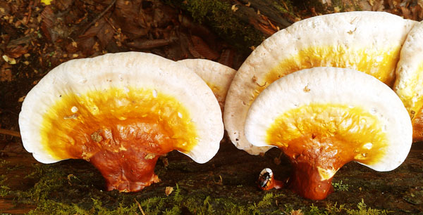
Shelf Fungus
Saturday, April 29, 2017
I saw a 2' Garter Snake, olive drab with black speckles, ¾:" diameter, whose tongue was bright red at the base but black on and near the fork tines. He was patient enough not to move as I observed a while, then stepped over him and left. A country store allowed me to stock up on ice cream and potato chips. The cashier told me of many recent arson forest fires. As I walked away, there were signs for a cafe, and I started dreaming of a burger. Alas, they were not yet open for the season.
Camp: McDonald Ridge, short of Wine Bald and AT
Miles: 19 571
Map: 784
Sunday, April 30, 2017
Wayah Tower's roof and fiberglass sides had burned in a recent forest fire. Fog cleared for a couple of minutes for a view to the south. Two mines with lots of quartz and mica spoil were beyond the AT split. I found iron radio telephone wire, logging steel cables, old can types, and other reminders of history as I descended east. Nearing the trailhead I met a local and asked where to find resupply stores, motels, etcetera. He ended up driving me to town and even planning to drive me past tomorrow's Bartram Trail roadwalk. Many thanks.
Camp: Motel, Franklin
Miles: 13 584
Map: 784, 785
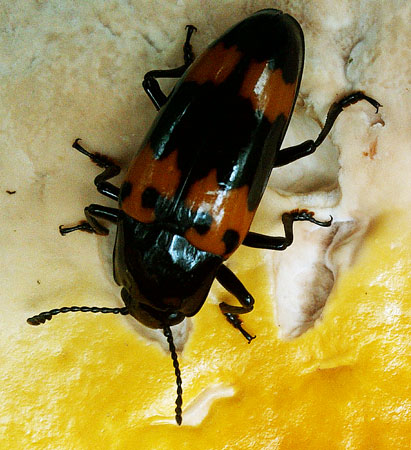
Shelf Fungus and Beetle
Monday, May 1, 2017
What with pouring rain, I decided a long roadwalk was a bad idea and arranged a ride to the junction of Tessentee And Buckeye Roads. The rain continued a few hours, and the sky cleared in late afternoon. Though I've seen many millipedes of the 4" round and 2" flatter, colorful types, I saw my first centipede of the trip today. There was an orange f newt and Turkeys too. Rain is predicted most days for the next two weeks. There is a new Bartram Trail section between Hickory Knoll Road and Doubletop Gap, but I didn't know it was done and open until too late. An old school bus on the ridge would have made a fun and unique shelter, but the windows had long since been shot out.
Camp: before Highway 106
Miles: 15 599
Map: 785
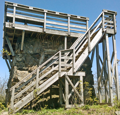
Rabun Bald Tower
Tuesday, May 2, 2017
The air was quite clear and the views from Rabun Bald's stone tower were excellent. To the east, where I'll walk tomorrow, the mountains fell far down to foothills. In Georgia many Bartram Trail signs are nicely carved into large stones. I saw an 18" striped Garter Snake and a large area rooted by pigs, including holes in the trailbed a foot deep.
Camp: beyond Raven Knob
Miles: 20 619
Map: 785, 778
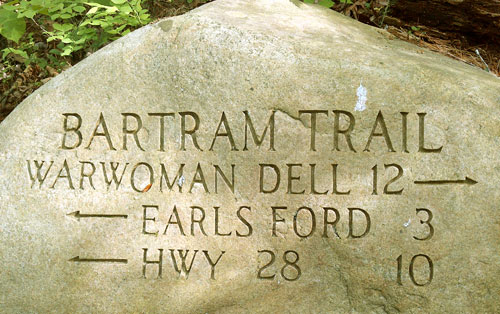
Stone Bartram Trail Marker
Wednesday, May 3, 2017
Warwoman Dell was interesting, with a geological shear, Cherokee history, a rail line abandoned in construction at the start of the Civil War, fancy CCC built picnic shelters and fireplaces, and CCC built trout storage troughs. I saw a dead snake, with just skin and bones, and a little rotting flesh with a few maggots.
Camp: beyond Warwoman Creek and horse trail 146
Miles: 20 639
Map: 778
Thursday, May 4, 2017
I saw a turtle with a shell just over 1", a 1" frog, and a couple of black, 4" salamanders. Heavy, cold rain fell through the afternoon and on into the night. The trail was occasionally signed Bartram even in South Carolina to the Foothills Trail.
Camp: before Walhalla Fish Hatchery Road
Miles: 22 661
Map: 778, 785
Friday, May 5, 2017
Many thanks to a Foothills Trail Conference Crew working east of Highway 281. I saw a Pileated Woodpecker and a Cardinal. Over the last week I've noticed a lot of recent woodpecker work on downed trees. I think this is unusual and may be the work of a local species.
Camp: Bearcamp Creek
Miles: 20 681
Map: 785, 780
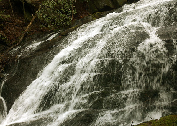
Waterfall
Saturday, May 6, 2017
I left the Foothills Trail on the Auger Hole Trail, and hitched north up US64. I resupplied in Pisgah Park and started north on the Art Leob Trail, on the next web page, today. Neither WIFI nor Cell Data got me on the internet. This has been an issue in several stops already. No email, website upload, long range weather, etcetera. A local couple told me to expect 5 days of clear weather, and that north of Ashville the climate is generally much drier. If true, that will be a huge relief after a long stretch of rainy and foggy days broken occasionally by a day or two of sun. Maybe I can get the mildew stink of my gear down to some reasonable level. Or maybe that's just a happy dream...
Camp: beyond Road 475C
Miles: 22 703
Map: 785, 780