
Tuscarora Trail
The Tuscarora Trail is a 252 mile bypass of the Appalachian Trail in Virginia, West Virginia, Maryland, and Pennsylvania. It was built starting in 1967 because it seemed that the AT near Washington DC would be overrun by development and disappear. In the wake of the 1968 National Trail System Act, the AT corridor was eventually protected. But the Tuscarora still is maintained by the Potomac Appalachian Trail Club as an AT side trail. I hope it has a somewhat different feel. The 142 miles in Virginia and West Virginia were once known as the Big Blue Trail. In Woodstock, a few miles off trail, is a Super Walmart and a full grocer. Then, along the C&O Canal is the potential resupply town of Hancock. Maryland and Pennsylvania host the remaining 110 Tuscarora miles. Though in the 1980s the trail was in areas overgrown, today it should be possible, with care, to follow it all the way through.
Monday, April 18, 2016
I had a breakfast of eggs, hash browns, toast, sausage, and ice cream at Elk Wallow, thus completing my quest to get a solid meal at every wayside and camp store in Shenandoah NP. Then I had a couple of beers while discussing the Camino de Santiago and Great Eastern Trails, etcetera, with the other hikers.
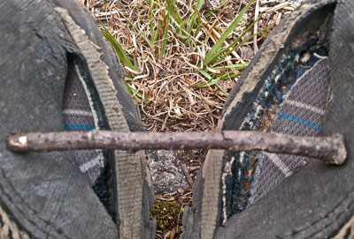
A developing Boot Failure. The upper is separating from the sole to the inside of the balls of my feet. |
A new phase of spring seems to have begun. For the last few days it's been warm, whereas frigid had been the rule before. Many more squirrels are out and about their business. They are most noticeable for rustling the leaf litter in just one spot and just for a moment as they jump around. All the other animals make noise continuous in time and space which can be aurally tracked. I saw a Garter Snake high in Overall Run, I believe the first of the trip. I found my first tick, still crawling fortunately. A few more trees are leafing.
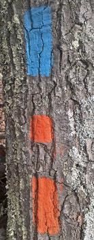
The Tuscarora seems easy to follow so far. Blazes are frequent enough and blowdowns and overgrowth not too bad. Maps 228 and G both have plenty of detail. I'm carrying 10+ days of food for the Tuscarora because I didn't know what to expect for trail and resupply conditions. With the trail being in decent shape and a local telling me today that hitching in to Woodstock, with a full grocer and a Super Walmart, and which I'll likely pass the day after tomorrow, there's little to worry over.
Miles: 20 628
Camp: West of Panhandle Road 613, GWNF, Morgan Military Road (pic)
Sections: 22, 21
Maps: NPS Handout, NGTI 228, PATC G
Tuesday, April 19, 2016
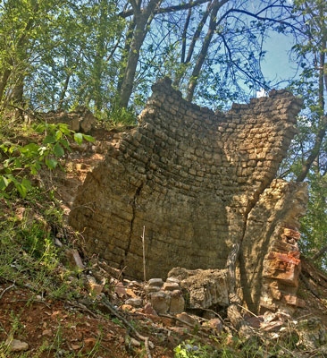
More signs of spring today included a 6' skinny Black Rat Snake and a two foot Green Snake, more kinds of insects including several types of moths and butterflies, a dragonfly, some flying ants, and etcetera. Elizabeth Furnace is partially collapsed, but enough remains to clearly identify its function. Chips of glassy slag are everywhere nearby, and there is a huge chunk of pig iron. Ascending west I saw several trench pit mines for the iron ore and a campsite in an old leveled charcoal burning area. The interpretive signs and trails were very good. The area had trash cans and toilets, but water taps were off. A swim in Strasburg Reservoir was much appreciated. Views of the South Fork Shenandoah River were excellent this morning. The shelter was quite nice. It's interesting what I hear from ridgetops: I could follow an auctioneer quite closely in a distant field with many parked cars, and the civil defense siren from Strasburg, miles to the north.
Miles: 20 648
Camp: East of North Fork Shenandoah River, GWNF, Fort Valley to southeast
Sections: 21, 20
Maps: NGTI 228, PATC G

Wednesday, April 20, 2016
I enjoyed the walk through family farms, dairies, etcetera, and saw no one on the forest trails. Deer kept a more natural distance than they had on the Appalachian Trail. I took a late detour on the Old Mail Path and Racer Camp Hollow Trails so that tomorrow will start with a riparian hike. I've come to think that eastern hiking, with its emphasis on (often viewless) ridges, sell the area short. So where I can see other ecosystems, I'll try to detour. I picked off several crawling ticks. Once I set my camp I smelled wood smoke several times.
Miles: 22 670
Camp: Gap between Cove and Paddy Creeks, GWNF
Sections: 20 - 18
Maps: NGTI 228, PATC G, F
Thursday, April 21, 2016
FR93 nearly always had a great view of the creek and valley floor, but I really didn't see any wildlife anyway. After a little cross country, I returned to the Tuscarora, which has moved east to the stateline ridge. The new route is dry, but I found a beer. On the north side of Dry Gap I found one Great Eastern Trail plastic diamond blaze. After a late afternoon downpour and a prediction of rain tonight, I stopped a little early at the Pinnacle Shelter.
Miles: 23 693
Camp: Pinnacle Shelter
Sections: 17 - 15
Maps: PATC F, L
Friday, April 22, 2016
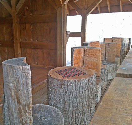
It rained through the morning, and the trail was up and down in teetering rocks and debris, so I took a long dry break at Barclay's Run Shelter. But the rain stopped as I started the long road walks. A local had many questions about potentially hiking the Tuscarora, which he called the Appalachian Trail. (Other local hikers still call the section in the Virginias the Big Blue Trail.) He had partied in the shelters and knew them all well, but other areas were of interest. He told me of a store just east of the trail at the junction of Gainsboro Road and US522. The store sold a bit of everything, but a true resupply would have been difficult. I had a can of ravioli, a pint of ice cream, and a tomato for lunch, and hauled away potato chips, cookies, and soda. The trail was closed due to property issues just north of Basore's Ridge Shelter. A not very helpful note suggested I take the road 600 reroute, but without describing the reroute. I had left road 600 a couple of miles back. I continued north several miles on 689, east on 600, and north on 690, which put me back on route. It rained through the late afternoon. It felt great to get out of my wet clothes at Shockey's Knob Shelter. It felt even greater to listen to the fairly heavy rain that started after dark patter on the steel roof while laying in my dry sleeping bag and typing this journal.
Miles: 26 719
Camp: Shockey's Knob Shelter
Sections: 15 - 13
Maps: PATC L
Saturday, April 23, 2016
I stayed in the shelter over an hour later than I'd usually leave due to rain. Boredom chased me out, but luckily the rain was done for the day. The first couple of hours were misty, starting with less than 100 yards of visibility. But that cold and damp morning continually improved to fairly clear skies and views by evening. I saw two turtles, several deer, a few turkey, and many other birds. The trail tread was usually good enough that I could watch nature rather than my footing.
Miles: 29 748
Camp: Dugan Hollow Shelter
Sections: 13 - 11
Maps: PATC L
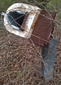
| Is anyone really safe from Mailbox Baseball? |
| 20 Miles Per Day Estimated Dates | ||||
|---|---|---|---|---|
| Location | Mile | Miles | Days | Date |
| Hancock | 1024 | |||
| Tuscarora | 1124 | 100 | 5 | April 29 |
| NY-CT | 1442 | 418 | 21 | May 13 |
| CT MA | 1494 | 470 | 24 | May 16 |
| MA VT | 1584 | 560 | 28 | May 20 |
| VT NH | 1734 | 710 | 36 | May 28 |
| Gorham | 1878 | 854 | 43 | June 4 |
| Katadyn | 2176 | 1152 | 58 | June 19 |
Sunday, April 24, 2016
I arrived in Hancock at 10 minutes before 8, and waited outside for a restaurant to open. A friendly cat who needed to shed a lot of hair due to spring warming entertained me. Breakfast was excellent: eggs, sausage, toast, potatoes, and a pancake. A visit to a grocer and a dollar store loaded my pack. Laundry was much appreciated, as the rain had fermented my plastic base layer and created a phenomenal stench. I walked on through town and had a burger lunch, but the two motels didn't seem necessary, and little else interested me.

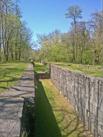
I walked out on the CO Canal and the Western Maryland Rail Trail. Both had interesting interpretive displays near town, but little further on. It might be interesting to walk or ride both since they each have separate historic features. It would be easy to ride the CO Towpath unless your bike had very skinny tires, as the roadbed was graveled and in good repair. Furthermore, points of interest can be widely separated, and riding would speed up the featureless parts. Little Pond Camp had a large knee high grassy area, a picnic table, a podium barbecue, a portable toilet with paper, and a modified hand pump that dribbled iodine treated well water. Other than the camps, the CO Canal is closed at night. I saw many turtles where the canal is still flooded.
Miles: 23 771
Camp: After Fort Davis Road
Sections: 11 - 8
Maps: PATC L, K

Monday, April 25, 2016
Except for creeks early this morning and a biker bar at US30, there was no water on today's long ridgewalk. With miles of teetering rocks, tripping stick litter, and foot tangling thorny vines, miles came tough and slow. But the occasional views of the farmlands below and of the many parallel ridges were outstanding. A burger and soda at the biker bar felt well deserved. And the sunset from the shelter was colorful and rich in detail.
Miles: 18 789
Camp: Big Mountain Shelter
Sections: 8 - 7
Maps: PATC K
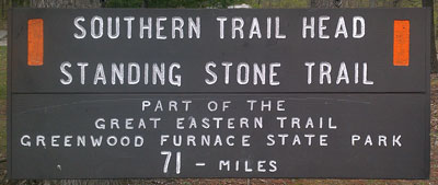
Junction of Tuscarora, Standing Stone, and Great Eastern Trails. |
Tuesday, April 26, 2016
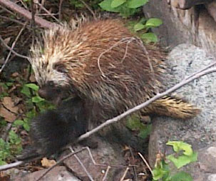
At Cowan's Gap State Park (handout topo map) the north bound Great Eastern Trail leaves the Tuscarora on the Standing Stone Trail. The sign at the trailhead was the first notice I've seen of the GET since the Potomac River. Between Dry Gap (mentioned earlier) and the Potomac, there was a plastic GET diamond blaze perhaps every 10 miles. On the other hand, PATC map K shows the GET, whereas PATC L does not. Along the Knob Mountain ridge, I saw a Porcupine Erethizon dorsatum mother nursing its baby. I had to get within 5' to get around it, and there was some posturing, but no quills were thrown.
Miles: 23 812
Camp: Knob Mountain after Dry Run - Newbridge Trail
Sections: 7 - 5
Maps: PATC K, J
Wednesday, April 27, 2016
More signs of spring: woodpeckers drumming, a raven carrying sticks for a nest, and trees leafing on some high ridges. The day was cold and the trail was fairly strenuous, with several good water sources.
Miles: 20 832
Camp: After Bill Miller Trail
Sections: 5 - 3
Maps: PATC J
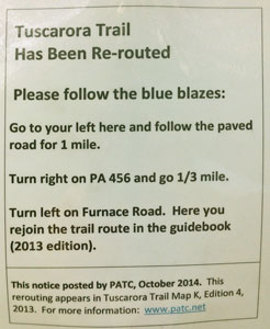
| It's scary to run into a sign like this in a stretch with lots of private property an hour before dark. Fortunately, I already knew about this reroute. |

Thursday, April 28, 2016
I saw a turkey and some deer. After 5 hours of continuous rain and slippery teetering rocks, I found the new Charlie Irwin Shelter west of Carlisle and decided if any day was made to wimp out on hiking, this was it. I read maps and made a few phone calls and waited. The weather never cleared, so I stayed the night.
Miles: 16 848
Camp: Charlie Irwin Shelter
Sections: 3 - 2
Maps: PATC J

Friday, April 29, 2016
After a long, rainy hike, I reached the northern terminus of the Tuscarora Trail near the Darlington Shelter on the Appalachian Trail. At the shelter I found two noodle cups someone had left. After showing them to Bear Snack, doing the AT NOBO in 500 mile sections, he boiled up some water and we enjoyed the free soup. I walked on to Cove Mountain Shelter without rain, though the rain returned after settling in.
Miles: 21 869
Camp: Cove Mountain Shelter
Sections: 2 - 1, AT
Maps: PATC J
Post Tuscarora Trail Thoughts
The Tuscarora Trail was quite beautiful. I met perhaps 2 people per day typically. I enjoyed the road walks through farm country, which were often quite picturesque. Forest sections were nice too and had a wilder feel than the AT. Road walks were usually on little travelled country lanes, but occasionally on busy highways. It is necessary to plan enough time to finish long road walks before dark, as otherwise camping would probably be in sight of residences and on posted property. Trail tread in wild areas varies from good to atrocious, with some areas featuring miles of unstable rock, stick litter, thorny vines, and blowdowns. But the trail is well blazed (except the CO Canal) and is easy to follow. The PATC maps were very good. Water sources were few and might be farm or urban runoff in some areas with long, dry ridgewalks, so watch the maps and plan ahead.
| Name | Latitude | Longitude | Comment |
|---|---|---|---|
| +ShermanGap Massanutten Tuscar | 38.892433 | -78.337350 | - |
| +BuzzardRock ShawlGap Mas.Tusc | 38.920149 | -78.317961 | - |
| +Tuscarora MassanuttenTrails | 38.932342 | -78.326276 | - |
| +Tuscarora TeaMtnHollowTrail | 38.956849 | -78.565758 | - |
| +ShefferGapRoad TuscaroraTrail | 38.953296 | -78.571767 | - |
| +CedarCreekTr TuscaroraTrail | 38.967737 | -78.570201 | - |
| +Tusc SulpherSpringsGapTrail | 38.984337 | -78.581632 | - |
| +OldMailPath Tuscarora | 38.983221 | -78.586275 | - |
| +OldMailPath RacerCampHollowTr | 38.998642 | -78.582728 | - |
| +FR93 GerhardShelterTrail | 39.039261 | -78.549065 | - |
| DryGap+Tusc 16/609CaponSpR GET | 39.109426 | -78.478025 | First GreatEasternTrail Plastic Diamond Blaze Here |
| +New Old Tuscarora Trail | 39.168789 | -78.403475 | - |
| BasoresRidgeShelter | 39.324254 | -78.256063 | - |
| Kiosk closure | 39.322924 | -78.258226 | - |
| DuganHollowShelter | 39.675437 | -78.129522 | - |
| +BearPondTr TuscaroraTrail | 40.222054 | -77.656275 | - |
| Name | Latitude | Longitude | Comment |