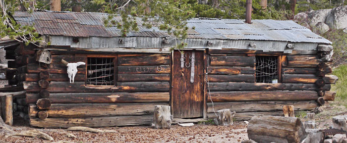
Mulkey Cow Camp Cabin
Summary
I walked from Lone Pine to Glen Aulin, downstream of Tuolumne Meadows, generally west of the Pacific Crest Trail. Before this trip I walked from near Mexico to Interstate 15 at Cajon Junction, ususally off the PCT, and after this trip I continued north, usually on the PCT, to Mount Hood in northern Oregon. On a separate page, I list some maps that I used to find interesting routes (Maps of the Pacific Crest Corridor). For family reasons, there were long breaks in, and an early end to, my 2015 hiking season.
Thursday, June 11, 2015
Rob, Bodie, Jodie, and Dior drove me to Lone Pine. After aquiring a permit, cheese, a water filter, etcetera, I hitched to Horseshoe Meadows in 3 stages, 1 paid. I saw Yellow Bellied Marmots and a couple of Snow Plants.
Miles: 6
Camp: West of Mulkey Pass
Maps: THGTW
Route: Trail Pass Trail, Trail Pass, PCT, Mulkey Pass, Mulkey Pass Trail

Mulkey Cow Camp Cabin
Friday, June 12, 2015
I guess today I adjusted to altitude, as I just plodded along and stopped for breath often. I saw Snow Plants and Coyote tracks. A fish and game group was out electroshocking Mulkey Creek to determine the per mile fish density. I visited several log cabins and ruins each at Mulkey Cow Camp, Templeton Meadows / Movie Stringer, and Templeton Cow Camp.
Miles: 15 21
Camp: South of the Trail to Bakeoven
Maps: THGTW
Route: Mulkey Pass Trail, Templeton Meadows, Strawberry Creek, Long Canyon Trail
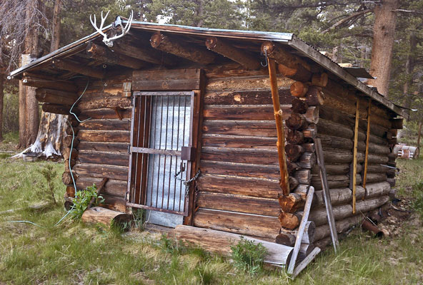
Templeton Cow Camp Cabin
Saturday, June 13, 2015
I got up at first light but barfed and returned to bed for an hour. Then I continued a slow pace until early afternoon when a storm of rain, hail, and lightening started. I hid under a rock and snoozed a while. When I saw the storm and cloud coverage had worsened, I set camp and gave it up for the day. I spent much of the afternoon sleeping, so I probably needed the extra break.
Miles: 6 27
Camp: Southwest of Lost Trout Creek
Maps: THGTW
Route: Long Canyon Trail
Sunday, June 14, 2015
Jordan Hot Springs was lukewarm and turbid, but a nice break and cleanup. I had thought there was no bridge on this area of the Kern River. I crossed today on a fallen tree and forded last fall. So imagine my shock when I came upon a perfectly nice steel bridge! (36.192549, -118.368348) I saw a toad, a Bald Eagle, and a fighter jet in the Kern Gorge. There were many cattle on my ascent of the Doe Meadow Trail 35e10.
Miles: 16 43
Camp: West of Cold Spring
Maps: THGTW
Route: Casa Vieja Meadow, Ninemile Creek Trail, Jordan Hot Springs, Soda Flat, Kern River, Doe Meadow Trail, Cold Spring
| Historic Trails across the Southern Sierra Nevada |
|---|
|
Jordan Trail / Toll Road Starting in May of 1861, from the western terminus in Exeter, they explored and built trail up Yokohl Creek, through Yokohl Valley, to the headwaters and south to the headwaters of Lewis Creek, descending Blue Ridge to the mouth of Bear Creek on the North Tule River. They ascended the northern branch of Bear Creek, and descended Meadow Creek to the Middle Fork. They ascended the river to Doyle Soda Springs (Enters THGTW) or Camp Wilson. They proceded over Jordan Peak to Cabin Meadows/ Click Creek Headwaters, Loggy Meadows, Fish Creek, Jerkey Meadows, Jug Spring, Little Kern River at Horse Bridge, to Trout Meadows. An early season route continued east to the Kern River, ascended that to Ninemile Creek, ascending that, Jordan Hot Springs, Casa Vieja Meadows, Monache Meadows, Olancha Pass (9500'), and Walker Creek down into the Owens Valley at Olancha. A late season route continued from Trout Meadows up the Kern to the present Kern Ranger Cabin. From the station, it climbed Golden Trout Creek, Groundhog Meadows, Big Whitney Meadows, Stokes Stringer, Cottonwood Pass (11,600'), Horseshoe Meadow, over a ridge and down Cottonwood Creek, finally following today's road to Lone Pine and Independence. In May of 1862, John Jordan followed the low, early season route through, hoping to declare the route done and open for business. On the westbound return, he drowned in the snowmelt swollen Kern River, and plans for the commercialization of the route fell through.
This information is largely taken from a 1976 article by William F Jordan. |
|
Hockett Trail The historic Hockett Trail should not be confused with the current Atwell Hockett Trail, which connects Atwell Mill on the Mineral King road with Hockett Meadows, and is north of the historic route. An excellent paper I found on line by Joshua Carter is the source I summarize here.
Background
Route |
|
Walker Pass Wagon Road |
Monday, June 15, 2015
I watched hummingbirds feed on thistle. I barfed soon after camping.
Miles: 15 58
Camp: West of Rifle Camp
Maps: THGTW
Route: Trout Meadows, Round Meadow, Burnt Corral Meadow, Table Meadow, Lion Meadow/R M Pyles Camp
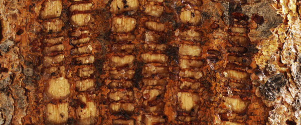
Sapsucker Holes
Tuesday, June 16, 2015
I watched a bird harass a squirrel running around on some downed trees. I saw several Marmots and 3 Black Bears near camp.
Miles: 13 71
Camp: 1 mile north of the Franklin Pass Trail
Maps: THGTW
Route: Broders Cabin Site, Farewell Gap
Wednesday, June 17, 2015
There were many wildflowers. The Redwood Grove had some impressive trees. I ate Wild Onions and Mint.
Miles: 15 86
Camp: Middle Fork Kaweah River
Maps: THGTW, NGTI205
Route: Aspen Grove, Mineral King Road End, Timber Gap, Redwood Meadow
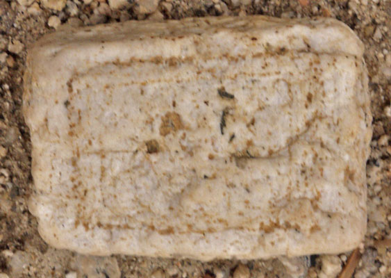
Thursday, June 18, 2015
There were 3 Black Bears and a Mule Deer buck with a nice rack in velvet at Little Bearpaw Meadow.
A 79 year old guy at Bearpaw had acheing knees. That's at least ten miles from a trailhead. I hope that's all I have to bitch about when I hit 79. Also, thanks for the trail mix with cashews, almonds, and M&Ms!
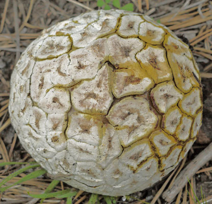
Puffball Mushroom
Today for the first time of this trip I took 1 caffeine pill. I was also atypically eating jelly beans. I noticed I was breathing more easily and stopping less to catch my breath. I made as many miles as my best days on this trip, even though I spent most of two hours shuttling, resupplying, and dining. I need to experiment more with the caffiene. (I don't usually carry candy because I tend to eat it all within the first few days rather than save it for the tough days.)
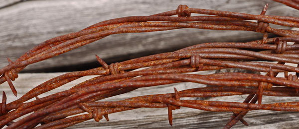
Barbed Wire
The shuttle bus system was thorough and free. Perhaps on some future trip I could take a hiker biker campsite and shuttle around to the front country attractions for a few days. One of the shuttles, with a reservation, can take you to or from Visalia, perhaps making access by bus or train possible?
In a front country campground, a bear bit a guy through his sleeping bag. When the guy managed to get out of the sleeping bag and away, the bear took off with the bag. Other campers tried to scare the bear away with pot banging, yelling, and etcetera..
|
|
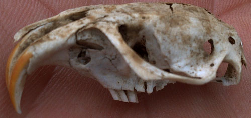
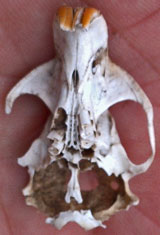
| Rodent Skull | |
|---|---|
I resupplied with four cheese sticks, an apple, banana, orange, and avocado, bagels, and a frozen burrito. I ate an ice cream bar, chili cheese fries, a slice of pizza, and several cups of soda. I've never really learned that I should eat less when I have to hike out immediately... But hey - I'll have some different flavors and nutrients today and tomorrow. The store by the Lodgepole Visitor Center is fine for full resupply. I would guess the store a few miles from Kings Canyon road end at Cedar Grove is run by the same vendor and would be similar, though I've never seen it.
Miles: 16 102
Camp: North of Cahoon Meadow
Maps: NGTI205
Route: Little Bearpaw Meadow, Bearpaw Meadow, High Sierra Trail westbound, Panther Gap, Wolverton, 2 free 15 minute interval Shuttle Busses, Lodgepole, Willow Meadow, Cahoon Meadow
|
High Sierra Trail
|
Friday, June 19, 2015
I found two creeks to dunk myself on this hot day. A Mule Deer doe watched one bath and drying time with wary interest. A Mule Deer buck had especially fuzzy velvet antlers. A Black Bear mother and cub ran off when I called at them.
Miles: 18 120
Camp: 1½ miles short of Roaring River Ranger Cabin
Maps: NGTI205
Route: Cahoun Gap, Twin Lakes, Silliman Pass, Sugarloaf Creek Trail
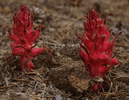
Snow Plants
Saturday, June 20, 2015
Other than between the Bubbs Creek confluence with the South Fork Kings River and Roads End, I saw only 2 people, which seems odd given the weekend day and popular trailhead. There was a lot of Mistletoe Phoradendron villosum in the Oak trees on ascent to Tent Meadow.
Miles: 20 140
Camp: A few miles up the Copper Creek Trail
Maps: NGTI205
Route: Roaring River Ranger Cabin, Avalanche Pass, Bubbs Creek, Kings Canyon Road End, Copper Creek Trail
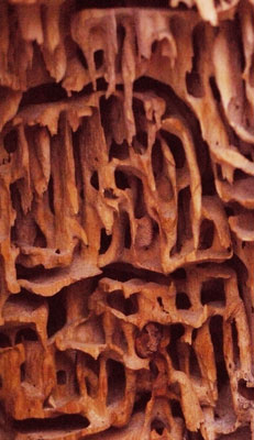
Termite Eaten Tree
Sunday, June 21, 2015
I saw a Mule Deer, a Black Bear, and several Yellow Bellied Marmots.
Miles: 13 153
Camp: Northern Junction of the State Lakes Loop and the Simpson Meadow Trail
Maps: NGTI205
Route: Tent Meadow, Granite Basin, Granite Pass, Simpson Meadow Trail, Dougherty Meadows
Monday, June 22, 2015
I saw a Mule Deer buck, and many trout swimming and feeding. The junction sign in Simpson Meadows points to a disused, overgrown trail to an area too deep and swift to ford. I crossed on a log near a horse camp with locked tool boxes. There may be other crossings upstream at the ranger cabin or the confluence with Goddard Creek. The whitewater in the river was often impressive. The trail was easy to follow but collecting debris.
Miles: 17 170
Camp: Blue Canyon
Maps: NGTI205
Route: Simpson Meadow Trail, Simpson Meadow, Middle Fork Kings River Trail
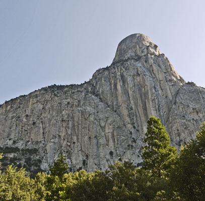
Tehipite Dome
From Tehipite Valley
Tuesday, June 23, 2015
The trail in the Middle Fork Kings Valley has Nettles, Poison Oak, and thorny vines, but it is easy to follow. It would probably be possible to bring stock southwest down the trail from the PCT/JMT. But southwest of Crown Creek in Tehipite Valley is a mess of blowdowns and Blackberry vines. Blowdowns continue on the steep switchbacks out of the canyon and through the rest of the day's hike. I saw no trail continuing down the Middle Fork Kings to Little Tehipite Valley as shown on some maps. There was no water on the ascent until trickles in Gnat Meadow and later creeks.
Miles: 10 180
Camp: Junction (+) Tehipite Valley, Wishon Reservoir, Geraldine Lakes Trails
Maps: NGTI205
Route: Tehipite Valley, Gnat Meadow, Hay Meadow, Rogers Creek
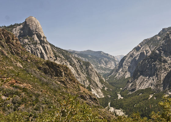
Tehipite Valley
From Switchbacks Looking East
Rough Fire, July 31 - October ?, 2015
Over a month after I passed through, the Rough Fire was started by lightning July 31 around 7:00pm 5 miles north of Hume Lake and 2.5 miles southwest of Spanish Mountain. On September 27, it was 85% contained. My route did not burn, though the fire was just to the west. West of Tehipite Valley, as I remember, an earlier fire had probably taken much of the fuel.
| Rough Fire Burn Area (Acres) On September 27, 2015 |
|
|---|---|
| Kings Canyon National Park | 8,564 |
| Sequoia National Forest | 82,288 |
| Sierra National Forest | 51,645 |
| State Lands | 6 |
| Private Lands | 1,057 |
| Total | 143,560 |
Rough Fire, 25 September, 2015
My Route, 19-24 June, 2015
Other trails highlighted in yellow
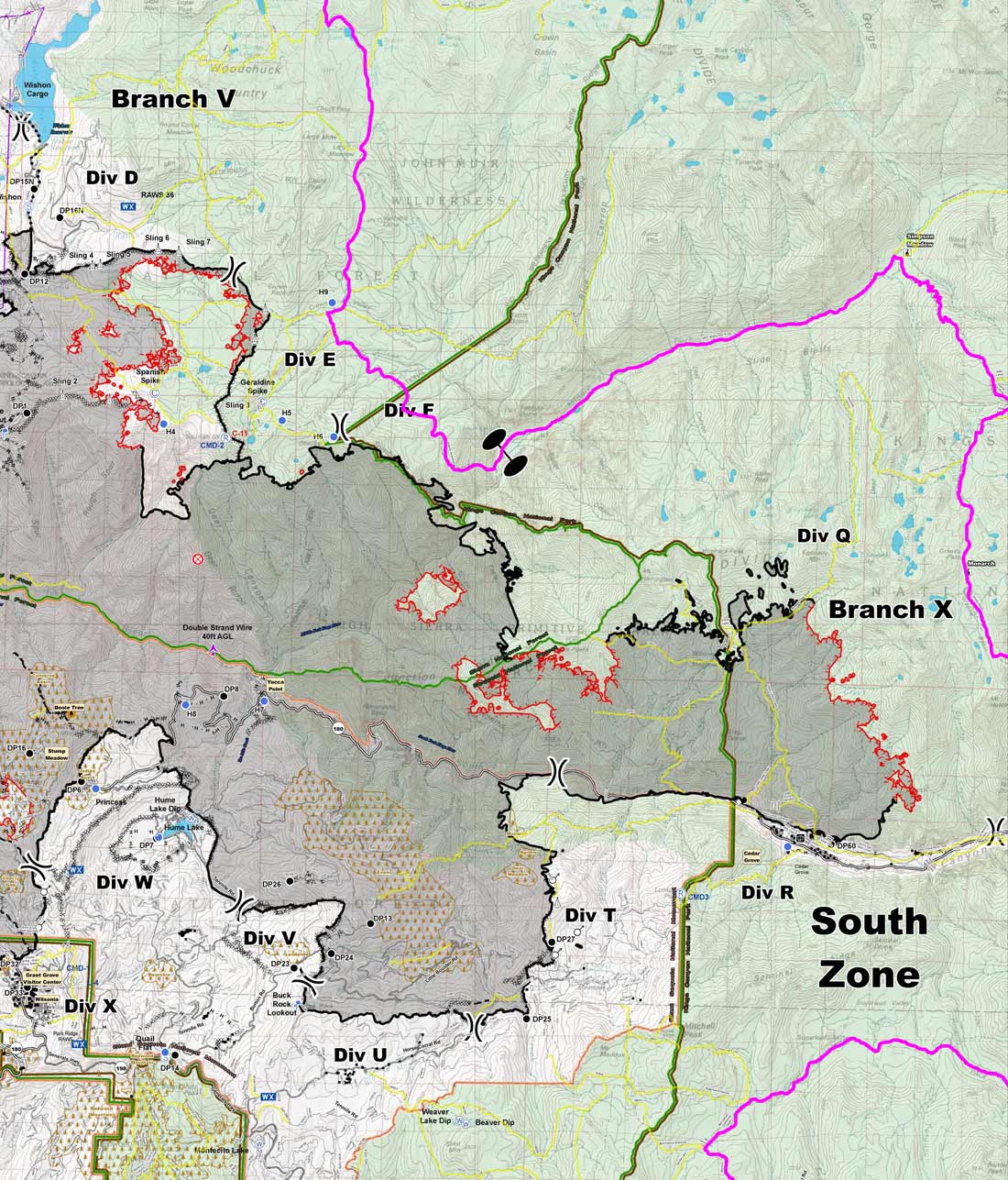
Rough Fire, 25 September, 2015
My Route, 19-24 June, 2015
Other trails highlighted in yellow
Wednesday, June 24, 2015
The first half dozen miles today were on easy to lose, disused trail. The trails were then progressively better until the North Fork Kings Trail, which was excellent. But I think the Meadow Brook Trail tomorrow will be poor again. I bought a Stansport filter in a water bottle in Lone Pine at the start of this trip. It is already too plugged to be practical for further use. It was supposed to be good for far longer, and Sierra Nevada water is relatively clear. I decided to switch to backup chemical treatment, but my Aquamira part A bottle, full at the start, had leaked and was totally dry.
Miles: 15 195
Camp: Junction (+) North Fork Kings River, Meadow Brook Trails
Maps: NGTI205, 809
Route: Crown Valley, 29e06, Elizabeth Lake, Crown Lake (swim), Crown Pass, Halfmoon Lake, 29e27, Big Maxson Meadow (Cabins), North Fork Kings River Trail 29e03
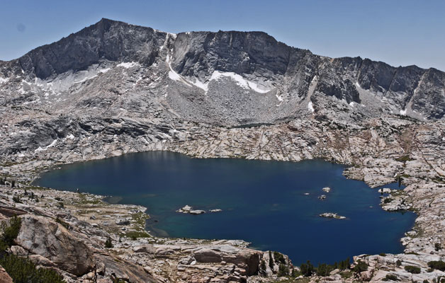
Hell For Sure Lake
Thursday, June 25, 2015
For the first time since fording the Middle Fork Kings Monday, I saw people. Two guys at Devils Punchbowl let me use a syringe to backflush my filter. This was much easier and more effective than blowing water back through by lung. Perhaps now the filter will just barely last the trip. There were some horrible mosquitos and excellent waterfalls in Goddard Canyon/South Fork San Joaquin Canyon.
Miles: 15 210
Camp: 1¾ miles south of the PCT bridge
Maps: NGTI205, 809
Route: Meadow Brook Trail 29e21, Cold Spring, Devils Punchbowl, 29e52, Hell For Sure Pass, Goddard Canyon/South Fork San Joaquin Canyon
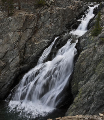
Waterfall, Goddard Canyon
Friday, June 26, 2015
A Mule Deer fawn observed me during a breakfast break, circling me and watching from behind various trees. I heard Pika and Frogs on the south side of Pine Creek Pass. Yesterday and today I occasionally smelled wildfire smoke. Some light afternoon storm clouds produced some tiny specks of drizzle in the pass.
Miles: 19 229
Camp: ½ mile south of Honeymoon Lake
Maps: NGTI809
Route: Goddard Canyon/South Fork San Joaquin Canyon, Franklin Meadow, PCJMT, Aspen Meadow, Piute Canyon Trail 30e01, Hutchinson Meadow, French Canyon Trail 30e02, Pine Creek Pass Trail 3002, Pine Creek Pass
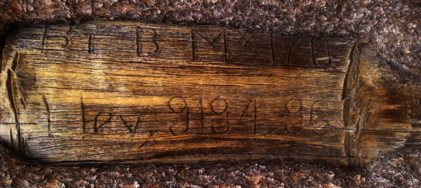
|
| Benchmark Carved in Tree |
|---|
|
Along Piute Canyon Trail 30E01 there are many of these benchmarks carved in trees. The 170 shown here is a serial number. B. BM#170 Elev. 9194.96 |
Saturday, June 27, 2015
I took many pictures of the closed tungsten mine as I descended Pine Creek Canyon. There were rotting old gondola towers and cables from long ago, but the buildings and vehicles were newer, the mine having last closed about a dozen years back. The mine caretaker's wife gave me a ride down to old 395 and told me there are upkeep and reclamation tasks enough to keep busy. I visited my brother and his family and he and I walked Dior around McLeod Lake from Horseshoe Lake. I then got down to resupply, backpack repair, and planning tasks. A 2600mAh USB external battery device fully charged my gps, and likely had energy remaining. In a previous experiment, it had upped the charge in my tablet computer by 42%. Both devices probably had several days use left after 17 days of conservative use and no charging since Lone Pine.
Miles: 10 239
Motel: Mammoth
Maps: NGTI809
Route: Pine Creek Pass Trail, Mammoth Pass Trail 2707
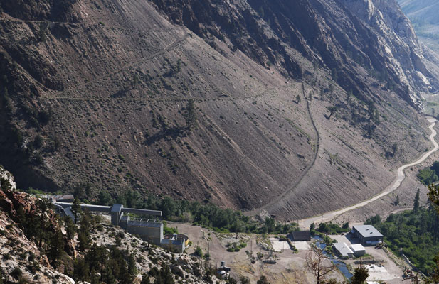
Pine Creek Tungsten Mill
| Pine Creek Tungsten Mine | ||||||||
|---|---|---|---|---|---|---|---|---|
|
Around 1895, gold and silver prospectors filed claims high in Pine Creek Canyon. The ores were not concentrated enough to mine economically. In 1916, Billie Vaughn and Arch Beauregard discovered outcrops of molybdenum and tungsten ores and filed claims at about 11,300'. The ore yielded about 0.5% WO3, .5% Molybdenite (MoS3), and recoverable traces of gold and silver. They lengthened the preexisting 7 mile road from Long Valley by 3 miles, and hauled in mining and milling equipment on mules. During and after World War I, the mine produced scheelite, calcium tungstate, CaWO4, tungsten ore. Roads, powerlines, pipelines, etcetera were built in this era. Roads went both down Pine Creek, and over to Rock Creek. Low tungsten prices after the war closed the mine. The mine operated intermittantly the 20's. In 1936 US Vanadium Corporation bought the mine, opened it, and began investing. Arial tramways were built. By 1942, the mine was the largest producer of tungsten in the US.
By 2001, tungsten prices had dropped enough that the mine closed. The mine equipment is still watched over by a caretaker, and cleanup work continues. Tungsten, also called Wolfram, has an atomic number of 74 and weight of 183.84. It has the highest melting point of all the metals (3422°C, 6192°F), so it is used as an electrode for arc welding and as incandescent light bulb filaments. It is very dense (19.25 g/cm3), so it is used for compact weights. Most is used in tungsten carbide (WC, WC2) and in advanced steels.
Maps: NGTI205, 7½' Mount Tom / 65, 7½' Mount Morgan / 57 | ||||||||
Sunday, June 28, 2015
After permits and resupply, I hiked in intermittant rain. The rain brought up unique, subtle scents from the Rainbow Burn and big blow areas around Reds Meadow. There I got ice cream, fruit, tortillas, mashed potatoes, and assorted goodies from the hiker box. A Stellers Jay occasionally pecked at my items as I repacked. Rain is 20-50% likely for the next 9 days, with some days possibly having thundershowers or dry lightning. The Washington Fire, burning south of Markleeville, is 29% contained and has not closed the PCT.
Miles: 9 248
Camp: King Creek / Snow Canyon
Maps: NGTI809
Route: Free Busses, Horseshoe Lake, Mammoth Pass / Reds Meadow Trail 2704, Reds Meadow, Devils Postpile, Summit Meadow Trail 2601
Monday, June 29, 2015
After hiking steeply uphill in thundershowers, I set up my hammock to wait out the rain just east of the Mammoth Trailhead. But after snacks and some map review, sun returned and I hiked on. Just before camping I had a bright red liquid crap. There was no discomfort, etcetera, to predict it. I hadn't been eating any particularly red foods, nor any untreated water or suspect foods. I had no injuries that might cause internal bleeding. I hadn't taken Aspirin or other anticoagulents in several days.
Miles: 18 266
Camp: Granite Creek / 5s005
Maps: NGTI809, 206
Route: Summit Meadow Trail 2601, Summit Meadow, Mammoth Trail 26e01, Granite Staircase, Cargyle Meadow, Corral Meadow, Snake Meadow, 5s30, Isberg Trailhead, 4s03, 5s005
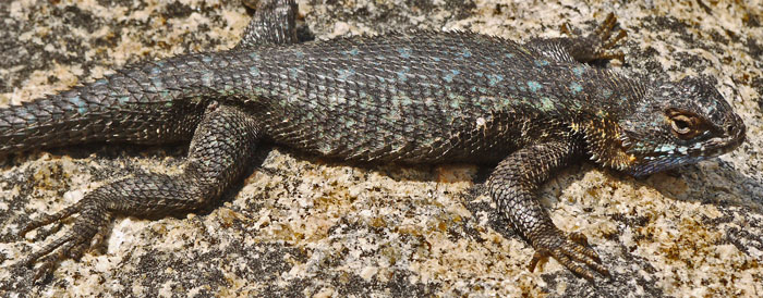
Lizard
Tuesday, June 30, 2015
I hiked a long, tough day, all ascending. After the junctions with the Lillian Lake and Timber Creek Trails, there was frequently no tread, but the route was marked with blazes, cairns, and etcetera. Red diarrhea came at 6am, 7, 9, 3pm, and 8. I think the quantities are lessening, but it's hard to judge.
Miles: 10 276
Camp: Post Peak Pass
Maps: NGTI206
Route: 5s005, Walton Trail 24e20, Post Peak Trail 24e17
Wednesday, July 1, 2015
After 2 tough days of walking until 8 pm, my leg muscles were tired. With that and my sickness, I walked slowly, rested often, and quit by 6:30pm. Rain and thunder started soon after. The red diarrhea came at 5, 6, and 8am, but not afterwards.
Miles: 10 286
Camp: A mile short of the Junction with the Lewis Creek Trail
Maps: NGTI206
Route: The high, eastern trail above the Triple Peak Fork
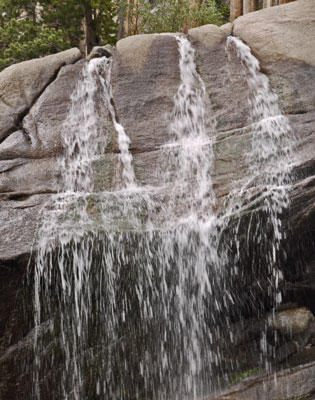
Waterfall
Thursday, July 2, 2015
The views from Vogelsang Pass were great. I arrived at Tuolumne Meadows a few minutes after 5, so the grill had just closed. So from the store, I had a microwave pizza, a frozen strawberry bar, a yoghurt, and grain bread for dinner. I also carried out bread, fruit, frozen burritos, and cheese sticks. As far as my sickness, I had one red semisolid turd. I got completly soaked in a surprise downpour and lightning extravaganza while setting up my tent, so I slept damp.
Miles: 15 301
Camp: Murphy Creek
Maps: NGTI206
Route: Merced River Canyon High Trail, Lewis Creek Trail, Volgelsang Pass, Vogelsang High Sierra Camp, Rafferty Creek Trail, John Muir Trail, Tuolumne Store, Bus to Tenaya Lake, Murphy Creek Trail
Spider
| Some Locations | |||
|---|---|---|---|
| Name | Comment | Latitude °North |
Longitude °East |
| +TrailsCottonwood,TrailPasses | TrailsToTrailheads | 36.448170 | -118.175911 |
| FlowingSpringTrailPassTrail | 36.438546 | -118.179088 | |
| +TrailPassTr MulkeyTrConnector | 36.433116 | -118.174224 | |
| TrailPass+PCT,TrPassTrail | 36.427140 | -118.176240 | |
| MulkeyPass+PCT,MulkeyPassTrail | 36.429773 | -118.165590 | |
| MulkeyCowCampCabinOnTrail | 36.417787 | -118.172105 | |
| +Mulkey,TrailPassTrails,Mulkey | 36.406940 | -118.196241 | |
| +35E07TrailsToTunnelM,BrownCow | MulkeyMeadow,TempletonCowCamp | 36.323346 | -118.230100 |
| 2LogCabinRuins | 36.317706 | -118.232180 | |
| +Templeton,RamshawMeadowTrails | 36.310725 | -118.234462 | |
| +Templeton,Redrock,Strawberry | 36.306991 | -118.217217 | |
| +TrailsBrown,Bakeoven,Templetn | 36.305086 | -118.214647 | |
| +Bakeoven LngCanyon Templeton | 36.290444 | -118.210829 | |
| +Blackrock Ninemile LongCanyon | CasaViejaMeadow | 36.202139 | -118.273153 |
| +Ninemile Redrock KernRiver | 36.229941 | -118.301060 | |
| +Ninemile ColdMeadowTrails | 36.231422 | -118.335756 | |
| BridgeKernRiver | 36.192549 | -118.368348 | |
| ColdSprings on35E10doeMeadowTr | 36.181142 | -118.406113 | |
| +Trails | 36.191479 | -118.419884 | |
| +Trails TroutMeadows | 36.196126 | -118.428306 | |
| +Trails RangerStation | 36.203517 | -118.425570 | |
| +CoyoteLakesTrailDisused | 36.220301 | -118.460995 | |
| +Trails | 36.224085 | -118.492957 | |
| +CoyoteLakesTrailNorthOfLionMw | 36.269514 | -118.498688 | |
| +ShotgunPass CoyotePass Little | AtShotgunCreekCrossing | 36.364791 | -118.533966 |
| +Trails | 36.368104 | -118.547419 | |
| +FarewellGap MineralKing Frank | 36.417428 | -118.576849 | |
| +ValleyBottomTrail | 36.437005 | -118.589414 | |
| +TimberGap ParadiseRidge | RedwoodMeadowRangerCabin WaterOff | 36.529803 | -118.636150 |
| +MiddleForkTr Redwood Bearpaw | 36.545825 | -118.627730 | |
| +MiddleFork Bearpaw RedwoodMdw | 36.551269 | -118.632709 | |
| +HST ElizabethPass CrescentMdw | 36.566759 | -118.622440 | |
| +HST Bearpaw Alta CrecentMeado | 36.569571 | -118.679189 | |
| +AltaPeak Wolverton toHST | 36.581628 | -118.691103 | |
| +RangerL ComancheM SevilleLake | 36.695777 | -118.706341 | |
| +ComancheM AvalancheP CoibyP | RoaringRiverRangerCabin | 36.712331 | -118.586695 |
| MiddleKingsLogCrossingAtCamp | 36.972221 | -118.633143 | |
| +MiddleForkTr TrUpOutOfTehipit | NoTrailSouthToLittleTehipiteValleyVisible Blowdown | 36.900943 | -118.788946 |
| +GeraldineL WishonR TehipiteVa | 36.944034 | -118.851748 | |
| +WishonR CrownPass CrownValley | 36.999470 | -118.841986 | |
| +ScepterCreekTr CrownValleyTrl | 37.023543 | -118.841384 | |
| +WishonR CrownPass CrownValley | +WoodchuckTrail CrownValleyTrail | 37.039734 | -118.856847 |
| +North | 37.081583 | -118.858056 | |
| +HellForSurePass,LakeTrails | 37.142426 | -118.802036 | |
| +HellForSurePass SForkSanJoqnR | 37.129550 | -118.764218 | |
| Name | Comment | Latitude °North |
Longitude °East |
