Summary
On this trip I walked from the Salton Sea to Borrego Springs, up Coyote Canyon to the PCT near Anza, and southbound on or near the PCT to Barrel Springs. After hitching to Borrego Springs I followed the California Riding and Hiking Trail (CRHT) / Trans County Trail (TCT) southwest to Lake Cuyamaca with a side trip to the San Felipe Valley. I walked through Cuyamaca State Park west of the PCT then near or on the PCT to Lake Morena. Then I walked west to Pine Valley Creek, and north along that, ending the trip at Lake Cuyamaca.
Saturday, November 29, 2014
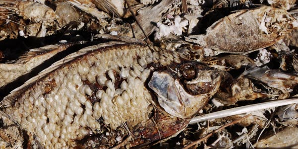
The Salton Sea had shrunk enough that the marina was dry, though the water was just beyond its jetties. There were many dead Tilapia fish, barnacle shells were in abundance, tufa had formed on the jetty riprap, and the sea had much red algae and a potent brine smell. An oasis along the Tectonic Gorge route had wet soil all around, a mature palm tree, several small palm trees with watering moats someone was tending, and a seep hole someone had dug. Less than a foot below grade water was standing: The taste was OK when I dipped my fingers. OHV people were out in force due to a thanksgiving weekend and beautiful weather. A local family who sold me some excellent tacos said it was usually much less busy. I saw a Snowy Egret and a Black Tail Jackrabbit.
Miles: 12
Camp: 1 mile ESE of the Microwave Tower on S22 and the boundary between ABDSP and OWSVRA
Maps: 7½' Truckhaven, THSDBABDSP
Route: Salton City abandoned streets, North Marina Drive, Tectonic Gorge, Gettysburg

|
Salton Sea Perhaps 2 or 3 million years ago, the Imperial Valley was part of the Gulf of California / Sea of Cortez. Today, the gulf separates Baja California from the rest of Mexico, and does not reach the United States at all. But the Colorado River, while carving canyons as large as the Grand Canyon along its course from the Rocky Mountains, eventually deposited enough mud to entirely dam the width of the Gulf. Over time, the sea water left in the northern reach evaporated away. The salt left over today makes springs and streams in the Anza Borrego Desert salty. Over the eons, the Colorado River sometimes flowed into the Gulf of California and other times switched courses and flowed into Imperial Valley. So over the last couple of million years, there has sometimes been a large lake there and sometimes the lake has dried away, leaving salt crusted over the desert floor. Just a few hundred years ago, the lake dried up once again. This was recent enough that local Indians still have oral traditions about catching abundant fish in the the lake, known as Lake Cahuilla. The oral traditions are backed up by ruins such as middens, housing, and fish traps in the desert. But the lake was entirely dried up by the time Spanish explorers and missionaries visited. In the late 1800s, the California Development Company began digging irrigation ditches from the Colorado River to the Imperial Valley. By the first few years of the 1900s, 100,000 acres were under cultivation. In 1905, the Colorado River was in flood, and the gates in the canals failed. The ditches eroded ever wider, deeper, and swifter. The entire flow of the Colorado River went into the Imperial Valley until 1907, when the Southern Pacific Railroad dammed it by dumping trainloads of dirt and even railcars. By then, the town of Salton, the New Liverpool Salt Company mine, many miles of rail tracks, and the Torres Martinez Indian Reservation had been innundated. The lake covered 350,000 acres. Today, the Salton Sea continues to evaporate away. Water enters mostly from the Whitewater River to the North and from the Alamo and New Rivers to the south, and from irrigation water originating in the Colorado River. The average inflow is less than 1,200,000 acre·feet. The soil of Imperial Valley Farms is salty, so fields are soaked enough that undergound perforated drain pipes will carry away salt saturated excess water. It is this saline drain water that enters the Salton Sea. The sea gets saltier every year. Southern California cities are getting more water by paying for more efficient irrigation practices and lining canals with concrete, etcetera. These practices will reduce the flow of water into the Salton Sea, and cause it to shrink faster.
Brine Shrimp Artemia satina, Barnacles Balanus amphitrite saltonensis, and Pile Worms Neanthes succinea, introduced on various boats, etcetera, consume the phytoplankton and serve as food for larger animals. Over the years, various fish were transplanted from the oceans and thrived until the water got too saline. Today, Tilapia Oreochromis massambicus, O. ureiepis, Tilapia zillii is the predominant fish in the sea, but Croaker. These three species are unique in their ability to breed in salt water, and to nest on the Salton Sea botton where oxygen is low and salinity is high. Threadfin Shad, Carp, Red Shiner, Channel Catfish, White Catfish, Largemouth Bass, Mosquitofish, Sailfin Molly, and Desert Pupfish live more in the fresher water streams entering the sea. The sea is an important migratory stop on the Pacific Flyway, supporting about 400 bird species. Perhaps 30% of American White Pelican use it. In the 1950s, several resort towns were built on the shores. But as the salinity increased, various game fish could no longer survive. As the sea shrunk, marinas went dry. The towns today are partially occupied but live on well enough even without the recreational amenities. The lake and Imperial Valley in general have some geothermal features such as mudpots and mud volcanoes. 11 geothermal powerplants generate 187 megaWatts of electric power. The San Andreas Fault, the San Jacinto Fault, and the Imperial Fault Zone are under or near the sea. Earthquakes as high as 7 or 8 have occurred and may reccur, especially if the sea fills again. |
Sunday, November 30, 2014
I had a poor night of sleep, as ATVs ran all night. There was even one guy who started shooting a couple hundred yards away. Shooting in the park is illegal, and since people were camped everywhere around, stupid. After talking with several people, I recommend against visiting the Anza Borrego Desert area on Thanksgiving weekend, as it is crazy like this every year.
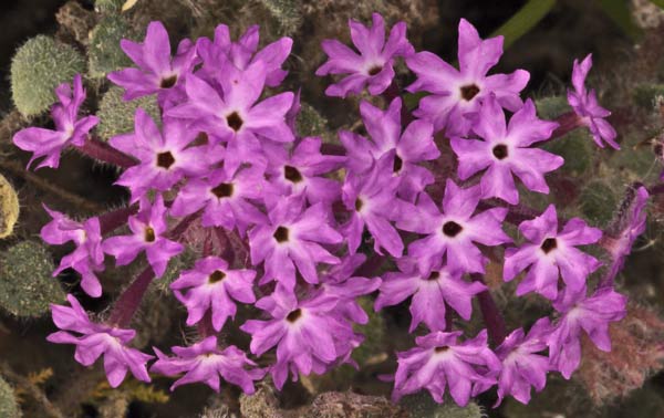
Ocotillo Flowers Blooming
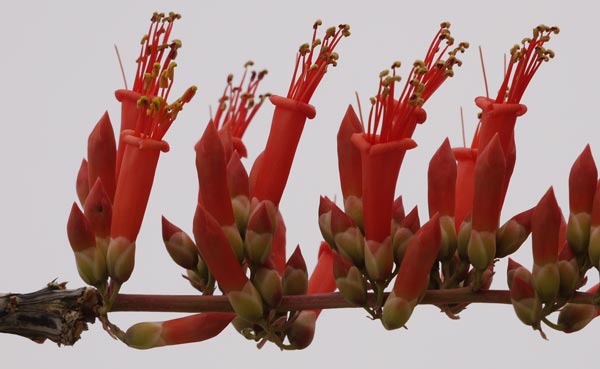
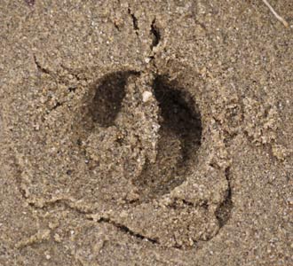
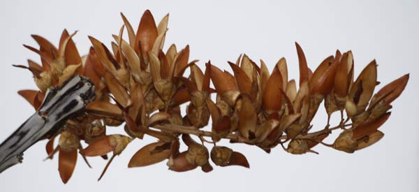
As I crossed ABDSP, the traffic in the gullies was much less than in the OWSVRA, and so the day was more enjoyable. I saw some footprints of small ungulates and Jackrabbits. There were many concretions, and one vertebra fossil. Ocotillo had leaves, and one was starting to bloom. Storm clouds were building to the west, and with no place to shelter from a storm, I hitched in from Fonts Point Wash to get a room in Borrego Springs. This section would have been a highway walk anyway.
Miles: 15 27
Motel: Borrego Springs
Maps: THSDBABDSP
Route: Truckhaven Trail, Arroyo Salado, Ella Wash, Short Wash, Fonts Point Wash, S22 Borrego Salton Seaway
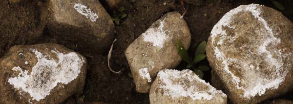
Salt Crusts in Coyote Creek

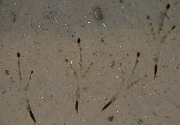
↑ Prints of a Rodent Hopping or Bounding on its Hind Feet ↑
Likely a Kangaroo Rat Dipodomys because of Hind Feet use.
↓ Prints of a Rodent Bounding on 4 Feet ↓
Likely not a kangaroo rat because 4 well separated footprints show.

Monday, December 1, 2014
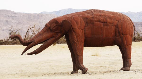
I walked first around town, familiarizing myself and asking about less expensive lodging, laundry, food, hiking advice, etcetera. 1¾ miles north of the main drag, just south of Big Horn Road, steel sculptures began to appear in the Galleta Meadows areas. I saw a Roadrunner in the groves of lemons, oranges, grapefruits, etcetera. The horse camp had working spigots, trash, tables, and even token operated showers with a credit card machine to sell tokens. No sign said how much a token would cost, or how long the shower would last. The El Vado and Santa Catarina monuments recalled the Anza Expeditions. A few Occotillo were in bloom. I saw some interesting bug tunnels, and sheep and rodent tracks. Once I entered the park, yellow topped brown posts were placed periodically, as were some directional signs. I felt just a few isolated drops of rain.
Miles: 16 43
Camp: 1 mile northwest of the Santa Catarina Historic Marker
Maps: THSDBABDSP
Route: Borrego Springs Road, Coyote Canyon


|
↓ Bighorn Sheep Print Ovis canadensis Roundish print is due to sinking in wet streamside sand: Hooves form a wedge like deer prints. Travel Direction Upward. Cracked and Uplifted Sand: Sheep stopping to drink at Coyote Creek. |
|
|
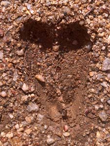
Mule Deer Print ↑ Odocoileus hemionus Typical Wedge Shaped Print. Travel Direction Downward. |
Tuesday, December 2, 2014
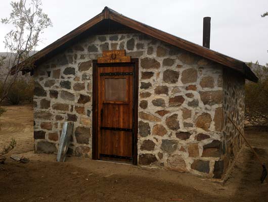
The route was a flagged and ok trail through overgrown and flooded riparian thicket for a half mile at Middle Willows, but otherwise through open desert or dirt road in Coyote Canyon. The PCT was easy and familiar walking. There was water flowing in Lower, Middle, and Upper Willows, and water in the wildlife guzzler on the PCT. I didn't check Tule Spring. It drizzled all day, and rained harder at night. I saw roadrunner and sheep tracks in Coyote Canyon. Baileys Cabin is a rock cabin in good shape: It was a welcome shelter for a lunch break. There are toilets, tables, and a corral there. There is a great deal of hiking to be done in the side canyons and east over the ridge to Rockhouse Canyon. There might be the better part of a week's worth of entertainment in Coyote Canyon alone. But with the rain, I didn't want to climb slippery rocks and whatnot, and didn't want to get maps all wet.
Miles: 17 60
Camp: PCT south of Tule Canyon Truck Trail
Maps: THSDBABDSP
Route: Coyote Canyon, PCT
Wednesday, December 3, 2014
There was all day drizzle, heavier rain overnight. In just a few places, gullies started to flow. Coyotes howled overnight. Several hikers are ahead of me on the PCT: The rain degrades their tracks fairly quickly, making guessing how far ahead they were an interesting game. I met Revo Ranger, who I'd hiked with between the southern Kennedy Meadows and Walker Pass earlier this fall. Water was available at Trail Angel Mike's and Lost Valley Spring (CRHT).
Miles: 24 84
Camp: PCT north of Warner Springs
Maps: THSDBABDSP
Route: PCT
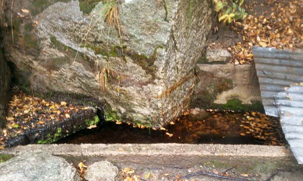
Lost Valley Spring
Thursday, December 4, 2014
Drizzle continued until mid morning, but I got myself mostly dry by noon. I saw deer and small dog tracks. The CRHT was marked east and west of the PCT north of highway 79 and east of the PCT south of the highway 79 loop. Water, tables, toilets, etcetera were available at the Warner Springs Community Center, but the center building was closed and the showers were turned off. Some sort of reservation only bus service is available at a stop across 79 from the community center. Laundry, shower, and food in Borrego Springs were much appreciated.
Miles: 11 95
Motel: Borrego Springs
Maps: THSDBABDSP
Route: PCT, hitch S22, Borrego Salton Seaway
Friday, December 5, 2014
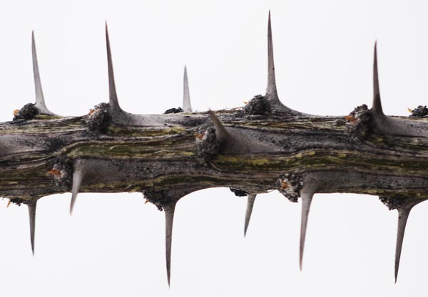
I stopped at the State Park Visitor Center and discussed my trip with some volunteers and staff. One had a niece who had recently thru hiked the PCT and one had 8,000 miles of long distance experience, so they were fairly conversant with long distance hiking issues. The center had potable water, toilets, displays, and a small store. The CRHT leaving the parking lot was unmarked. The junction of the CRHT and the Hellhole Canyon Trail was unmarked. I took a side hike a couple of miles up Hellhole with Sharon and Leo of Sacramento. Quite a ways up the Hellhole Trail TCT was scratched into a sign, but I think the TCT is on the CRHT. Per another hiker, if I had gone a little further up Hellhole, I would have come to a few inches of standing water and some grapevines. I passed two palm groves and some morteros. Returning to the CRHT, I ascended the ridge south of Hellhole on steep, rocky tread overgrown with thorny plants. There were yellow topped brown posts only at two intersections: see gps data. The tread was easily followed, but since it was sometimes hard to see from a distance, if you lost the trail it might be hard to find it again. Therefore, hikers should have the physical skills, stamina, and navigation skills to hike cross country through steep, rocky desert terrain.
Miles: 14 109
Camp: CRHT ridge north of Culp Valley
Maps: THSDBABDSP
Route: California Riding and Hiking Trail, Hellhole Canyon Trail
Water in Cased Seep of By Jim Spring
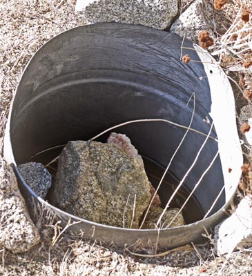
Bench and Defunct Tank near By Jim Spring
Saturday, December 6, 2014
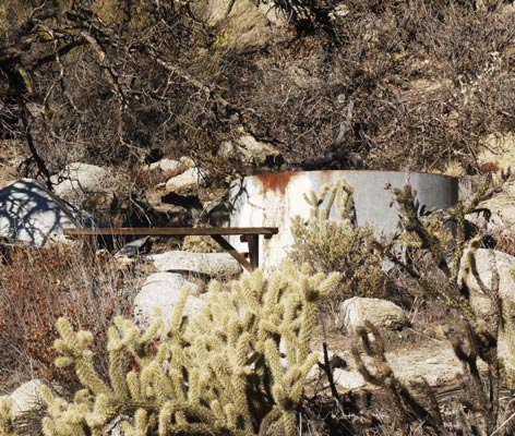
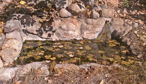
Pena Spring was north down a wash almost to South Fork Hellhole Canyon. A cluster of relatively lush bushes just to the left / west of the wash marked the spring. Water was standing an inch deep in several places. By Jim Spring was 50' west of the trail by a bench and old tank. A cased seep dug a foot and a half into the sand below the tank had 3" of standing water. I didn't see Jim Spring. Stuart Spring had a rock trough fed by a piped spring flowing a few minutes per quart. Angelina Spring was where Grapevine Canyon fed into a bedrock gully. There was much damp sand, but no standing water. A seep hole would probably have filled quickly. I saw a Black Tail Jackrabbit. I met only two mountain bikers all day. The CRHT was marked periodically and was easy to follow.
Miles: 20 129
Camp: CRHT east of Shelter Valley
Maps: THSDBABDSP
Route: California Riding and Hiking Trail, Pena Spring Wash
Stuart Spring
Mortero Worn Through Layered Rock,
Near Box Canyon
Sunday, December 7, 2014
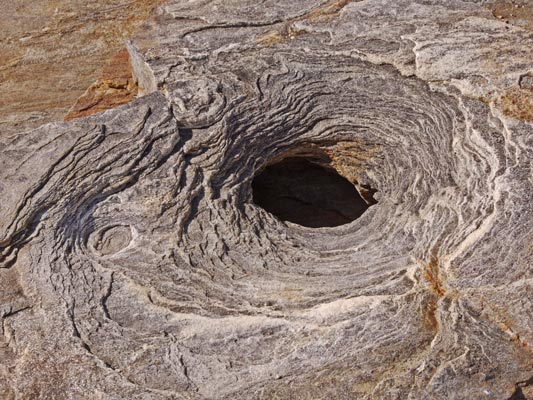
Until I crossed S2, the CRHT was on the Mormon Battalion and Butterfield Stagecoach Routes. There were many markers for the historic routes, and Box Canyon has always been a personal favorite. Near Box Canyon one can see roadbeds built by the Mormon Battalion and the Butterfield Overland Stage people. Elsewhere, these routes often ran in sandy washes, and no visible trace of their passing is left. Rather than ascending Oriflame Canyon right away, I detoured north along Rodriguez Canyon to San Felipe Valley. I saw old tailing piles, an old concrete block cabin, and an abandoned pickup truck. I also saw several Mule Deer and a Grey Fox.
Miles: 19 148
Camp: CRHT San Felipe Valley
Maps: THSDBABDSP
Route: California Riding and Hiking Trail, Rodriguez Canyon
Dry Trough near Vallecito Wash
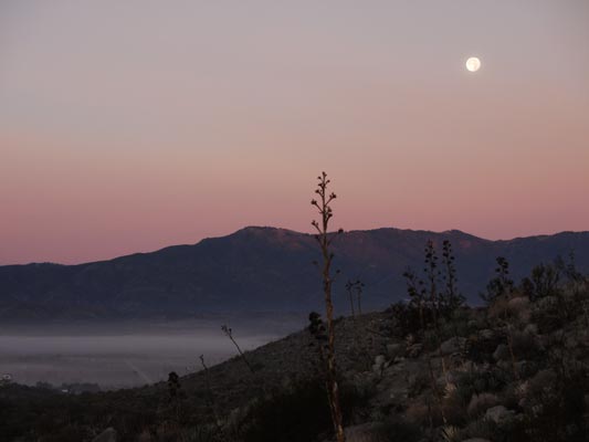
Foggy Dawn in Shelter Valley
Monday, December 8, 2014
The trail across San Felipe Valley was closed two miles north of 78, before a house, barn, etcetera. There was one brown and yellow CRHT post along it. The trail was posted for pedestrians only. The area east of the trail was closed to entry. On the south side of 78, perhaps 50 yards from the road, were several CRHT posts, but they ended not far west. Chariot Canyon Road CC159 was marked as CRHT south of the mine and double intersection with CC165. One spring was flowing just a bit (See gps table for location.). I descended Mason Valley Truck Trail through Oriflame Canyon, and visited the work camp the builders of the road had used. There was no water flowing up or downstream of the camp as far as I explored. West of the junction with Chariot Canyon Road, MVTT was periodically signed as both CRHT and TCT. A hiker I met gave me a banana, an apple, and some jerky. Many thanks.
Miles: 22 170
Camp: CRHT/TCT between PCT and Sunrise Highway S1
Maps: THSDBABDSP
Route: California Riding and Hiking Trail, San Felipe Valley, Chariot Canyon, Oriflame Canyon, Mason Valley Truck Trail, Trans County Trail
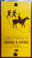
| California Riding and Hiking Trail Markers | ||
|---|---|---|
|

|

|
| Sign |
Concrete T Post |
Yellow Topped Brown Post |
Tuesday, December 9, 2014
Last night a lot of coyotes howled and much frost formed. It was so cold even the skunks were shivering: I smelled whiffs of skunk musk all night and on through mid morning. The CRHT was blazed as CRHT but not as TCT west of S1 Sunrise Highway. I saw some bobcat prints. The GATR spigot at the S1 Sunrise Highway Trailhead for the Noble Canyon Trail produced good, clear water. I had to hitch the last couple miles along S1 Sunrise Highway to make it to the store / motel at Laguna by closing time.
Miles: 18 188
Motel: Laguna Store / Lodge
Maps: THSDBABDSP, TH Cuyamaca Rancho State Park
Route: California Riding and Hiking Trail, Soapstone Grade Fire Road, Upper Green Valley Fire Road, Harvey Moore Trail, Deer Park Trail (formerly East Mesa Fire Road, now overgrown to single track), (Pine Valley Creek is where Jim and I once backpacked from East Mesa Trailhead to explore the old mines.), Indian Creek Trail, Noble Canyon Trail, Sunrise Highway S1
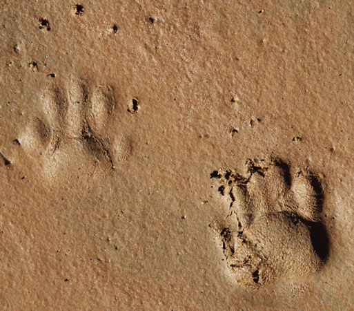
Raccoon Prints Procyon lotor
Note: Right claws registered twice: Hesitant step?
Note: Pebbly Texture of Skin
Wednesday, December 10, 2014
I had some broccoli quiche hot from the oven and a banana for breakfast at the Pines Restaurant. There was excellent animal print taking mud in various places along Thing Valley and Fred Canyon Roads. Among the frequent travelers of these roads were a small Mountain Lion, a Fox, and Mule Deer. I saw a Red Tailed Hawk and a Cottontail Rabbit. There were many pools in the bedrock channel of Kitchen Creek, but not much flow. The spigots were working at Boulder Oaks Campground. Two helicopters circled for a long time north of Lake Morena.
Miles: 19 207
Camp: a couple miles north of Lake Morena on the PCT
Maps: THSDBABDSP
Route: Thing Valley Road (AKA Morris Ranch Road, La Posta Road, #), Fred Canyon Road #, PCT
Red Fox Print Vulpes vulpes
Note claws show and are dull.
Note ridge on Interdigital Pad.
Note fur imprint radiates from center of prints.
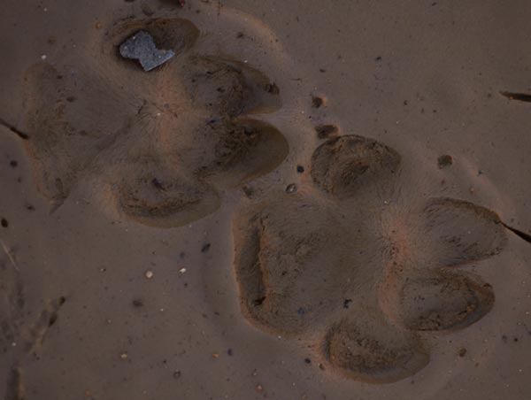
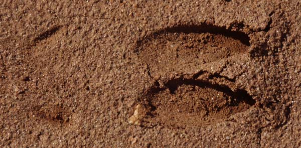
Mule Deer Print Odocoileus hemionus
Dewclaws, or toes 2 and 5, rarely show in deer prints:
Here, the mud was slimy enough to cause a strained gait and imprint the dewclaws.
Thursday, December 11, 2014
After scrambled eggs, sausage, hashbrowns, and toast at the Lake Morena store/grill (also wifi), I headed to the ranger station and talked with the staff for a while. There's a decent museum with dam history, the Hatfield rainmaking story, and some live animals. There were some morteros, metates, and some nice pools in the bedrock creek bottoms that could have been used to leach foods when the creek flows were low. I saw a Red Tail Hawk. There was much discarded clothing along the Secret Canyon Trail, indicating that it is an occasional human smuggling route.
Miles: 20 227
Camp: Pine Valley
Maps: THSDBABDSP
Route: PCT, town streets, cross country, Corral Canyon Road, Espinosa Trail, Secret Canyon Trail
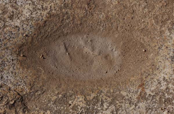
Metate, Espinosa Trail
Hiking in the Holiday Season
One good thing about hiking at this time of year is that there is egg nog in all the stores, and I'm doing enough exercise that I can drink it without guilt. But why is there no such thing as chocolate egg nog? Or mint? Most importantly of all, why is there no such thing as mint chocolate egg nog?!?! Imponderable!
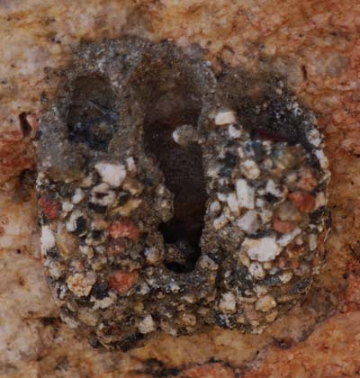
Mud Wasp Tunnels, Espinosa Trail
Friday, December 12, 2014
Ice cold rain began slightly before dawn. Water was flowing in Nelson and Pine Valley Creeks. The latter had grazing cattle and flows through the town of Pine Valley upstream, so the former would be preferable as a water source.
Miles: 10 237
Motel: Pine Valley, raining most of my stay
Maps: THSDBABDSP
Route: Secret Canyon Trail, Old US80,
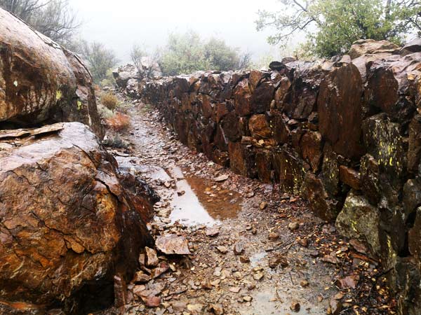
Pine Valley Creek Diversion Ditch
Saturday, December 13, 2014
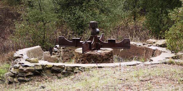
Along Deer Park Road I visited the arrastra in the mining district Jim and I once backpacked to. There was much more flow in Harper Creek than a few days ago. On entering Green Valley, I scared off a half dozen Mule Deer. There were morteros and pits useful for leaching food in a bedrock area in Stonewall Creek. American Coots Fulica amaericana and Canadian Geese Branta canadensis were plentiful in Cuyamaca Lake.
Miles: 18 255
Maps: THSDBABDSP, THCRSP
Route: Pine Creek Road, Deer Park Road, Deer Park Trail, Harvey Moore Trail, Stonewall Creek Fire Road, Vern Whitaker Trail, Los Vaqueros Trail
Borrego Springs Predicted Weather
Saturday, November 29 - 81-50F, 0%
Sunday, November 30 - 74-48F, 0%
Monday, December 1 - 74-55F, 0%
Tuesday, December 2 - 70-56F, 90%
Wednesday, December 3 - 75-55F, 60%
Thursday, December 4 - 77-52F, 10%
Friday, December 5 - 73-53F, 0%
Saturday, December 6 - 73-51F, 10%
Sunday, December 7 - 73-53F, 0%
Monday, December 8 - 75-52F, 0%
Tuesday, December 9 - 75-53F, 0%
Wednesday, December 10 - 75-52F, 0%
Julian Predicted Weather
Saturday, November 29 - 62-44F, 0%
Sunday, November 30 - 53-44F, 10%
Monday, December 1 - 57-50F, 0%
Tuesday, December 2 - 53-50F, 90%
Wednesday, December 3 - 53-45F, 60%
Thursday, December 4 - 54-43F, 0%
Friday, December 5 - 52-45F, 20%
Saturday, December 6 - 56-47F, 0%
Sunday, December 7 - 60-51F, 0%
Monday, December 8 - 59-48F, 0%
Tuesday, December 9 - 60-50F, 0%
Wednesday, December 10 - 62-50F, 0%
Thursday, December 11 - 59-44F, 0%
Friday, December 12 - 46-37F, 100%
Saturday, December 13 - 43-36F, 20%
Sunday, December 14 - 49-39F, 0%
Monday, December 15 - 47-40F, 0%
Tuesday, December 16 - 45-38F, 90%
Wednesday, December 17 - 43-37F, 40%
Thursday, December 18 - 46-39F, 20%
Trans County Trail
This trail connects the Salton Sea, Borrego Springs, Lake Cuyamaca, El Capitan, Poway, Los Penasquitos Canyon, and Torrey Pines. It is about 140 miles, or one week, in length. The TCT has been known as the Sea to Sea and the Spines to Pines Trails by various groups over time.
Intersecting Trails
Along the way, it crosses or uses the California Rding and Hiking Trail, the Juan Bautista de Anza National Historic Trail, the Pacific Crest Trail, and the California Coastal Trail. It would be possible to hike parts of these and other, shorter, trails from the Sea to Sea Trail, and see a good bit of San Diego County. If the trip extended to 2 or 3 weeks, that would be OK with me. I have about November 29 - December 17 available, or 17 full hiking days and a day each to get to and from the trail.
Desert Hiking, Winter, Water
Much of the proposed area is desert or chapparral, so hiking would be more pleasant in winter. Hiking following a rainstorm might make finding water easier.
Borrego Springs
Pena Spring
Stuart Spring (piped spring)
Oriflamme Canyon (creek)
Lake Cuyamaca (Lake and Store)
Pine Hills fire station spigot
Cedar Creek
San Diego river
spigot a few minutes into the Oak Oasis
Food, Supplies
Food and supplies are available in Borrego Springs, Cuyamaca Lake, Laguna, Lake Morena, Pine Valley, Barona Casino, Poway, and everywhere west.
Salton Sea to Borrego Springs 35/323 miles
Maps: TH San Diego, Need more to east
Schad: D5-281
I don't know which roads, but one follows dirt roads from the Salton Sea most of the way into Borrego Springs. One could stash water near Arroyo Salado Campground along S22, or follow a more southerly route to pick up the Anza Trail further south.
Local Borrego Springs Activities 8/288
Maps: TH San Diego
Schad: D2-241
There is a visitor center and park headquarters. I would want to hike Borrego Palm Canyon, as I remember hiking it with Helen during college. I would also want to hike Hellhole Canyon / Maidenhair Falls. Campgrounds, hotels, stores?
Juan Bautista de Anza National Historic Trail 75/280
Maps: TH San Diego
Schad: D2-241, D1-231
From the Salton Sea, I would have roughly been following the Anza Trail. I might be able to follow it northwest on roads through Coyote Canyon to the area of the town of Anza. There are monuments at San Gregorio, El Vado, Lower Willows / Santa Catarina, and Upper willows. If I then took the PCT, and perhaps bits of the CRHT south, I might hitch back from Barrel Springs to Borrego springs and resume. Or if there's traffic in Coyote Canyon, just hitch back there.
Borrego Springs to Cedar Creek Falls
Maps: TH San Diego, c2c Hellhole Canyon, Culp Valley, Grapevine Canyon, Oriflame, Cuyamaca, Boulder Creek, Eagle Peak
Schad: D2-241, D6-287, M5-159
Although there are gaps, the c2c maps cover enough that I can follow the rest on TH San Diego. Water could be stashed at Plum Canyon along Highway 78.
Loop through Cuyamacas, Lagunas, and south 120/205
Maps: TH San Diego, c2c Cuyamaca, More?
One could follow trails west of Sunrise Highway S1 to Laguna M7-171, the PCT, Thing Valley and Fred Canyon Road M8-193 to Lake Morena M9-215, Los Pinos Road, Espinosa Trail, Noble Canyon Trail M7-171, East Mesa Road, and various trails to Cuyamaca Peak, and visit Stonewall Peak and Mine, and the Lake Cuyamaca Store before rejoining the Sea to Sea Trail along Kelly Ditch M6-167.
I've decided that I'd rather spend more time hiking the wild lands east of Barona and skip hiking the urban parks to the West. The Barona Casino has transportation back to San Diego, hotel, food, and etcetera.
85 miles Barona to Borrego Springs

Cedar Creek Falls to Poway
Schad: C8-111, C3-73
Maps: c2c and more, but what?
The c2c maps make it clear that I need to further investigate this area. I seems no wild route is available, and busy, dangerous roads would be the plan.
Poway to Torrey Pines
Maps: c2c
Schad: C4-84, B2-31
The c2c maps are clear. Maybe I would stay in Poway?
Torrey Pines to Point Loma
Maps: CCT Book
Schad: B2-31, C5-90
Easy enough.
References:
TH San Diego: Tom Harrison San Diego Backcountry, Anza-Borrego Desert State Park Recreation Map
TH Cuyamaca: Tom Harrison Cuyamaca Rancho State Park
X2.1-123: Section and page # from Afoot and Afield in San Diego County by Jerry Schad, 1986 printing
ABAZ: Book Anza Borrego A to Z by Diana Lindsay
Hiking the California Coastal Trail, Volume 2, Monterey to Mexico by Bob Laurentzen and Richard Nichols
| Name | Comment | Latitude °North |
Longitude °East |
|---|---|---|---|
| SaltonSeaJetty | 33.329028 | -115.939875 | |
| +Highway86 NorthMarinaDrive | 33.302772 | -115.981804 | |
| OasisTectonicWashWater1'BelowS | WaterInSeepDug1'BelowGradeTasteOKpalmsOK | 33.269088 | -116.034143 |
| +TruckhavenTrail CannonballWsh | 33.275960 | -116.108193 | |
| +TruckhavenTr NForkArroyoSlado | 33.274950 | -116.112091 | |
| +NForkArroyoWash TruckhavenTrl | 33.277766 | -116.119404 | |
| +ArroyoSalado S22borregoSalton | 33.283094 | -116.152339 | |
| +Ella Verde Short Washes | 33.265031 | -116.162580 | |
| +PaloVerde Short Washes | 33.267480 | -116.164511 | |
| +ShortWash DelMalpaisVistaRout | 33.270050 | -116.186858 | |
| +ShortWash ThimbleTrail | 33.276767 | -116.202161 | |
| +FontsPointWash ShortWash | 33.283903 | -116.220641 | |
| +FontsPointWash S22BorregoSalt | 33.303463 | -116.238980 | |
| BusStop892 www.sdmts.com | 33.256573 | -116.396744 | |
| FullGrocer CenterMarket InBack | 33.257735 | -116.379928 | |
| NaturalHistoryBookStoreAdvice | 33.256726 | -116.377069 | |
| BorregoSpringsMotel$75 | 33.260416 | -116.375045 | |
| StartOfScuptures | 33.282063 | -116.374922 | |
| CRHT BYP | Sign: HorseCampRoad DesertTrail (Junction) | 33.334431 | -116.386755 |
| CRHT BYP ElVadoAnzaPlaque634 | 33.342718 | -116.393949 | |
| +CRHT (BYP) DesertTrail | 33.345966 | -116.397197 | |
| HorseCamp SpigotOnTrashToilet | Tables CRHT BYP | 33.348657 | -116.398952 |
| DryStockPond CRHT | 33.352873 | -116.401795 | |
| +Trail Road CRHT BYP | 33.359850 | -116.404879 | |
| +Road OcotilloFlatTr CRHT BYP | 33.368645 | -116.420877 | |
| +CatarinaMonRoad Main Road | 33.370037 | -116.439939 | |
| +Road Trail | 33.371743 | -116.440467 | |
| SantaCatarinaLandmark785 | 33.372057 | -116.440661 | |
| +MainRoad SheepCanyonTrail | 33.372071 | -116.449194 | |
| +MainRd SheepCanyonRd LowerWil | LowerWillowsTrail | 33.374149 | -116.449249 |
| RoadEnd Trailhead CoyoteCreek | CoyoteCreekHighFlowClear | 33.420295 | -116.476546 |
| Sign BaileysCabin AlderCanyon | Fence RoadEnd Trilhead | 33.444409 | -116.512111 |
| BaileysCabin ToiletTablesCoral | 33.440734 | -116.512039 | |
| +Roads BaileysCabin AlderCanyn | 33.439817 | -116.523269 | |
| +CoyoteCanyonRd TuleCanyonRoad | ConcreteCisternNear Water??? | 33.470324 | -116.548645 |
| +PCT CoyoteCanyonRd | 33.476645 | -116.577330 | |
| ConcreteGuzzler CisternFullPCT | 33.475377 | -116.578386 | |
| CornerMarkABDSPboundary PCT | 33.470777 | -116.587575 | |
| +PCT TuleCanyonRoad | 33.460159 | -116.599936 | |
| +Road PCT ABDSPboundary | 33.441776 | -116.604906 | |
| Lost Valley + Unpaved Road | 33.354063 | -116.636181 | |
| Lost Valley + Unpaved Road 1 | 33.361788 | -116.637297 | |
| +PCT Lost/ChihuahuaValleyRoad | 33.381578 | -116.595141 | |
| DansValley | 33.357885 | -116.608467 | |
| +PCT FaintTrailsEastWest | 33.341486 | -116.627187 | |
| +PCT CRHT | 33.333697 | -116.638008 | |
| +CRHT/LostValleyRoad RoadWest | 33.320485 | -116.635318 | |
| +CRHT/LVR RoadEast LockedToilt | 33.313485 | -116.640426 | |
| +LVR/CRHT TrailEast | 33.310507 | -116.643255 | |
| LVR/CRHT CNFboundary | 33.301427 | -116.648296 | |
| +LVR TrailEast | 33.299577 | -116.648803 | |
| +PCT TrailWest | 33.293265 | -116.648633 | |
| +PCT CRHTeast PostOffice | 33.289611 | -116.653800 | |
| CRHTwest BYP | 33.289143 | -116.654345 | |
| +PCT Highway79 | 33.288705 | -116.653822 | |
| +PCT Highway79 WestOfFireStatn | 33.273452 | -116.644941 | |
| WarnerSpringsCommunityCenter | WaterTrashTablesShowerStoreToilet | 33.274440 | -116.644925 |
| +PCT CRHT 1.2milesEastToPostOf | 33.271255 | -116.642780 | |
| PCTfordsSanYsidroCreek | DryAfter2DaysOfRain | 33.248033 | -116.599966 |
| +PCT S22MontezumaHighway | 33.216856 | -116.587857 | |
| UnmarkedTrailToCRHThellholeCyn | 33.257342 | -116.406630 | |
| LaundryStoreMoreExpensiveMotel | 33.256125 | -116.397223 | |
| VisitorCenter | WaterStoreToilets | 33.257821 | -116.405767 |
| +Trail Wash | 33.247600 | -116.409821 | |
| +CRHT VisitorCenterTr Hellhole | PoorlyMarkedJunction | 33.246081 | -116.409825 |
| EndOfHellholeCanyonSideHike | SharonLeoSacramento 10MinutesMoreTo3"WaterGrapevin | 33.236753 | -116.440787 |
| 3RockpileGraves | 33.244957 | -116.415056 | |
| CRHT TCT Benchmark | 33.242038 | -116.413323 | |
| CRHT TCT BYP +TrailSouth | 33.239462 | -116.413023 | |
| CRHT TCT | 33.228526 | -116.438604 | |
| TCT CRHT BYP +TrailSouth Saddl | 33.225866 | -116.447889 | |
| +CRHT TCT TrailSouth | 33.226701 | -116.450667 | |
| FollowSign CRHTeastbound | 33.228037 | -116.454353 | |
| +CRHT TCT GravelledFootPath | NoHorsesToCulpValley? Follow BYP CRHT TCT Westbnd | 33.227839 | -116.454804 |
| EastboundCRHT TCT +WashToPenaSpring | 33.225090 | -116.460950 | |
| PenaSpring | 800' North of CRHT TCT 1"deepWaterSeveralPlaces | 33.226787 | -116.462652 |
| DirtRoadEndTrailhead | 150'OffCRHT TCT ManyBYP nearby | 33.224089 | -116.461522 |
| CRHT TCT BYP | 33.220508 | -116.473832 | |
| ByJimSpring 3"WaterInCasedSeep | 50'OffCRHT TCT | 33.216660 | -116.482899 |
| +CRHT TCT S22MontezumaGrade | CRHT TCT on dirt road "Jasper Trail" to south. | 33.210600 | -116.491038 |
| +CRHT sideRoadToCampsite? | 33.203892 | -116.487137 | |
| +CRHT TCT JasperTrail BYP sign | 33.201536 | -116.495228 | |
| +CRHT OldCulpValleyOrWilsonRd | 33.196793 | -116.494816 | |
| +JasperTrail(dirtRoad) CRHTBYP | 33.189902 | -116.493928 | |
| +CRHT TCT Jasper StubRoadEast | 33.188181 | -116.492320 | |
| +Jasper CRHT TCT BrownOrWhite | FiberglassPosts | 33.185970 | -116.492573 |
| +JasperTr TCT CRHT BYP | 33.175100 | -116.498356 | |
| +Jasper,GrapevineCanyonRoads | CRHT BYP Turn | 33.163880 | -116.510815 |
| StuartSpring ClearHighFlow CRHT BYP | 33.162740 | -116.506776 | |
| +GrapevineCanyonRd CRHTtoPlumC | 33.145823 | -116.448728 | |
| +Hwy78 CRHT Plum,GrapevineCyns | 33.128699 | -116.425637 | |
| +DirtRoads CRHT Sign | 33.114056 | -116.429562 | |
| EndOfRoad CRHTcontinuesInGully | 33.110269 | -116.431691 | |
| CRHTleavesGullyFloor | AroundPourover | 33.107207 | -116.433382 |
| CRHTleavesGullyFloorAtPourover | 33.100544 | -116.435044 | |
| CRHTleavesGully | 33.098916 | -116.434784 | |
| CRHT Ridge NiceView | 33.096903 | -116.434495 | |
| +CRHT TrailWest | 33.086554 | -116.428882 | |
| +4WDroad CRHT BYP | 33.066817 | -116.412973 | |
| +CRHT BYP 4WDroad | 33.050980 | -116.406994 | |
| CRHT MormonBattalionPost | 33.041935 | -116.405308 | |
| CRHTparallelsRoad | 33.041270 | -116.405213 | |
| CRHT ButterfieldMormonKearnyEmigrantFootWalkerPass | 33.036460 | -116.403104 | |
| +CRHT BlaireValleyRoad | 33.035152 | -116.403466 | |
| CRHT HistoricMark+DirtRoad | 33.030432 | -116.408771 | |
| +CRHT SpurRoadToS2 | 33.023126 | -116.417267 | |
| +CRHT Road | 33.019364 | -116.416084 | |
| US MORMON BATTALION TRAIL | 33.017868 | -116.421482 | |
| CRHT BoxCanyon | 33.014569 | -116.442310 | |
| +CRHT S2Stagecoach | 33.013019 | -116.453740 | |
| CRHTdefunctConcreteWaterTrough | 33.011672 | -116.457498 | |
| CRHTleavesWash | 33.010509 | -116.459249 | |
| CRHTjoinsWashRoad | 33.010740 | -116.460989 | |
| +CRHTonRoad PrivateRoadGate | 33.013252 | -116.471652 | |
| RoadGate CRHTblaze | 33.017647 | -116.477730 | |
| +CRHT MVTT OriflameRodriguezCn | 33.018446 | -116.479776 | |
| ConcreteBlockHutRodriguezRoad | 33.035390 | -116.510484 | |
| RodriguezCynRdRC160 BLM/ABDSP | 33.041633 | -116.513748 | |
| +RodriguezRC160 RC164stub? | 33.044608 | -116.516325 | |
| +RodriguezRC160 RC163toPCT? | 33.046799 | -116.519474 | |
| +PCT RodriguezRC160 RC162 | 33.050363 | -116.524165 | |
| 78South | 33.078369 | -116.531474 | |
| +Hwy78 GatedDirtRoad With BYP | Sign:PedestrianTrafficOnly | 33.080702 | -116.524504 |
| BYP | 33.081242 | -116.524192 | |
| ClosedEastofroad | 33.103519 | -116.526486 | |
| GateClosedToNorth | 33.109328 | -116.525340 | |
| BYP SouthOf78 | 33.080291 | -116.525540 | |
| CRHT BYP oldRoad | 33.078879 | -116.528288 | |
| CRHT BYP | 33.078356 | -116.530075 | |
| CRHT BYP | 33.077574 | -116.531270 | |
| BannerStoreBus891 | 33.068440 | -116.547493 | |
| +78Road | 33.067482 | -116.547698 | |
| CattleGateBLMboundary | 33.063532 | -116.547558 | |
| +CC159 RoadEast | 33.053986 | -116.542400 | |
| +ChariotCynRdCC159 RdsE&W Sddl | 33.047046 | -116.539320 | |
| +ChariotCynRdCC159 CC165 | 33.038307 | -116.537205 | |
| +CC159 CC165 CRHT BYP | 33.037259 | -116.536659 | |
| SeasonalChariotCanyonSpring | LowFlow AtBaseOfLargeOakTree | 33.035771 | -116.536301 |
| ChariotCanyonFireTank | Contains1"water andLotsOfTrash | 33.029058 | -116.531355 |
| CRHTChariotCynRd BLM/ABDSPbdry | 33.021289 | -116.528509 | |
| Morteros ChariotCanyon CRHT | 33.014612 | -116.526714 | |
| +CRHT PCT ChariotCanyonRoad | 33.013365 | -116.527238 | |
| +PCT ChariotCanyonRoad | 33.011124 | -116.523317 | |
| +ChariotCynRd MVTT CRHT TCTblz | 33.010660 | -116.519234 | |
| MasonValleyTruckTr CRHTBYPsign | 33.012323 | -116.498156 | |
| +MVTT CRHT RoadToOriflameCreek | 33.014869 | -116.495074 | |
| EarthPlatforms Camp | 33.014477 | -116.491965 | |
| ConcreteSlab | 33.014598 | -116.493318 | |
| +PCT MVTT CRHTsplit TCT | CisternDry | 33.010690 | -116.538281 |
| +CRHT TCT MasonValleyTruckTrai | 33.010296 | -116.539249 | |
| +CRHT Road | 33.001982 | -116.537614 | |
| +CRHT S1SunriseHwy PedroFagesM | ConcreteTrough2"Water | 32.994333 | -116.542843 |
| +CRHT LaCimaTrail | UpperGreenValleyTrail1.4m SunriseTrailhead2.6m | 32.993759 | -116.543305 |
| +CRHT OldRoad | 32.978738 | -116.548988 | |
| CRHT ABDSP CuyamacaRanchoSPbdy | 32.976835 | -116.549085 | |
| +CRHT SoapstoneGradeFireRoad | 32.969463 | -116.545160 | |
| +SGFR UpperGreenValleyFR,Trail | 32.968542 | -116.538259 | |
| Gate LaCimaFireRoad UpperGreen | 32.957913 | -116.540469 | |
| +UGVFR RoadEast | 32.941052 | -116.551087 | |
| +UGVFR StonewallCreekFireRoad | 32.940218 | -116.553104 | |
| +UGVFR HarveyMooreTrail | 32.939867 | -116.553052 | |
| +HarveyMooreTr EastSideTrail | HarperCreekDryHere PoolsSeepsInBedrockChannelUpstr | 32.933405 | -116.547154 |
| HarveyMooreTrail DryCampSite | 32.926080 | -116.533516 | |
| +HarveyMooreTrail DeerParkTrl | 1.1MileSouthGraniteSpring 1.5mEastCRSP/CNFboundary | 32.916688 | -116.532998 |
| +CNFindianCreekTr CRSPdeerPark | 32.909677 | -116.514721 | |
| +IndianCreekTrail DeerParkRoad | ChampagnePass2 | 32.909939 | -116.513485 |
| +IndianCrTr OldRoaDToMines | 32.911668 | -116.512448 | |
| +IndianCreek PineMountainTrail | ChampagnePass | 32.909058 | -116.497143 |
| +IndianCrTr TrailNorth AtIndia | AtIndianCreek | 32.908314 | -116.489480 |
| +IndianCrTr NobleCanyonTrail | 32.900213 | -116.484846 | |
| +NobleCanyonTrail Road | 32.904190 | -116.476321 | |
| +NobleCynTr Trail5 | 32.904110 | -116.472495 | |
| +NobleCanyonTr Trail | 32.905457 | -116.459197 | |
| GATRspigotFlows NobleS1trailhd | 32.905712 | -116.458219 | |
| LagunaStoreMotelPostOffice | 32.867061 | -116.419221 | |
| VisitorCenterLagunaClevelandNF | 32.867838 | -116.418714 | |
| LagunaSportsAndSupply | 32.864956 | -116.420283 | |
| PineHouseCafe OftenOpen | 32.862163 | -116.420048 | |
| +PCT ThingValleyRoad | OldRoadNearTVR | 32.850855 | -116.419023 |
| +PCT ThingValley/MorrisRanchRd | 32.841576 | -116.418381 | |
| ThingValleyRd OldCabinToWest | NewCabinsToSouth | 32.829457 | -116.411210 |
| +FredCanyonRd16s08 15s05 | 15S05:LaPosta/MorrisRanch/ThingValleyRdVehicleGate | 32.813546 | -116.407223 |
| FredCynRd AnemometerTower | 32.793352 | -116.420341 | |
| +PCT FredCanyonRoad | CibbetsFlatCampground.6mWest UnexplodedMilitaryOrd | 32.771656 | -116.439067 |
| +PCT KitchenCreekRoad | 32.747298 | -116.451379 | |
| +PCT TrailSoutheast | 32.728378 | -116.474288 | |
| +PCT Interstate8 | 32.734282 | -116.479971 | |
| +PCT OldHighway80 | 32.731919 | -116.483296 | |
| PCT BoulderOaksCampground | ToiletsWaterTrashTablesCorrals | 32.729001 | -116.483183 |
| +PCT BuckmanSpringsRoad | 32.714838 | -116.498503 | |
| +PCT TrailWest | 32.696148 | -116.500017 | |
| StoreGrillLakeMorena | 32.680275 | -116.512156 | |
| LakeMorenaOverflowParking | 32.685606 | -116.521051 | |
| LakeMorenaNorthShoreCampground | Closed | 32.701980 | -116.520538 |
| +KernanCycleTrail 17s04CorralC | 17S04/CorralCanyonOMorenaStokesRoad | 32.728274 | -116.539807 |
| +EspinosaTrail 17S04CorralCnyn | 32.735885 | -116.557416 | |
| +DirtRoad EspinosaTrail | 32.740139 | -116.563528 | |
| +EspinosaTrail LosPinosRoad | 32.747562 | -116.575508 | |
| +EspiosaTrail Road | 32.752673 | -116.608442 | |
| +EsplnosaTrail CorteMaderaRoad | 32.754160 | -116.619667 | |
| +EspinosaTrail CorteMaderaRoad | 32.755120 | -116.621618 | |
| +Espinosa SecretCanyon/PineVal | 32.753974 | -116.646863 | |
| SecretCynTrFordsSecretCrDry | 32.761404 | -116.636619 | |
| +SecretCanyonTrail TrailWest | ToTrailNorth? | 32.810436 | -116.602964 |
| HiFloClearWaterNelsonCreek | 32.811482 | -116.601798 | |
| +PineCreekRoad NobleCanyonThRd | 14S05B | 32.853096 | -116.523445 |
| +PineCreekRd14s05 RoadWest | 32.867259 | -116.516230 | |
| Road PartiallyFullTroughsLowQua | 32.883192 | -116.503138 | |
| +DeerParkRoad PineCr/LagunaMdw | 32.894259 | -116.505006 | |
| +ColdSpringTr StonewallCreekFR | 32.951972 | -116.559089 | |
| +StonewallCrFR VernWhitakerTrl | 32.967967 | -116.556488 | |
| TrailheadShowersToiletsOff | 32.969802 | -116.562131 | |
| LosVaquerosTrailhead | 32.970803 | -116.563695 | |
| +LosVaquerosTr CRHT | 32.971559 | -116.564543 | |
| +LosVaquerosTrail CRHT BYP | 32.974352 | -116.569055 | |
| +LosVaquerosTrail Road | 32.976979 | -116.572488 | |
| LakeCuyamacaStoreRestaurant | 32.986858 | -116.583289 | |
| Name | Comment | Latitude °North |
Longitude °East |