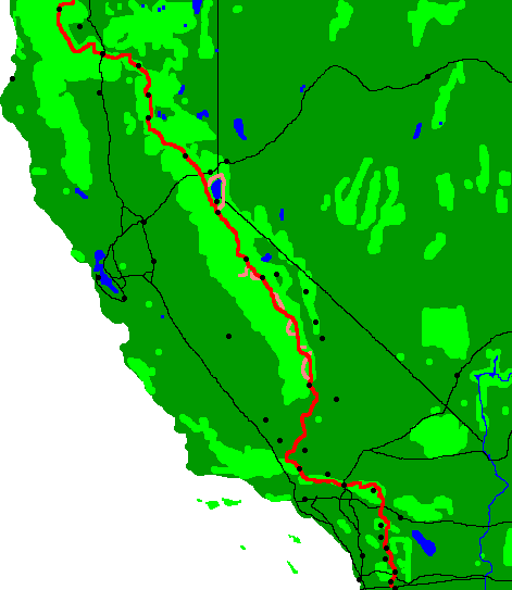

Friday, May 31, 2013
At the South Fork Kern River bridge, a hawk swooped right past me going after the swifts living in the mud nests under the bridge. I had another excellent swim there. Later, I saw a pheasant with a white neck ring and with a length of 12+ inches beak to tail.
Camp: Bear Trap Meadow
Miles Walked: 20 752
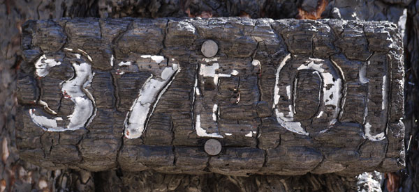
Saturday, June 1, 2013
I celebrated with a chocolate and chocolate chip muffin I had carried from Kennedy Meadows. Also, some other hikers gave me a bowl of extra chili.
Camp: ½ mile short of Mulkey Pass.
Miles Walked: 22 774
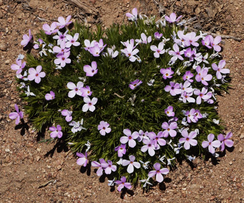
Sunday, June 2, 2013
I came off the PCT at Mulkey Pass and hitched to Independence.
On the news I saw that the Powerhouse Wildfire is burning near Green Valley, with evacuations at Lake Hughes and Elizaberh Lake. Coincidentally, I've heard that the pack of hikers who left ADZPCTKO is currently centered in that area. I hope they are not too badly affected. There is a temporary reroute along aqueduct roads, but I know nothing about water availability or other desirability factors.
Motel: Independence
Miles Walked: 5 779
Independence Weather Forecast
Monday, June 3 - 95F / 65F 0%
Tuesday, June 4 - 95F / 66F 0%
Wednesday, June 5 - 97F / 68F 0%
Thursday, June 6 - 99F / 70F 0%
Friday, June 7 - 103F / 73F 0%
Saturday, June 8 - 106F / 73F 0%
Sunday, June 9 - 100F / 67F 30%
Monday, June 10 - 91F / 67F 0%
Tuesday, June 11 - 96F / 66F 0%
Wednesday, June 12 - 95F / 66F 0%
Thursday, June 13 - 96F / 65F 0%
Friday, June 14 - 96F / 65F 0%
Saturday, June 15 - 95F / 63F 0%
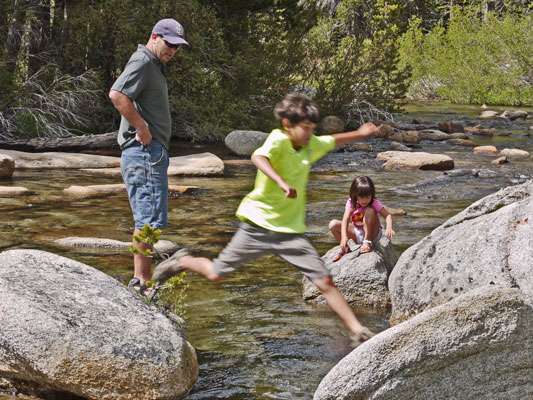
Monday - Wednesday, June 3-5, 2013
I visited my brother's family near Bishop. In one hike on Rock Creek, we saw a Fox, woodpeckers Picidae with red heads, a Northern Rubber Boa Charina bottae, American Beaver Castor canadensis dams and felled trees, big trout, a California Striped Racer Masticophis lateralis lateralis, an owl Strigiformes, and California Quail Callipepla californica.
Stayed: Bishop
Miles Walked: 8 787
Thursday, June 6, 2013
I returned to the PCT at Cottonwood Pass from Horseshoe Meadows near Lone Pine. I plan to be on the PCT except that I'll probably climb Mount Whitney and visit Vermillion Valley Resort. I anticipate reaching Mammoth Lakes around June 18.
Camp: ½ mile east of Cottonwood Pass
Miles Walked: 5 792
Lone Pine Resupply
Although many hikers get their ice axes and bear barrels at Kennedy Meadows, they are not really needed typically until the PCT joins the John Muir Trail (JMT) at Crabtree Meadows. Therefore I like the idea of getting them at Lone Pine. Even if one needs food at Kennedy Meadows, one could buy a couple of days worth and hike on to Lone Pine. And then, there are 43 PCT miles during which the axe and barrel don't have to be carried.
There are 4 trails to Horseshoe Meadows. Mulkey Pass is the southernmost and 1.8 miles takes you to the road near a government corral with no public parking or signage. Less than 1 PCT mile later is Trail Pass, and 2.3 miles takes you to a trailhead with much parking, plus toilets, trash, and potable water. 6 PCT miles past Mulkey Pass is Cottonwood Pass, and with 3.7 miles of walking you would get to the same trailhead described for Trail Pass Trail. New Army Pass goes north from Horseshoe to Rock Creek, down which a northbound hiker could walk to the PCT.
Hitching the 22 miles to Lone Pine may take awhile when traffic is light. One could either hang out at the trailhead and chat with hikers returning to their cars, or walk east to thumb past the campground entrance so that both the campers and hikers are passing you. Pick your favorite method.
Hitching back from Lone Pine will probably be a 2 stage or more hitch, since most drivers on Whitney Portal Road are heading to Whitney Portal. So likely your first hitch would be the 3 miles to Horseshoe Meadows Road. Then, the vast majority of traffic is people who live in the Alabama Hills. So that ride may only get you past that neighborhood. Finally, the majority of the traffic is headed for Horseshoe Meadows, so the 3rd hitch should get you there. I waited nearly 2 hours total for the 2 hitches that got me up the hill. Be patient.
Lone Pine is a good resupply town with a medium grocer, several outfitters, motels, and restaurants, a post office, and a hostel. Bus service is available north and south on highway 395.
In an emergency, one could access Lone Pine via the Whitney Portal Trail and road. But east of Trail Crest, special permits with an exact date (inconvenient for long distance hikers who have no idea what day they will arrive) are required, and can be difficult to get. More importantly, the trail is unattractive for many reasons related to its heavy use. Tents and toilet paper are everywhere. To address the second issue, poop bags are issued to permit holders. Many hikers place these along the trail rather than packing them out. To me, these seem worse than the toilet paper and the mounds the TP marks, since those at least will rot away sometime. Anyway, I would avoid Whiney Portal if possible.
Friday, June 7, 2013
I saw Mule Deer, a Grouse with a chick, and Yellow Bellied Marmots. I had minor nausea and a slight headache from altitude.
Camp: Crabtree Ranger Station
Miles Walked: 17 809
Saturday, June 8, 2013
I ascended the 7.5 miles to Whitney in 5 hours with some nausea and headache. On descent, I took a swim at Guitar Lake. Norway told me about a more scenic alternate route between VVR and Reds Meadow along Fish Creek, also including local favorite Iva Bell Hot Spring. On a sad note, I heard that my friend and PCT icon Billygoat had a heart attack on the PCT and was hospitalized.
Camp: Wallace Creek. Many Mosquitos!
Miles Walked: 20 829
Sunday, June 9, 2013
Today's standouts were the numerous Yellow Bellied Marmots south of Forester Pass and the many, many cascades of water.
Camp: Between the Bullfrog Lake Trail and the Charlotte Lake Trail, atop the switchbacks.
Miles Walked: 19 848
Monday, June 10, 2013
A fairly heavy rainstorm started around 2pm, so I decided to camp and take an easy day.
Camp: Across the canyon from the Baxter Creek Cascades.
Miles Walked: 8 856
Tuesday, June 11, 2013
I saw a Mule Deer Buck with velvet antlers about as long as his ears.
Israeli National Trail
Pinco and I discussed an ADZPCTKO style kickoff for the Israeli National Trail. If he starts it, I promised to market it to American long distance hikers. Most of it would be in Hebrew, the language of most of the hikers. But foreigners would also be accommodated. It would be about March 1, for northbound hikers. The INT is about 600 miles, so would take 5-6 weeks for an experienced long distance hiker to complete. But there are sites, such as Nazareth and Jerusalem, which are off trail, and which foreign visitors would want to see, so 2 months or more are recommended. Hitchhiking is common. Pinco confirmed the existence of the large water caches, but warned that they may get used up in the high season. Spring is much preferred over fall since spring rains bring green and flowers, whereas fall is a much drier, browner season.
Camp: Above the southern of the Palisade Lakes.
Miles Walked: 22 878
Wednesday, June 12, 2013
I saw Mule Deer and a grouse.
Camp: Muir Pass.
Miles Walked: 19 897
Thursday, June 13, 2013
I soaked a while in Blayney Hot Springs, across the South Fork San Joaquin River from Muir Trail Ranch. While there, a hiker was lounging against a rock pile. A 30" Garter Snake Thamnophis slithered out of the rocks just behind the hiker's arm pit, very much entertaining all the other hikers. The ranch was not yet open for the year.
Camp: Atop the switchbacks just short of Senger Creek
Miles Walked: 24 921
Off and on I've hiked with Pinco. I showed him wild Onions, Mint, and Miner's Lettuce. Sierra Onions are so strong I usually only eat a few inches of a leaf at a time, but he was thrilled to know about them and ate great handfuls. He showed me I could eat peanuts and onion leaves together and get a taste reminiscent of Thai food, and that the peanuts moderated the strong onion taste.
Friday, June 14, 2013
I took the Bear Ridge Trail down to Vermillion Valley Resort and had some great fish tacos, vegetables, and rice pilaf for dinner, with cherry pie and chocolate ice cream for desert. Beer and campfire powered conversations ran late into the night.
Camp: VVR
Miles Walked: 22 941
Saturday, June 15, 2013
I had the PCT Hiker Breakfast: 3 eggs, steak, potatoes, and an oat pancake, plus cherry pie and chocolate ice cream for desert. In all, I spent $65 on 2 big meals, a banana, and a six pack of beer. The hiker box yielded many interesting supplements to my food stores. When the socializing died out around 11am, I walked out via the Mono Creek Trail along the north shore of Lake Edison and on up the PCT. I saw many Snow Plants yesterday and today at the elevations near Lake Edison. They were healthy, but not as lush as the specimens I saw in the wetter soil of the San Jacintos.
Camp: Silver Creek
Miles Walked: 11 952
Sunday, June 16, 2013
I left the PCT / JMT and traveled west on the Cascade Valley or Fish Creek Trail. The Iva Bell Hot Springs were scenic and refreshing. I saw a lizard with bright red eye patches and a brilliant blue dewlap.
Camp: West of Iva Bell Hot Springs
Miles Walked: 17 969

Monday, June 17, 2013
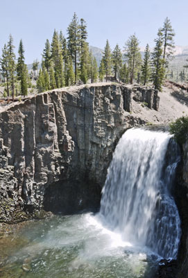
Fish Creek Trail was as scenic as promised, and I hope to visit it and the Iva Bell Hot Springs again. A distant wildfire filled the valley with haze. I visited Rainbow Falls, which I saw with Nancy in 2003 and with a big family reunion group once too. At Red's Meadow I had an excellent burger and butter pecan milkshake. Too bad the mustard exploded all over me! I bought whole grain bread and an apple at the store. I could easily have resupplied to VVR or Tuolumne Meadows there, but had plenty of food already. After various cell phone calls and wifi internet work, I headed over the top of Devils Postpile, sampled the soda spring, and joined the John Muir Trail where it splits from the PCT. The idea is to hike the JMT to the floor of Yosemite Valley and finish that this summer too.
Camp: Vivian/Trinity Lakes
Miles Walked: 21 990
South Lake Tahoe Weather Forecast
Tuesday, June 18 - 68F / 35F 0%
Wednesday, June 19 - 65F / 31F 0%
Thursday, June 20 - 70F / 33F 0%
Friday, June 21 - 75F / 38F 0%
Saturday, June 22 - 78F / 40F 0%
Sunday, June 23 - 79F / 43F 0%
Monday, June 24 - 77F / 43F 0%
Tuesday, June 25 - 76F / 43F 0%
Wednesday, June 26 - 78F / 43F 0%
Rainbow Fire and Big Blow
In August 1992 the Rainbow Fire killed mature forest near Reds Meadow. Without the shade of mature trees, pine seedlings have been unable to survive, and an ecosystem of much more xeric plants has grown around the skeletons of the former forest. Additionally, there was a very strong windstorm November 30, 2011, which blew over many live trees and snags in the area. I stopped and did some trailwork to clean up after that storm on my 2012 hike through the area.
Tuesday, June 18, 2013
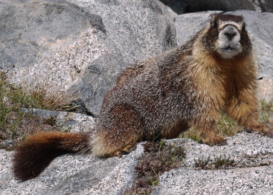
In Donohue Pass a Marmot walked right up to my pack and food many times. Yosemite and its problem animals are here.
Camp: Lyell Canyon, across from Kuna Creek cascades
Miles Walked: 20 1010
Wednesday, June 19, 2013
I had eggs, sausage, potatoes, and a biscuit for breakfast in Tuolumne Meadows. Though many hikers had told me the store was now well stocked with anything a hiker might want to resupply to South Lake Tahoe, it had the same slim selection I remembered from 2003. Luckily, I had more than half the food I needed in my pack. Other hikers were not so fortunate and wandered the aisles in dismay. I visited the soda springs and the Parsons Lodge and hiked out of the high impact area of Yosemite National Park.
Camp: McCabe Lake trail junction
Miles Walked: 22 1032
Thursday, June 20, 2013
The morning was bitterly cold, with much frost and 3 barefoot icy fords before 7am. The hiking all day long was transverse to the ridge direction, climbing in and out of valleys. There were many mosquitos. Some days are tough...
Camp: Seavey Pass
Miles Walked: 21 1053
Friday, June 21, 2013
Per the Halfmile Maps I'm using, I camped at 998.3 PCT miles from the Mexican Border. My cumulative mileage is 77 more than the PCT mileage, or 7-8% more than the trail mileage. I would guess that 5-10% extra is normal for me on long distance hikes. The extra miles are from side trips to scenic sites or to grocery stores, etcetera.
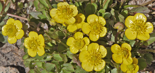
A Mule Deer Buck was walking around my campsite. The antlers on a typical buck now rise to the top of the ear, then have a horizontal bar with nubs from which the tines will grow.
Camp: Dorothy Lake Pass
Miles Walked: 22 1075
Saturday, June 22, 2013
After Muir Pass, the 10 miles south of Sonora Pass had the greatest length of trail under snow. The snow was well consolidated, never rotten, had good footwells in it, and was never dangerous, so travel was fast.
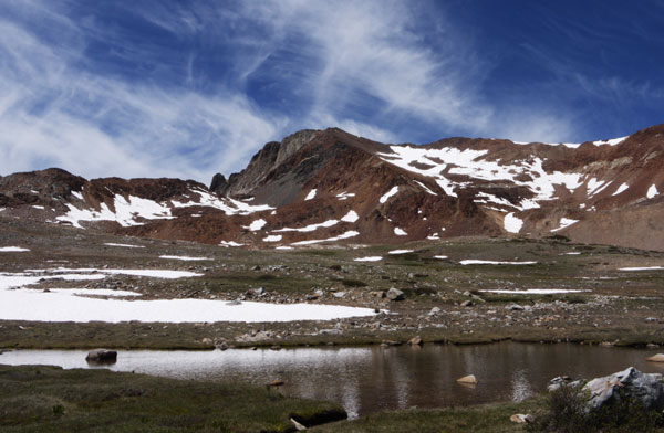
I arrived at Sonora Pass expecting to do nothing but walk through. But 100 yards before the pass was a case of beer left by other hikers so we could celebrate the 1000 mike mark. There was less than an hour of hiking time left in the day, so I sat down and had a beer. A pickup truck pulled up and a couple asked whether I was on the PCT. Soon they gave me a nut bar, a brownie, and a quart of water. I asked whether they might take my trash, then collected the refuse from my pack and the empty beer cans. Many thanks! I hiked on. I checked the trailhead to see what might be useful to hikers (toilets, tables, no trash, no water) and found several hikers and 2 trail angels. We shared more beer, and a potluck sort of dinner, and talked into the night.
Camp: Sonora Pass
Miles Walked: 20 1095
Tahoe Yosemite Trail
I like to take parallel routes where they are available and where I have already taken the primary route. Therefore, I'm interested in taking the TYT, which parallels the PCT from Tahoe to Tuolumne, someday. I talked with Terry, who had walked the TYT 35 years ago, while at Sonora Pass, and also had done a bit of research on the web. The TYT runs from Meeks Bay on the west shore of Lake Tahoe to Tuolumne Meadows. Except near Lake Tahoe, it never gained official recognition. It differs from the PCT for about half its length. It goes much lower than the PCT and visits the northern of the Kennedy Meadows resorts. A guidebook is long out of print. The cashier at Kennedy Meadows recommended the National Geographic topographic map Tuolumne-Hoover as covering much of the route, though they were out of stock. Here's Terry's recollection of his route:
Meeks Bay
Phipps Pass
Join the PCT near Velma Lakes
South of Carson Pass near Frog Lakes split west from the PCT
Fourth of July Lake
Summit City Creek, partially unmaintained trail
Bear Valley (ski area)
Lake Alpine (grocer)
Clark Fork Meadow (road?)
Kennedy Meadows Resort (store, restaurant)
Relief Reservoir
Bond Pass
Join PCT to Tuolumne Meadows
Sunday, June 23, 2013
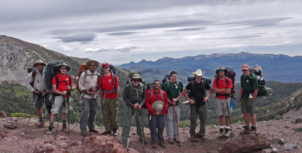
We had hot chocolate and oatmeal, then headed down to Kennedy Meadows for a breakfast of pancakes, sausage, eggs, and hashbrowns. I picked up tortillas, hard boiled eggs, cheese, fruit, peanuts, and Crackerjacks for the trail. It drizzled off and on from 2-4. Heavier rain is predicted Monday afternoon through Tuesday morning. I met Boy Scout Troop 59 out of Elk Grove, California, out doing an overnight training hike for an August visit to Philmont Scout Ranch.
Camp: Beyond the Murray Canyon Trail
Miles Walked: 20 1115
Monday, June 24, 2013
An ice cold drizzle began before dawn and never let up. Reports were that the storm would clear early tomorrow, so I took a short day, having had enough of being soaked in ice water.
Camp: Beyond the Asa Lake Trail
Miles Walked: 6 1121
Tuesday, June 25, 2013
The icy drizzle continued until 4pm, but sun and blue sky occasionally broke through after 11am. A cache of drinks, apples, and chips at Ebbetts Pass brought great happiness on an otherwise tough and dreary day. Wind gusts were strong enough to lean into and to blow me well out of the trail tread. In one foul event, my used toilet paper flew straight up out of the cathole and circled me several times before it gathered enough rain to get heavy and fall towards ground. I was able to catch it on a stick and get it buried. Let's hope another whirlwind didn't uncover it. Wind was also blowing my food away as I tried to eat. What a day! Winds were drier in the evening, so I walked until dark to get my clothes dry(er).
Camp: Lost Lakes / Blue Lakes Road
Miles Walked: 28 1149
Wednesday, June 26, 2013
The day was sunny and a pleasant walking temperature. At Carson Pass, the visitor center volunteers had fruit and water for the PCT hikers. Thanks!
Camp: Echo Lake
Miles Walked: 22 1171
Thursday, June 27, 2013
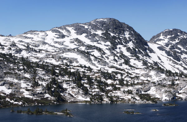
At Echo Chalet I breakfasted on a turkey sandwich, a chocolate muffin and a chocolate shake. I resupplied with whole grain bread, cheese, an apple, orange, and banana, peanuts, and some snack mix. Small chalets were available starting at $140, but otherwise showers, laundry, or even a quart of water in your bottle were not available. Too bad, because many cabins have outhouses very near the lake, so you certainly would not want to drink the surface water. The Desolation Wilderness has more visitors per unit area than any other US wilderness per the sign at Echo Lake. I believe it after meeting other hikers every few minutes most of the day, and after seeing a spiderweb of multiple use and official trails going to every lake. Mosquitos were everywhere, and will probably get worse with the warm weather and the many areas flooded by the recent rains. Much of the PCT was flooded with stagnant or running water. A hiker told me about a trail she really enjoyed, the 200 mile Kungsleden which runs north-south through a fairly undeveloped region of Sweden. Lodges there offer beds and meals.
Camp: Dicks Lake
Miles Walked: 15 1186
Friday, June 28, 2013
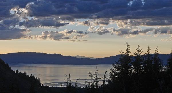
The weather was sunny and a bit hot for me, but east across Lake Tahoe I saw afternoon rain storms. Mosquitoes last night and this morning were atrocious, but seem ok this evening.
Camp: Ridge south of Tahoe Rim Trail junction
Miles Walked: 22 1208
Saturday, June 29, 2013
I saw a female Coyote Canis latrans squatting and marking several spots. I left the Pacific Crest Trail on the Coldstream Trail bound for Truckee and the end of this hike.
Camp: Coldstream Trail
Miles Walked: 19 1227
Sunday, June 30, 2013
I walked into Truckee, had time for laundry before catching the noon bus to Reno, and relaxed the day away there.
Motel: Reno, Nevada
Miles Walked: 7 1234
Mammoth Lakes Weather Forecast
Monday, July 1 - 88F / 56F 20%
Tuesday, July 2 - 88F / 56F 20%
Wednesday, July 3 - 86F / 54F 10%
Thursday, July 4 - 85F / 52F 30%
Friday, July 5 - 85F / 49F 10%
Saturday, July 6 - 83F / 47F 0%
Monday, July 1, 2013
I spent the morning in Reno walking along the Truckee River, buying a little food, and emailing some friends. I then caught the 1:30pm Eastern Sierra Transit bus from the Reno Greyhound Station to the intersection of Lower Rock Creek Road and US395 ($50), arrived at 5:55pm, and hiked part way down Rock Creek to my brother's place.
Camp: Lower Rock Creek
Miles Walked: 7 1241
Some thoughts on this Pacific Crest Trail hike
Snow Conditions
2013 is an exceptionally low snow year, as was 2012. Indeed, the PCT passes in the South or High Sierra both years typically had only short sections of snow, and the short snow sections were not dangerous / exposed. (Off the PCT in 2012, there were some hairy spots I avoided.) in 2003, I hiked through the same area two weeks later in the year, and found miles of snow in many of the same patches, some fairly exposed / risky. So in 2003, I wouldn't have gone through without an ice axe, but this year, I would have been happy without one. Still, I'd rather carry it than take big risks or have to turn back. Except for Muir Pass, all the well known passes had a handful of short snow sections. With no need to trudge or kick step through miles of snow every day, the Sierras were much easier and faster than they might be in high snow years.
Even though 2013 was a very low snow year, there were patches to cross almost daily from the High Sierra through Truckee. The ridgeline of the ten miles preceding Sonora Pass held a surprising amount of snow, rivaling Muir Pass, which always seems to hold more miles of snow than any other.
Record Year for Number of PCT Hikers?
There seem to me to be 4 or 5 times as many PCT thru hikers as there were in 2003. During my through hike 10 years ago, there were 24 days when I met no other people. Almost every day in 2013 I spoke with a half dozen thru hikers. So I estimate that if I completed the PCT in 2013, there would not be a single full day of solitude. The PCTA issued something like 1500 thru permits.
It's a shame that the typical 2013 thru hiker will not get to experience that type of solitude. But even greater solitude is available on other well known long distance routes. (In 2011 while hiking the CDT across New Mexico, twice I met no one for 12 days in a row.) I think the greater traffic will be good for the long distance hiking world. We will have a bigger constituency, and greater leverage for funding and action. And I was still able to walk for hours at a time, so the contemplative part of hiking I love was not too badly compromised.
Along with the greater number of hikers came more trail angels and more trail magic. It was a great deal of fun to find so many caches of food, water, etcetera, and in many cases it was fun to meet an angel hanging out at some pass. There was way more magic than in 2003.
Wildflower and Pika Surveys
It was fun looking for the Pika and Rare Wildflowers this trip. I may seek out more such projects for future hikes. One negative with the wildflowers was that the rare plant people would not send the information early, so that I had to find color printers, etcetera, out on the trail. I like to do all my preparations in advance, so I don't waste time hiking to and hanging out in extra towns.
Tuesday-Saturday, July 2-6, 2013
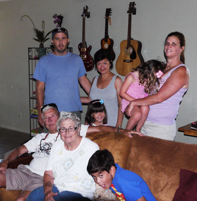
I visited my brother Bob, and his family Chette, Bodie, Jodie, Shadow, and El Tigre, while my Mom and Dad, and Marie, Kate, and Lucky also visited. A focus of the trip was the old fashioned small town Independence Day parade in Mammoth Lakes, and the open house at the local forest service fire station following the parade. It was fun to watch Lucky howl along with the fire truck sirens at to parade, and the kids got to play with some of the fire fighting equipment. There were also some kid hikes and a day with the canoe at Rock Creek Lake.
Camp: Lower Rock Creek
Miles Walked: 5 1246
Saturday-Friday, July 6-12, 2013
In San Diego I visited family and friends Don and Gene.
Camp: Lower Rock Creek
Miles Walked: 15 1261
| Pre - Trip Planning | ||||||||||||||||||||||||||||||||||||||||||||||||
|---|---|---|---|---|---|---|---|---|---|---|---|---|---|---|---|---|---|---|---|---|---|---|---|---|---|---|---|---|---|---|---|---|---|---|---|---|---|---|---|---|---|---|---|---|---|---|---|---|
|
Schedule
Eastern Sierra Transit
ADZPCTKO 2013
Poodle-Dog Bush
Water |
||||||||||||||||||||||||||||||||||||||||||||||||
| Pre - Trip Planning | ||||||||||||||||||||||||||||||||||||||||||||||||