
Saturday-Monday, July 13-5, 2013
I took the train from San Diego to East Glacier via Portland. There was plenty of great scenery and conversation.
GIS Software
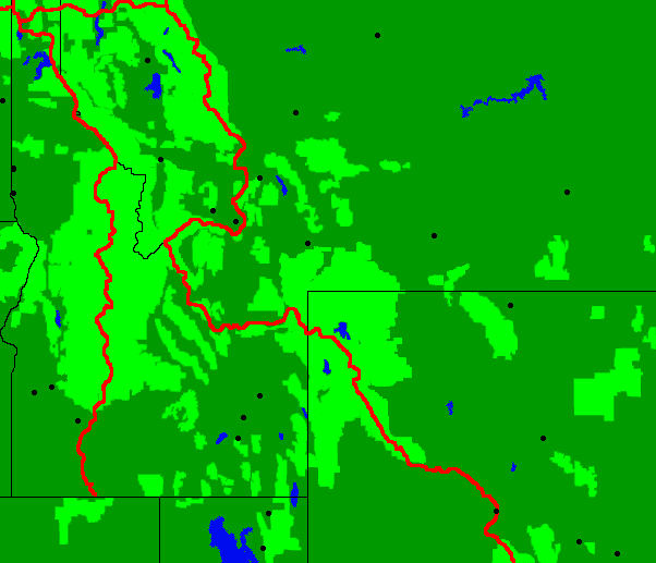
For some time I've wanted to be able to make various types of maps of the long distance trails. For example, if one could plot a route versus the land managers, and annual precipitation, and plant type, etcetera, one could learn and predict much about the route. So I talked with a fellow passenger and took a few notes.
QGIS, available from qgis.org, is a free GIS program that is useful on its own, and also to translate data to formats useful in other programs. In QGIS, one must always choose to reproject all data sets to a consistent type, as this is not the default. Arcgis costs $150 and is a good general program. OSGEO4W has open source Windows programs that perform some useful tasks.
The USGS maintains the DEM Digital Elevation Model or National Elevation Dataset. Elevation maps can be downloaded in a modified tiff format where the one color is elevation at 32 or 48 bit resolution. With an appropriate code, I could make custom elevation maps.
Penn State has good GIS tutorials.
Monday, July 15, 2013
I checked into the hostel and hitched to Two Medicine for hiking permits.
With everything I had scheduled accomplished before noon, I hiked the CDT south from 2 Medicine to East Glacier. The skies were 99% clear, and the temperatures were comfortable for T-shirt hiking. Winds were strong enough to blow my hat away twice but not strong enough to blow me out of tread. The highlands were rocky and had pretty wind twisted trees. The lowlands were filled with lush grass and wildflowers. I saw Mule Deer, Elk, frogs, a hawk, and much pretty scenery.
Miles: 11
Hostel: East Glacier
East Glacier Weather Forecast
Tuesday, July 16 - 70/43F Sunny 0% E at 10 mph
Wednesday, July 17 - 78/47F Isolated Thundertorms 30% E at 7 mph
Thursday, July - 18 76/42F Partly Cloudy 0% ESE at 8 mph
Friday, July 19 - 79/44F Partly Cloudy 0% ESE at 6 mph
Saturday, July 20 - 82/45F Sunny 0% SSE at 7 mph
Sunday, July 21 - 79/44F Mostly Sunny 0% N at 9 mph
Monday, July 22 - 76/43F Mostly Sunny 0% WSW at 9 mph
Tuesday, July 23 - 69/40F Mostly Cloudy 10% N at 8 mph
Wednesday, July 24 - 68/40F Sunny 0% NNW at 10 mph
Tuesday, July 16, 2013
I got 4 rides to Waterton's Prince of Wales Hotel and began hiking by 10:30am. The trail was a little overgrown but easy to follow. There were many day and overnight hikers out. I saw some bear scat and tree scratches.
Miles: 14 25
Camp: Kootenai Lake. A beaver lodge was visible from my camp.
Wednesday, July 17, 2013
I saw a Mountain Goat Oreamnos americanus and many bear scat piles. Some piles contained fur, some grass, some berries, etcetera. There were many overturned rocks, logs, and bushes. So there are many bears here and they have a widely varied diet. The Ahern Drift was the only significant snow on the trail, and was not too difficult to cross. There were brief thundershowers.
Miles: 20 45
Camp: Granite Park Campground
Thursday, July 18, 2013
The crowds on the trails near the Going to the Sun Highway were quite a shock. I had to step out of the way so often it was tough to make any progress at all. Yesterday I saw only 4 people outside of my two camps. I ate some onions, huckleberries, and sweet grass. I saw 10 Mountain Goats.
Miles: 23 68
Camp: Red Eagle Lake Outlet Campground
Friday, July 19, 2013
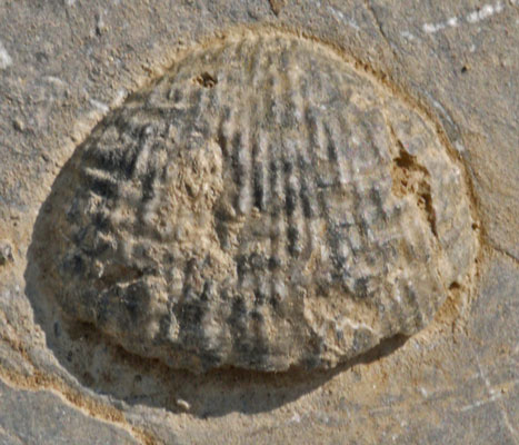
I saw 2 Moose Alces alces and a Garter Snake Thamnophis. There were many Stromalyte fossils throughout Glacier NP.
Miles: 20 88
Camp: Oldman Lake Campground
Saturday, July 20, 2013
I hiked to Two Medicine and hitched to East Glacier for resupply, laundry, and shower. It was great to be clean.
Miles: 7 95
Hostel: East Glacier
Glacier National Park
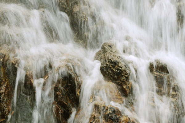
The hike through Glacier was nice, with lush green valleys and rocky passes. The rocks are sedimentary, so distant views all feature layering, and fossils are often seen. The backcountry campground system was ok, but one day a lack of unreserved sites forced a 30 mile day on the official CDT. I had concluded that 20-25 was all I could handle, as understory plants overgrow the trail for miles, slowing travel. So I hiked a shorter route. I noticed that several other parties had permits to camp out of the designated sites. A hammock would be ideal for such off trail camping in the lush pine and understory forests here. My permit cost $20. Hitching from East Glacier to Waterton was easy enough and took me 4½ hours. But if I wanted to hike the PNT, I could also just hike north out of East Glacier, pick up permits at Two Medicine, and keep hiking north. There are parallel routes often enough that it would not all be a repeat.
East Glacier Weather Forecast
Sunday, July 21 - 78/42 Sunny 0% NE at 6 mph
Monday, July 22 - 78/43 Sunny 0% NNW at 9 mph
Tuesday, July 23 78/44 Sunny 0% ENE at 7 mph
Wednesday, July 24 77/44 Partly Cloudy 10% E at 5 mph
Thursday, July 25 - 79/42 Mostly Sunny 10% WSW at 8 mph
Friday, July 26 - 77/42 Sunny 0% WSW at 8 mph
Saturday, July 27 - 74/41 Sunny 0% SW at 8 mph
Sunday, July 28 - 71/41 Sunny 0% SE at 7 mph
Monday, July 29 - 70/41 Sunny 0% WSW at 9 mph
Sunday, July 21, 2013
I walked out of Glacier National Park, through Marias Pass, and into the Lewis and Clark National Forest. I saw an American Marten Martes americana, frogs, and tadpoles.
Miles: 25 120
Camp: South Fork Two Medicine River, Full Moon, Frog in river
Monday, July 22, 2013
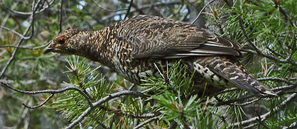
I saw a Spruce Grouse Dendragapus canadensis and a Ruffed Grouse Bonasa umbellus mother with chicks. I ate some tasty tiny strawberries. Late in the afternoon I crossed into the Flathead NF and its Bob Marshall Wilderness.
Miles: 21 141
Camp: Strawberry Creek Meadow
Tuesday, July 23, 2013
I climbed from Strawberry Creek to Sun River Pass only to find the CDT was closed from there to Spotted Bear Pass, including trails 110 South, 109, 116, 109, and 174 due to the Red Shale Fire. Southbound CDT hikers were advised to return to Strawberry Creek, proceed up Clack Creek, to Switchback Pass, Spotted Bear River, and return to the CDT at spotted Bear Pass. Local hikers were advised to exit via Teton Pass. I saw a moisture bank probably forming over the fire. I saw some Western Toads Bufo boreas and both a female with chicks and a male Spruce Grouse. Some fresh bear scat was full of lush, grassy plants.
Miles: 23 164
Camp: Clack Creek
Wednesday, July 24, 2013
A rabbit hopped within 18" of my head this morning. On this trip I've been staying silently in my sleeping bag until 6:30 or so. During these early morning hours, there has been way more bird calling and other animal activity than at any other part of the day. A rodent chewed up part of my fairly new bear rope. I saw my first other hiker in over 2 days. Overnight, pockets of hot air from the Red Shale Fire occasionally drifted through.
Miles: 26 190
Camp: Spotted Bear River
Thursday, July 25, 2013
I saw 2 Mule Deer, and passed the Chinese Wall. I camped well past the Red Shale Fire closure areas. Throughout this trip, Black Flies Simulium, Deer Flies Chrysops, Big Black Horse Flies Tabunus punctifer, and Mosquitos Aedes have been out in force and biting like crazy. DEET seems to have little or no effect.
Miles: 21 211
Camp: West Fork Sun River
Friday, July 26, 2013
I saw a juvenile Black Bear north of Benchmark. Signs in the area warned of increased bear activity due to a mule carcass. Some people saw two small grizzly bears, but not me. Ascending Straight Creek in the afternoon, I saw the standing dead trees of the huge 1988 Canyon Creek Fire as well as a smaller burn in 2012. It's interesting to see the degree of recovery of the forest and know the dates of the fires.
Miles: 25 236
Camp: Straight Creek Pass
Saturday, July 27, 2013
There was much smoke smell and haze from perhaps several fires. I could see a moisture cap north over the Red Shale Fire, and perhaps another to the southeast. After several days in river valleys, I ascended to the Continental Divide this afternoon and enjoyed the views.
Miles: 21 257
Camp: Valley of the Moon
Sunday, July 28, 2013
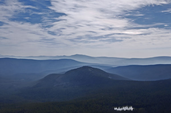
It was foggy through the morning, and cloudy for the rest of the day, but the sky cleared in the evening. The hiking was tough, with many ascents and descents straight along ridges. There was little water. No bugs attacked all day.
A female Moose and I happened to be lunching on the same hilltop, with conifers and grass interspersed. She would occasionally get curious and come over to watch me for a while. I was just as curious to see a moose as close as 15-20'. I didn't dare take my camera out and spoil the experience. But if I had, I would have some great portraits, with every expression and hair perfectly clear.
I saw many Grouse, and there were good views of the prairies to the east. There were many bugs, perhaps moths, flitting around conifers.
I crossed Lewis and Clark Pass, through which Meriwether Lewis passed on July 7, 1806, on the return eastbound journey.
Two guys stopped in Rogers Pass and had a Sage and Sweetgrass burning ceremony for me. One, in 2001, had hiked the CDT from Mexico into Colorado before he lost so much weight and muscle he had to quit.
Miles: 20 277
Camp: Ridge Southbound or East of Rogers Pass, Montana 200
Monday, July 29, 2013
Strong, cold wind gusts woke me several times last night, so I slept in and fooled around until 10, rather than my usual start time of 7 on this trip. Fog lingered until early afternoon. Then there were clouds, which cleared by evening.
Miles: 17 294
Camp: 4 miles north of Stemple Pass
Tuesday, July 30, 2013
I met Shirley in Stemple Pass and was offered a ride to Lincoln and back in the morning. Though I had not planned on resupplying for several days, it seemed like too good an offer to refuse. So I resupplied, laundered, and etcetera. There were many days of hot, fairly humid, weather, so I really appreciated the shower. Thanks to Shirley and George for hosting me. Thanks also to Mary and Mitch, who owned the home, and who, in an odd coincidence, had met me and given me water just north of Lewis and Clark Pass 2 days earlier, just after the curious moose incident.
Miles: 4 298
Camp: Lincoln, from Stemple Pass. Lincoln was the home of the Unabomber, Ted Kaczynski, while he was building bombs.
Wednesday, July 31, 2013
There were many White Tail and Mule Deer of all ages and sexes in the Lincoln an Stemple Pass areas. In the trailbed were many bird dust bath depressions. In the Dana Spring box were 10-15 dead gophers: the smell was terrible.
Miles: 23 321
Camp: Intersection of Ophir Creek Road and road to Spring Gulch
Anaconda Weather Forecast
Tuesday, July 30 - 75/43F Partly Cloudy 20% WSW at 4 mph
Wednesday, July 31 - 87/48F Mostly Sunny 20% E at 4 mph
Thursday, August 1 - 80/44F Isolated T-Storms 30% ENE at 5 mph
Friday, August 2 - 77/43F Isolated T-Storms 30% SW at 7 mph
Saturday, August 3 - 79/43F Isolated T-Storms 30% WSW at 7 mph
Sunday, August 4 - 80/43F Mostly Sunny 0% WNW at 6 mph
Monday, August 5 - 81/44F Partly Cloudy 20% W at 7 mph
Tuesday, August 6 - 82/44F Sunny 0% WNW at 4 mph
Wednesday, August 7 - 84/45F Sunny 0% W at 5 mph
Thursday, August 8 - 83/47F Partly Cloudy 10% NE at 6 mph
Friday, August 9 - 79/46F Isolated T-Storms 30% ENE at 5 mph
Saturday, August 10 - 84/46F Mostly Sunny 10% SSE at 6 mph
Sunday, August 11 - 81/45F Mostly Sunny 10% SSE at 5 mph
Monday, August 12 - 82/46F Partly Cloudy 10% WSW at 5 mph
Tuesday, August 13 - 83/47F Mostly Sunny 10% E at 6 mph
Wednesday, August 14 - 83/46F Mostly Sunny 10% SSE at 6 mph
Thursday, August 1, 2013
I saw many Elk and Deer. 3 major thunderstorms with much rain and lightning, one also featuring hail, occurred today. It was so cold and wet that I camped several hours early, with the thought that the conditions could easily bring on hypothermia. Indeed, my fingers were cold enough that I had to concentrate to tie and untie knots to set up camp. Days passed before there was enough sun to really dry all my gear throughly.
Miles: 21 342
Camp: 2 miles south of MacDonald Pass
Friday, August 2, 2013
I met Woodrose and Muleskinner, out from Florida to hike the Montana section of the CDT. They were the first long distance hikers I met on this summer's CDT hike. It was fun talking with them.
Miles: 20 362
Camp: South of Bison Mountain
Saturday, August 3, 2013
Leadville had ruins of some very spacious log cabins. It must have been a rich mining area. I met Ross, my first northbound thruhiker. I saw a Red Tailed Hawk.
Miles: 24 386
Camp: South of Champion Pass
Sunday, August 4, 2013
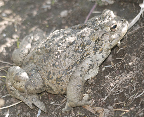
I saw some White Tail Deer and a Western Toad, and met an Americorps Trail Crew. Thanks for the work.
Miles: 29 415
Camp: 3 miles east of Interstate 15
Monday, August 5, 2013
I saw a Spruce Grouse. Last night a big Elk buck walked within 20' of me in my sleeping bag before seeing and hearing me and bolting. There were lots of knee-high blowdowns, and it was just light enough that I could barely see, so there was quite a ruckus.
Okay, I cheated. I was on Delmoe Lake Road hiking toward Interstate 90. The area was wrecked with beer bottles and cans and tire ruts from ATV people. Every few minutes, several vehicles came roaring by and kicked up clouds of dust. A thunderstorm started dropping lots of rain and lighting was cracking. I stuck out my thumb and got a ride into Butte to resupply. I have no intention of returning and doing the walk to I90. I hereby give all purists permission to say I never hiked the whole CDT.
Miles: 17 432
Motel: Butte, from Interstate 90 / Homestake Pass
Tuesday, August 6, 2013
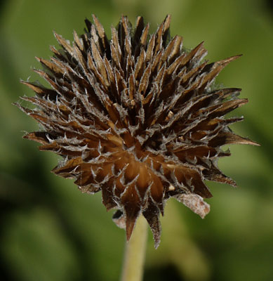
I finished resupplying for an anticipated 8 days walk to Chief Joeseph Pass for resupply in Darby, Montana. After a half hour plus of trying, I concluded it would be impossible to hitch I90 to Homestake Pass. Instead, I walked south through town on Montana 2 and eventually hitched to Pipestone Pass. So I skipped another 8 miles of the CDT. I ate Raspberries Rubus idaeus and Strawberries Fragaria vesca, and saw American Robins Turdus migratorius, Common Ravens Corvus corax, and Gray Jays Perisoreus canadensis.
Miles: 13 445
Camp: Highland Mine. There were old log buildings and water was gushing from the mine.
Wednesday, August 7, 2013
I met a guy who had previously through hiked the AT and PCT and, for the past 11 years, has been section hiking the CDT in day and short overnight hikes. He figures he can finish it in 4 more summers, but also that he goes back and rehikes sections which have been rerouted, so extra time must be allotted for that. For today's section, he drove to the Highland Mine Trailhead, biked Highland Road to the Burton Park Trailhead, and walked back to his car. Good luck with it all!!
I watched two hawks doing Paired Flying, sort of like a mating dance in the sky. And there were some Whitetail Deer Fawns.
Miles: 21 466
Camp: 5 Miles West of Interstate 15
Thursday, August 8, 2013
I saw a Moose cow and calf, some Elk, and a hawk. I was close enough to a male Spruce Grouse to see all the details of the red fringes above the eyes. There was a bit of rain and thunder, but never enough to put on a jacket or hide out.
Miles: 20 486
Camp: 2 Miles East of Mill Creek Highway 274
Friday, August 9, 2013
I saw a Mule Deer Buck with antlers well developed but still in velvet, and a Marmot. I camped at Upper Seymour Lake at 6pm due to a developing rain, cold wind, and lightning storm, and because soon after the trail would have ascended above treeline. On this trip I've typically been walking between 7am and 8:30pm.
Miles: 23 509
Camp: Upper Seymour Lake
Saturday, August 10, 2013
There were afternoon thundershowers, but I was under forest cover so I didn't need to stop. I had 3 nice conversations, one with a group from the University of Montana out surveying conditions in the wilderness, one with a couple from the Bitterroot area, and one with a NOBO thruhiker couple. Of the areas I've visited on this trip, I like this Anaconda Pintler Wilderness the best. It has nice lakes, streams, forests, and meadows, and isn't overcrowded or burnt out like many places in Glacier, or the Bob Marshall of Scapegoat Wildernesses. There was smoke from some wildfire this morning, but several people told me all local fires are well away from the CDT.
Miles: 22 531
Camp: 1½ miles before Rainbow Lake
Sunday, August 11, 2013
I met two more couples thru hiking the CDT, Cherrypicker and Wired, and Bloodbath and Rampage. It must be tough to get along with another hiker on such a difficult and long trail. So I respect anyone who pulls it off. It seems like an anomaly that 6 of the 7 thruhikers I've met have been couples. I was told that Lima had been a good resupply and that one of the hotels will shuttle hikers who call. In Darby there's a campground with $10 for tenting and a shower. Leadore has a convenience store with high prices and a motel, and hitching was tough. Much of today I walked in standing dead trees from the 2000 Mussigbrod Fire Complex. New pines were growing, but few were more than 6 feet tall.
Miles: 20 551
Camp: Beyond the Mussigbrod Lake and Buck Creek Trails.
Monday, August 12, 2013
If a tree falls in the forest, and no one is there to hear it, does it make a sound?
Well, I've been there plenty of times, and the sound was always big and scary. I heard one of the Mussigbrod trees crack and fall of its own accord, and pushed over a few widow makers leaning over the trail today.
A Mule Deer Doe approached me and another hiker while we were talking, then circled around and walked in to check us out from the opposite direction, both times approaching within 25'.
Leadore has a Homestead Hotel which will shuttle both ways from Bannock Pass, $50 including the stay. There is a 25 mile dry stretch into Sacajawea Spring. I should take all suggested scenic alternate routes in the Wind River Range, as the official route is scenically uninteresting.
NOBO Thruhikers: Raisin, Joe, Sweet As, Aquaman, Dain, Elizabeth, Neon, Balls, Sunshine, Why Wait, Steady
SOBO Montana: Muleskinner, Woodrose
Miles: 25 576
Camp: Gibbons Pass
Tuesday, August 13, 2013
I walked to Lost Trail Pass and hitched into Darby. I resupplied and returned to the trail. Darby was a good town, with a full grocer, a nice US Forest Service Office and Museum, a post office, a good library, and several hotels. Had I run into a pack of gregarious thruhikers, I might have stayed the night, but there were none to be seen. Traffic on the highway was fast, and it took an hour to get a ride into town. Returning to Lost Trail Pass took a four stage hitch and a few hours. This morning, too early to visit, I saw a few camped hikers, but I talked to none today. That's quite a difference from yesterday's 13.
Miles: 15 591
Camp: 5 miles south of Highway 43, at the junction of the CDT and the spur road to the spring.
Leadore, Idaho Weather Forecast
Tuesday, August 13 - 78/44F Scattered T-Storms 40% S at 7 mph
Wednesday, August 14 - 84/44F Sunny 0% E at 6 mph
Thursday, August 15 - 88/45F Sunny 0% SSE at 4 mph
Friday, August 16 - 88/46F Mostly Sunny 10% SSW at 10 mph
Saturday, August 17 - 81/45F Partly Cloudy 10% WNW at 11 mph
Sunday, August 18 - 80/43FPartly Cloudy 0% NNW at 7 mph
Monday, August 19 - 84/45F Mostly Sunny 0% NW at 7 mph
Tuesady, August 20 - 85/45F Sunny 0% WNW at 8 mph
Wednesday, August 21 - 84/45F Mostly Sunny 0% WNW at 9 mph
Thursday, August 22 - 82/44F Mostly Sunny 0% NW at 8 mph
Wednesday, August 14, 2013
I saw a small Black Bear and an American Marten. I ate many great Huckleberries and thimbleberries. This was the first day in perhaps a week with no rain or thunderstorms. I met northbounders Adam and Papa Smurf.
I should resupply at Sawtell, a little before Mack's Inn, as the store is a little bigger and better. In Lima, call 406-276-3535 for shuttle to the hotel. In Leadore, the Homestead shuttles free with a room, 208-768-2742 or 208-303-7441, or for $15 208-768-2313.
Based on my rate of travel so far, I may reach Rawlins, Wyoming as early as September 25. That leaves quite some time before the ALDHA Gathering around October 12. I'll need to make plans...
Miles: 19 610
Camp: Last crossing, South Fork Sheep Creek
Thursday, August 15, 2013
I photographed a Spruce Grouse. An excellent swim in Upper Slag-A-Melt Lake indeed melted away the slag I'd accumulated since Butte. I talked with northbounders Huckleberry Finn and Sycamore.
In the Great Basin, Sweetwater, Mormon (in rocks), Weasel (18 miles dry/bad water), Benton, AW Reservoir, Bull Spring (solar), and Fish Creek were good water sources. There was one source with east and west points, and the name may have started with A. That source made Sycamore more-a-Syc.
Miles: 22 632
Camp: West Rock Island Lake.
Friday, August 16, 2013
There were Mule Deer and Grouse, and much smoke from several fires to the west in Idaho.
Before Lima I should take the Nichlolia-Deadman Pass alternate for scenery reasons. There will be a stream, then a spring, but that's the last water to the pass. Deadman Creek is dry. There is a side trail to scenic Divide Lake. Divide Creek itself is dry, but several springs are flowing.
NOBOs: Bo, Lovenote, Drop and Roll, Burly Whites, Ninja, Sweetfish
Miles: 21 653
Camp: Pond Before Darkhorse and Cowbone Lakes
Saturday, August 17, 2013
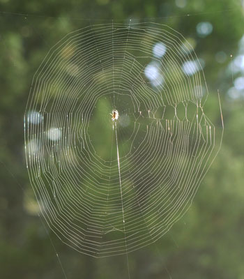
I saw 2 Mule Deer Bucks with nice racks in velvet. There were Grouse, Marmots, Pika, and a young Woodpecker. Many spider webs spanned the trail. I saw no one all day. Lemhi Pass is where Lewis and Clark crossed the continental divide on the way to the Pacific, and where Clark returned to the east side.
Miles: 28 681
Camp: 3 miles south of Lemhi Pass
Sunday, August 18, 2013
I saw a Kestrel. If I wanted to spend extra time in the Wind River Range, I could resupply by hitching down from the Moose/Elk Heart Trailhead to Pinedale.
NOBOs: Flyby, Softwalker, Mark, Puck I knew Puck from the PCT in 2003, and from his Colorado Trail hike in 2013. We hiked into the Copper Mountain Ski Resort on I70 and generally hung out for most of the day.
Miles: 26 707
Camp: 1 mile south of Bannock Pass
Monday, August 19, 2013
I saw Elk, Mule Deer, Hawks, and woodpeckers. The route was largely in rolling sage and grass covered hills, on ATV/Jeep roads. I'm considering taking extra off-CDT hikes in Yellowstone and in the Wind River Range as it looks like I have 10+ days of margin before I need to Travel east for ALDHA.
NOBOs: Green Flash, Annie, Breeze
Miles: 29 736
Camp: Tex Creek
Things to do in Lima
Ship Books and Axe home (Later?)
Sewing: Pack, many places, Camera Case, Ice Axe Protector
Buy Toilet Paper
Select route to Yellowstone
Buy Yellowstone Trail Topo Map
Consider route through Yellowstone
Consider route through Wind River Range
Consider hike on AT after ALDHA Gathering
Email Mother Nature's Son re before and after ALDHA
Calculate resupply days for remainder of trip
Determine duration of bus trip to Birmingham
Tuesday, August 20, 2013
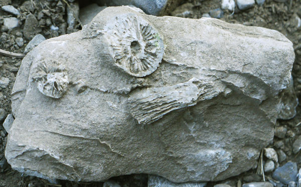
I saw Mule Deer, and a Jackrabbit Lepus. I also saw, for the first time on this trip, about 20 Antelope/Pronghorn Antilocapra americana. There were fossils of coral and more in Coyote Creek Canyon and elsewhere. A couple on an ATV gave me a beer and a half dozen assorted granola and candy bars: many thanks!! I think a slow paced trip in the high country along today's route would be interesting. The views from the naked ridges, the fossils, and the mountain sheep and goats could all be found and savored with extra time.
In the Old Faithful area, on the second floor of the Snow Lodge is a coin laundry. Stores and restaurants near Old Faithful have long lines just after the eruption, so time chores accordingly. In the south part of the park, Witch Creek is warm and swimmable. Grant Village is a 7 mile hitch for good resupply.
Little Sheep Creek is a route directly to Lima, bypassing the I15 hitch.
NOBO: Tommy
Miles: 26 762
Camp: On Ascent from Deadman Lake
Wednesday, August 21, 2013
The sunset and sunrise last night, this morning and this evening were excellent. An ice ring around the full moon, cirrostratus and cumulonimbus clouds today told me a weather system may be moving in. I even got a couple of drops of rain. Along with the weather there was smoke, as there has occasionally been for two weeks. I found a piece of obsidian from which flakes had been removed, and obsidian is not one of the local rock types. There were several Grouse, some Red Tail Hawks, and some American Robins. In the evening I saw a White Tailed Deer.
Miles: 26 788
Camp: Shineberger Creek

Thursday, August 22, 2013
I got less than a mile off the CDT, but by the time I realized it, it would have been quite tough to get back on. It was fairly straightforward to get to the Shineberger/Sawmill road. And that took me closer to Lima, so that's what I did. I had a solid lunch and resupplied. I saw Pronghorn and a Coyote. Atlantic City has limited convenience items and is closed Mondays. Carry staples from Pinedale. In Pinedale, the Wagonwheel looks closed but is $60/night, the Sundance is $80. Riley's Market has all groceries. There are about 230 miles on the AT in Georgia, North Carolina, and Tennessee. A bus trip from Rawlins to Birmingham or Pennsylvania takes about 36 hours and costs less than $200, but seems to either begin or end at 2am.
NOBO: Pacer
Miles: 12 800
Motel: Lima, Montana
Yellowstone National Park Weather Forecast
Friday, August 23 - 74/41F Scattered T-Storms 50% SSW at 9 mph
Saturday, August 24 - 70/38F Scattered T-Storms 40% S at 9 mph
Sunday, August 25 - 72/40F Isolated T-Storms 30% S at 9 mph
Monday, August 26 - 70/41F Isolated T-Storms 30% S at 8 mph
Tuesday, August 27 - 73/45F PM T-Storms 40% SE at 5 mph
Wednesday, August 28 - 69/42F Scattered T-Storms 30% SSW at 10 mph
Thursday, August 29 - 74/41F Isolated T-Storms 30% SSW at 4 mph
Friday, August 30 - 74/42F Scattered T-Storms 40% SW at 5 mph
Saturday, August 31 - 69/40F Isolated T-Storms 30% SSW at 7 mph
Sunday, September 1 - 69/38F Partly Cloudy 10% SW at 5 mph
Monday, September 2, Labor Day - 65/33F Mostly Sunny 10% SW at 7 mph
Tuesday, September 3 - 68/36F Partly Cloudy 20% WSW at 3 mph
Wednesday, September 4 - 67/38F Showers 40% N at 3 mph
Friday, August 23, 2013
There was lots of black obsidian among the rocks today. I passed through the US Sheep Experiment Station into the Targhee NF. There were occasional light rain showers. Evening brought strong winds which lasted through the night and into the morning.
The Mack's Inn gas station has wifi. The Subway has wifi and outlets at the tables. There is a Green Fire I need to get around. A reroute map is posted on Inciweb. I should get campsites at Summit Lake before Old Faithful and at Lonestar after.
Miles: 21 821
Camp: Beyond the Coal Mine Trail
Saturday, August 24, 2013
I saw several hawks and ate Huckleberries, Raspberries, and Thimbleberries. I saw bear prints on ascent from Aldous Trailhead. The trail was tough, with overgrowth, blowdowns, steep pitches with loose soil, and intersections with better animal paths. Plus, my motivation was low, so I didn't go particularly fast. Then, a close electrical, rain, and hail storm ended the hiking day at 6:45, earlier than my usual 8:30. So my miles are a bit short of expectations.
Miles: 18 839
Camp: Beyond East Dry Creek Road 327
Sunday, August 25, 2013
I saw some Elk and a Bull Moose. I climbed to the furthest spring from the Gulf of Mexico on the Mississippi-Missouri River system, but it was dry and I had to walk back down Hell Roaring Creek for a drink. Without water, there wasn't a Hell of a lot of Roaring going on.
Miles: 26 865
Camp: Sawtell Peak Road 24

Monday, August 26, 2013
Last night, with clear skies, I slept under the stars. Very early, a bit of rain came. I covered up under my tarp, and there wasn't much rain, but it proved impossible to get back to sleep. The Sawtell Peak Road was very smooth, and with some moonlight I began walking at 4:30. So I was waiting outside the door when the Sawtelle / Island Park store opened. I resupplied, used the Internet, and breakfasted on a sausage and egg muffin, a banana and two plums. In Mack's Inn I added an ice cream bar for desert and headed for the hills.
NOBO: Michigan Wolverine
Miles: 28 893
Camp: Yellowstone National Park Boundary
| Resupply Towns | |
|---|---|
| Mile | Town |
| 0 | Waterton |
| 105 | East Glacier |
| 279 | Rogers Pass / Lincoln |
| 346 | MacDonald Pass / Elliston |
| 391 | Champion Pass / Anaconda |
| 437 | Homestake Pass / Butte |
| 497 | Highway 274 Anaconda Tough Hitch |
| 591 | Chief Joseph Pass 43 |
| 713 | Bannock Pass / Leadore |
| 901 | Mack's Inn |
| 948 | Yellowstone |
| 1253 | Sweetwater Station |
| 1310 | Muddy Gap |
| 1397 | Rawlins |
|
Large Store Small Store or Restaurant |
|
| Resupply Towns | |