

Saturday - Sunday, July 28 - 29th, 2012
After walking the beaches, I took the train from a family reunion in Santa Barbara, California, to Santa Fe, New Mexico, and got a motel Sunday night.
Miles: 7
Silverton Weather Forecast
Monday, July 30 - 69F / 43F 50%
Tuesday, July 31 - 71F / 44F 40%
Wednesday, August 1 - 68F / 42F 30%
Thursday, August 2 - 67F / 42F 30%
Friday, August 3 - 68F / 42F 30%
Saturday, August 4 - 67F / 44F 40%
Sunday, August 5 - 68F / 43F 20%
Monday, August 6 - 68F / 43F 20%
Tuesday, August 7 - 68F / 43F 20%
Monday, July 30th, 2012
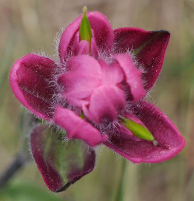
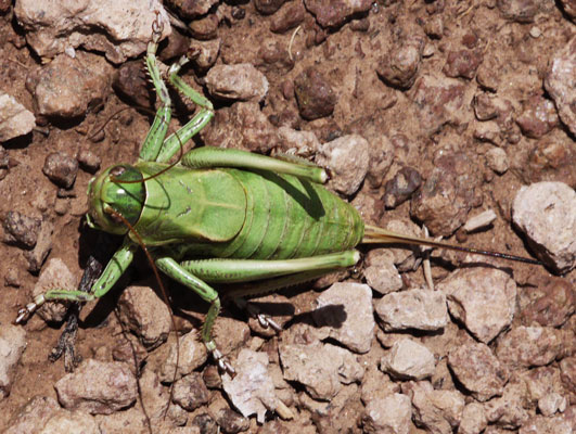
I took the free North Central Regional Transit District Blue Busses almost as far as Abiquiu, and hitched to Chama and Cumbres Pass. John gave me a ride most of the way, though it was 120 miles out of the way. So many thanks to him. John loves to see wildlife, and asked me to keep track of likely places to observe beavers, so that will be in this journal. There were many wildflowers (Yarrow Achillea millefllium, Daisy Erigeron, Harebell Campanula rotundifolia, Paintbrush Castilleja), a mule deer Odocoileus hemionus with antlers in velvet, and a hawk to entertain me. The soil was damp enough for green plants everywhere and occasional springs. Many grasshoppers were ratcheting loudly. I saw no one on the trail.
Camp: Near the junction with the Mangas Stock Trail
Miles: 12 19
Wolf: Volume 5: Southern Colorado, South San Juan Segment Section 3 Map 23
Ley: Colorado 46, 45
Tuesday, July 31st, 2012
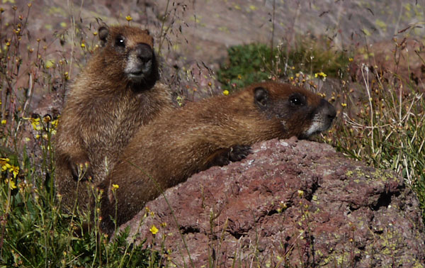
A very heavy rain, hail, and lightning storm lasted from mid afternoon into the night. I saw many Yellow Bellied Marmots Marmota flaviventris. In Dipping Lakes were many 3/4" fish and invertebrates. I saw a flock of grazing sheep.
Camp: North of Blue Lake
Miles: 14 33
Wolf: Volume 5: Southern Colorado, South San Juan Segment Section 3, 2 Map 23, 22
Ley: Colorado 45, 44
Wednesday, August 1st, 2012
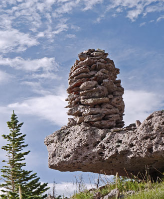
I saw only one person. There was a bit of afternoon rain. I saw many elk tracks, and scat. A herd of Elk, Wapiti, Cervus elaphus gathered across the Adams fork of the Conejos River for a squealing festival. I think I am adjusting to the altitude, but my 15 mile day testifies to how tough and slow this process is for me. I just stop to breath all the time while ascending. There were eskers on the mountain above my camp (Summit Peak). Eskers are formed when a layer of ice had a stream running over it, and the stream bed collected dirt and rocks from upstream, and then the ice melted, leaving just the long pile of rocks and dirt, the Esker.
Camp: Pond at head of Treasure Creek
Miles: 15 48
Wolf: Volume 5: Southern Colorado, South San Juan Segment Section 2 Map 22, 21
Ley: Colorado 44, 43
Thursday, August 2nd, 2012
I saw no other hikers today. I waited out an hour long rain and lightning storm, plus another half hour to be sure the lightning was done. I got back to hiking, but the thunder returned. I took a lower, forested dirt road route into the ski resort, and by the time I returned to the ridgeline, the day's storming was over. I saw several grouse, some Steller's Jays Cyanocitta stelleri, Mountain Chickadees Peocile gambeli, American Pikas Ochotona princeps, and several Mule Deer.
Camp: Alberta Peak
Miles: 20 68
Wolf: Volume 5: Southern Colorado, South San Juan Segment Section 1, 2 Map 21, 20
Ley: Colorado 43, 42
Friday, August 3rd, 2012
There were many hikers and packers out today. A thundershower started at noon. I was able to walk as far as Archuleta Lake because that portion of the route was low and forested, but the route afterwards was on the ridgeline, and not prudent for hiking in electrical storms.
Camp: Archuleta Lake
Miles: 12 80
Wolf: Volume 5: Southern Colorado, South San Juan Segment Section 1, San Juan Mountains Segment, Section 7, Map 20, 19
Ley: Colorado 42, 41
Saturday, August 4th, 2012
With no thunder, I was able to finally put in a full day of hiking. I saw a small brown squirrel carrying off a smaller grey mouse. In Piedra Pass was a well graded narrow path, perhaps a former narrow gauge logging railway or flume. A long dead and dried standing tree had recently been struck by lightning, blasting the top half into 2X4 sized splinters, and removing a lightning strip from the bark of the lower half.
Camp: Beyond Unnamed Lake East of and Below CDT
Miles: 21 101
Wolf: Volume 5: Southern Colorado, San Juan Mountains Segment, Section 7, 6, Map 19, 18
Ley: Colorado 41, 40
Sunday, August 5th, 2012
A helicopter was searching the ridgelines to either side of Squaw Pass. A violent and heavy rain, hail, and thunderstorm lasted from 2:30 - 7pm. Heavy rain returned for several hours of the night.
Camp: Lake in Cirque 3 Miles Beyond Squaw Pass
Miles: 15 116
Wolf: Volume 5: Southern Colorado, San Juan Mountains Segment, Section 6, 5, Map 18
Ley: Colorado 40, 39
Altitude, Lightning, and Schedule
Altitude is pretty hard on me. With 7 days behind me, headaches and nausea are gone, but I still huff and puff up hills, and ascents take a long time. Level hiking and descents are at my normal speed.
Thunder storms have been curtailing hiking some afternoons. If the hiking is to be high on the ridgelines, thunder ends the hiking, often for the rest of the day. If the storm starts at 3pm, that takes 5 hours out of the day...
Between the Altitude and the Electrical Storms, my average thus far is 16 miles per day. That's enough to do the CDT itself, but I may have to cut out side trips, like down the Colorado Trail to Durango (cancelled) to keep my Schedule. I'll have to keep monitoring the conditions and my progress, and decide in a few days.
Monday, August 6th, 2012
With ice cold water brushing off overgrowth all morning, I was generally cold, tired, and slow. I spent a lot of time talking with a few other hikers: one gave me some excess food. Thanks. There were Beaver Castor canadensis dams, stick dome lodges, and a bank tunnel lodge that had broken open on the North Fork Pine River. In Weminuche Pass, this being wilderness, Amish were using horses and sleds to haul sandbags to repair a breach in the Raber Lohr Ditch. There were many blowdowns today, and I stopped to thank two back country rangers who were clearing trail. I saw two lamas and a moose Alces alces bull, cow, and calf. I was surprised to see moose here, but later hikers confirmed they live here in southern Colorado. The palmate antlers on the bull were much smaller than I've seen on moose in Minnesota, Maine, etcetera.
Camp: 2 miles short of Rio Grande Pyramid
Miles: 13 129
Wolf: Volume 5: Southern Colorado, San Juan Mountains Segment, Section 5, , Map 18, 17
Ley: Colorado 39, 38
Tuesday, August 7th, 2012
An early afternoon thunderstorm broke and the sky was clearing, so I began hiking again at 5:30pm. Then I got in conversations with several people out looking for a couple with a 2 year old and 3 lamas, 1 injured. Plus I met 3 Lama Mamas who had hiked all of the Colorado Trail and talked a while with them. I started to see old mines and related structures on descent to Kite Lake Dirt Road. I left the CDT on the Colorado Trail or Elk Creek Trail westbound on my way into Silverton for resupply. I reached the divide after the sun had set and walked in the silent twilight watching the beautiful glowing clouds towards the head of Elk Creek. I descended a bit and camped when it was too dark to walk. The stargazing was great: Cassiopeia, Polaris, the Big Dipper, the Milky Way, satellites, many meteors, so much to see.
Camp: Below 1st switchbacks of the Elk Creek Headwaters
Miles: 20 149
Wolf: Volume 5: Southern Colorado, San Juan Mountains Segment, Section 4,3, Map 17, 16
Ley: Colorado 38, 37
Wednesday, August 8th, 2012
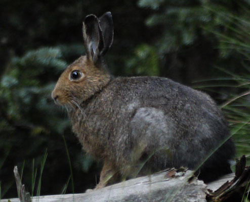
I walked down Elk Creek and up to Molas Pass on the Colorado Trail. The low altitude, the large creek and river, and the riparian habitat were different than the divide and were interesting. I saw beaver ponds and many types of beaver sign on Elk Creek and beaver felled stumps on the Animas River. I also saw a rabbit. In the hostel, I hung out with Bill, who was thru hiking the Colorado Trail. I resupplied for a 10 day hike to Monarch Pass, US50, 130 miles, for my next resupply in Gunnison or Salida.
Hostel: Silverton
Miles: 14 163
CDT Conditions: Cumbres Pass to Silverton
There has been no snow on the trail, and just a few isolated patches on the hills. That's an incredible difference from last year's thick snow layer. I'm glad I waited until this year, and got to see so much wildlife, flowers, etcetera. Much of the CDT is overgrown with grass or bushes. In the Weminuche Wilderness most trees are standing dead and there are many dead trees that have fallen over the trail. Several days I have seen no other hikers, but some areas were quite popular and I saw many hikers and camps. I have yet to meet any hiker trying to do a long distance CDT hike, whether thru or section. I've seen a great deal of wildlife and unspoiled country, and really enjoyed it. The thunderstorms and associated low miles per day and long periods of sitting around with little to do are unique to this trip and take some getting used to.
Creede Weather Forecast
Thursday, August 9 - 70F / 45F 40%
Friday, August 10 - 69F / 45F 40%
Saturday, August 11 - 66F / 44F 40%
Sunday, August 12 - 65F / 44F 40%
Monday, August 13 - 64F / 44F 40%
Tuesday, August 14 - 65F / 44F 40%
Wednesday, August 15 - 68F / 44F 40%
Thursday, August 16 - 67F / 43F 10%
Friday, August 17 - 65F / 42F 10%
Thursday, August 9th, 2012
I got a ride out of Silverton to the base of the Stony Pass road. Though I tried to hitch, I walked the whole way. I took the Pole Creek alternate/old route because of rain, hail, and lightning. I camped mid afternoon in the head of Pole Creek to avoid the ridgeline during lightning, and fell asleep until morning. Town stops are tough on me.
Camp: Head of Pole Creek
Miles: 16 179
Wolf: Volume 5: Southern Colorado, San Juan Mountains Segment, Section 2, Map 16
Ley: Colorado 37, 36
Colorado Trail Maps: 47, 46, Segments 24, 23
Friday, August 10th, 2012
I saw, and later heard, Coyotes Canis latrans in the head of Lost Creek, and there were beaver ponds along Lost Creek too. I poked around the mine ruins and log cabins of Carson Ghost Town. An afternoon hail, rain, and thunder storm cleared so I walked from 5:30 into twilight, and saw an owl silently hunting through a forest.
Camp: La Garita Stock Driveway
Miles: 16 195
Wolf: Volume 5: Southern Colorado, San Juan Mountains Segment, Section 2, 1, Map 15
Ley: Colorado 36, 35
Colorado Trail Maps: 46-44, Segments 23, 22
Saturday, August 11th, 2012
I found a banana on the trail. Fresh fruit is tough to get on the trail, and there don't seem to be many wild edibles here, so it was appreciated. There were sheep on Snow Mesa, and I flushed some grouse in San Luis Pass. I talked with many Colorado Trail thru hikers on this storm free day. I saw a dozen Mule Deer.
Camp: San Luis Pass
Miles: 20 215
Wolf: Volume 5: Southern Colorado, San Juan Mountains Segment, Section 1, Cochetopa Hills Segment Sections 7, 6, Maps 14, 13
Ley: Colorado 35, 34
Colorado Trail Maps: 44-41, Segments 22 - 20
Sunday, August 12th, 2012
This was an easy day, with low altitudes, no big climbs, no thunder, and just a few minutes of rain. I saw a Mule Deer and an 8" long slender brown snake with a black head. That may have been my first reptile sighting of the trip. I also met my first serious CDT hiker today: he was walking from Steamboat Springs to Cumbres Pass on his 5th hike through Colorado on the CDT.
Camp: Before Texas Creek
Miles: 28 243
Wolf: Volume 5: Southern Colorado, Cochetopa Hills Segment Sections 6-4, Maps 13-11
Ley: Colorado 34-31
Colorado Trail Maps: 41-37, Segments 20-18
Monday, August 13th, 2012
I got lost today, perhaps burning an hour or two. But I did some interesting cross country to get back on course. There were trail magic sodas south of highway 114, so thanks. It rained and thundered from 11am onward, but I was under trees and kept going. I quit in mid afternoon, figuring I was cold and wet enough for one day.
Camp: After Lujan Pass Trailhead on Ridge
Miles: 22 265
Wolf: Volume 5: Southern Colorado, Cochetopa Hills Segment Sections 4-3, Maps 11
Ley: Colorado 31-30
Tuesday, August 14th, 2012
I saw no hikers on the trail today, just one tent with two voices at the crossing of Tank Seven Creek. That's quite a surprise since I've seen a dozen westbound Colorado Trail hikers every day since Silverton. I saw two Mule Deer fawns, still with white spots, and their mother grazing. They all stotted away in different directions when they saw me. Squirrels feeding in favorite spots had built piles of pine cone refuse 2 feet high and 4 feet in diameter. The sky was overcast with white clouds most of the day, and there was 20 minutes of light rain.
Camp: After Tank Seven Creek and natural gas pipeline
Miles: 22 287
Wolf: Volume 5: Southern Colorado, Cochetopa Hills Segment Sections 3-2, Maps 10-9
Ley: Colorado 30-28
Wednesday, August 15th, 2012
This was one of the worst days in my hiking life. After Marshall Pass, one motorcycle and mountain bike after another came ripping down the trail. There were more than 200, and they rarely were more than a minute or two apart. The entire day consisted of jumping out of the way. And why are motorcycles allowed on the CT and CDT anyway? They tear up the trails so they're deep, 5 feet wide, and the trailbed is all rocks, roots, and mud. It's dangerous to hikers at every meeting, and you can hear them from far away. I didn't mind the mountain bikes when I was on CT tread, but why are they and motorcycles on dedicated CDT tread? I hike for peace and quiet and wildlife, not for this garbage. Someone at the Forest Service desperately needs to be fired.
Camp: A few miles before Monarch Pass / US50
Miles: 17 304
Wolf: Volume 5: Southern Colorado, Cochetopa Hills Segment Sections 2-1, Maps 9-8
Ley: Colorado 28-27
Trail Conditions, Silverton to Monarch Pass, US50
From Silverton through Cochetopa Creek, the Colorado Trail / CDT tread was excellent and the hike very enjoyable. After that, much of the trail is abused and in horrible condition. This is largely because of the inexplicable Forest Service decision to allow motorcycles on hiking trails.
Shedule
With better weather and more acclimatization, I'm making more miles per day since Silverton. So I'll need to slow down somehow to avoid reaching Rawlins early. But my metabolism, appetite, and eating accelerated on this segment, so I needed to get to Monarch Pass for resupply without delay, therefore I've been keeping up the speed. From Cumbres Pass to Silverton, I averaged 15.6 miles per day, and since Silverton 20.1. I have 41 hiking days left, and 491 miles, ~12 miles per day. I can occupy some of the time with side trips and rest days.
Thursday, August 16th, 2012
I hitched down US50 to Salida for a good resupply and motel, shower, laundry, etcetera. US50 is a relatively tough hitch, but ironically, I got a ride down with a guy who makes his living shuttling all those mountain bikers up to Monarch Pass. So many thanks. Maybe the solution is to build a safe, peaceful, separate trail for hikers, and let the riders run each others down.
Motel: Salida
Miles: 5 309
Wolf: Volume 5: Southern Colorado, Cochetopa Hills Segment Section 1, Map 8
Ley: Colorado 27
Leadville Weather Forecast
Friday, August 17 - 71F / 39F 30%
Saturday, August 18 - 72F / 36F 30%
Sunday, August 19 - 71F / 41F 10%
Monday, August 20 - 67F / 36F 40%
Tuesday, August 21 - 70F / 41F 40%
Wednesday, August 22 - 69F / 39F 40%
Thursday, August 23 - 68F / 39F 40%
Friday, August 24 - 68F / 38F 60%
Saturday, August 25 - 68F / 38F 60%
Friday, August 17th, 2012
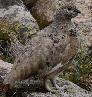
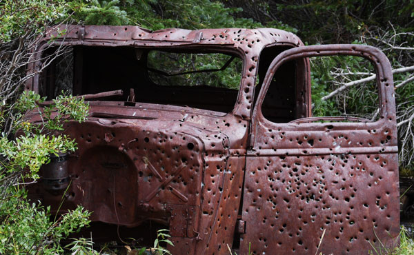
I had a great breakfast of hash browns of perfect texture and taste and fluffy scrambled eggs and chorizo at La Girasol. Today's section was scenic and on nice, well built and well maintained tread and some dirt roads. I saw a White Tailed Ptarmigan Lagopus leucurus as well as pikas and deer. I met a hiker who this year had hiked from Mexico to Wolf Creek Pass, flip-flopped to Rawlins, and was now hiking south back to Wolf Creek Pass. There were 2 nice log cabins that are periodically repaired, with good wood stoves, chinking, roofs, etcetera, but, unfortunately, some jerk had shot out the windows. An even nicer, obviously lived in log cabin was just up the hill. I found a scale along the way and weighed my pack; 39 pounds, including an eight day food supply, but not including my GPS or the clothes I was wearing.
Camp: A mile short of Chalk Creek Pass
Miles: 15 324
Wolf: Volume 5: Southern Colorado, Sawatch Range Segment Section 8, Maps 8, 7
Ley: Colorado 27, 26
Mountain Bike Solution
I've come up with a solution to at least part of the mountain bike problem. Some bikers are polite and don't ruin trails or ruin hiker's days. I have nothing against them. So we need to separate them from the worst: those who rush down on hikers so we have to jump out of the way, those who ruin trails, those who shout to each others so no one in the whole valley can enjoy peace and quiet, and so many more etceteras.
So the idea is to construct a trap kind of like the cliff traps ancient American Indians used to kill buffalo. We would build a 'Rad' trail straight down a mountain, so steep only an idiot would ride it. Half way down, we would clearly post that bikes have to turn left, and the left turn would be a fun ride the rest of the way down the mountain. But we would also have a trail going straight down, and clearly post that trail for hikers only. Just beyond the intersection would be a cliff, so any biker ignoring the hiker only sign would fall to their deaths. I don't think they would mind, as leaping to their deaths would be the most exciting ride of their lives - Totally Rad!!
Of course, there are a lot of jerks in the world, and if the whole valley filled in with bodies and bikes, pretty soon the cliff wouldn't kill them anymore. And the novelty of riding a bike over their dead friends would draw even more morons into mountain biking. So here we need to draw another lesson from the Indians. They tried to use every last part of the Bison they slaughtered as food, clothes, tools, etcetera. We would need to allow people to harvest all the detritus: bikes could be recycled, organs could be transplanted, etcetera.
Reminiscing About Gear
The oldest bit of gear I'm using on this trip is my Trigon Deva pack. I bought it circa 1990, when I was buying all sorts of bomb proof gear for a potential life long section hike of the Pacific Crest Trail. Since it had to carry a 7 pound 4 season tent, and a whole kit of other heavy, bomb proof gear, it too is heavy, bomb proof, high volume, and it comfortably suspends a lot of weight. During the last two years I have been hiking non-stop in this pack. The aluminum stiffeners have broken from fatigue and been removed. Zippers are failing, coming back open after they've been zipped. I think it will make it to Thanksgiving and the end of the two year hiking plan. That would be a fitting end to a pack that is almost a long time friend of mine.
I'm using a silnylon tarp and groundsheet I originally made for my 2003 PCT through hike. They are still going strong, though I did replace all the shock cord at the start of the two year plan. My fleece sweater is the one my mom bought for my 2003 PCT hike, and my fleece balaclava dates to my Seattle days, circa 1996.
The Merino Wool shirt that Needles lost and I found on the Florida Trail a year and a half ago finally wore out and was thrown away in Silverton. Big holes had worn through the back where the pack bears on my back. The sun hat I found on the same 2011 Florida Trail trip still keeps the sun off my head and neck, though the top bit of fabric was so degraded by the sun and torn by thorns that I tore it out while on the Grand Enchantment Trail in 2012.
A lot of my gear is too worn out to make it on to the shelves at a thrift store, but the more worn it looks, the more likely I have one or more great stories about it. I'll probably throw half of my gear away when I finish the two year plan around thanksgiving, but I'll miss it...
Saturday, August 18th, 2012
The Alpine Tunnel Rail Trail still has ties in place, though the tunnel was closed in 1910, 102 years ago. Incredible! At Sawmill Curve there was an interpretive sign about a derailment where tons of coal were spilt. The soil was still black with all the coal. And the soil nearby still felt spongy from the sawdust from the mill. I peered over Altman Pass, and there were remains of old rail buildings, some track, and a display probably of an old rail turntable. There were many beaver ponds today.
Camp: Mirror Lake - I hope the ATVs don't drive all night!
Miles: 17 341
Wolf: Volume 5: Southern Colorado, Sawatch Range Segment Sections 8, 7, Map 7
Ley: Colorado 26, 25
Sunday, August 19th, 2012
I saw a Moose cow and calf at Cow Creek, and Beaver ponds at Sanford, Cow, Pass, and Texas Creeks. There was a Grouse pair, and there was a lot of mica on ascent out of Prospector Gulch. From Mirror Lake to Sanford Creek Trail the trail was blown wide and torn up by ATV traffic, then for the remainder of the day there was often extensive motorcycle damage. I met a hiker who had done New Mexico last year and was section hiking Colorado this year. As darkness came, an owl flew right over my head, checking me out. He then hung around, observing me from a few different trees for about 10 minutes, before leaving for the night's hunt.
Camp: Beyond Prospector Gulch
Miles: 18 359
Wolf: Volume 5: Southern Colorado, Sawatch Range Segment Sections 6, 5, Map 7, 6
Ley: Colorado 25, 24
Monday, August 20th, 2012
A family gave me a bag of cherries! Mmm!! There was new CDT tread from Winfield to Sheep Gulch, and volunteers were extending the new tread southward. Thanks!! The new tread will skip Winfield and Rockdale altogether. I went into Twin Lakes, thinking I'd get a restaurant meal or some fresh food from the store, but arrived just after everything closed. Bummer!
Camp: Beyond Twin Lakes
Miles: 22 381
Wolf: Volume 5: Southern Colorado, Sawatch Range Segment Sections 5, 4 Maps 6-4
Ley: Colorado 24-22
Tuesday, August 21st, 2012
I saw an American Marten Martes americana - a rare sighting, so very thrilling. I had also seen ropey scat placed prominently on rocks, characteristic of the mink/weasel family. Also, squirrels here were quite brave in approaching and chiding me - perhaps warning all the squirrels in the area is a survival strategy where hunters like Marten are present. Later, a Mule Deer doe circled my camp at 10 yards, carefully observing me. Finally, I met Puck, who like me hiked the Pacific Crest Trail in 2003. It was good to catch up a bit, and he told me there's a plan being discussed for a PCT 2003 reunion to be held in the summer of 2013.
Camp: Beyond Mount Massive Wilderness
Miles: 16 397
Wolf: Volume 5: Southern Colorado, Sawatch Range Segment Section 3 Map 3
Ley: Colorado 22, 21
Wednesday, August 22nd, 2012
There were some beaver ponds.
Camp: 5 miles from Tennessee Pass
Miles: 11 408
Wolf: Volume 5: Southern Colorado, Sawatch Range Segment Sections 3, 2 Maps 3, 2
Ley: Colorado 21, 20
Thursday, August 23rd, 2012
I met a southbound thruhiker. Near Tennessee Pass was a trail magic stash of sodas and goodies. I'd just finished an awesome snack when the magician himself showed up. It's a real treat to meet the trail angels who make the effort to help hikers they'll typically never know. He gave me a ride into Leadville. Lead, Silver, Gold, Zinc and Molybdenum have historically been mined here, but tourism is the main business today. Many ores were sulfides, and decomposition of iron pyrite, fool's gold, mean the tailings leach sulphur as sulfuric acid into nearby streams, so there are many superfund sites nearby. Remediation efforts seem to concentrate on capping tailings piles to keep precipitation from leaching the piles. Some places dirt in retaining or crib walls would effloresce yellow sulphur or white crystals. There was a major 100 mile road bike race through town, and it was fun to cheer the racers on. I bought 6 books at the second hand store to entertain myself in the afternoons. Since there are groceries available in 22 and 44 miles, I'm carrying 15 grain bread, cheese, and fruit - much more appetizing than my typical trail fare. And I joined another hiker to prepare dinner and breakfast; eggs scrambled with spinach, tomatoes, and onions, corned beef hash, fresh spinach, avocado, cauliflower with cheese, and ice cream. It's great to get these nutritious meals in town. I hung out with Puck and Chris, both on the Colorado Trail. The Leadville Hostel is very nice, a first class operation.
Hostel: Leadville
Miles: 6 414
Wolf: Volume 5: Southern Colorado, Sawatch Range Segment Section 2 Map 2
Ley: Colorado 20
Silverthorne Weather Forecast
Friday, August 24 67F / 45F 50%
Saturday, August 25 69F / 45F 30%
Sunday, August 26 72F / 46F 10%
Monday, August 27 73F / 49F 20%
Tuesday, August 28 73F / 49F 20%
Wednesday, August 29 72F / 47F 30%
Thursday, August 30 72F / 46F 20%
Friday, August 31 71F / 46F 60%
Saturday, September 1 69F / 45F 40%
Friday, August 24th, 2012
Leadville has a 12 mile interpretive asphalt bike trail, The Mineral Belt, which I explored before heading back to the CDT. Leadville has quite an interesting history, and with this interpretive trail and a couple of museums, I recommend that any hiker with adequate time stop to explore a little. It will bring some of that almost forgotten history from school back to life.
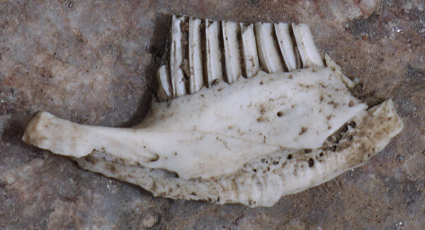
Back on the CDT, I saw a Mule Deer Buck with antlers in velvet, foundations and ordnance bunkers at the site of World War II's 10th Mountain Division's Camp Hale, and a skeleton of a domestic cattle bull whose horns had been sawn off.
Camp: 3 miles short of Kokomo Pass
Miles: 21 435
Wolf: Volume 5: Southern Colorado, Sawatch Range Segment Section 1 Maps 2, 1
Ley: Colorado 19
Saturday, August 25th, 2012
I hiked with Puck a half dozen miles to I70 and the Copper Mountain Ski Resort. I might recommend to other hikers walking the ridgeline between Searle and Kokomo Passes since the official route wanders aimlessly, and the ridge looked like it might be easy terrain and might have nice views. On the other hand, the marmots there were so used to hikers I was able to walk within 2 feet of several of them. I met Markus, a southbound CDT thruhiker.
Camp: Between I70 and Wheeler Lakes
Miles: 18 453
Wolf: Volume 5: Southern Colorado, Sawatch Range Segment Section 1 Map 1, Volume 4: Northern Colorado, Vasquez-Gore Segment Section 3 Map 22
Ley: Colorado 19, 18
Sunday, August 26th, 2012
I saw several Mule Deer and a guy bow hunting Elk. There were many huckleberry bushes, none with ripe berries. This Eagles Nest Wilderness section has apparently been officially replaced by the Colorado Trail between Copper Mountain and Silverthorne, but it's quite beautiful, the trail is in good repair, and one avoids the crowds and bikes on the CT. Plus, my maps and guidebook don't show the new route, so here I am.
Camp: Where the Mesa Cortina Trail / CDT crosses South Willow Creek
Miles: 15 468
Wolf: Volume 4: Northern Colorado, Vasquez-Gore Segment Section 3 Maps 22, 21
Ley: Colorado 18, 17
Monday, August 27th, 2012
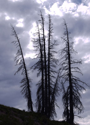
I resupplied in Silverthorne. My next resupply will be Monday, September 3rd, Labor Day, in Grand Lake. There are many standing dead pine trees here - victims of the Mountain Pine Beetle Dendroctonus ponderosae. On my way out of Silverthorne, a group stopped and gave me a ride to the trailhead, though I was not trying to hitch. It turned out two of the group had just gotten married, and today's hike was part of the celebration. Good luck in married life!!
Camp: Between Silverthorne and Ptarmigan Pass
Miles: 11 479
Wolf: Volume 4: Northern Colorado, Vasquez-Gore Segment Section 3, 2 Map 21
Ley: Colorado 17, 16
Grand Lake Weather Forecast
Monday, August 27 - 79F / 47F 40%
Tuesday, August 28 - 79F / 47F 30%
Wednesday, August 29 - 80F / 48F 20%
Thursday, August 30 - 76F / 45F 30%
Friday, August 31 - 74F / 45F 30%
Saturday, September 1 - 72F / 44F 30%
Sunday, September 2 - 71F / 43F 30%
Monday, September 3 - 72F / 44F 0%
Tuesday, September 4 - 74F / 43F 20%
Wednesday, September 5 - 70F / 40F 20%
Tuesday, August 28th, 2012
Today's section was sometimes cross country, as bits of trail disappeared or headed off in the wrong direction. I took a few extra gps points to help future hikers along. I met two elk bow hunters who had earlier inadvertently called in a cougar Felis concolor while trying to call elk. The panther stalked within 10 yards, when they scared it away with a pistol shot at a rock near the cat. I also met a couple hiking about half the CDT southbound, and exchanged much info.
Camp: Bobtail Creek Valley
Miles: 12 491
Wolf: Volume 4: Northern Colorado, Vasquez-Gore Segment Section 2 Map 21, 20
Ley: Colorado 16, 15
Wednesday, August 29th, 2012
I saw a few Mule Deer and a Bull Moose in Bobtail Valley. The Henderson Molybdenum mine was running well, if the noise was any indication. Survey markers, test bores, and claim markers were everywhere along the trail within a couple mile radius of the mine. Red Mountain has already been extensively mined. We hikers need to keep aware and not let the CDT be mined away!!!
Camp: Berthoud Pass
Miles: 16 507
Wolf: Volume 4: Northern Colorado, Vasquez-Gore Segment Section 2, 1, Front Range Segment 4, Map 20, 19
Ley: Colorado 15, 14
Trails Illustrated: 103 - Winter Park, Central City, Rollins Pass
Book: I finished reading Gaia, in which JE Lovelace explains his theory that since the chemical composition of the earth's atmosphere and oceans is advantageous to life, yet not what one might expect on a dead planet, and yet has remained stable during two periods, once before oxygen entered the atmosphere, then again after aerobic life established itself, and since the earths oceans and atmosphere have remained at temperatures amenable to life for 3.5 billion years, at least in equatorial regions, that life in general must, through many negative feedback loops, control the chemical composition and temperature of the earth at levels optimal for life. I'm not convinced, but I enjoyed the book.

Thursday, August 30th, 2012
Ripe Raspberries Rubus idaeus were a welcome snack in the Mill Creek and Fall River valleys. There was an old riveted pipe paralleling Loch Lomond Road.
Camp: Loch Lomond Road
Miles: 12 519
Wolf: Volume 4: Northern Colorado, Front Range Segment 4, Map 19, Off of Wolf Route
Ley: Colorado 14
Trails Illustrated: 103 - Winter Park, Central City, Rollins Pass
Book: I finished reading A Desert Bestiary, in which Gregory McNamee has gathered various historical and contemporary writings about desert animals from around the globe.
Friday, August 31st, 2012
I met two southbound CDT thruhikers, Roaring Lion and Transient.
Camp: Beyond Hamilton Creek
Miles: 17 536
Wolf: Volume 4: Northern Colorado, Front Range Segment 4, 3, Map 18, 17, Off of Wolf Route
Ley: Colorado 14, 13
Trails Illustrated: 103 - Winter Park, Central City, Rollins Pass, 102 - Indian Peaks, Gold Hill
Book: I finished reading The Tracker, an autobiographical book by Tom Brown Junior. He has authored some excellent books on interpreting animal signs: his life story is not as interesting to me. But the book I found in Leadville is 3 of his autobiographical books in one, so that's what I'll be reading for a couple of days.
Saturday, September 1st, 2012
I saw 3 Moose and two Mule Deer. I stopped in at the Little Moose Trading Post to buy some snack tastier than what was in my pack, but the proprietors declared themselves trail angels and wouldn't take my money. They were sad to hear they had missed at least 4 thruhikers I had met in the last week or so. I had a Coke, cookies, a brownie, and a cinnamon roll. They were excellent; many thanks! All the sugar came in handy on the Knight Ridge Trail, which had many blowdowns.
Camp: Twin Creek Outlet
Miles: 17 553
Wolf: Volume 4: Northern Colorado, Front Range Segment 2, 1, Map 17, 16, Off of Wolf Route
Ley: Colorado 12, 11
Trails Illustrated: 103 - Winter Park, Central City, Rollins Pass, 102 - Indian Peaks, Gold Hill, 200 - Rocky Mountain National Park
Sunday, September 2nd, 2012
I saw a Bull Moose on my way into Grand Lake. For the previous two days, I had a probable urinary tract infection, the symptoms being dark urine, frequent urge to pee, and a burning sensation in the end of the urethra starting as I finished peeing and ending a few seconds later. Within a few hours of reaching the hostel, all symptoms cleared, probably due to less motion from not walking, rest, and better cleanliness after a shower and laundry.
Hostel: Grand Lake
Miles: 8 561
Wolf: Volume 4: Northern Colorado, Front Range Segment 1, Map 16
Ley: Colorado 11, 10
Trails Illustrated: 102 - Indian Peaks, Gold Hill, 200 - Rocky Mountain National Park
Monday, September 3rd, Labor Day, 2012
I saw several Bull Moose and Mule Deer while day hiking and slack packing my own variant of the CDT Rocky Mountain National Park Loop. I ascended the North Inlet Trail and descended the Tonahutu Trail, skipping the Green Mountain Trail CDT section as it runs near busy US34. I also saw two Red Foxes, Vulpes vulpes. There was a large bore wooden pipe rotting along the last / lowest mile or so of the Tonahutu Trail.
Hostel: Grand Lake
Miles: 25 586
Wolf: Volume 4: Northern Colorado, Never Summer Range Segment 4, Map 16, 15, Off Wolf Route
Ley: Colorado 10a
Trails Illustrated: 200 - Rocky Mountain National Park
Steamboat Springs Weather Forecast
Tuesday, September 4 - 79F / 43F 0%
Wednesday, September 5 - 78F / 42F 0%
Thursday, September 6 - 79F / 43F 0%
Friday, September 7 - 73F / 39F 0%
Saturday, September 8 - 75F / 44F 10%
Sunday, September 9 - 76F / 44F 0%
Monday, September 10 - 76F / 43F 20%
Tuesday, September 11 - 74F / 42F 20%
Tuesday, September 4th, 2012
I saw a moose and a road killed 24" snake, beige with black speckles. I met Freebird and later Mike and Naomi, all southbound CDT thruhikers, and heard Yogi is headed my way too.
Camp: West of Bowen Pass
Miles: 17 603
Wolf: Update to Volume 4: Northern Colorado, Rabbit Ears Range Segment 5, 4
Ley: Colorado 10, 9
Trails Illustrated: 200 - Rocky Mountain National Park, 115 East - Rand, Stillwater Pass
Book to Buy: Rocky Mountain Mammals by David M Armstrong has good natural history and activity descriptions of many North American wild mammals.
Wednesday, September 5th, 2012
This morning many elk were bugling and woodpeckers drumming around me. Other than drivers on Colorado Highway 125 at Willow Creek Pass, I've seen no one since Mike and Naomi near Bowen Pass. Just before dark, as birds were catching insects from mid-air over me, an owl came hunting. For a few minutes many of the birds harassed the owl until he left the area.
Camp: Saddle West of Parkview Peak
Miles: 17 620
Wolf: Update to Volume 4: Northern Colorado, Rabbit Ears Range Segment 4, 3
Ley: Colorado 9, 8
Trails Illustrated: 115 East - Rand, Stillwater Pass
Thursday, September 6th, 2012
On the windy ridgelines, American Kestrel Falco sparverius were surfing the wind waves, holding positions quite closely, and hunting. Sometimes pairs flew together. There were other falcon family birds also hunting in the ridge winds. I also saw Steller's Jays Cyanocitta stelleri and groups of grouse.
Camp: Junction of Jeep Road and Arapaho Ridge Trail 1135
Miles: 13 633
Wolf: Update to Volume 4: Northern Colorado, Rabbit Ears Range Segment 3, 2
Ley: Colorado 8, 7
Trails Illustrated: 115 East & West - Rand, Stillwater Pass
Friday, September 7th, 2012
Early in the morning, Coyotes Canis latrans were howling, so distant as to be almost inaudible. I sat down and enjoyed their singing for the few minutes it lasted. I saw a few grouse and hawks. There were American Beaver Castor canadensis dams and lodges in Indian Creek. Coyotes howled and cows mooed all night, all around me.
Camp: NF Boundary, Road 103/53, Indian Creek
Miles: 16 649
Wolf: Update to Volume 4: Northern Colorado, Rabbit Ears Range Segment 2
Ley: Colorado 7, 6
Trails Illustrated: 115 West - Rand, Stillwater Pass
Book: I finished reading The Vision by Tom Brown Junior.
Saturday, September 8th, 2012
I walked to Colorado Highway 14 and hitched to Steamboat Springs for resupply.
Motel: Steamboat Springs
Miles: 10 659
Wolf: Update to Volume 4: Northern Colorado, Rabbit Ears Range Segment 2
Ley: Colorado 6
Trails Illustrated: 115 West - Rand, Stillwater Pass
Steamboat Springs Weather Forecast
Sunday, September 9 - 75F / 47F 0%
Monday, September 10 - 73F / 50F 30%
Tuesday, September 11 - 62F / 46F 40%
Wednesday, September 12 - 61F / 39F 30%
Thursday, September 13 - 65F / 38F 0%
Friday, September 14 - 67F / 41F 10%
Saturday, September 15 - 67F / 41F 30%
Sunday, September 16 - 66F / 43F 0%
Monday, September 17 - 67F / 43F 10%
Sunday, September 9th, 2012
In town, I walked the bike path along the Yampa River, and picked up a few more supplies. I then hitched to Rabbit Ears Pass and continued my northbound walk. I sat down with a couple of muzzle load elk hunters and enjoyed a couple of ice cold beers, a sausage sandwich, and some very entertaining conversation. They advised me on how to catch various small game and dry it into jerky while on the trail. They also recommended I catch a black bear and use the hide to make a coat. Just imagining the reactions of other long distance hikers to one of us in a self caught, tanned, and stitched bear coat will keep me laughing for days. Many thanks.
Camp: Fishhook Lake
Miles: 9 668
Wolf: Update to Volume 4: Northern Colorado, Mount Zirkel Wilderness Segment 6, 5
Ley: Colorado 5

Resupply Strategy
To illustrate a typical resupply stop, I'll detail and discuss my Steamboat Springs trip.
Getting to Town
Friday night I camped just a few miles short of Colorado Highway 12 in the hope that I could start hitching early in the morning and arrive in town early enough to address all chores. Traffic was light, cars moved at well over 70 mph, and the highway shoulders were too narrow to stop without obstructing traffic. I got to town by noon, but that was late enough that the Post Office was closed and I could not mail the Trails Illustrated maps I'd borrowed from Mother Nature's Son back. Laundry, Groceries, a Shower and a Motel were the remaining items and were easily addressed.
Groceries
There are 4 categories of grocery items I need in towns. One is batteries, aspirin, and other expendable non food items, which I replace as required. Two is town food, fruits and vegetables, dairy, perhaps cooking supplies if a kitchen is available. I want to eat all the nutritious foods not available on trail when I'm in town. Three is food that will last just a few days in a pack. I got 8 pieces of fried chicken at the supermarket, a rare treat. It will all be eaten by morning. A pack of carrots must also be eaten by sometime tomorrow. Whole grain bread and cheese must be eaten by the third day or so. The fourth category is foods that last a long time in the pack. I took a nine day supply, so six days are in this category. For each day there are granola bars, mashed potatos, nuts, jerky, raisins and dried bananas. I would have bought granola, but they didn't stock it and a bit of variety is nice anyway. Between whole grains and nuts, my protein and calorie requirements are addressed. On many trips I would eat many wild foods to provide vitamins, etcetera, but the altitude of this trail is too high for much forageable food to grow. A vitamin pill every few days is my solution.
Monday, September 10th, 2012
I met Caveman, who had walked south from the Canadian border, but had skipped much of the Great Basin and Red Desert and had just started again after getting a ride to Steamboat Springs. Then I met Not Yet and Making Tracks, hiking south from Butte, Montana. All three hoped to make it through New Mexico. Truck Driver Creek is dry, the cabin to the south has ok water in ponds, but much of the other water sources north of Highway 70 are too muddy to be useable or are dry. All southbounders are recommending the highway alternate route into Rawlins. I find that pretty disappointing.
Camp: 2 miles past Buffalo Pass
Miles: 12 680
Wolf: Update to Volume 4: Northern Colorado, Mount Zirkel Wilderness Segment 5, 4
Ley: Colorado 5, 4
Tuesday, September 11th, 2012
A flock of grouse walked by as I took a rest break. Five Mountain or Bighorn Sheep Ovis canadensis were high on Lost Ranger Peak. In the evening, Coyotes Canis latrans were howling and yipping somewhere to the north.
Camp: Beyond Lost Ranger Trail Junction
Miles: 12 692
Wolf: Volume 4: Northern Colorado, Mount Zirkel Wilderness Segment 4, 3, 10, 9
Ley: Colorado 4, 3
Books: I finished reading Awakening Spirits by Tom Brown Junior and Ralph Waldo Emerson's Nature.
Wenesday, September 12th, 2012
Yesterday afternoon's rain continued through the night and resulted in a cold, wet, mist shrouded morning. Seven Bighorn Sheep Ovis canadensis were were in the high meadows. I saw some Mule Deer and a Bald Eagle Haliaeetus leucocephalus. A hawk circled slowly above me near the Seedhouse Guard Station.
Camp: North Fork Elk River
Miles: 12 704
Wolf: Volume 4: Northern Colorado, Mount Zirkel Wilderness Segment 3, 2, 1, off route via Three Island Lake, 9
Ley: Colorado 3, 2
Book: I finished reading Walking by Henry David Thoreau and Seashore Life of Southern California by Sam Hinton.
Thursday, September 13th, 2012
I observed a Ruffed Grouse Bonasa umbellus for a while. Most of the grouse I've seen on this trip were Ruffed, and they generally allow me to observe from about 20 feet as they forage, intently studying the ground, for whatever food appeals to them. I see them both singly and in groups of 6 or 8. Another bird who visits regularly and allows observation from as little as 5 feet is the Gray Jay Perisoreus canadensis. Also known as camp robbers, they often approach people in hopes of a handout or some spilled lunch. They can try, but any food I carry 100 miles is eaten by me, not tossed to birds. Right before dark a Long Tailed Weasel, Mustela frenata, walked by my camp, just 15 feet away. Once he saw me observing, he walked out of visual range. This is a pretty rare sighting, so I was pretty happy.
Camp: Road 499
Miles: 12 716
Wolf: Volume 4: Northern Colorado, Mount Zirkel Wilderness Segment 1, 8
Ley: Colorado 2, 1
Friday, September 14th, 2012
I found a peanut in the shell, doubtless dropped by some hunter. It was tasty, and got me singing the kid's song "Found a Peanut." Summer ended and autumn started about a week ago. Until then, I had more or less worn shorts 24 hours a day, but since I often wear all my warm clothes for the first few hours of morning hiking. Aspen stands are yellow and occasionally orange. Some brush is also changing colors.
Colorado Wyoming Border
Today I crossed the Colorado Wyoming Border. There are less than 100 miles to go and perhaps 50 of that will be out of mountains and in desert conditions. So that foreboding sense I often get towards the end of a big hike is here. With so much extra time to burn before my Arizona Trail hike, I have been hiking very short days, often finishing by noon or one. This also is odd for me as hiking usually is my all day entertainment. The books I acquired in Leadville were all read a couple of days ago.
History I Can See - The Stock Driveway and Fireline
Yesterday's and today's walk have been along an historic stock driveway and firebreak. The stock driveway's center and sides are marked with old, rusted metal signs, on most of which the black lettering long ago faded away. Stock driveways are how cowboys and shepherds of long ago moved flocks and herds from pasture to pasture or to and from markets and railheads, and such stock drives are the source of many cowboy tales. The century plus old firebreak is still quite visible. Mature trees are in its center fairly often, proof that it has not been maintained as a firebreak in decades. Sometimes forest has fully covered it, and often young trees are colonizing it. Yet still there are long swaths where the trail continues down a naked, grassy corridor, and fully dense forest starts at the edges that were cut over 100 years ago.
Camp: North of Pipeline Trail Road 809
Miles: 14 730
Wolf: Volume 4: Northern Colorado, Mount Zirkel Wilderness Segment 1, Sierra Madre Segments 6, 5
Ley: Colorado 1, Wyoming 44, 43
Saturday, September 15th, 2012
I awoke before light, and watched stars and satellites for a while. When there was just enough light to pack, and I was getting ready to rise, a Red Fox came into my camp to investigate the commotion. I was still in my sleeping bag and he came within a dozen feet on my left side, circled around to my right side, approached within a dozen feet again, then ran off over a hill. I saw Elk on the ridgeline above me in my first half hour of hiking. In Huston Park I saw a whitish Coyote. My left boot has started to separate between the sole and upper behind the big toe at the ball. The opening is about 3/4" long, and the stitching behind that has also failed. Even so, I think these boots will be fine going into Rawlins. Between the CDT, the Sierra High Route, and a few day hikes, these boots probably have over 900 miles of wear.
Camp: Baby Lake Trail 859 Junction
Miles: 11 741
Wolf: Volume 4: Northern Colorado, Sierra Madre Segments 5
Ley: Wyoming 43
Sunday, September 16th, 2012
I hiked to Wyoming Highway 70 and went to Encampment and Riverside for resupply. Judy, who ran the visitor center picked me up and I enjoyed our conversations.
Log Cabin: Riverside
Miles: 3 744
Wolf: Volume 4: Northern Colorado, Sierra Madre Segment 5
Ley: Wyoming 43, 42
Walking Route into Encampment and Riverside
I've often thought that we long distance hikers spend too much time and energy hitchhiking. Traffic was light on Wyoming 70. Judy was the fourth driver through, and picked me up, but that was after two hours of waiting. This is but one example of a difficult hitch: many resupply stops are difficult. So I've been trying to find interesting routes by which we could simply walk to towns. For example, from the CDT's crossing of the Wyoming Colorado border, one could walk about fifteen miles into Encampment and Riverside. First, a mile of cross country northeast, then a mile on dirt roads, then down the Encampment River Trail 470 to the Oddfellow Trailhead and Campground, crossing the bridge there, and following BLM Road 405 and County Road 353, would take a hiker right into town. The river route would be quite scenic and would traverse the Encampment River Wilderness. The ecosystems would be interesting and different than on the divide because of the major river and lower altitude.
Encampment Weather Forecast
Monday, September 17 - 64F / 38F 10%
Tuesday, September 18 - 71F / 41F 0%
Wednesday, September 19 - 71F / 40F 0%
Thursday, September 20 - 71F / 39F 0%
Friday, September 21 - 62F / 38F 0%
Saturday, September 22 - 65F / 39F 0%
Sunday, September 23 - 68F / 41F 0%
Monday, September 24 - 70F / 41F 0%
Tuesday, September 25 - 69F / 42F 0%
Monday, September 17th, 2012
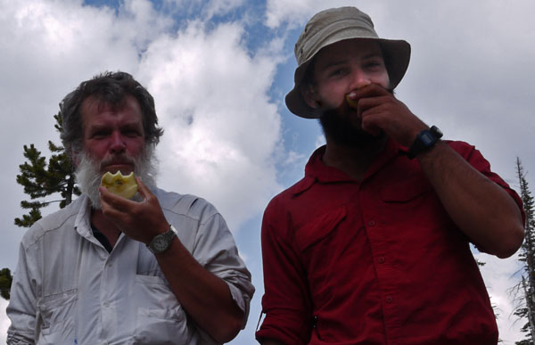
I spent much of the day in Encampment, visiting the Post Office, Library, and Museum, and met Tamir, an Israeli southbound CDT thruhiker. Midafternoon, we set out to hitchhike back to Battle Pass to resume our hikes. We hadn't even gotten out of town and started hitching when local Patty offered us a ride out. That's almost a miracle, and many thanks. At the pass we talked a while and Tamir mentioned that he had hoped to buy apples in town to properly celebrate Hebrew New Years, which is today. I had bought an apple (for a small fortune), so we celebrated.
Camp: A mile past Battle Pass
Miles: 3 747
Wolf: Volume 4: Northern Colorado, Sierra Madre Segment 4
Ley: Wyoming 42
Book: Ishmael by Daniel Quinn. - A gorilla teaches us about the greed of societies starting with the agricultural revolution in the Tigris-Euphrates Fertile Crescent.
Encampment History
Encampment had a large copper mining complex a century ago, and the museum had all sorts of displays on that, including parts of the then worlds longest ore bucket arial tramway rebuilt on site. The original tramway was gravity powered and transported ore from the mines west of Battle Pass over the divide to Grand Emcampment, where the mill complex was located. The museum had all sorts of other excellent exhibits and was free. Other important industries were lumber and railroad ties.
Israeli National Trail
There are about 20 plastic topo maps which cover all of Israel at 1:50,000. On the back is additional information and blown up maps of areas of interest. Not all the maps have the INT on them, so some are not required. The INT is shown as are all side trails which would be of interest. In the northern part of the country, a hiker passes through villages often enough that tap water supplies all needs. In the south, trail angels have buried enough caches that so long as the hiker carries a couple of gallons, there won't be problems. In national parks, camping is allowed only in designated areas.
Tuesday, September 18th, 2012
A wildfire burned somewhere upwind, bringing pine smoke smells and a greyish brown haze that obscured distant views. A Bull Moose browsed all around my campsite, coming occasionally within 20 yards. I suppose a nearly motionless guy reading books doesn't seem like much of a threat to a Moose.
Camp: 5 1/2 miles Northwest of Bridger Peak
Miles: 9 756
Wolf: Volume 4: Northern Colorado,Update, Sierra Madre Segment 4
Ley: Wyoming 42, 41
Book: American Nature Writing 1996 300 pages of nature essays.
Wenesday, September 19th, 2012
I hope that the reduced smoke smell and haze mean the wildfire is less of a threat. Regardless, I'm losing altitude as I climb down through the foothills into the Red Desert and I may not be in trees much longer. Yesterday's climb over Bridger Peak was my last brush with 11,000 feet: today I camped at less than 9,000 feet and I'll gradually descend below 6,800 feet as I approach Rawlins. Cacti and sage dot grasslands which alternate with coniferous woodlands, accented with autumn tinted Aspens. I saw a Mule Deer and a Grouse.
Camp: A Mile Beyond Divide Peak
Miles: 7 763
Wolf: Volume 4: Northern Colorado, Update, Sierra Madre Segment 4
Ley: Wyoming 41
Book: The Death of Bernadette Lefthand Ron Querry spins a tale of murder and cultural differences between various Indian Tribes in northwestern New Mexico.
Thursday, September 20th, 2012
I left the Medicine Bow NF, the foothills, and all coniferous trees behind. In the rolling plains are grass and sage. One small stand of aspens is just south of North Fork Savery Creek, and eight foot high willows grow along the creek. They are the food for the beavers who have dammed the creek every hundred yards or so. I saw cattle and a mule deer buck in the plains, but there are many more Pronghorn Antelope Antilocapra americana. While reading in my camp I saw a small American Badger Taxidea taxus. There is sedimentary rock in the soil, with some fossils, but nothing I can identify.
Camp: North Fork Savery Creek
Miles: 8 771
Wolf: Volume 4: Northern Colorado, Update, Sierra Madre Segment 4, 3
Ley: Wyoming 40
Book: Western Mining An Informal Account of Precious-Metals Prospecting, Placering, Lode Mining, and Milling on the American Frontier from Spanish Times to 1893 by Otis E Young, Jr.
Friday, September 21st, 2012
A full size American Badger was excavating a hole in Road 3306/CDT and allowed me to approach to within 20 feet: he then descended the burrow. There were many cattle and antelope around. With no shade in the rolling plains here, it was too bright to read. Besides, my food stocks were dwindling. I decided to end my extra slow pace and walked into the evening. A chorus of coyotes entertained me from the stock pond east of the trail a few miles north of the last crossing of Muddy Creek.
Camp: Along Road 3301 / CDT beyond spring 5 miles north of the last crossing of Muddy Creek
Miles: 24 795
Wolf: Volume 4: Northern Colorado, Update, Sierra Madre Segment 3, 2, 1
Ley: Wyoming 39, 38
Saturday, September 22nd, 2012
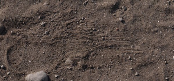
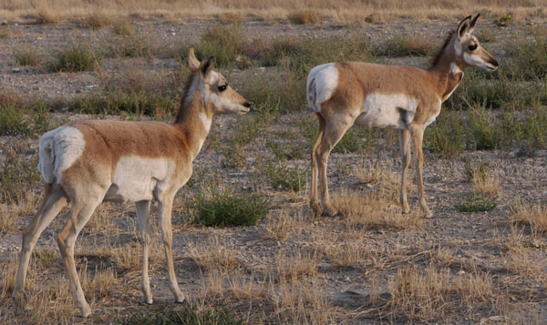
I met southbounders Miss Parkay and Coach K. David with the BLM stopped and gave me some water and told me where I could camp in the desert outside Rawlins for a few days. We discussed animal tracks and he said some prints I'd seen with hair brush marks might be North American Porcupine Erethizon dorsatum. The tail makes brush marks and the foot pad has a pebbly texture, as I've been seeing. Part of today's route was on the Overland Trail, an old stagecoach route. My bus ride away, in a couple of days, also roughly followed the Overland Trail, and the original Transcontinental Railroad Route, into Colorado. After a few hungry days, all you can eat Chinese in Rawlins was great. There are tame antelope in town: you can approach within 20 feet.
Motel: Rawlins
Miles: 28 823
Wolf: Volume 4: Northern Colorado, Update, Sierra Madre Segment 1
Ley: Wyoming 38 - 35
Rawlins Weather Forecast
Sunday, September 23- 79F / 47F 10%
Monday, September 24 - 73F / 43F 30%
Tuesday, September 25 - 65F / 40F 30%
Wednesday, September 26 - 66F / 41F 30%
Thursday, September 27 - 70F / 39F 30%
Sunday, September 23rd, 2012
I walked 15 miles northeast of Rawlins via Wyoming Highway 76, Sinclair, and the Seminoe Alcova Back Country Byway 351 to the Dugway Recreation Area on the Platte River. I saw a Mule Deer, several Rabbits, and many Pronghorn Antelope. I saw a roadkilled Horned Lizard but no live reptiles, though it was warm enough. In the river were many shed crayfish shells, and up in the camp area were some mature broken shells from some crayfish feast.
Camp: Dugway Recreation Area / Platte River
Miles: 15 838
Map: BLM Rawlins, Wyoming 30 x 60 Minute Topographic
Book: The Ancient Engineers L. Sprague de Camp
Monday & Tuesday, September 24th & 25th, 2012
I saw a couple of beaver swimming. The pronghorn just south of the camp were in rut, so males were chasing does a bit, and occasionally calling. Ravens flew above the river. A few rabbits were around. Coyotes sang in crepuscular hours. There was a bit of thunder, a couple of brief showers, and some virga.
Camp: Dugway Recreation Area / Platte River
Miles: 2 840
Map: BLM Rawlins, Wyoming 30 x 60 Minute Topographic
Wednesday, September 26th, 2012
I returned to Rawlins, resupplied for the Arizona Trail, got a haircut, mailed my CDT guides home, worked on the website, and generally cleaned up and reorganized.
Motel: Rawlins
Miles: 17 857
Map: BLM Rawlins, Wyoming 30 x 60 Minute Topographic
Thursday & Friday, September 27th & 28th, 2012
I took the bus from Rawlins, Wyoming to Denver, Colorado Thursday, overnight to Las Cruces, New Mexico, and Friday to Phoenix, to start the Arizona Trail. Along the way I passed through Albuquerque, where I finished the Grand Enchantment Trail a few months ago, and Deming, where I started the CDT last year.
Miles: 2 859
Post Hike Thoughts, Colorado and Wyoming CDT
There has been no snowpack on the trail, though there have been patches far below me off trail. What a difference from my 2011 hike. I'm glad I stopped last year and resumed this year. I've seen way more wildlife and flowers than I otherwise would have. The Long Tail Weasel and American Marten sightings were special treats, as I consider them rare. So were the Badgers. The Moose were a surprise, as I had thought of them as living only along the Canadian border, but they turn out to be common here. Seeing 3 Red Fox seems like a lot. There are surprisingly few edible wild plants on the CDT.
Ecosystems
There have been just a few ecosystem types; Scree with Pikas, Ridgeline Meadows with Marmots, Coniferous Forest, and Willow - Beaver Riparian Corridors. I've found the lack of variety a bit monotonous at times. The last 50 miles to Rawlins were sage and grass plains, occasionally with Aspen growing on north facing slopes, and with willows and beavers in riparian corridors along streams.
History
With the exception of the Monarch Pass Game Drive, there hasn't been much American Indian History to see. But there are many mining ruins of various eras, and an astounding number of log cabins. Leadville also has a rich history. A little history reading could go a long way toward making the Colorado CDT come to life.
Motor Traffic on CDT
A lot of motor vehicle traffic leaves the Colorado CDT torn up in places, and meeting ATVs, motorcycles, etcetera, can spoil the solitude and wildlife viewing opportunities.
Weather
The weather for the first week or so was absolutely atrocious. Electrical storms would start mid day and continue into the night, with thunder every few seconds. Hiking was often limited to less than half the day. After Silverton, the weather has been fine, with occasional afternoon thunder, hail, and rainstorms of reasonable duration. My hiking was not much curtailed. There were no snow falls while hiking, but they started before I got out of Wyoming on the bus.
Mountain Pine Beetle
Probably half the forests have been heavily damaged by beetle infestations. Often half or more of the trees in an area are standing dead, sometimes 99% dead.
Colorado CDT Planning Table |
||
| Book | Segment | Miles |
|---|---|---|
| Cumbres Pass Colorado 17 To Rawlins: 887.3 | ||
| V5 Southern Colorado | South San Juan | 64.5 |
| Wolf Creek Pass US160 To Rawlins: 822.8 | ||
| V5 Southern Colorado | San Juan Mountains | 74.9 |
| Junction Colorado Trail To Rawlins: 747.9 Ley Map CO37 | ||
| None | Colorado Trail Section 23 | 8.0 |
| Rio Grande Reservoir Road To Rawlins: 739.9 | ||
| None | Colorado Trail Section 24 | 20.2 |
| Molas Pass To Rawlins: 719.7 | ||
| None | Colorado Trail Section 25 | 20.9 |
| Bolam Pass Road To Rawlins: 698.8 | ||
| None | Colorado Trail Section 26 | 10.9 |
| Hotel Draw Road To Rawlins: 687.9 | ||
| None | Colorado Trail Section 27 | 20.6 |
| Cumberland Basin To Rawlins: 667.3 | ||
| None | Colorado Trail Section 28 | 21.5 |
| Kennebeck Trailhead Terminus To Rawlins: 645.8 | ||
| None | Road to Durango | 3.0 |
| Durango To Rawlins: | ||
| Narrow Guage Train | ||
| Silverton To Rawlins: 642.8 | ||
| V5 Southern Colorado | San Juan Mountains | 51.1 |
| Colorado 149 To Rawlins: 591.7 | ||
| V5 Southern Colorado | Cochetopa Hills | 101.0 |
| Monarch Pass US50 To Rawlins: 490.7 | ||
| V5 Southern Colorado | Sawatch Range | 131.7 |
| Copper Mountain To Rawlins: 359.0 | V4 Northern Colorado | Vasquez - Gore | 54.8 |
| Berthoud Pass To Rawlins: 304.2 | V4 Northern Colorado | Front Range | 52.1 |
| Grand Lake To Rawlins: 252.1 | V4 Northern Colorado | Never Summer Range | 42.9 |
| Illinois River To Rawlins: 209.2 | V4 Northern Colorado | Rabbit Ears Range | 45.4 |
| Colorado Highway 14 To Rawlins: 163.8 | V4 Northern Colorado | Mount Zirkle Wilderness | 65.2 |
| Colorado Wyoming Border To Rawlins: 98.6 | V4 Northern Colorado | Sierra Madre | 98.6 |
| Rawlins, Wyoming | ||
| Book | Segment | Miles |
The Gear I Used |
||
| Things I Wore | Comments | |
|---|---|---|
| Short Pants | ||
| Long Sleeved Shirt | ||
| Sun Hat | ||
| Boots | ||
| Wool Ankle Socks | ||
| Underwear | ||
| Panasonic G1 Micro 4/3 Camera | 45-200 Lens, 14-45 Lens, assorted filters, bag, etcetera | |
| Wallet | ||
| Garmin 450T GPS | CDT and CT Tracks Loaded, Has Topo Map | |
| iPod Touch | For writing this journal | |
| Things in My Pack | Comments | |
| Jim Wolf Guide, Ley Map, More Maps, Rockies nature guide | ||
| Flashlight | 1 AA Cell Aluminum LED | |
| Key | ||
| Aspirin, Tylenol, Vitamins | ||
| Lip Wax | ||
| Sunscreen | ||
| Glacier Glasses | ||
| 2 Pair Reading Glasses | ||
| Compass | ||
| Cell Phone | ||
| Cigarette Lighter | ||
| Fingernail Clippers | ||
| Scissors | ||
| Battery Charging | ||
| iPod Cable and Charger | ||
| Camera Cord and Charger | ||
| Phone Charger | ||
| 3 way plug | ||
| Extra AA Lithium Batteries | For Steripen, GPS, and Flashlight | |
| Eating Gear | ||
| Spoon | ||
| Water Bottle | ||
| Steripen | UV Water Sterilizer: I've now used the Steripen for months, since the Grand Enchantment Trail without getting sick. So it works well enough by that standard. Premium lithium AA batteries last long enough and are available in most towns. Sometimes these are quite expensive, but it's much easier than procuring replacement filter cartridges, so that aspect too is generally good. My chief complaint is that it often declares a fault, turns the red error light on, and stops the Ultraviolet Sterilization prematurely, though the batteries are not dead and it will complete the cycle if reset. This error detection does not seem to have any value and is often a nuisance. I wonder if I can modify it to eliminate this useless, annoying, and battery wasting 'feature' or procure one without this problem. | |
| Potable Aqua | Backup Chemical Water Sterilizer | |
| Bear Rope | ||
| Hygiene | ||
| Toilet Paper | ||
| Toothbrush, Paste, and Floss | ||
| Sleeping Gear | ||
| Silnylon Tarp and Groundsheet | ||
| Sleeping Bag | ||
| Foam Pad | ||
| Backpack | ||
| Trigon Deva | ||
| Plastic garbage bag | To keep gear dry | |
| Clothing | ||
| Wool Socks | ||
| Rain Jacket | ||
| Rain Pants | ||
| Fleece Shirt | ||
| Fleece Pants | ||
| Fleece Balaclava | ||
Some Locations along the Continental Divide Trail |
|||||
| Name | Latitude | Longitude | Comment | On Continental Divide Trail? | Water Source? |
|---|---|---|---|---|---|
| Blue Bus Santa Fe Bus Stop | 35.689070 | -105.939068 | Off CDT | No Water | |
| CDT Cumbres Pass | 37.018236 | -106.450868 | On CDT | No Water | |
| CDT813 2011DetourSignRemoved | 37.025205 | -106.486873 | On CDT | No Water | |
| CDT Sweet Tasting Spring | 37.046254 | -106.510382 | On CDT | Water Source | |
| +813CDT Trail to East | 37.054600 | -106.506031 | On CDT | No Water | |
| +813CDT 736 Hazard On CDT Sign | 37.080076 | -106.516202 | On CDT | No Water | |
| CDT SouthSanJuanWildernessBndry | 37.086082 | -106.517667 | On CDT | No Water | |
| +813CDT 731 | 37.134388 | -106.556833 | On CDT | No Water | |
| +813CDT 727 Trail Lake | 37.160082 | -106.585187 | On CDT | Water Source | |
| +813CDT 726 to Green Lake | 37.194558 | -106.591658 | On CDT | No Water | |
| +CDT 718RitoAzulTrTo3ForksPark | 37.238012 | -106.629074 | On CDT | Water Source | |
| +813CDT 574 Fish Lake Trail | 37.252464 | -106.634689 | On CDT | Water Source | |
| +813CDT MiddleForkConejosTrTo3F | 37.277677 | -106.679145 | On CDT | Water Source | |
| +813CDT AdamsForkConejosRiverTr | 37.330473 | -106.689610 | On CDT | Water Source | |
| +813CDT 571 572 | 37.336410 | -106.704669 | On CDT | No Water | |
| +813CDT Old 2 Track | 37.396218 | -106.670200 | On CDT | No Water | |
| +813CDT 707 | 37.399073 | -106.660240 | On CDT | No Water | |
| +813CDT Dirt Road ElwoodPass | 37.405575 | -106.644172 | On CDT | No Water | |
| +CDT TrToSummitville SummitPass | 37.411757 | -106.643776 | On CDT | No Water | |
| +813CDT NaturalGasPipeline | 37.413931 | -106.645667 | On CDT | No Water | |
| +CDT Switchbacks | 37.445761 | -106.722883 | On CDT | No Water | |
| +813CDT TrToEastForkSanJuanRvr5 | 37.453918 | -106.729193 | SilverPass SilverCreekTrail | On CDT | No Water |
| +CDT 878toLoboThRadioTower | 37.494619 | -106.807851 | On CDT | No Water | |
| +813CDT TrUpToRidgeline | 37.497681 | -106.815170 | On CDT | No Water | |
| CDT WeminucheWildBoundRioGrande | 37.495732 | -106.823634 | On CDT | No Water | |
| +813CDT SouthForkTrail | 37.504115 | -106.874717 | On CDT | No Water | |
| +813CDT ArchuletaTrail839 | 37.534030 | -106.878741 | On CDT | No Water | |
| +813CDT HighlineTrail832 | 37.558600 | -106.880765 | On CDT | No Water | |
| +CDT BeaverCrTr560Closed@Mile4 | 37.564890 | -106.888372 | On CDT | No Water | |
| +CDT Sawtooth/GooseTrail | 37.564044 | -106.906442 | GooseCrTr2Miles WagonWheelGap15Miles | On CDT | No Water |
| Springs@Pass TrailJunction | 37.569271 | -106.925866 | On CDT | Water Source | |
| +CDT TrailToSouthRiverPeak | 37.566592 | -106.977596 | On CDT | No Water | |
| +813CDT WestForkTrail561 Piedra | 37.570558 | -107.000963 | On CDT | No Water | |
| +CDT RedMountainTrail PiedraPas | 37.571103 | -107.001236 | On CDT | No Water | |
| +813CDT TurkeyCreekTr580 Piedra | 37.571139 | -107.003021 | OldRailBedOrFlumeInPiedraPass | On CDT | No Water |
| +CDT TrDownIntoValley | 37.571271 | -107.045819 | On CDT | No Water | |
| +CDT ?Trail | 37.601087 | -107.137616 | On CDT | No Water | |
| Spring on CDT | 37.616819 | -107.139698 | On CDT | Water Source | |
| Springs | 37.629136 | -107.142288 | On CDT | Water Source | |
| +CDT WilliamsCreekTrail | 37.636585 | -107.155735 | On CDT | No Water | |
| +CDT SnowslideCanyonTrail | 37.672886 | -107.283749 | On CDT | No Water | |
| BeaverDamsNorthForkPineRiver | 37.675955 | -107.304270 | On CDT | Water Source | |
| +CDT FuchsDitch | 37.663304 | -107.320924 | On CDT | No Water | |
| +CDT RinconLaVacaTrail | 37.665131 | -107.331767 | On CDT | No Water | |
| +CDT Raber Lohr Ditch Repairing | 37.668904 | -107.334667 | On CDT | No Water | |
| +CDT/RinconLaVaca SkylineNBLeft | 37.676381 | -107.369078 | On CDT | No Water | |
| +CDT PostlineRoute | 37.672145 | -107.381048 | On CDT | No Water | |
| +CDT EastUteCreekTrail | 37.649629 | -107.406817 | On CDT | No Water | |
| +CDT RinconLaOsaTrail NBRight | 37.649068 | -107.407958 | On CDT | No Water | |
| +CDT TrToRinconLaOsaNBRight | 37.635166 | -107.424826 | On CDT | No Water | |
| +CDT TrailUphill | 37.633784 | -107.427601 | On CDT | No Water | |
| +CDT FlintCreekTrail | 37.636146 | -107.431898 | On CDT | No Water | |
| +CDT UteLakeTrail | 37.636336 | -107.432095 | On CDT | No Water | |
| +CDT RockLakeTrail | 37.641727 | -107.456850 | On CDT | No Water | |
| +CDT MiddleUteCreekTrail | 37.649915 | -107.461892 | On CDT | Water Source | |
| +CDT WestUteCreekTr@WUteLakeWtr | 37.670279 | -107.480235 | On CDT | Water Source | |
| +CDT NeboCreekTr VallecitoTrail | 37.687621 | -107.520422 | On CDT | No Water | |
| +CDT KiteLakeRoad | 37.712234 | -107.517966 | On CDT | No Water | |
| +CDT CT | 37.725863 | -107.532001 | On CDT | No Water | |
| CT Turn Elk Creek Trail | 37.718364 | -107.536089 | Off CDT | No Water | |
| BeaverPonds CT ElkCreekTrail | 37.720507 | -107.608497 | Off CDT | Water Source | |
| +CDT/CTSB StonyPassRoad | 37.794326 | -107.546072 | On CDT | No Water | |
| +CDTCTNB StonyPassRoad | 37.791663 | -107.542589 | On CDT | No Water | |
| +CDT TrailDownToMeadow | 37.791038 | -107.534052 | On CDT | No Water | |
| +CDT MaggieGulchTrail | 37.801106 | -107.538270 | On CDT | No Water | |
| +CDT WestForkPoleCreekTrail | 37.813989 | -107.524519 | On CDT | No Water | |
| +918 916 787 @PoleCreekForks | 37.809071 | -107.467781 | Off CDT | Water Source | |
| +CCDT PoleCreekTrail787 | 37.845244 | -107.438403 | On CDT | No Water | |
| +CCDT 822ToWestLostTrailCreek | 37.846665 | -107.435797 | On CDT | No Water | |
| CDT BeaverDamsInValleyBelow | 37.848857 | -107.382815 | On CDT | No Water | |
| +CCDT813 DirtRoad | 37.849216 | -107.369123 | On CDT | No Water | |
| CCDTTurns@VallyHead Mines | 37.855381 | -107.368315 | On CDT | No Water | |
| +CCDT Road547 | 37.928506 | -107.249841 | On CDT | No Water | |
| +CCDT Hwy149 SpringCreekPass | 37.940134 | -107.158781 | On CDT | Water Source | |
| +CCDT RoughCreekTrToTumbleCrThd | 37.955402 | -107.071995 | On CDT | No Water | |
| +CCDT 803PostButNoVisableTread | 37.956171 | -107.066863 | On CDT | No Water | |
| +CCDT MineralCreekTrail466Posts | 37.949623 | -107.042315 | On CDT | No Water | |
| +CCDT EastMineralCreekTrail | 37.950264 | -106.979065 | On CDT | No Water | |
| +CCDT WestWillowCr CascadeCreek | 37.971718 | -106.972225 | On CDT | No Water | |
| +CCDT BondholderMeadowsTrail | 37.961575 | -106.940314 | On CDT | Water Source | |
| +CCDT StewartCreekTrail | 37.975633 | -106.905300 | On CDT | Water Source | |
| +CCDT MachinBasinTrail | 38.009015 | -106.825360 | On CDT | Water Source | |
| CCDT Turn CochetopaCrToRoads | 38.101644 | -106.777948 | On CDT | Water Source | |
| +CCDT FR597 FR597-1A @Pass | 38.097073 | -106.761658 | On CDT | No Water | |
| FlowingSpring30FeetEastOfCCDT | 38.105248 | -106.758750 | On CDT | Water Source | |
| +597CCDT 597-1D | 38.115224 | -106.754681 | On CDT | No Water | |
| +CCDT 597 5971C 7872D Turn | 38.117360 | -106.754293 | On CDT | No Water | |
| FlowingSpringInFencedArea | 38.120214 | -106.751628 | On CDT | Water Source | |
| CCDT Turn 597 7872J | 38.124339 | -106.734421 | On CDT | No Water | |
| +CCDT Turn 787 SaguacheNN14 | 38.179266 | -106.685191 | On CDT | No Water | |
| CDT FlowingWater | 38.158170 | -106.618684 | On CDT | Water Source | |
| +CCDT NOBO HWY114 | 38.225472 | -106.585891 | On CDT | No Water | |
| CCDT Turn LujanPassTrailhead | 38.240027 | -106.557601 | On CDT | No Water | |
| +CCDT UpperRazorSpurTrail4871A | 38.286875 | -106.519937 | On CDT | No Water | |
| +813CCDT TrToRazorParkTHead | 38.296832 | -106.516600 | On CDT | No Water | |
| +CCDT WSheepCrTr770 | 38.302020 | -106.514451 | On CDT | No Water | |
| +CCDT RazorCrTr487ToNeedleCrRsv | 38.306055 | -106.517891 | On CDT | No Water | |
| +CCDT DutchmanCrTr490ToLeftHand | 38.317085 | -106.512135 | On CDT | No Water | |
| +CCDT BaldyLkTr491 ESheepCrT771 | 38.313684 | -106.465728 | On CDT | No Water | |
| +CCDT LongBranchTr489ToRd780 6M | 38.281057 | -106.413846 | On CDT | No Water | |
| +CCDT Turn Road | 38.281913 | -106.411237 | On CDT | No Water | |
| +CCDT BigBendTr488ToLongBranch7 | 38.296837 | -106.372836 | On CDT | No Water | |
| +CCDT DirtRoad | 38.301197 | -106.362422 | On CDT | No Water | |
| FlowingSpring@Road CabinRuins | 38.305283 | -106.348656 | On CDT | Water Source | |
| +CCDT Turn Tank7CrTrToRd480 3Ml | 38.313749 | -106.333077 | On CDT | Water Source | |
| +CCDT NaturalGasPipeline | 38.343195 | -106.312320 | On CDT | No Water | |
| +CCDT DirtRoad | 38.348163 | -106.283938 | On CDT | No Water | |
| +CCDT SilverCreekTrail1407 | 38.353637 | -106.241550 | On CDT | No Water | |
| +CCDT MazeOfRoads | 38.391779 | -106.246615 | On CDT | No Water | |
| +CCDT LarkspurDitchGoodWater | 38.395556 | -106.248513 | On CDT | Water Source | |
| +CCDT AgateCrTr484toLimeCrTr2Ml | 38.427954 | -106.255118 | On CDT | No Water | |
| +CCDT LittleCochetopaCrTr | 38.428229 | -106.255211 | On CDT | No Water | |
| CCDT PipeSpring | 38.438699 | -106.256652 | On CDT | Water Source | |
| +CCDT GreensCrTr LeanTo | 38.442209 | -106.258678 | On CDT | No Water | |
| +CDT CT Split SFoosesCrTr | 38.454508 | -106.277070 | On CDT | No Water | |
| +CDT Turn@Powerlines | 38.489625 | -106.309512 | On CDT | No Water | |
| +CDT Road Turn | 38.493305 | -106.321043 | On CDT | No Water | |
| +CDT US50 Monarch Pass | 38.496102 | -106.325955 | On CDT | No Water | |
| +CDT NOBO US50 Monarch Pass | 38.492824 | -106.326995 | On CDT | No Water | |
| +CDT Road OldMonarchPass | 38.497971 | -106.337524 | On CDT | No Water | |
| CDTonRoads Turn | 38.499954 | -106.336967 | On CDT | No Water | |
| +CDT Road Tread CrestTrail531 | 38.517002 | -106.344771 | On CDT | No Water | |
| MonarchPassGameDriveIndianSite | 38.527055 | -106.346757 | On CDT | No Water | |
| +CDT Powerlines | 38.534060 | -106.355323 | On CDT | No Water | |
| BossLakeDam | 38.558254 | -106.319544 | On CDT | Water Source | |
| MiddleForkSArkansasRiverBridge | 38.563361 | -106.314147 | On CDT | Water Source | |
| CDT 2NiceLogCabins | 38.572049 | -106.328123 | On CDT | Water Source | |
| BeaverPonds | 38.599033 | -106.346807 | On CDT | Water Source | |
| CDT ChalkCreekPass | 38.606535 | -106.350945 | On CDT | No Water | |
| +CDT295 HancockPassRoad299 | 38.638049 | -106.361354 | On CDT | No Water | |
| +CDTAlpineTunnelTr WilliamsPass | 38.639682 | -106.368338 | On CDT | Water Source | |
| AlpineTunnelEastPortal | 38.649973 | -106.406006 | On CDT | Water Source | |
| +CDT AlpineTunnelTrail | 38.649726 | -106.404314 | On CDT | No Water | |
| +CDT AlpineTunnelWestPortalTrai | "38.647755 | -106.406625 | On CDT | No Water | |
| NewTreadUnderConstruction | 38.687200 | -106.423369 | On CDT | No Water | |
| NorthForkChalkCrBridgeBeaverDam | 38.690327 | -106.418314 | On CDT | Water Source | |
| +CDT Turn Tread Road | 38.692301 | -106.414171 | On CDT | No Water | |
| CDT TincupPass | 38.709204 | -106.434663 | On CDT | No Water | |
| CDT GardenBasinTrailhead | 38.751633 | -106.434865 | On CDT | No Water | |
| +CDT TimberlineTrail414 | 38.763115 | -106.431119 | On CDT | No Water | |
| +CDT TrailToNorth | 38.781416 | -106.444802 | On CDT | No Water | |
| +CDTTimberline414 SanfordCrT584 | 38.801525 | -106.446047 | On CDT | Water Source | |
| CDTTimberlineTrailhead | 38.844212 | -106.447140 | On CDT | Water Source | |
| +CDTTimberline CottonwoodPassRd | 38.847227 | -106.454501 | On CDT | No Water | |
| CDT South Texas Meadow | 38.865847 | -106.442001 | On CDT | No Water | |
| CDT North Texas Meadow Wolf7.7 | 38.868329 | -106.441396 | On CDT | No Water | |
| +CDT CTSpurToTexasRidgeTR571 | 38.893993 | -106.468309 | On CDT | Water Source | |
| +CDTTurn CTSpur TimberlineTrail | 38.908583 | -106.482539 | On CDT | No Water | |
| CDT Lost All Hope Pass | 38.912552 | -106.468990 | On CDT | No Water | |
| +CDT TrToLakeAnn | 38.920851 | -106.466623 | On CDT | No Water | |
| +CDT ApostleBasinTrail | 38.940569 | -106.456636 | On CDT | Water Source | |
| CDT Winfield StartNewTread | 38.984890 | -106.441278 | On CDT | No Water | |
| +NewCDT Road | 38.986154 | -106.451482 | On CDT | No Water | |
| +NewCDT OldCDTSheepGulchTrail | 38.998183 | -106.403424 | On CDT | No Water | |
| CDT Hope Pass | 39.019881 | -106.405141 | On CDT | No Water | |
| +CDT Ditch | 39.047689 | -106.389853 | On CDT | No Water | |
| +CDT BigWillisTrail | 39.049592 | -106.390265 | On CDT | No Water | |
| +CDT BridgeOverWillisCreek | 39.055783 | -106.388872 | On CDT | Water Source | |
| +AlternateRoute Highway82 | 39.078220 | -106.393307 | On CDT | No Water | |
| CCDT Trailhead | 39.105604 | -106.395416 | On CDT | Water Source | |
| +CCDT MountElbertTrailSouth | 39.109446 | -106.393894 | On CDT | No Water | |
| +CCDT MountElbertTrailNorth | 39.143990 | -106.408240 | On CDT | No Water | |
| +CCDT NorthElbertCreekTrailToTH | 39.150483 | -106.414094 | On CDT | Water Source | |
| +CCDT Road MtMassiveTrailhead | 39.151497 | -106.419416 | On CDT | Water Source | |
| +CCDT TrailDownhill | 39.179854 | -106.425683 | On CDT | Water Source | |
| +CCDT MainMtMassiveTrUphill1487 | 39.180676 | -106.425074 | On CDT | No Water | |
| +CCDT NorthWillowCreek | 39.194933 | -106.430831 | On CDT | Water Source | |
| +CCDT HighlineTrail | 39.208371 | -106.427195 | On CDT | No Water | |
| +CCDT RoadTrail | 39.216307 | -106.425261 | On CDT | No Water | |
| +CDT BridgeRockCr FishHatcheryT | 39.225411 | -106.423858 | On CDT | Water Source | |
| +CCDT SwampLakesTrail | 39.231230 | -106.422751 | On CDT | No Water | |
| +CCDT TrToFishHatchery | 39.230858 | -106.421166 | On CDT | No Water | |
| +CCDT Powerlines | 39.259183 | -106.422514 | On CDT | No Water | |
| CCDT BuskCreekBridge | 39.274260 | -106.439222 | On CDT | Water Source | |
| +CCDT GlacierCreekBridge | 39.281809 | -106.447878 | On CDT | Water Source | |
| +CCDT Powerlines | 39.282831 | -106.449343 | On CDT | No Water | |
| +CCDT TimberlineLakeTrail | 39.284606 | -106.448648 | On CDT | No Water | |
| +CCDT LakeForkBridge | 39.284679 | -106.448229 | On CDT | Water Source | |
| +CCDT Roadend Trailhead | 39.284955 | -106.446920 | On CDT | No Water | |
| +CCDT MillCreekBridge | 39.285323 | -106.446242 | On CDT | Water Source | |
| +CCDT Powerlines | 39.284809 | -106.444497 | On CDT | No Water | |
| +CCDT Trail | 39.291983 | -106.438384 | On CDT | No Water | |
| CCDT TopRidge | 39.295857 | -106.430476 | On CDT | No Water | |
| CCDT Lake | 39.296795 | -106.423330 | On CDT | Water Source | |
| +CCDT TrToBearLakeThUncleBudsRd | 39.302551 | -106.411300 | On CDT | No Water | |
| +CCDT BridgeLongsGulch | 39.328730 | -106.406476 | On CDT | Water Source | |
| +CCDT OldMineTrail | 39.342143 | -106.378392 | 1/4 Mile To Much Old Machinery, Ladder Down Pit | On CDT | No Water |
| WestTennesseeCreekBridge CCDT | 39.344415 | -106.359948 | On CDT | Water Source | |
| NorthForkBridge CCDT | 39.347244 | -106.360186 | On CDT | Water Source | |
| +CCDT LilyLakeLoopDirtRoad | 39.347855 | -106.358877 | On CDT | No Water | |
| +CCDT WurtsDitchRoadDirt | 39.350744 | -106.350039 | On CDT | No Water | |
| WurtsDitchBr CraneParkTrail CDT | 39.351899 | -106.349893 | On CDT | No Water | |
| +CCDT TreelineTrail | 39.354794 | -106.325977 | On CDT | No Water | |
| +CCDT TrToCabins | 39.359026 | -106.319944 | On CDT | No Water | |
| +CCDT US24 TennesseePassTrailhd | 39.362573 | -106.311324 | On CDT | No Water | |
| +CCDT PowderhoundSkiTrail | 39.366589 | -106.323571 | On CDT | No Water | |
| +CCDT Turn OldRailGrade | 39.379308 | -106.327873 | On CDT | No Water | |
| CCDT BridgePineyGulch | 39.387893 | -106.319471 | On CDT | Water Source | |
| +CCDT US24 | 39.388915 | -106.317250 | On CDT | No Water | |
| +CCDT FR726 | 39.413064 | -106.314263 | On CDT | No Water | |
| CCDT2108 CampHaleBunkers Bridge | 39.419826 | -106.302479 | On CDT | Water Source | |
| +CCDT Turn 714 NaturalGasPipeln | 39.424280 | -106.301126 | On CDT | No Water | |
| CCDT Turn Trailhead | 39.423966 | -106.298676 | On CDT | No Water | |
| +CCDT FR714 | 39.421825 | -106.288157 | On CDT | No Water | |
| +CCDT FR714 | 39.421314 | -106.285575 | On CDT | No Water | |
| CCDT OrangeBridge | 39.422576 | -106.271925 | On CDT | Water Source | |
| CCDT Turn | 39.421908 | -106.271531 | On CDT | No Water | |
| CCDT KokomoPass | 39.428731 | -106.226981 | On CDT | No Water | |
| CCDT ElkRidge | 39.432250 | -106.218468 | On CDT | No Water | |
| SearlePass CCDT | 39.458232 | -106.228244 | On CDT | No Water | |
| +CCDT TrToJonesCabin10thMtnHuts | 39.465230 | -106.231320 | On CDT | No Water | |
| +CCDT TrailUphill | 39.490765 | -106.186511 | On CDT | No Water | |
| +CCDT Trail | 39.493398 | -106.172025 | On CDT | No Water | |
| +CCDT Trail | 39.496195 | -106.169238 | On CDT | No Water | |
| +CCDT TrailDownhill | 39.497801 | -106.165582 | On CDT | No Water | |
| +CDT I70 | 39.506577 | -106.143837 | On CDT | No Water | |
| +CDTGoreRangeTr60 WheelerLakesT | 39.518527 | -106.169335 | On CDT | No Water | |
| UnevaPass CDT | 39.546297 | -106.183551 | On CDT | No Water | |
| NorthTenmileCr CDT+NTenmileTr | 39.573007 | -106.171687 | On CDT | Water Source | |
| +CDTGoreRangeTr60 MeadowCrTr33 | 39.601129 | -106.169266 | On CDT | Water Source | |
| EcclesPass CDT | 39.607207 | -106.171996 | On CDT | No Water | |
| +RedBuffaloPassTr CDT | 39.616935 | -106.172190 | On CDT | Water Source | |
| +CDTGoreRangeTr60 SWillowFallsT | 39.630317 | -106.135976 | On CDT | No Water | |
| +60CDT SWillowBuffaloCabinConne | 39.632476 | -106.127547 | On CDT | No Water | |
| +CDT GoreRangeTr MesaCortinaT32 | 39.637280 | -106.112179 | On CDT | Water Source | |
| CDTMesaCortinaTrailhead | 39.624139 | -106.082033 | On CDT | No Water | |
| +CDTPtarmiganTr AnglerMtnTr29 | 39.657757 | -106.053995 | On CDT | No Water | |
| +CDTPtarmiganPassTr35 PeakTr69 | 39.678309 | -106.037186 | On CDT | No Water | |
| CDT pass | 39.679348 | -106.026600 | On CDT | No Water | |
| Ptarmigan Pass CDT | 39.686482 | -106.003868 | On CDT | No Water | |
| CDTRidgeTrail | 39.691337 | -105.991294 | On CDT | No Water | |
| +CDTPtarmiganPsTr BobtailMineTr | 39.702535 | -105.984288 | On CDT | No Water | |
| South Fork Williams Fork CDT | 39.702969 | -105.979323 | On CDT | Water Source | |
| CDT pass | 39.715825 | -105.971286 | On CDT | No Water | |
| CDT pass | 39.716741 | -105.960890 | On CDT | No Water | |
| CDT pass | 39.722056 | -105.955198 | On CDT | No Water | |
| CDT pass | 39.724513 | -105.939014 | On CDT | No Water | |
| CDTSouthForkTrAtopRidgeSwbacks | 39.724491 | -105.931095 | On CDT | No Water | |
| CDTCreek | 39.729166 | -105.926078 | On CDT | Water Source | |
| CDTFordsBobtailCreek | 39.732993 | -105.917546 | On CDT | Water Source | |
| +CDT BobtailCreek | 39.746435 | -105.907469 | On CDT | Water Source | |
| +CDT BobtailCreek LogBuilding | 39.759641 | -105.906078 | On CDT | Water Source | |
| +CDT Tr21 3Roads BaseOfSwitchbk | 39.762430 | -105.905688 | On CDT | No Water | |
| +CDT 1441B JonesPass | 39.773876 | -105.889383 | On CDT | No Water | |
| +CDT VasquezPeakWildernessBound | 39.782171 | -105.893942 | On CDT | No Water | |
| CDT Sign:JonesPassTr96 1.7Miles | 39.796804 | -105.887687 | On CDT | No Water | |
| +CDT AltVasquezRoute Pass | 39.796601 | -105.866854 | On CDT | No Water | |
| +CDTMtNystromTr HendersonSpurTr | 39.778089 | -105.844911 | On CDT | Water Source | |
| Stanley Mountain, 12530 CDT | 39.785642 | -105.822741 | On CDT | No Water | |
| CDT@VasquezWildernessBoundary | 39.803138 | -105.798425 | On CDT | No Water | |
| +CDT US40BerthoudPass | 39.798337 | -105.777220 | On CDT | No Water | |
| +CDT ColoradoMinesPeakRoad | 39.796651 | -105.772072 | On CDT | No Water | |
| Mount Flora, 13127 Ft CDT | 39.804848 | -105.735483 | On CDT | No Water | |
| CDT AtopSwitchbacks | 39.798539 | -105.710927 | On CDT | No Water | |
| +CDT BillMooreLakeRoad183 | 39.802840 | -105.709031 | On CDT | No Water | |
| +CDT OldRoad WildernessBoundary | 39.809732 | -105.675014 | On CDT | No Water | |
| +CDT RainbowRd OtherRoads | 39.811751 | -105.670108 | On CDT | No Water | |
| +CDT RainbowRoad174 | 39.811382 | -105.667374 | On CDT | Water Source | |
| LochLomondDam | 39.834232 | -105.675191 | On CDT | Water Source | |
| 39.851961 | -105.690645 | On CDT | No Water | ||
| +CDT Ditch RogersPass | 39.870525 | -105.697569 | On CDT | No Water | |
| +CDTUteT803RogersPassT93 | 39.871879 | -105.698424 | On CDT | No Water | |
| +CDT RogersPassTr93 RollinsPsT5 | 39.872751 | -105.699038 | On CDT | No Water | |
| +CDT OldPoleLine | 39.897039 | -105.693490 | On CDT | No Water | |
| CDT RollinsPass | 39.934593 | -105.683062 | On CDT | No Water | |
| +CDTHighLonesomeTr KingLakeTr | 39.937649 | -105.687255 | On CDT | No Water | |
| +CDTHLonesomeT DevilsThumbTr902 | 39.963867 | -105.691169 | On CDT | No Water | |
| +CDTHLT7.3 SpurToDevilsThumb | 39.974844 | -105.689851 | On CDT | No Water | |
| +CDTHLT DevilsThumbTrailheadTr | 39.986401 | -105.731206 | On CDT | No Water | |
| +CDT OldRoad | 40.001420 | -105.735130 | On CDT | No Water | |
| +CDTHLT HamiltonCreek | 40.002238 | -105.735230 | On CDT | Water Source | |
| +CDTHLT7 CaribouPassTr11 | 40.043889 | -105.729877 | On CDT | No Water | |
| CDT JuncoLakeTrailhead | 40.044492 | -105.731992 | On CDT | No Water | |
| +CDT Roads | 40.053839 | -105.732967 | On CDT | Water Source | |
| +CDT Road | 40.054170 | -105.732017 | On CDT | No Water | |
| +CDT Road | 40.061635 | -105.738899 | On CDT | No Water | |
| +CDT Roads | 40.063742 | -105.739609 | On CDT | No Water | |
| +CDTHLT7Road | 40.065045 | -105.742123 | On CDT | No Water | |
| +CDTHLT7 StrawberryBenchTrail9 | 40.091393 | -105.737320 | On CDT | No Water | |
| +CDTHLT7 ArapahoPassTr6 | 40.099635 | -105.731111 | On CDT | No Water | |
| Monarch Lake Trailhead CDT | 40.110777 | -105.746316 | On CDT | Water Source | |
| LittleMooseTradingPost | 40.120980 | -105.758731 | On CDT | Water Source | |
| CDT ColumbineCreekBridge | 40.186910 | -105.819667 | On CDT | Water Source | |
| +CDT EastShoreTrail | 40.198532 | -105.831357 | On CDT | No Water | |
| +CDT ShadowMountainDamTrail | 40.200566 | -105.833061 | On CDT | No Water | |
| +CDT TrailWestbound | 40.205645 | -105.829333 | On CDT | No Water | |
| CDT RangerCreek | 40.216871 | -105.830071 | On CDT | Water Source | |
| +CDT EastShoreTrail | 40.222554 | -105.834488 | On CDT | No Water | |
| +CDT ShadowMountainLookoutTrail | 40.223133 | -105.834446 | On CDT | No Water | |
| HostelShadowcliff | 40.253812 | -105.814309 | On CDT | Water Source | |
| TonahutuTrailhead | 40.256454 | -105.816234 | On CDT | No Water | |
| CDT NorthInletTrailhead | 40.256531 | -105.814628 | On CDT | No Water | |
| +CDTNorthInletTr99 LakeNanitaTr | 40.281427 | -105.721298 | On CDT | No Water | |
| +CDTNorthInletTTonahutuTFlattop | 40.309594 | -105.694737 | On CDT | No Water | |
| +CDTTonahutuTr OnahuCreekTrail | 40.318818 | -105.812703 | On CDT | No Water | |
| +CDTTonahutuTr GreenMountainTr | 40.311029 | -105.812025 | On CDT | No Water | |
| +TonahutuTr TrToKawuneecheVisCe | 40.266470 | -105.821906 | On CDT | No Water | |
| +TonahutuTr TrToGrandLakeLodge | 40.264879 | -105.822411 | On CDT | No Water | |
| +CDT US34 VisitorCenter | 40.266255 | -105.833361 | On CDT | No Water | |
| +CDT Road | 40.265791 | -105.837173 | On CDT | No Water | |
| +CDTRoad491 ColoradoRiverBridge | 40.276990 | -105.850327 | On CDT | Water Source | |
| CDT120-4Trailhead | 40.278382 | -105.862020 | On CDT | No Water | |
| +CDT120-4 119-1 | 40.277701 | -105.871010 | On CDT | No Water | |
| +CDT120-4 NorthSouthTrM126 | 40.281703 | -105.877865 | On CDT | No Water | |
| +CDT1204NSupplyT RoadToNorth | 40.286644 | -105.882371 | On CDT | No Water | |
| +CDT120 120-4 | 40.290621 | -105.893314 | On CDT | No Water | |
| +CDT120-4 120 | 40.294003 | -105.899335 | On CDT | No Water | |
| +CDT120-4 120 | 40.294126 | -105.901256 | On CDT | No Water | |
| +CDT120-4NSupplyJeepTr 120Kawun | 40.299415 | -105.918828 | On CDT | No Water | |
| CDTNorthSupplyTrailhead | 40.300162 | -105.920187 | On CDT | Water Source | |
| +CDTNSupplyLoopWolverineBlueRdg | 40.297673 | -105.926059 | On CDT | No Water | |
| +CDTRoad Tread Turn | 40.298604 | -105.929243 | On CDT | No Water | |
| +CDT WolverineT OnBlueRidgePrpl | 40.291658 | -105.932717 | On CDT | No Water | |
| +CDTWT WolverineBypassT30Purple | 40.296637 | -105.933320 | On CDT | No Water | |
| +CDTWT BlueRidgeTrLeyRedRoute | 40.306833 | -105.933789 | On CDT | No Water | |
| +CDT BowenLakeTr NeverSummerBdy | 40.326691 | -105.944395 | On CDT | No Water | |
| Bowen Pass +CDTBowenPassTrail | 40.363930 | -105.944585 | On CDT | No Water | |
| +CDTBowenPassTr1136 RubyMtT1211 | 40.366575 | -105.945345 | On CDT | Water Source | |
| +CDT OvergrownTrail Rill | 40.360942 | -105.961238 | On CDT | Water Source | |
| +CDTRubyMtnTr1211 BillCrTrN28 | 40.361423 | -106.009034 | On CDT | No Water | |
| +CDT ATVTrail | 40.366261 | -106.017286 | On CDT | No Water | |
| +CDTATV WillowPassTrM110 | 40.359870 | -106.023893 | On CDT | Water Source | |
| +CDT WillowPassTr1140 | 40.350942 | -106.074651 | On CDT | No Water | |
| +CDT 125Hwy WillowCrPass | 40.349669 | -106.090042 | On CDT | No Water | |
| +CDT Road | 40.346282 | -106.115646 | On CDT | No Water | |
| +CDT FS730 | 40.334440 | -106.182972 | On CDT | No Water | |
| CDTTrailheadEastPoisonRidge | 40.325085 | -106.233829 | On CDT | No Water | |
| +CDT ArapahoCreekTrail1187 | 40.353697 | -106.256735 | On CDT | No Water | |
| +CDT ArapahoRidgeTr1135 | 40.360254 | -106.284995 | On CDT | No Water | |
| CDT On Ridge | 40.355525 | -106.297115 | On CDT | No Water | |
| +CDTTurnArapahoRidgeT1135JeepRd | 40.345721 | -106.309764 | On CDT | Water Source | |
| +CDTTurn 2Track104 Closed711 | 40.330833 | -106.313338 | On CDT | No Water | |
| +CDT104 Rd709 Benchmark10892 | 40.353854 | -106.378038 | On CDT | No Water | |
| CDT 103/53NFBoundaryCowGrate | 40.391232 | -106.455742 | On CDT | No Water | |
| +CDT104 RoadSouth | 40.351352 | -106.379605 | On CDT | No Water | |
| +CDT104 ClosedRoad | 40.344697 | -106.404706 | On CDT | No Water | |
| +CDT104RoadSouth | 40.347288 | -106.409125 | On CDT | No Water | |
| +CDT104 Rd700 | 40.347167 | -106.410271 | On CDT | No Water | |
| +CDT700 103 | 40.345448 | -106.410995 | On CDT | No Water | |
| +CDT103 Road | 40.350882 | -106.417278 | On CDT | No Water | |
| +103CDT 103-3A | 40.363986 | -106.431398 | On CDT | No Water | |
| +103CDT 103-3B | 40.365351 | -106.435698 | On CDT | No Water | |
| +103CDT Road | 40.371644 | -106.445327 | On CDT | No Water | |
| +CDT 53 103 12 | 40.441185 | -106.445623 | On CDT | No Water | |
| CDT US40 RabbitEarPass | 40.384357 | -106.612191 | On CDT | No Water | |
| CDTMonumentTr1097MuddyCrTrailhd | 40.387753 | -106.618305 | On CDT | No Water | |
| +CDTMonumentTr1097 OldHwy FS311 | 40.399590 | -106.618209 | On CDT | No Water | |
| CDT1101DitchTrailhead | 40.401392 | -106.618338 | On CDT | No Water | |
| +CDTCampgroundDitch | 40.402926 | -106.620187 | PumpDownhillInSight | On CDT | Water Source |
| +CDTDitchCampground | 40.404176 | -106.622563 | OngoingDitchSurveyingAndRepairs | On CDT | No Water |
| CDTDitchDiversionDamFordMuddyCr | 40.412902 | -106.638468 | Beaver Dams | On CDT | Water Source |
| +CDT1101 Road311 | 40.424974 | -106.651674 | On CDT | No Water | |
| +CDT311 WyomingTr1101 | 40.430180 | -106.658601 | On CDT | No Water | |
| CDTFordsFishhookLakeOutlet | 40.446291 | -106.662024 | On CDT | Water Source | |
| CDTNearLakeElmo | 40.462301 | -106.662708 | On CDT | Water Source | |
| +CDTWyomingTr1101FishCrFallsTr | 40.472773 | -106.667643 | 1102 PercyLakeTr1134 | On CDT | No Water |
| CDTNearGrizzlyLake | 40.509939 | -106.658448 | On CDT | Water Source | |
| CDTUnderPowerlines | 40.532884 | -106.667554 | On CDT | No Water | |
| +CDT1101 310 60 BuffaloPass | 40.543927 | -106.684596 | On CDT | Water Source | |
| +CDTWyomingTr1101 NewcombCT1132 | 40.572832 | -106.695142 | On CDT | No Water | |
| +CDT1101 1198West @Pond | 40.583837 | -106.699601 | On CDT | Water Source | |
| +CDTWT1101 LunaLakeTr1168 | 40.626784 | -106.700463 | On CDT | No Water | |
| +CDTWT1101 CragsTr1182 | 40.656159 | -106.692298 | On CDT | No Water | |
| +CDTWT1101 RainbowLakesTr1130 | 40.671596 | -106.685771 | On CDT | No Water | |
| +CDTWT1101 LostRangerTr1131 | 40.709954 | -106.668741 | On CDT | Water Source | |
| +CDTWT1101RedPurpleRoutes | 40.727023 | -106.670535 | On CDT | No Water | |
| +CDTWT1101 3IslandLakeTr1163 | 40.737838 | -106.672510 | On CDT | No Water | |
| +CDT3IslandLakeT SpurTo3IslandL | 40.761211 | -106.696656 | On CDT | Water Source | |
| +3IslandTr1163 3IsSpur1163-1A | 40.767875 | -106.744170 | FollowSpurWest | On CDT | No Water |
| +CDT3IslandLakeSpTr1163-1a R443 | 40.769796 | -106.763187 | On CDT | No Water | |
| +CDT 400 443 | 40.774605 | -106.758834 | On CDT | No Water | |
| +CDTWyomingTr1101 Road400 | 40.774271 | -106.767716 | ToiletAndTrashAcrossRoad | On CDT | No Water |
| +CDT RoadBridgeNorthForkElkRivr | 40.820824 | -106.776088 | On CDT | Water Source | |
| +CDTWT1101 MainForkTrail1152 | 40.837632 | -106.778350 | On CDT | No Water | |
| +CDTWT1101 TrailCreekTrail1154 | 40.879198 | -106.798216 | On CDT | No Water | |
| +CDTWT1101 HareTrail1199Blocked | 40.897709 | -106.805723 | On CDT | No Water | |
| +CDTWT1101 ManzanaresTrail1204 | 40.923398 | -106.819613 | On CDT | No Water | |
| +CDTWT ManzanaresTr1204West | 40.924124 | -106.822270 | On CDT | No Water | |
| TrailheadCDTWyomingTr1101 Rd499 | 40.924341 | -106.834881 | On CDT | No Water | |
| +CDT 499 500 | 40.940308 | -106.861434 | On CDT | No Water | |
| +CDT 500 499 | 40.942645 | -106.862241 | On CDT | No Water | |
| CDTWyomingTr1101Trailhead Rd500 | 40.984210 | -106.856679 | On CDT | No Water | |
| CDTTouchesRoadSwitchback | 40.989365 | -106.854005 | On CDT | No Water | |
| +CDTWT1101 TrailWest | 40.990620 | -106.853275 | On CDT | No Water | |
| +CDTWT1101 WhiskeyCrTr1197 | 40.997001 | -106.860989 | On CDT | No Water | |
| CDT Wyoming Colorado Border | 41.002383 | -106.861182 | On CDT | No Water | |
| LowFlowClearSpringOnCDT | 41.016190 | -106.900761 | On CDT | Water Source | |
| HighFlowSpringOnCDT | 41.016711 | -106.904101 | On CDT | Water Source | |
| +CDT HighGradeGravelRoad550 | 41.015674 | -106.906751 | On CDT | No Water | |
| +CDT DirtRoadTurn | 41.013000 | -106.919337 | On CDT | No Water | |
| +CDT TrailWest | 41.019537 | -106.937048 | On CDT | No Water | |
| +CDT ClosedRoadWest | 41.023299 | -106.938059 | On CDT | No Water | |
| +CDT Road | 41.023649 | -106.937573 | On CDT | No Water | |
| +CDT412 Rd809PipelineTrail | 41.040976 | -106.927330 | On CDT | No Water | |
| +CDT Old NewCairnPostRoute | 41.054060 | -106.920158 | On CDT | No Water | |
| CDT LowFlowSpring | 41.057837 | -106.915357 | On CDT | Water Source | |
| CDT NorthForkLittleSnakeRiver | 41.065292 | -106.899710 | On CDT | Water Source | |
| LowFlowClearSpring CDT | 41.089412 | -106.907856 | On CDT | Water Source | |
| CreekGoodWater CDT | 41.089188 | -106.909985 | On CDT | Water Source | |
| +CDT GreenMountainTrail479 | 41.088159 | -106.919322 | On CDT | No Water | |
| CDT StagnantClearPond | 41.097211 | -106.960262 | On CDT | Water Source | |
| WBranchNFkLittleSnakeR CDT | 41.102402 | -106.965175 | On CDT | Water Source | |
| +CDT VerdeMineTrail858 | 41.103254 | -106.966283 | On CDT | No Water | |
| CDT FordsStream | 41.109728 | -106.969573 | On CDT | Water Source | |
| CDT Fords Creek | 41.113821 | -106.980002 | On CDT | Water Source | |
| +CDT RoaringForkTrail860 Rill | 41.114485 | -106.982307 | On CDT | Water Source | |
| NorthForkEncampmentRiver CDT | 41.129140 | -106.984422 | On CDT | Water Source | |
| +CDT BabyLakeTrail859 | 41.131580 | -106.985232 | On CDT | No Water | |
| +CDT Road | 41.148421 | -106.978266 | On CDT | No Water | |
| +CDTWyomingHwy70 RedMtnTHead | 41.153764 | -106.981274 | On CDT | No Water | |
| +CDT WyomingHwy70 FR429 | 41.161366 | -106.983264 | On CDT | No Water | |
| +CDT 429 412 | 41.161596 | -106.982262 | On CDT | No Water | |
| +CDTSingletrack Road412 | 41.161975 | -106.982320 | On CDT | No Water | |
| +CDT Road | 41.170741 | -106.993355 | On CDT | No Water | |
| +CDTRoad ATVRoad414 | 41.184489 | -107.023972 | On CDT | No Water | |
| +CDT Road | 41.185915 | -107.027080 | On CDT | No Water | |
| Bridger Peak, 10915 CDT | 41.186113 | -107.031727 | On CDT | Water Source | |
| +CDT Road | 41.186580 | -107.037114 | On CDT | No Water | |
| +CDT ?121A | 41.186684 | "-107.037939 | On CDT | No Water | |
| +CDT Roads | 41.191971 | -107.053235 | On CDT | No Water | |
| +CDT Road | 41.196630 | -107.061199 | On CDT | No Water | |
| +CDT Roads 412 450 | 41.200857 | -107.064324 | On CDT | No Water | |
| +CDT Turn Singletrack Road | 41.221716 | -107.109565 | On CDT | No Water | |
| CDT Fords Stream ExcellentWater | 41.232520 | -107.117031 | Last Water To Battle Pass | On CDT | Water Source |
| +CDT Road830 DeepJackTrailhead | 41.245219 | -107.116640 | On CDT | No Water | |
| +CDT Roads | 41.254429 | -107.121399 | On CDT | No Water | |
| +CDT Road | 41.257478 | -107.121507 | On CDT | No Water | |
| +CDT Road | 41.287392 | -107.147063 | On CDT | No Water | |
| Off CDT Dam Water | 41.290303 | -107.157203 | Off CDT | Water Source | |
| +CDT Road Near Gate | 41.296402 | -107.164130 | On CDT | No Water | |
| +CDT Trail | 41.297179 | -107.181292 | On CDT | No Water | |
| CDT FenceGate | 41.300761 | -107.189687 | On CDT | No Water | |
| CDT Fords Stream | 41.300943 | -107.191072 | On CDT | Water Source | |
| CDT Through Gate | 41.303956 | -107.198213 | On CDT | No Water | |
| +CDTCairnRoute 2Track | 41.311004 | -107.226779 | On CDT | No Water | |
| +CDTRoad CR401 Turn | 41.308610 | -107.256304 | On CDT | No Water | |
| CDTDeepGorge StagnantOilFilm | 41.315544 | -107.253729 | LiveFish | On CDT | Water Source |
| Truckdrivers Creek CDT CR401Dry | 41.325165 | -107.254315 | On CDT | No Water | |
| +CDT401 CarsonitePostTurn | 41.328914 | -107.250817 | On CDT | No Water | |
| CDTGoodFlowingSpring | 41.333291 | -107.250691 | On CDT | Water Source | |
| +CDT2TrackTurn | 41.342014 | -107.250753 | On CDT | No Water | |
| +CDTRoadsTurn | 41.342778 | -107.253075 | On CDT | No Water | |
| +CDT 2Track Fenceline @Gate | 41.340648 | -107.258207 | On CDT | No Water | |
| +CDTFenceRoadTurn | 41.344425 | -107.259059 | On CDT | No Water | |
| CDT Bridge North Fork Savery Cr | 41.346888 | -107.257469 | On CDT | Water Source | |
| +CDTRoads Turn @Gate | 41.379992 | -107.268815 | On CDT | No Water | |
| CDTRoadThroughGate | 41.382565 | -107.301921 | On CDT | No Water | |
| CDTRoadThroughGate | 41.387599 | -107.303553 | On CDT | No Water | |
| +CDT MillerHillRoad3328 Co505W | 41.389951 | -107.306182 | On CDT | No Water | |
| +CDTMillerHillRd3328/505 MuddyC | 41.412169 | -107.358416 | MuddyCreekRoad3306 | On CDT | No Water |
| +CDT3308 RoadSouth Gate | 41.423494 | -107.386068 | On CDT | No Water | |
| CDTRoadCrossesStream | 41.418071 | -107.396236 | On CDT | Water Source | |
| +CDT Shortcut | 41.406050 | -107.416064 | On CDT | Water Source | |
| +CDT 2TrackShortcut | 41.406161 | -107.426867 | On CDT | No Water | |
| CDT3306SouthBridgeMuddyCreek | 41.424904 | -107.439192 | On CDT | Water Source | |
| CDT3306BridgeMuddyCreek | 41.444250 | -107.460859 | On CDT | Water Source | |
| CDTMuddyCreekBridge | 41.453829 | -107.472675 | On CDT | Water Source | |
| CDTNorthMuddyCreekBridge | 41.468321 | -107.490608 | On CDT | Water Source | |
| PipeSpring | 41.527616 | -107.467754 | On CDT | Water Source | |
| CDT3301BridgerPass | 41.550860 | -107.431251 | On CDT | No Water | |
| +CDT RoadUpEmigrantCreek | 41.570295 | -107.396784 | On CDT | No Water | |
| SpringByCDT | 41.581991 | -107.378449 | On CDT | Water Source | |
| +CDT3301 RoadWest | 41.589693 | -107.364503 | On CDT | No Water | |
| +CDTBridgerPassRd3301 RoadNorth | 41.604331 | -107.320314 | On CDT | No Water | |
| +CDT3301 CrossCountryRoute | 41.614683 | -107.278694 | On CDT | No Water | |
| +CDT3301BridgerPassRd Highway71 | 41.616444 | -107.271709 | On CDT | No Water | |
| +Highway71 RimLakeRoad3420 | 41.704723 | -107.268394 | On CDT | No Water | |
| Dugway Camp, Platte River | 41.859921 | -107.051625 | Off CDT | Water Source | |
|
About These Locations
Water
Location Names
Display Symbols
Warnings |
|||||