
Wednesday, June 8th, 2011
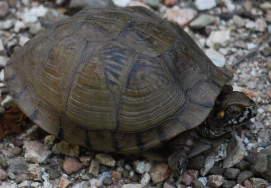
With limited time (until the 14th of June) to enjoy some of the Ozark Highlands Trail I started at the Tyler Bend Visitor Center near the US64 Bridge over the Buffalo River this morning. My friend John or Mother Nature's Son and his wife Sale took me here on their way home from a dude ranch vacation in Colorado. I saw fish and soft-shell turtles swimming in the clear, lazy meanders in the river from the cliffs high above. At the Collier Homestead, I saw two Black Bear cubs and heard their mother calling them with quiet, deep, long "ub ub" sounds. A doe and fawn were wading in Calf Creek. Bugs and birds sang all day.
Camp: Arnold Bend, Buffalo River
Mile: 4
Book: A Sand County Almanac, by Aldo Leopold
Weather: Sunny, hot, humid
Thursday, June 9th, 2011
A swim in the Buffalo River at Woolum was much appreciated at mid day. Ticks both large and small climbed up me by the dozen: Every break included a search and destroy mission. I saw fish and Great Blue Herons in the river and tributaries. I read a magazine of short stories.
Camp: Near Stack Rock
Mile: 28
Weather: Sunny, hot, humid

Friday, June 10th, 2011
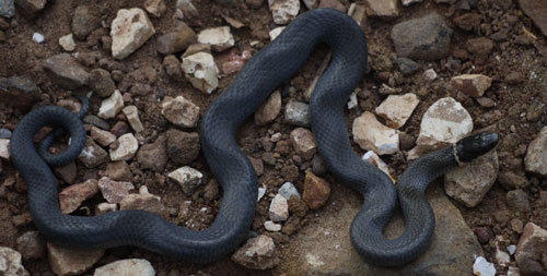
I saw a year old Mule Deer buck and a ringneck snake.
Camp: Richland Creek Campground, where I swam twice
Mile: 38
Weather: Sunny, hot, humid
Saturday, June 11th, 2011
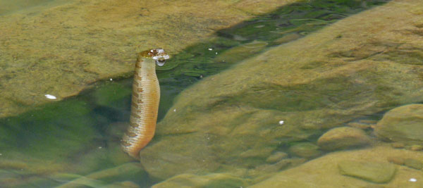
I saw 3 box turtles and 2 cottontail rabbits. At the next ford of Richland Creek a northern water snake had most of his body hidden under a rock in the stream, but with his head just above water. He stayed in this position through most of my snack, water, and swimming break. The ticks were uncountable. I picked dozens off my legs every few minutes. I also had formed small poison ivy rashes on my legs. It was so humid and hot that by 9am my sweat had soaked through my camera bag and the outside of the camera was wet. My shirt sleeves were so worn out and ripped that I tore them off.
Camp: 5 miles from Highway 7
Mile: 53
Weather: Sunny, hot, humid in the morning, thunder and rain in the afternoon
Sunday - Tuesday, June 12th - 14th, 2011
I walked out to Scenic Highway 7 and Miss Cindy and Miss Sharon came and found me. We drove a few miles down Highway 7 to their place. It was a wildlife lovers paradise, with a pond full of turtles, frogs, and fish, and huge lawns full of deer and birds. Large flocks of brilliant yellow American Goldfinches Spinus tristus, as well as cardinals and bluejays, all in their spring mating colors, came to feed at the sunflower seeds they set out. I enjoyed all the conversations with Ed, Cindy, and Sharon.
Camp: Miss Cindy's Place
Mile: 58
Weather: Sunny, hot, humid
Wednesday, June 15th, 2011
Ace and I drove west on ![]() 40 through Arkansas, Oklahoma, Texas, and into New Mexico.
40 through Arkansas, Oklahoma, Texas, and into New Mexico.
Motel: Tucumcari
Weather: Sunny, hot, humid
Wednesday, June 15th, 2011
Ace and I continued to Chama, New Mexico.
Motel: Cumbres Suites
Weather: Sunny, hot

The Great Divide Mountain Bike Route
I read a GDMBR map tonight. 6 sheets cover the US with one more to ride to Banff in Canada. Both maps and a mile by mile description are included. An odometer is recommended for navigation. Latitudes and longitudes are available from the ACA website for all points discussed in the mile by mile description. Paragraphs cover history and natural history, etcetera. The USFS and BLM large scale maps I would want to buy and carry are listed. There are elevation and annual temperature profiles and much other useful information. In short, the Adventure Cycling Association maps are well done and worth using if I bike this route at some future date. A set costs about $100.
| Place | Latitude | Longitude | Elevation | Date & Time | Comment |
|---|---|---|---|---|---|
| BuffaloRiverCliffsView | 35.980851 | -92.769603 | 214 | 2011-06-08T15:36:21Z | |
| CollierHomestead | 35.975124 | -92.767701 | 255 | 2011-06-08T15:58:54Z | |
| +BRTRoad | 35.969241 | -92.768555 | 181 | 2011-06-08T17:09:09Z | |
| ArnoldHomestead | 35.973437 | -92.774692 | 187 | 2011-06-08T17:33:28Z | |
| ArnoldBend&OldCemetary | 35.976613 | -92.779800 | 192 | 2011-06-08T17:42:23Z | |
| +BRT ArnoldBendRoad | 35.977068 | -92.784230 | 203 | 2011-06-08T17:50:44Z | |
| +BRT NewArnoldCemetaryRoad | 35.976571 | -92.785109 | 203 | 2011-06-08T17:52:51Z | |
| NewArnoldCemetary | 35.977511 | -92.790060 | 214 | 2011-06-08T18:03:01Z | |
| Arnold Bend Camp | 35.979557 | -92.791554 | 2011-06-08T19:51:08Z | ||
| SlayBranchCemetary | 35.958724 | -92.838774 | 178 | 2011-06-09T14:24:46Z | |
| BurntConcreteBlockHouses | 35.957042 | -92.867812 | 273 | 2011-06-09T15:57:32Z | |
| EulaFord | 35.900151 | -92.895875 | 228 | 2011-06-09T22:29:13Z | |
| +FR1201 1205 | 35.838014 | -92.953917 | 596 | 2011-06-10T14:09:57Z | |
| RichlandCreekCampground | 35.797275 | -92.934262 | 330 | 2011-06-10T23:24:29Z | |
| +FR1203Co32 OHT | 35.749420 | -92.978350 | 330 | 2011-06-10T23:27:13Z | |
| OHTRichlandCreek | 35.763810 | -92.987380 | 330 | 2011-06-10T23:28:57Z | |
| FairviewCampground+7OHT | 35.738750 | -93.093760 | 447 | 2011-06-11T17:42:02Z | |
| Place | Latitude | Longitude | Elevation | Date & Time | Comment |