Friday - Sunday, August 20th - 22nd, 2010
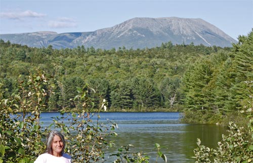
Friday, I moved out of my Marietta, Georgia home, and closed its sale. Saturday and Sunday I drove to Maine.
Monday, August 23rd, 2010
I took a 13 mile walk on the Kennebeck River Rail Trail near Augusta, Maine. There were historic buildings, views of the river through the trees, and edible thimbleberries, blackberries, and grapes to entertain me. The weather was cool and overcast with occasional sprinkles. This was a huge relief after Georgia, where I was dripping with sweat when hiking at dawn.

Tuesday, August 24th, 2010
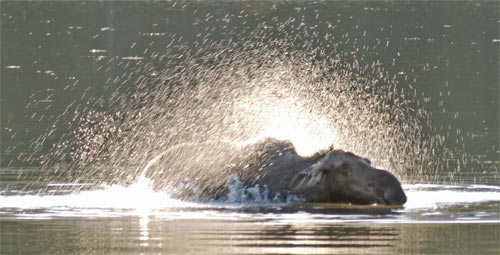
I walked a few miles on the Greenway Trail across the river from yesterday's walk. Then I visited the Maine State Museum and Library. In the afternoon, Chandra and I drove to Baxter State Park and saw a Cow Moose Alces alces in Sandy Pond.
Wedesday, August 25th, 2010
I climbed the 5.2 miles up Katahdin and started my hike on the ![]() Appalachian Trail. Parts of the view were in clouds but others were great. Rain started after I got down past all the hairy boulder climbing stretches of the trail.
Appalachian Trail. Parts of the view were in clouds but others were great. Rain started after I got down past all the hairy boulder climbing stretches of the trail.
A detailed map of the
![]() with towns, roads, and rivers shown, 2 MegaByte PDF
with towns, roads, and rivers shown, 2 MegaByte PDF
Thursday, August 26th, 2010
Rainbow Ledges, Rainbow Lake
Rain continued, clearing in the afternoon.
Camp: ![]() mile 26.3
mile 26.3
Friday, August 27th, 2010
Nesuntabunt Mountain, Nahmakanta Lake
There was a nice view of Katahdin and its cloud cap from Nesuntabunt Mountain Camp.
Camp: Nahmakanta Stream, ![]() Mile 41
Mile 41
Saturday, August 28th, 2010
The one pound burger and brownies at White House Landing were great.
Camp: ![]() Mile 54
Mile 54
Sunday, August 29th, 2010
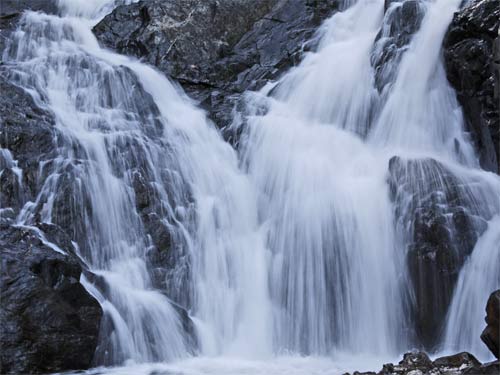
Cooper Brook Falls, Little Boardman Mountain
Camp: ![]() mile 69
mile 69
Monday, August 30th, 2010
Whitecap Mountain, Hay Mountain, West Peak, Gulf Hagas Mountain
Camp: Carl Newhall Shelter, ![]() mile 78.9
mile 78.9
Tuesday, August 31st, 2010
Gulf Hagas, Chairback Mountain
I took the 5 mile Gulf Hagas side trail, a nice canyon with lots of pourovers. There were trail magic Whoopie Pies and Ginger Ale at the Katahdin Iron Works Road.
Camp: ![]() Mile 88.5
Mile 88.5
Wednesday, September 1st, 2010
Columbus Mountain, Third Mountain, Fourth Mountain, Barren Mountain
It was a thrill and a great view to climb the Barren Mountain Fire Tower.
Camp: ![]() Mile 101
Mile 101
Thursday, September 2nd, 2010
I walked to Maine Highway 15 and hitched to Monson, ![]() mile 114.5.
mile 114.5.
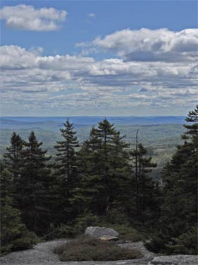
It had been very hot over the previous 5 days, 98°F and 100% humidity. I had gone from grinning and bearing it to just bearing it. I really needed a break in town to rest and rehydrate.
Friday, September 3rd, 2010
I spent a resupply and rest 'zero miles' day at Shaw's in Monson.
Saturday, September 4th, 2010
After a morning deluge of hurricane rain, the weather cleared a little and I hiked out. I felt great walking: the zero day really helped. The trail was flooded in many normally dry places. I saw a beaver enjoying the temporary flood on the trail, 15 feet away and unconcerned with my presence. One of my water bottles had gone septic; it really stunk. Luckily, I had another. I wondered if that was part of the problem I had drinking enough to stay hydrated in the heat wave.
At about ![]() mile 127, about an hour before dark, I ran into 4 college students at a dirt road with a car. They told me they were waiting on one of their friends with a sprained ankle to evacuate from a mile and a half in. I hiked in at maximum walking pace for 22 minutes and found the group camped on the side of the trail. All was under control, the kids really had their stuff together. I left my pack and went back to tell the kids in the car their friends were fine and camped, and they should come back in the morning and help with the evacuation when the light would be better. Then I went back and camped at about
mile 127, about an hour before dark, I ran into 4 college students at a dirt road with a car. They told me they were waiting on one of their friends with a sprained ankle to evacuate from a mile and a half in. I hiked in at maximum walking pace for 22 minutes and found the group camped on the side of the trail. All was under control, the kids really had their stuff together. I left my pack and went back to tell the kids in the car their friends were fine and camped, and they should come back in the morning and help with the evacuation when the light would be better. Then I went back and camped at about ![]() mile 128 near the group.
mile 128 near the group.
Sunday, September 5th, 2010
Moxie Bald Mountain, Pleasant Pond Mountain
The group was sleeping when I broke my camp in the morning, so I left them to rest and went out to meet the kids hiking in. When they were all together and everything looked fine, we all agreed there was no need for me to hang around or help any more. So I hiked on, and they got on with their evacuation. By Monday when I got to the Northern Outdoor Resort, I'd gotten an email saying they were out and fine, the evacuation had taken about an hour, the doctor had seen Ally's ankle and all was as well as could be. My hat is off to Ally and Luke, leaders of this group of 8 Colby College students. They did everything right.
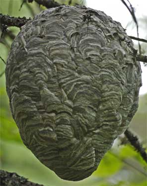
There were loons Gavia swimming and calling at Bald Mountain Lake. The view from Moxie Bald was great. I saw lots of pheasants ruffing and strutting along the trail, plus a couple of garter snakes. Later, I heard Kris playing bagpipes off somewhere through the trees, and went off trail to say hi to her. I saw a very pretty hornet's Vespa nest. The view from Pleasant Pond Mountain was nice, but I climbed down the very steep trail as the day darkened out, and it was pretty scary in areas where you could have fallen and really gotten hurt.
Camp: Pleasant Pond Lean-To at ![]() mile 145.5
mile 145.5
Monday, September 6th, 2010
I saw 2 White Tail Deer Odocoileus virginianus, the only deer sighting of the trip. I hiked the 6 miles out to Caratunk and its Northern Outdoor Resort, where I had a late full breakfast and an Octoberfest Beer brewed on site. I was able to use the internet, then went on to the canoe ford of the Kennebeck River. I camped at the Pierce Pond Lean-To (![]() mile 155.2) and reserved breakfast with the Pancake Man.
mile 155.2) and reserved breakfast with the Pancake Man.

Tuesday, September 7th, 2010
Roundtop Mountain
The pancake breakfast was great and filling. I could hear logging operations off through the trees. Overnight rain, and morning drizzle and overcast cleared by late afternoon.
Camp: Little Bigelow Lean-To ![]() mile 172.5
mile 172.5
Wednesday, September 8th, 2010
Little Bigelow Mountain, Bigelow Mountain (Avery and West Peaks), South Horn
A cold drizzle fell most of the day. The trail was steep and slippery over the Bigelows. Above treeline, gusts were strong enough to challenge my balance. By the end of the day, a painful friction rash had developed between my thighs.
Camp: ![]() mile 186
mile 186
Thursday, September 9th, 2010
I walked a couple of miles to Maine Highway 27 and hitched to Stratton to rest my rash and right hip, which had been complaining for a few days.
Hostel: ![]() mile 187.8
mile 187.8
Friday, September 10th, 2010
Sugarloaf Mountain, Spaulding Mountain
Camp: Spaulding Mountain Lean To ![]() mile 201.3
mile 201.3
Saturday, September 11th, 2010
Lone Mountain, Saddleback Junior, The Horn, Saddleback Mountain
Finally, a clear, dry, cool day came: great weather! The views from the Saddleback Range were outstanding.
Camp: Piazza Rock Lean To ![]() mile 218.2
mile 218.2
Sunday, September 12th, 2010
After a couple miles walk, I hitched into Rangeley for groceries. After returning to the woods, I saw a hawk Accipitriformes weaving silently through the trees. Then I walked on to Maine Road 17 (![]() Mile 233.1). Though it had been clear most of the day, it was drizzling when I reached the road. By chance, Earle of The Cabin Hostel was waiting there for some northbound hikers. With rain predicted for several days, I decided to go to his East Andover Hostel.
Mile 233.1). Though it had been clear most of the day, it was drizzling when I reached the road. By chance, Earle of The Cabin Hostel was waiting there for some northbound hikers. With rain predicted for several days, I decided to go to his East Andover Hostel.
Hostel: The Cabin
Monday, September 13th, 2010
Bemis Range, Old Blue Mountain
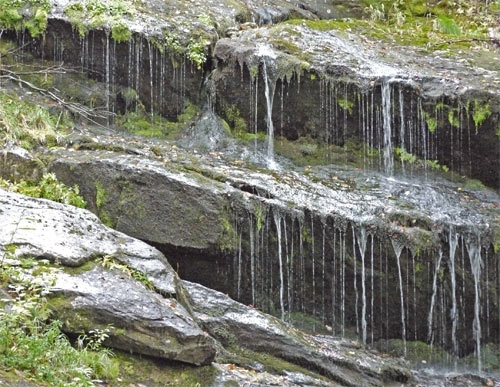
It was a rainy day with lots of mud and slippery rocks. On the drive to the trail we saw a flock of about 20 Turkeys Meleagris gallopavo. A pheasant allowed me to walk within ten feet. I walked from Maine Road 17 to South Arm Road (![]() Mile 246.4) with just a day pack.
Mile 246.4) with just a day pack.
Hostel: The Cabin
Tuesday, September 14th, 2010
Moody Mountain, Wyman Mountain
Sometimes it rained, sometimes the sun shined, sometimes both. It was a muddy slog, with some good views. I walked from South Arm Road to East B Hill Road (![]() Mile 256.5) with just a day pack.
Mile 256.5) with just a day pack.
Hostel: The Cabin
Wednesday, September 15th, 2010
Dunn Notch Waterfalls, Baldpate Mountain (East and West Peaks), Old Speck
I slipped on the cobble beach of the beautiful Dunn Notch Falls, bruising my right thigh, avulsing my right elbow, and spraining the two middle fingers of my left hand. There was some rain, and some sun.
Camp: Speck Pond ![]() Mile 271.4
Mile 271.4
Thursday, September 16th, 2010
Mahoosuc Arm, Mahoosuc Notch, Fulling Mill Mountain (South Peak)
Very slippery conditions made the infamous notch even tougher, with some tricky rock moves. No discoloration from bruising appeared on my thigh or fingers, but they hurt plenty when taking odd steps or closing my fist. With predicted afternoon thundershowers, I quit hiking after lunch.
Camp: Full Goose Shelter ![]() Mile 276.5
Mile 276.5
Friday, September 17th, 2010
Goose Eye Mountain (North and East Peaks), Mount Carlo, Maine/New Hampshire Line, Mount Success
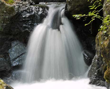
Hard rain all night turned several steep rock scrambles into waterfalls cascading into my face, making certain ascents and descents hairy and exhausting. Some puncheons were several inches under water. The weather cleared in the afternoon. That night, a bright ice ring appeared around the moon.
Camp: Gentian Pond Shelter ![]() Mile 286.1 Great View from shelter!
Mile 286.1 Great View from shelter!
Saturday, September 18th, 2010
Cascade Mountain, Mount Hayes
It was finally a clear, sunny, and comfortable, so I screwed around all day, stopping for anything beautiful. That's my favorite mode of hiking.
Camp: Rattle River Shelter ![]() Mile 299.8
Mile 299.8
Sunday, September 19th, 2010
Mount Moriah
It was clear below a high cloud base when I summitted Moriah, but the cloud base soon descended below the Carter Range, which I would have summitted in hours. With rain and a low cloud base predicted for the afternoon, I hiked out the Stony Brook Trail, ![]() mile 305, to Gorham for supplies, shower, and laundry. Weather for the following 2 days was predicted to be high clouds but clear views, and following that worse weather.
mile 305, to Gorham for supplies, shower, and laundry. Weather for the following 2 days was predicted to be high clouds but clear views, and following that worse weather.
Hostel: The Barn
Monday, September 20th, 2010
Mount Madison
With 2 good weather days predicted, I headed straight for the Presidential Range, the highest ridgeline of the White Mountains. It was clear, with incredible views from the Presidentials' ridgeline. Above treeline a stiff, bitterly cold wind blew.
Camp: Valley Way Tentsite ![]() Mile 326.8
Mile 326.8
Tuesday, September 21st, 2010
Mount Washington
Clear, cold, windy conditions continued. The view was awesome, a great day to end the trip. The next 4 days were predicted to have cloud bases below the ridgelines, and 3 of the 4 days would have rain too. So I ended the hike atop Mount Washington ![]() Mile 332.4 and descended to Pinkham Notch on the Lion's Head and Tuckerman Ridge Trails.
Mile 332.4 and descended to Pinkham Notch on the Lion's Head and Tuckerman Ridge Trails.
Camp: Pinkham Notch
Weather
Most days of this trip were drizzly. The cloud base was usually somewhere between the valleys and the peaks, so most viewpoints were socked in with clouds.
Wildlife
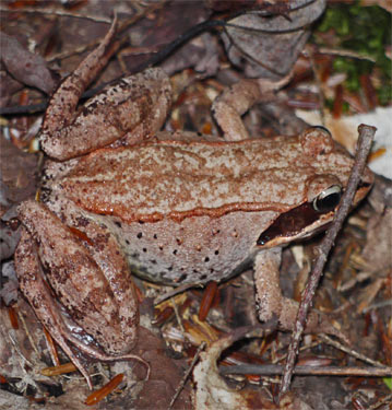
Up until about Stratton, I saw one turtle, about one or two Common Garter Snakes Thamnophis sirtalis a day, and dozens of frogs and toads of various species per day. I guess after that the cold blooded animals were hiding someplace warm. I saw only one frog and one snake later. I saw many pheasants, some loons swimming and calling, the hawk, and the flock of turkeys. There were just the 2 white tail deer, and some prints, mostly on roads rather than the trail. There were many moose tracks and turds, but on the ![]() I never saw a moose. Shelters had many rodents of all kinds, and various species of squirrels chided me from the woods. There were lots of interesting mosses and fungi.
I never saw a moose. Shelters had many rodents of all kinds, and various species of squirrels chided me from the woods. There were lots of interesting mosses and fungi.
Medical
The trail had lots of steep steps downhill, these were pounding my feet, knees and right hip. However, there was no debilitating joint pain. I had some friction/dampness rashes between thighs and on my feet, but they were not problematic. I had 5 infected hangnails on my feet; some infections took a while to heal. I was inspecting and draining them several times daily, and they seemed to be improving, but with the soaking wet conditions, I kept watching. I also had one abcess in my right armpit.
Future Hikes on Wet Trails
I spent some time thinking about whether Britain and New Zealand should be on my hiking plans, since hikes like this, where I am sopping wet most of the time, bring on foot and skin problems. Maybe I should plan to spent many nights in shelters to allow my feet and skin some dry time, or not go on hikes that are so wet. I've had foot and skin problems in Wales, here, and on the Florida Trail, all very wet hikes.
Wednesday, September 22nd, 2010
I took the bus to Boston then to Augusta, Maine.
Camp: Chandra's
Thursday, September 23rd, 2010
Mount Desert
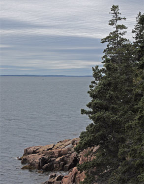
I visited Liberty Antique Tools. There were many old tools I would have been happy to put back to work in a machine shop or doing trail maintenance. However, most cutting edges were dull beyond use. I drove to Acadia National Park, & took walks all around the east loop road. The views were awesome, and it was much warmer on the coast.
Camp: Blackwoods Campground
Friday, September 24th, 2010
Wonderland, Ship Harbor, Knight Nubble, Bernard Mountain, Pretty Marsh
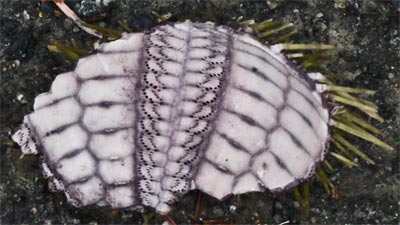
This overcast, drizzly day I took strolls all around the west peninsula of Mt Desert Island. I especially enjoyed any beach and seaside walks. I liked the sights and sounds of the shore, but the smell is the most intense experience. It's the reek of life, death, and decay of the tidal reefs and mudflats: pungent and fecund.
Camp: Blackwoods Campground
Saturday, September 25th, 2010
Bar Harbor, Eagle Lake, Sand Beach
I visited Bar Harbor to walk its shore path, resupply at its grocer, and update this journal and send emails at its library. Later, I walked around Eagle Lake and visited Sand Beach.
Camp: Blackwoods Campground

Sunday, September 26th, 2010
Witch Hole Pond, Great Head, Valley Cove, Wonderland, Ship Harbor
This was an overcast, sometimes misty day. I concentrated on coastal walks, and one freshwater wetland. The fall colors were nice too, with some bright yellows, some flaming reds, and everything in between. But most trees were conifers, so possibly a better autumn show was proceeding elsewhere. I saw a beaver Castor canadensis and some deer.
Camp: Blackwoods Campground
Monday, September 27th, 2010
Schoodic Peninsula, Petit Manan Wildlife Refuge
I helped Ranger Bill move some trash across a tidal race on the Schoodic Peninsula. Later I found a free volunteer hat under my windshield wipers. Thanks!!
The trails at the Petit Manan Refuge were really nice, not overused like the Appalachian Trail and Mt Desert Island trails. Plus there were comfortable chairs at every viewpoint. As I was sitting in one of these chairs, a Bald Eagle flew over.
Camp: Cutler/Bold Coast Trail
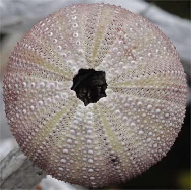
Tuesday, September 28th, 2010
The Bold Coast was peaceful, beautiful, and foggy.
Camp: Cutler/Bold Coast Trail
Wednesday, September 29th, 2010
I saw squirrels, seals, and many birds. There were moose tracks.
Camp: Cutler/Bold Coast Trail
Thursday, September 30th, 2010
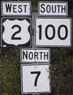
Cutler/Bold Coast Trail
Motel: Machias
Friday, October 1st, 2010
On this blustery, overcast, day, I walked the Down East Sunrise Rail Trail from Machias to East Machias along a tidal river. Later I walked the same trail a few miles south from Ayers. That section was through mixed conifer/leaf forest, grasslands and wetlands. I saw a 6 inch common garter snake Thamnophis sirtalis of about 3/16" diameter, and a predated turtle nest. Right next to the predated nest was a new nest with a fresh, loose soil plug. Let's hope this batch made it past the predators.
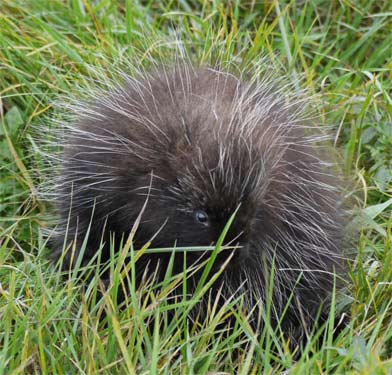
Later, at Reversing Falls, there was some class 2 whitewater, and the current was very fast. Seals were playing in the eddylines. A porcupine Erethizon dorsatum was foraging at the base of grasses near the 1800s graveyard.
Camp: Reversing Falls
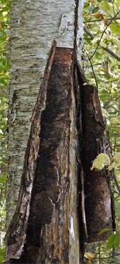
Saturday, October 2nd, 2010 With similar weather and topography, I followed the same trail from near the 86 and 191 road junction 5 miles north. I saw many predated and untouched turtle nests, beaver dams and lodges, small moose tracks, blue jays, great blue herons, and a white tail deer. I saw a Common Snapping Turtle Chelydra serpentina with a 3 inch shell crossing the path. In the afternoon, I walked a few miles south on the path from Whitneyville, but a sunny Saturday had brought out many ATV riders, so I gave it up.
Camp: Bangor Walmart
Sunday, October 3rd, 2010
Mount Mist
Having finished exploring the coast up to Canada, and with a few days of good weather predicted, I got back on the ![]() at the south or west end of the White Mountains National Forest, Road 25C,
at the south or west end of the White Mountains National Forest, Road 25C, ![]() mile 403.5, and started walking north towards Franconia Notch.
mile 403.5, and started walking north towards Franconia Notch.
Camp: Jeffries Brook Shelter ![]() mile 397.4
mile 397.4
Monday, October 4th, 2010
Mount Moosilauke, Mount Wolf (East Peak)
Another beautiful day with a great view from the bitterly cold summit of Moosilauke. I met an AMC work crew at the Eliza Shelter. A new shelter had been built previously, and this crew was building new mineral soil tent pads, fixing the approach trails, and etc. Thanks.
Camp: Eliza Brook Shelter ![]() mile 381.5
mile 381.5
Tuesday, October 5th, 2010
South and North Kinsman Mountain
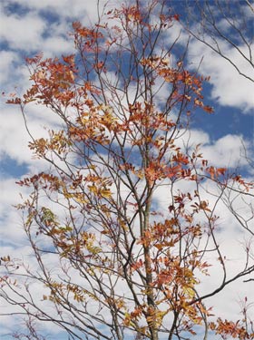
The weather was again gorgeous, and there were great views from South Kinsman, without the cold winds. I walked to Franconia Notch (![]() mile 372.7) and got a shuttle into Lincoln, where I had left my car at Chet's One Step at a Time Hostel.
mile 372.7) and got a shuttle into Lincoln, where I had left my car at Chet's One Step at a Time Hostel.
Hostel: Chet's
Wednesday, October 6th, 2010
Green and Adirondack Ranges
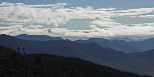
With rain and possibly snow predicted for a couple of days on Mount Washington, I took a road trip west to see the Green and Adirondack Ranges. It rained all day. The highlight was sampling the excellent beers and eating lunch at the Long Trail Brewery. I was shocked, though, that they had sunk so low as to serve beer in plastic "glasses".
Hotel: Amsterdam, New York
Thursday, October 7th, 2010
It was a long drive, but I decided to see Niagara Falls. In the couple of hours before I arrived, the weather cleared to a sunny, warm day. As I drove over the Niagara River a few miles upstream, I thought WOW, this river must be a mile wide, this is going to be a BIG waterfall. And clouds of mist from the falls were rising in the distance. The falls were as impressive as promised; tall, wide, and with thundering noise you could feel in your bones. The mist rising from the bottom sometimes obscured the whole of the falls. I took the boat and all kinds of trails to every view point, including right under the falls, a very wet place.
Hotel: Syracuse, New York
Friday, October 8th, 2010
I drove east on ![]() 90 into a beautiful sunrise. Dark, wavy, ripply wind effect clouds off the Adirondacks occasionally let through brilliant patches of color and crepuscular rays. Later, a shadow of a cloud raced ahead of me, with the sun and tree shadows decorating just the hundred yards or so of ground ahead of me as I drove. It was quite an astounding effect.
90 into a beautiful sunrise. Dark, wavy, ripply wind effect clouds off the Adirondacks occasionally let through brilliant patches of color and crepuscular rays. Later, a shadow of a cloud raced ahead of me, with the sun and tree shadows decorating just the hundred yards or so of ground ahead of me as I drove. It was quite an astounding effect.
Hostel: Chet's

Saturday, October 9th, 2010
I went to the Mt Washington Cog Railway, hoping to ride up and continue my ![]() hike south to Franconia Notch, but it was too windy and they were not running the trains all the way to the top. I decided to see for myself and ascended the Amonoosuc Ravine Trail. At the Lake of the Clouds Hut, even with all my foul weather gear on, I felt myself getting colder and my fingers numbing. The cloudbase was less than 100 feet above me. I decided 3 days of hiking in the clouds, with no view, and with constant concerns about frostbite and hypothermia were not worthwhile, and descended. The weather report predicted windchill of -5°F for the next several days, with no other improving trends, so I decided to give up on hiking from Mt Washington to Franconia.
hike south to Franconia Notch, but it was too windy and they were not running the trains all the way to the top. I decided to see for myself and ascended the Amonoosuc Ravine Trail. At the Lake of the Clouds Hut, even with all my foul weather gear on, I felt myself getting colder and my fingers numbing. The cloudbase was less than 100 feet above me. I decided 3 days of hiking in the clouds, with no view, and with constant concerns about frostbite and hypothermia were not worthwhile, and descended. The weather report predicted windchill of -5°F for the next several days, with no other improving trends, so I decided to give up on hiking from Mt Washington to Franconia.
Hostel: Chet's
Sunday, October 10th, 2010
I drove several other hikers back to the trail and to Dartmouth/Hanover.
Hostel: Chet's
Monday, October 11th, 2010
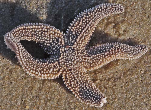
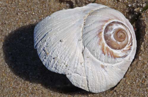
After driving a hiker to the train station in Boston, I headed to Cape Cod, where the weather was warm enough to hike shirtless. What a relief. I explored the Cape Cod Canal, where the current was ripping, and wondered whether that was more due to the tides, the Gulf Stream, or what. I also walked out the Great Island sand spit and generally drove around to orient myself. Seals watched me from the water as I walked the beaches, and there were Great Blue Herons Ardea herodias fishing, lots of gulls, a few huge turkeys, and many seashells. Based on the shape of the Cape, I had expected the typical fine sand found at dunes, but the base material is morraine from the glaciation of the rest of New England, so there are rocks of all sizes and the sand was much larger grained than I had imagined. Some lakes, too, are holes left where glacial ice chunks melted away. So it's a morraine pile reshaped by the wind and wave action that creates dune covered barrier islands. An interesting combo. Cape Cod Geology
Camp: Cape Cod
Tuesday, October 12th, 2010
Trails: Beech Forest, Province Lands Bike, Hatches Harbor Marsh, Provincetown Breakwater, High Head Bike, various Beaches and Fire Roads
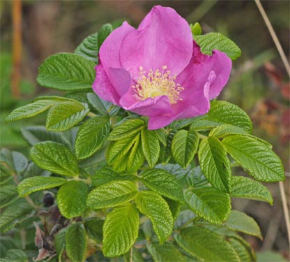
Rain overnight and morning overcast cleared to partly cloudy skies by afternoon. I started at the north end of Cape Cod and explored every interesting trail as I worked south. The most interesting walk was the Hatches area, where I watched the incoming tide flood the marsh. I liked watching the various rivulets of water probe over the sand, much of the water soaking in, with the streams eventually joining and flooding areas, then the air trapped in the sand bubbling up. There were many gulls, a Great Blue Heron, and other shorebirds, plus a snake track, quite straight, and about an inch in diameter. The Salt Spray Roses Rosa rugosa looked and smelled great, and their petals and hips were sweet and delicious, with less of the astringent taste than with most roses.
Camp: Cape Cod
Wednesday, October 13th, 2010
Trails: Small's Swamp, Pilgrim Spring, Pamet/Bearberry, Marconi/Atlantic White Cedar Swamp, Three Sisters/Nauset Lighthouses, Nauset Marsh, Fort Hill/Red Maple Swamp, various Beaches
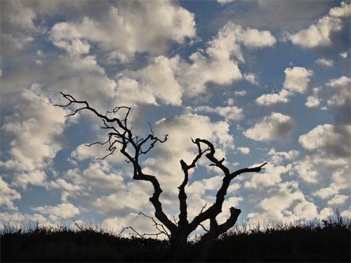
A clear, sunny, beautiful day. The predominant tree species on the tops of dunes is Pitch Pine Pinus rigida. It grows in open, easily wandered groves. At the bases of dunes, impenetrable thickets of all sorts of trees, bushes, and other plants grow. The Atlantic White Cedar Chamaecyparis thyoides Swamp and Red Maple Acer rubus Swamp were interesting and different. I saw all the same wildlife plus some Bluejays Cyanocitta cristata and Swans.
Camp: Cape Cod
Thursday, October 14th, 2010
Trails: Cape Cod Ship Canal & Sagamore Hill, Larkin State Park Rail Trail, Connecticut
Sunrise was gorgeous, with mist rising from the canal brilliantly lit. The hill had the circular track from its World War II gun and a great view. The rail trail had bright fall colors.
Hotel: Middletown, New York
Friday, October 15th, 2010
This was an all day drive down ![]() 84,
84, ![]() 81, &
81, & ![]() 460. The previous evening I had driven west towards the eye of a storm system rotor and stopped for the evening after an hour of rain. By morning the eye had passed to the east, and I had only a little drizzle all day. But the whole route was beneath a spoke of the storm, overcast with occasional clear holes. This produced crepuscular rays all day. The sunset was great, puffs of orange cloud in a fairly clear sky.
460. The previous evening I had driven west towards the eye of a storm system rotor and stopped for the evening after an hour of rain. By morning the eye had passed to the east, and I had only a little drizzle all day. But the whole route was beneath a spoke of the storm, overcast with occasional clear holes. This produced crepuscular rays all day. The sunset was great, puffs of orange cloud in a fairly clear sky.
Camp: Near the ALDHA Gathering at Concord University, Athens, West Virginia
Saturday, October 16th, 2010
It was great to attend the Appalachian Long Distance Hikers Association Gathering. Best was seeing old friends like John and Sale Calhoun and Billygoat. I also liked the presentations on hiking the Florida Trail and hiking or tramping in New Zealand.
Camp: Southern Folk Life Center, West Virginia
Next I headed south and west for more hiking.