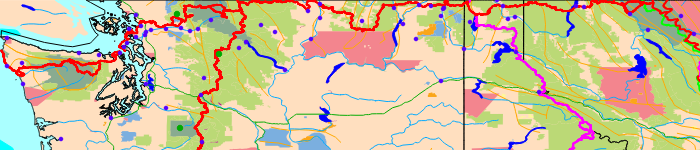
PNT Map - Dwell cursor for area names.
Saturday, June 21 - Sunday, June 29, 2014
Visiting Family in Georgia
I had a family reunion in Sautee Nacoochee, north Georgia. We hiked to Anna Ruby Falls and Raven Cliffs Falls, tubed the Chatahoochee River in Helen, and rode the water slides there. We saw ringneck snakes, Eastern Box Turtles, Frogs, Fireflies, etcetera.
Attendees: Mom, Dad, Lisa, Jorge junior, Julie, Michael, Jenny, Dan, Marie, Roy, Kate, Rob, Chette, Jodie, and Bodie.
Sunday, June 29 - Wednesday, July 2, 2014
Train, Atlanta to East Glacier
My train left Atlanta Sunday evening, June 29th. Monday, I stopped in Washington DC 9:53AM-4:05PM. Tuesday, July 1st, I stopped in Chicago noon-2:15PM. Wednesday, July 2nd, I arrived in East Glacier after midnight.
Route: Crescent 20, Capitol Limited 29, Empire Builder 7
Wildlife: Red Wing Blackbirds, Great Egrets, White Pelicans, Common Grackles, White Tail Deer, Mule Deer, Bison, Corn, Hay, Alfalfa
Glacier NP Predicted Weather:
Wednesday, July 2 - 82-53F, Sunny, 0%, ESE at 4 mph
Thursday, July 3 - 81-52F, Partly Cloudy, 20%, S at 7 mph
Friday, July 4 - 79-51F, Isolated Thunderstorms, 30%, WSW at 10 mph
Saturday, July 5 - 78-49F, Sunny, 10%, WSW at 11 mph
Sunday, July 6 - 72-50F, Partly Cloudy, 10%, WSW at 12 mph
Monday, July 7 - 72-48F, Mostly Sunny, 0%, WSW at 12 mph
Tuesday, July 8 - 73-47F, Sunny, 0%, WSW at 11 mph
Wednesday, July 9 - 72-44F, Sunny, 0%, WSW at 12 mph
Thursday, July 3, 2014
I arrived in the wee hours, and camped away from East Glacier. At 1AM, I could see bright satellites, though what was illuminating them I don't know. There were a few shooting stars.
Later, I hiked to Two Medicine via the CDT / Mount Henry Trail. At the high ridge, I saw perhaps 20 Bighorn Sheep about 300 yards away. I sat on my pack and quietly watched them. They came within 20 yards of me and grazed. The sheep dispersed and stayed further away after people hiking up from the 2 Medicine area talked and moved around.

Steep, hard snow and deep, swift stream fords convinced me to set aside my plan to hike alternates to my last CDT hike. I hitched to Rising Sun Campground with permits for a new route.
Miles: 10
Friday, July 4, 2014
I took the free shuttle to Apgar on the west side to see more of Glacier NP. I liked the river and Lake McDonald. I then took the Flattop Mountain Trail from The Loop parking area to Fifty Mountain and camped. I saw a toad and Bighorn Sheep, and tracks of Grizzly Bears, Badgers or perhaps Wolverines, and Rabbits.
Miles: 12 23
Camp: 50 Mile Mountain

Saturday, July 5, 2014
I saw a Mule Deer, a Marmot, and much green, fiberous Grizzly scat.
Miles: 17 40
Camp: Lake Frances
Sunday, July 6, 2014
I watched a Mule Deer buck, with small antlers in velvet, chew up a hiker's shirt for salt while the ranger chased it away. There were two specled garter snakes near Bowman Lake. I joined some great divide mountain bikers for food and beer in Polebridge.
Miles: 18 58
Camp: Polebridge
Monday, July 7, 2014
A wolf walked by my camp as I was waking up. He was used to people enough that when I said Hey! he looked at me for a few seconds before trotting off. There were 3 striped garter snakes on ascent up Hay Creek Road. There were dust bath holes in the closed road, and one grouse hen put on a great distress / distract display to draw me away from her several very small chicks.
Miles: 22 80
Camp: West of Whitefish Mountain
Tuesday, July 8, 2014
I left the Whitefish Divide and walked down the closed Stillwater River Road. The valley was lush; I saw many snakes. I hitched into Eureka along US93. The weather has been quite hot and will continue to be. The heat is making the many ascents grueling.
Miles: 20 100
Motel: Eureka, Montana
Metaline Falls, Washington, Predicted Weather:
Wednesday, July 9 - 92-57F, Partly Cloudy, 0%, SW at 9 mph
Thursday, July 10 - 88-56F, Sunny, 0%, NW at 7 mph
Friday, July 11 - 90-58F, Sunny, 0%, SE at 6 mph
Saturday, July 12 - 95-60F, Sunny, 0%, NW at 5 mph
Sunday, July 13 - 97-62F, Mostly Sunny, 0%, WSW at 4 mph
Monday, July - 14 96-61F, Mostly Sunny, 0%, NE at 6 mph
Tuesday, July 15 - 96-64F, Sunny, 0%, E at 5 mph
Wednesday, July 16 - 97-64F, Sunny, 0%, SW at 6 mph
Thursday, July 17 - 95-61F, Mostly Sunny, 0%, S at 6 mph
Friday, July 18 - 92-60F, Sunny, 0%, S at 8 mph
Wednesday, July 9, 2014
After resupplying, etcetera, I hitched west along Highway 37 to the Tobacco River and followed paths to the Rexford Marina. Prices were good, so I tanked up on soda and ice cream and carried a big frozen burrito out on the trail. I hitched 37 again across the bridge over the lake and walked down that road and up the Webb Mountain Lookout switchbacks. The long ascent was improved by a lazy attitude, huckleberries, and just a few strawberries. I had found a few strawberries previously, and yesterday I ate huckleberry flowers: today's were the first huckleberries I've found. A family had rented the Webb Mountain Lookout Tower for a campout: I enjoyed the conversation, the kids, a s'more, a sausage sandwich, some fruit, and some water. It seems like this would be an unforgettable family campout!
Miles: 10 110
Camp: ½ mile east of Thirsty Mountain
Thursday, July 10, 2014
I saw a Grizzly Bear and a Rabbit.
Miles: 16 126
Camp: beyond Fish Lakes
Friday, July 11, 2014
I saw some Rabbits.
Miles: 26 152
Camp: North of Black Top
Saturday, July 12, 2014
I met another westbound PNT hiker.
Miles: 15 167
Camp: ½ mile into Idaho
Sunday, July 13, 2014
I ate many Huckleberries, and a few Strawberries and Thimbleberries. I met the other hiker again.
Miles: 21 188
Camp: South of Bethlehem Mountain
Monday, July 14, 2014
There was some rain. I saw Whitetail Deer and rabbits. Though someone had chainsawed up the Parker Ridge Trail 221 this year, there are many dead trees and enough had fallen since the trailwork to be a nuisance.
Miles: 21 209
Camp: Parker Ridge
Tuesday, July 15, 2014
This ridgewalk had many beautiful views of rocky, snowy peaks. However, all of the up and down at 7,000 feet was exhausting. I think the PNT is not for me.
Miles: 12 221
Camp: Lower Ball Lake
Wednesday, July 16, 2014
I mostly walked and camped with Michael, the thruhiker I've seen off and on for a few days. A bushwhack in the morning was tough; later walking was easy.
Miles: 18 239
Camp: Upper Priest Lake beach, campfire.
Thursday, July 17, 2014
There was much easy trail and roadwalking, but also a tremendously tough bushwhack up an overgrown road and trail.
Miles: 23 262
Camp: Shedroof Mountain, Washington
Friday, July 18, 2014
I hiked down into Metaline Falls, Washington and got a motel room. While BSing with the manager, I found out he was heading to Spokane in the morning and set up a ride. I've decided that the PNT is so physically demanding that I have little time or energy left over to enjoy myself.
Miles: 15 277
Motel: Metaline Falls
| Some GPS Locations | |||||
|---|---|---|---|---|---|
| +GraniteParkTr TrToTheLoopTHed | 48.757142 | -113.807859 | Off PNT | No Water | - |
| +FlattopMtnTr GraniteParkTrail | 48.749533 | -113.796795 | Off PNT | No Water | PackersRoost1 FlattopCG4 FiftyMtnCG111.4miles |
| FlattopTr at FlattopCampsite | 48.786309 | -113.844494 | Off PNT | Water Source | - |
| +CDT TrailUpWatertonRiver | 48.884897 | -113.911249 | Off PNT | Water Source | - |
| CDT RangerCabin Bridge | 48.896230 | -113.906870 | Off PNT | Water Source | - |
| +CDT StoneyIndianPassTrail | 48.897717 | -113.905000 | Off PNT | Water | StoneyIndianPssCG2.6 GoatHaunt4.9 50MtnCG5.6miles |
| +CDT PorcupineLookoutTrail | 48.908587 | -113.905948 | Off PNT | No Water | 5.4toLookout .9toStoneyIndianPassTrailJunction |
| CDT atKootenaiLakesCG | 48.926361 | -113.896989 | Off PNT | Water Source | - |
| +CDT PNT GoatHaunt | 48.958040 | -113.892159 | On PNT | Water Source | - |
| +CDT/PNT RainbowFallsTrail | 48.953616 | -113.900559 | On PNT | No Water | - |
| +PNT CDT BoulderPassTr Watertn | 48.958095 | -113.903717 | On PNT | No Water | - |
| +PNT/BowmanLkTr NumaRidgeLOtr | 48.837635 | -114.195070 | On PNT | No Water | - |
| +PNT Tr26WhitefishDivide | 48.738471 | -114.554999 | On PNT | No Water | - |
| +PNT26 FR115 | 48.747697 | -114.571265 | On PNT | No Water | - |
| +PNTWebbMtnT435CliffPtThirstyM | 48.818512 | -115.359802 | On PNT | No Water | CliffPtThirstyMtnT436 Rd751 4.2m Rd228 10miles |
| +PNT TrailSouth | 48.814203 | -115.385967 | On PNT | No Water | South of Thirsty Mountain |
| +PNT7183L/7229 7183 | 48.828646 | -115.409057 | On PNT | No Water | - |
| +PNT BoulderLakeSpurTrail | 48.837193 | -115.444891 | On PNT | No Water | - |
| +PNT BoulderMtnTr337 | 48.836123 | -115.453568 | On PNT | No Water | 1MileSouth to BoulderMtn |
| +PNT Purcell/LostHorseTrail | 48.845350 | -115.520070 | On PNT | No Water | - |
| +PNT/PurcellNRT 233 161TurnerC | 48.851852 | -115.518240 | On PNT | No Water | - |
| +PNT BunkerCreekTieTrail | 48.871227 | -115.583863 | On PNT | No Water | +VinalLakeRoad746 6miles |
I used the following information to plan my trip.
Hike across Glacier NP to PNT
I'll follow the CDT north to Two Medicine and pick up permits for Glacier NP. Whereas in 2013 I walked the Pitamakin Trail north of 2 Medicine, I'll follow the Dawson Pass Trail through Bighorn Basin. To Saint Mary Lake I'll be on the CDT and my 2013 route, but I could hike east on the Red Eagle Trail to Saint Mary, have a nice lunch, and bus back up the Going to the Sun Road to the CDT. These busses are free, so it might be possible to explore along the road for a day, so long as I can figure out the overnight stay. In 2013, I took the Highline Trail, so I'll take the CDT / Piegan Pass Road north from the Going to the Sun Road. At Many Glacier, I'll leave the on the Ptarmigan Trail to the Cosley Lake and Gros Ventre Falls area. There I would pick up the PNT on its access route from the Chief Mountain Border Crossing Trailhead.
Glacier National Park notes from 2013
My 2013 hike through Glacier was nice, with lush green valleys and rocky passes. The rocks are sedimentary, so distant views all feature layering, and fossils are often seen. There were many Stromalyte fossils throughout Glacier NP. The backcountry campground system was ok, but one day a lack of unreserved sites forced a 30 mile day on the official CDT. I had concluded that 20-25 was all I could handle, as understory plants overgrow the trail for miles, slowing travel. So I hiked a shorter route. I noticed that several other parties had permits to camp out of the designated sites. A hammock would be ideal for such off trail camping in the lush pine and understory forests here. My permit cost $20. Hitching from East Glacier to Waterton was easy enough and took me 4½ hours. I could also just hike north out of East Glacier, pick up permits at Two Medicine, and keep hiking north. Alternatively, I could hike north out of West Glacier and repeat almost nothing. There are parallel routes often enough that it would not all be a repeat. I may use the Going To The Sun Road Shuttles to explore and resupply in Saint Mary's for a day.
PNT Overview Maps, Detailed Printable Hiking Maps, Data Book
Pacific Northwest Trail Planning Table |
||||||
| # | Name | Miles | Difficulty | Route Finding |
Visitation | Supplies |
|---|---|---|---|---|---|---|
| West Glacier To Cape Alava: 1212.6 Miles | ||||||
| Opt2 1-3 Map |
Access Via West Glacier | 62 | West Glacier, CDT at Deadwood Falls (Supplies in Saint Mary Via Going to Sun Road), Many Glacier (Restaurant), Goat Haunt | |||
| Chief Mountain Border Crossing To Cape Alava: 1172.6 Miles | ||||||
| Opt1 1-1 |
Access Via Chief Mountain | 22 | Long Hitch to Chief Mountain, Hike over Stoney Indian Pass, Goat Haunt | |||
| Waterton Lake / Goat Haunt To Cape Alava: 1150.6 Miles | ||||||
| MT1 1-8 |
Glacier National Park | 31.7 | Moderate | Moderate | High | Polebridge Grocer Restaurant |
| Kishenehn Trailhead Glacier Route 7 To Cape Alava: 1118.9 Miles | ||||||
| 1MT2 | North Fork Flathead River | 9.2 | Easy | Easy to Moderate | Light | |
| Thoma Trailhead To Cape Alava: 1109.7 Miles | ||||||
| 1MT3 | Thoma Lookout | 13.6 | Moderate | Moderate | Light | |
| Tuchuck Pass To Cape Alava: 1096.1 Miles | ||||||
| 1MT4 | West Tuchuck Traverse | 6.9 | Easy to Moderate | Moderate | Light | |
| Camp Creek Trailhead To Cape Alava: 1089.2 Miles | ||||||
| 1MT5 | Mount Wam | 11.7 | Moderate | Moderate | Light | |
| Theriault Lakes Road 319 To Cape Alava: 1077.5 Miles | ||||||
| 1MT6 | Ten Lakes Scenic Area | 20.1 | Moderate | Moderate | Light | |
| Sinclair Creek Road 864 To Cape Alava: 1057.4 Miles | ||||||
| 1MT7 1-17 |
Eureka US93 | 5.8 | Easy | Easy | High | All Services |
| Riverside Park To Cape Alava: 1051.6 Miles | ||||||
| 1MT8 | Koocanusa Country | 11.0 | Easy | Easy | Light to Heavy | |
| Koocanusa Bridge To Cape Alava: 1040.6 Miles | ||||||
| 2MT9 | Webb Mountain | 12.2 | Moderate | Easy | Light to Moderate | Yaak Grocer Restaurant |
| Boulder Lakes Trailhead To Cape Alava: 1028.4 Miles | ||||||
| 2MT10 | Vinal - Mount Henry - Boulder National Recreation Trail | 25.9 | Moderate | Moderate to Difficult | Light | |
| Yaak River Road 92 To Cape Alava: 1002.5 Miles | ||||||
| 2MT11 | Garver Mountain Lookout | 26.8 | Easy to Moderate | Easy | Light | |
| Northwest Peak Trailhead To Cape Alava: 975.7 Miles | ||||||
| 2MT12 | Northwest Peak Scenic Area | 10.5 | Strenuous | Moderate | Light | |
| Spread Creek Road 435 at Kounkel Pass To Cape Alava: 965.2 Miles | ||||||
| 2ID1 | Alpine Ridge Trail | 3.1 | Moderate | Moderate | Light | |
| Canuck Pass To Cape Alava: 962.1 Miles | ||||||
| 2ID2 | Moyie River | 10.4 | Easy to Moderate | Easy to Moderate | Light | |
| Moyie River Crossing To Cape Alava: 951.7 Miles | ||||||
| 2ID3 | The Lost Mines | 18.3 | Moderate to Strenuous | Moderate to Difficult | Light | Bonner's Ferry Grocer |
| Copeland Bridge To Cape Alava: 933.4 Miles | ||||||
| 3ID4 | Dikes, Farms and Views | 6.3 | Easy | Easy | Light | |
| Parker Ridge Trailhead To Cape Alava: 927.1 Miles | ||||||
| 3ID5 | Parker Peak | 15.4 | Moderate to Strenuous | Easy | Light | |
| Ball Lakes Trailhead To Cape Alava: 911.7 Miles | ||||||
| 3ID6 | Selkirk Crest High Route | 12.0 | Strenuous | Difficult | Light | |
| Road 423 To Cape Alava: 899.7 Miles | ||||||
| 3ID7 | Lookout Mountain | 12.3 | Moderate to Difficult | Easy to Difficult | Light | |
| Road 1 To Cape Alava: 887.4 Miles | ||||||
| 3ID8 | Upper Priest Lake | 14.3 | Easy | Easy | Light to Heavy | Nordman Grocer Restaurant Coolin Resort |
| Upper Priest River Trailhead To Cape Alava: 873.1 Miles | ||||||
| 3WA1 | Salmo - Priest Wilderness | 18.1 | Moderate | Easy | Moderate | Sullivan Lake Resort |
| Sullivan Lake Road 2220 To Cape Alava: 855 Miles | ||||||
| 3WA2 3-11 |
Pend Oreille River SR31 | 40.5 | Moderate | Easy | Light | Metaline Grocer Restaurant |
| Flume Creek Trailhead To Cape Alava: 814.5 Miles | ||||||
| 3WA3 | Abercrombie - Columbia | 30.4 | Moderate | Moderate | Light | Northport All Services |
| Northport Columbia River Bridge To Cape Alava: 784.1 Miles | ||||||
| 4WA4 | Kettle River Country | 34.2 | Easy | Easy | Light | Orient Restaurant Grocer |
| Green Mountain To Cape Alava: 749.9 Miles | ||||||
| 4WA5 | North Kettle Range | 8.5 | Moderate | Easy | Light | |
| Deer Creek Summit To Cape Alava: 741.4 Miles | ||||||
| 4WA6 | Central Kettle Range | 28.6 | Moderate | Easy | Moderate | |
| Sherman Pass To Cape Alava: 712.8 Miles | ||||||
| 4WA7 | South Kettle Range | 12.3 | Moderate to Strenuous | Easy to Difficult | Light | |
| Thirteen Mile Trailhead To Cape Alava: 700.5 Miles | ||||||
| 4WA8 | Grand Canyon of the Sanpoil | 14.5 | Moderate to Strenuous | Moderate to Difficult | Light | Republic All Services |
| Tenmile Campground To Cape Alava: 686 Miles | ||||||
| 4WA9 | Swan Lake | 7.2 | Moderate | Moderate to Difficult | Light | |
| Swan Lake To Cape Alava: 678.8 Miles | ||||||
| 4WA10 | Aeneas Highlands | 17.5 | Easy | Easy | Light | |
| Sweat Lake Campground To Cape Alava: 661.3 Miles | ||||||
| 5WA11 | The Clackamas | 19.6 | Easy | Easy | Light | |
| Bonaparte Lake Campground To Cape Alava: 641.7 Miles | ||||||
| 5WA12 | Mount Bonaparte | 16.4 | Moderate | Easy | Light on the Trails | Bonaparte Lake Resort Burgers small store |
| Swanson Mill County Road 4662 To Cape Alava: 625.3 Miles | ||||||
| 5WA13 | Okanogan Highlands | 12.8 | Easy | Easy | Light Gravel Roads | No Supplies |
| Whistler Canyon Road 3525 To Cape Alava: 612.5 Miles | ||||||
| 5WA14 | Whistler Canyon | 14.8 | Easy | Easy | Light in Backcountry | US14 Oroville Groceries Laundry PO Motels |
| Oroville To Cape Alava: 597.7 Miles | ||||||
| 5WA15 | Similkameen Grade | 12.9 | Easy | Easy | Light | No Supplies |
| Nighthawk To Cape Alava: 584.8 Miles | ||||||
| 5WA16 | Chopakas Cascades Approach | 22.1 | Easy | Easy | Light Vehicular Traffic | No Supplies |
| Cold Springs Campground To Cape Alava: 562.7 Miles | ||||||
| 6WA17 | Eastern Pasayten | 9.8 | Moderate | Moderate | Light | Winthrop Mazama All Supplies Far Off Route Would Need Maps |
| Horseshoe Pass To Cape Alava: 552.9 Miles | ||||||
| 6WA18 | High Pasayten | 79.6 | Moderate | Easy | Light to Moderate | No Supplies |
| Holman Pass / Pacific Crest Trail To Cape Alava: 473.3 Miles | ||||||
| 6WA19 | Western Pasayten | 36.5 | Strenuous (Radical Elevation Gain and Loss) | Easy | Moderate | No Supplies |
| Ross Dam To Cape Alava: 436.8 Miles | ||||||
| 7WA20 | North Cascades | 47.0 | Moderate | Easy | Moderate | No Supplies |
| Ruth Creek Road 32 To Cape Alava: 389.8 Miles | ||||||
| 7WA21 | North Mount Baker | 15.2 | Easy | Easy | Heavy | No Supplies |
| Austin Pass To Cape Alava: 374.6 Miles | ||||||
| 7WA22 | Swift Creek | 17.5 | Easy Roads and Strenuous Swift Creek Trail | Easy - Difficult | Heavy | No Supplies |
| Baker Lake Trailhead To Cape Alava: 357.1 Miles | ||||||
| 7WA23 | Baker Lake | 23.6 | Easy | Easy | Light - Heavy | No Supplies |
| Grandy Lake To Cape Alava: 333.5 Miles | ||||||
| 7WA24 | North Skagit Ridges | 21.0 | Easy | Easy | Light | No Supplies |
| Main Line Road 100 To Cape Alava: 312.5 Miles | ||||||
| 7WA25 | Lyman Hill | 22.6 | Easy | Easy | Light | No Supplies |
| Bloedel Timberlands Gate on State Highway 9 To Cape Alava: 289.9 Miles | ||||||
| 7WA26 | Anderson Mountain | 14.6 | Easy | Easy | Light | No Supplies |
| Mount Baldy Trailhead To Cape Alava: 275.3 Miles | ||||||
| 7WA27 | Little Baldy | 5.7 | Easy | Easy | Light | No Supplies |
| Bloedel Timberlands Gate on Summerland road To Cape Alava: 269.6 Miles | ||||||
| 7WA28 | Chuckanuts | 10.9 | Easy | Easy | Light to Heavy | No Supplies |
| Colony Creek Bridge To Cape Alava: 258.7 Miles | ||||||
| 8WA29 | Samish and Padilla Bays | 12.4 | Easy | Easy | Moderate | No Supplies |
| La Conner and Samish Road To Cape Alava: 246.3 Miles | ||||||
| 8WA30 | Fidalgo Island | 14.9 | Easy | Easy | Moderate | No Supplies |
| Whistle Lake Trailhead To Cape Alava: 231.4 Miles | ||||||
| 8WA31 | Mount Erie Highlands and Deception Pass | 10.7 | Easy | Easy | Moderate | No Supplies |
| Deception Pass Bridge To Cape Alava: 220.7 Miles | ||||||
| 8WA32 | North Whidbey Island | 12.4 | Easy | Easy | Moderate | No Supplies |
| Joseph Whidbey State Park To Cape Alava: 208.3 Miles | ||||||
| 8WA33 | Strait of Juan de Fuca | 11.9 | Easy | Easy | Moderate | Oak Harbor |
| Admiralty Head Ferry To Cape Alava: 195.4 Miles | ||||||
| Port Townsend Ferry Terminal | ||||||
| 9WA34 | Quimper Peninsula | 13.0 | Easy | Easy | Moderate | Port Townsend Full |
| West Uncas Road To Cape Alava: 182.4 Miles | ||||||
| 9WA35 | Olympic Foothills | 15.5 | Easy | Easy | Light | No Supplies |
| Gray Wolf River Trailhead To Cape Alava: 166.9 Miles | ||||||
| 9WA36 | Gray Wolf and Deer Park | 12.8 | Easy | Easy | Light | No Supplies |
| Deer Park To Cape Alava: 154.1 Miles | ||||||
| 9WA37 | Hurricane Ridge | 15.9 | Easy | Easy | Moderate | Port Angeles |
| Hurricane Ridge Visitors Center To Cape Alava: 138.2 Miles | ||||||
| 9WA38 | Hurricane Hill | 7.9 | Easy | Easy | Low | No Supplies |
| Olympic Hot Springs Road To Cape Alava: 130.3 Miles | ||||||
| 9WA39 | Hot Springs | 19.7 | Easy | Easy | Moderate | No Supplies |
| High Divide To Cape Alava: 110.6 Miles | ||||||
| 9WA40 | Seven Lakes Basin | 12.8 | Moderate | Easy | Moderate | No Supplies |
| Slide Pass To Cape Alava: 97.8 Miles | ||||||
| 9WA41 | Bogie | 27.7 | Easy | Easy | Light | No Supplies |
| Bogachiel State Park To Cape Alava: 70.1 Miles | ||||||
| 10WA42 | Hoh | 27.9 | Easy | Easy | Light | Forks |
| Hoh River Mouth To Cape Alava: 42.2 Miles | ||||||
| 10WA43 | Wilderness Sands | 19.9 | Moderate | Easy | Light | No Supplies |
| La Push To Cape Alava: 22.3 Miles | ||||||
| 10WA44 | Lands End | 22.3 | Moderate | Easy | Light to Moderate | No Supplies |
| Cape Alava | ||||||
| # | Name | Miles | Difficulty | Route Finding |
Visitation | Supplies |