
Tuesday, August 27, 2013
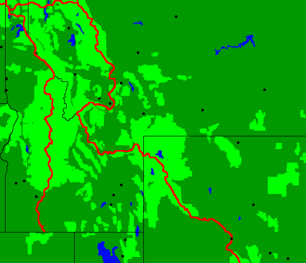
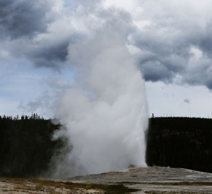
I walked into Yellowstone National Park and Wyoming. There were several Bison scat splats in the woods. I arrived at the Biscuit Basin Geysers about 1pm and walked the geyser boardwalk up the valley to the Old Faithful area. Besides getting permits, mailing Montana guides home, resupplying, and pigging out on a 6" pizza, antipasto salad, banana, and ice cream, I had a leisurely afternoon to watch geysers and enjoy the Old Faithful area, including an Old Faithful eruption.
Miles: 22 915
Camp: Yellowstone National Park, OA1, Lone Star
Wednesday, August 28, 2013
With 33 miles between available campsites, this was a day of much walking at maximum speed and of little rest beyond the time required to eat. Occasional rain, wet grass and bushes, and many stream fords kept my boots sopping wet. Despite a walking day starting well before sunrise and ending with barely enough light to see the trail, I felt pretty good and saw interesting things.
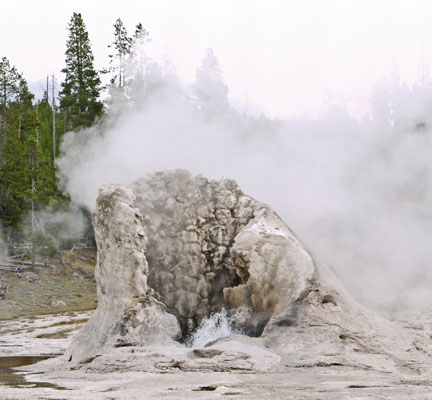
There were two Bison; one a huge, muscular bull, and later a cow. I saw a Mule Deer Doe with two fawns from this year and a buck, probably last year's fawn. A mule deer skull with antlers was interesting. Loons were calling. A chipmunk ran up my leg at the Shoshone Lake Ranger Cabin picnic table. I saw a Garter Snake, perhaps my first reptile on this summer's CDT. Throughout the day there were geothermal pools, hot springs, and steam vents. There was a perfect warm stream on descent to Heart Lake, Witch Creek, and I would certainly have swum in it were it not for the cold rain and lack of leisure time.
Miles: 33 948
Camp: Yellowstone National Park, 8J3, Surprise Creek, East of Heart Lake
Thursday, August 29, 2013
Intermittent rain continued today, so my feet stayed wet. The skin atop my right big toe rubbed through until it bled. I taped it and hoped for drier weather. This toe concerns me because it had a series of small blisters in the same area atop the toe earlier in the trip, as well as an infected hangnail. Those, and cracked heel callouses, are the only foot problems I've had so far on this trip.
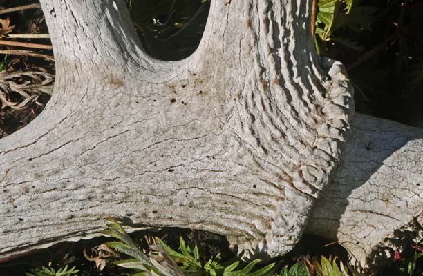
There was a great deal of bear scat and many bear prints on the trail today. Oddly, there were not as many overturned rotting logs as in the past few days. I saw Elk and a pair of shed Elk antlers, and a Mule Deer. There were Wolf tracks on the trail.
Miles: 22 970
Camp: A mile past Mink Creek, Teton Wilderness, Bridger-Teton National Forest
Friday, August 30, 2013
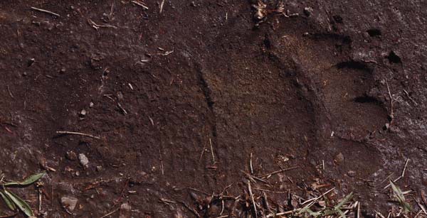
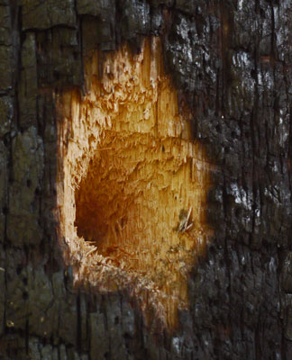
There was much less rain today, and I was able to keep fairly dry. I saw Mule Deer and an Elk with an excellent rack. Bear tracks and scat continued. There are many large horse parties here. Much of today's hike burned recently enough that plants have not recolonized the black forest floor, and that a little bit of rain sharpens the charred scent of the woods.
Miles: 23 993
Camp: A few miles past the Soda Fork of the Buffalo River, Teton Wilderness, Bridger-Teton National Forest
Saturday, August 31, 2013
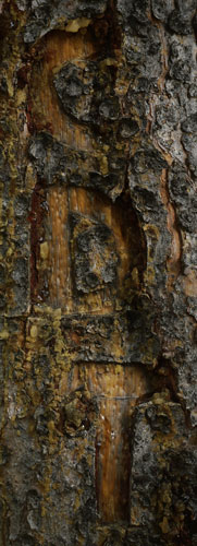
Finally, a day without rain. I saw a Mule Deer and was told I just missed seeing a Grizzly Bear. Certainly, bear tracks and scat are common here. A fire was burning to the east of today's route. I want to thank the USFS trail crew I met this morning.
Miles: 21 1014
Camp: A few miles past Highway US26
Sunday, September 1, 2013
This was the first day of archery hunting season. Yesterday and today I saw a bunch of hunters out driving their trucks or ATVs, 'looking for game'. It's too bad they don't get off their butts and walk around. I saw 18 Elk and 4 Mule Deer today. Those fuzzy, pointy things on the animal's head are ears, and they hear motors from miles away. And I've seen the game hide when motors approach. But I can walk within viewing distance without spooking game, often even well into hunting season. ATVs are probably the biggest cause of failed hunts.
Miles: 26 1040
Camp: Bullmoose Creek, a couple of miles south of Fish Lake Mountain
Monday, September 2, 2013
This was a grey, drizzly day. I saw a Black Bear and many Pronghorn Antelope. Wax or Squaw Currant Ribes cereum bushes were full of ripe berries. All the bear scat had lots of these berries, so they're probably the best tasting thing out here right now. I walked an extra 4 miles and forded the Green River to reroute around the Green Fire, only to find at the Green River Lakes Trailhead a notice that the closure had been lifted and I could have walked through. The fire is largely out, with just a few smoldering areas. And with all the rain, I wouldn't have worried much about them.
Miles: 29 1069
Camp: Lower Green River Lake
Tuesday, September 3, 2013
There was no rain all day. Huckleberries and Raspberries were ripe on a few bushes. I saw 2 Mule Deer. In the morning, I walked up the Green River to its source near Green River Pass. The Green River Lakes apparently allow the Glacial Flour to settle out, as the river is clear below and milky turquoise above. In the headwaters, the water is clear, but glacier fed tributaries from the east add the silt. The Green River was in a glacial valley with steep, high walls. Some of the walls were of tilted sedimentary rock. It was all quite beautiful. In the afternoon, I left the CDT at Summit Lake and began descending Pine Creek Canyon Trail towards the Elkheart Trailhead. There were many beautiful lakes, with plenty of jumping fish.
Just after dark, a torrential thunderstorm began and it poured for hours. I was under my tarp and didn't care. Around midnight I woke due to wet feet. The little hill I was on wasn't steep enough to drain away the pouring rain. The duff was totally saturated and water was spongeing in forwards me. A few little rivulets had flowed over the top of the duff under my pad and sleeping bag. After hours of drenching rain, there were no dry spots to move to, and getting out from under my tarp would have put me right in the rain. So I tried to grin and bear it. Another hour passed and the rain cleared. And another hour or two of being awake left me tired enough to sleep in my wet bag. So all in all, it wasn't too bad. Of course, with the next day being a resupply day, there wasn't time to dry the gear, so I slept in the wet bag again...
Two hikers told me that if I liked the Anaconda-Pintler Wilderness for the lakes, creeks, and rugged untouched character of the place, I would love the Abrasoka-Beartooth Wilderness.
Miles: 23 1092
Camp: Trapper Lake
Wednesday, September 4, 2013
I resupplied in Pinedale for an estimated 280 mile stretch into Rawlins, and the end of this hike. I'm guessing that will take about 12 days. There are a couple of gas station type stores along the way, but this is the last real grocer. Ridley's was a full grocer, with deli, pharmacy, shoes, and clothing, and with a very large hardware store next door. The library was large and had wifi. I imagine anything a hiker might want would be available in Pinedale.
I spent probably a record $84 on my lunch and 12 day resupply. But there's been so much rain that my food consumption is up radically. Here's what I bought:
Lunch:
Two dented cans of cola, $.25
each
A dented can of peaches
A banana
An avocado
2 chicken drumsticks
A pound of potato salad
A chocolate muffin
For the trail:
8 chicken drumsticks and thighs
3 pounds of peanuts
2 pounds of Sunflower Seeds
9 sausage sticks
Bread rolls
3 day-old chocolate muffins
A loaf of whole grain bread
A bag of ginger snaps
1½ pounds of granola
1¼ pounds of crushed corn flakes
4 4 ounce bags of corn nuts
6 flavored mashed potato portions
1 ramen noodle biscuit, to be eaten like potato chips
2 pounds of raisins
1 apple
1 string cheese stick
1 cheddar cheese portion
1 wedge Parmesan Cheese
I saw 2 Cow Moose, and ate some thimbleberries and raspberries.
My ride back to the trail was with a retired state fish and game biologist for the Wind River Range. He saw me walking up the road and hitching, and came out from his house to offer me the ride. He gave me a great tour, stopping and explaining the view a couple of times. At the trailhead, I ran into an animal control officer who had many questions about long distance hiking and hiker nutrition, so we had a long, interesting conversation
Miles: 10 1102
Camp: A couple miles up the Pole Creek Trail from Elkheart Trailhead and Campground
Pinedale, Wyoming Weather Forecast
Wednesday, September 4 - 79/47F Isolated T-Storms 30% WSW at 9 mph
Thursday, September 5 - 82/47F Mostly Sunny 20% SSW at 11 mph
Friday, September 6 - 79/43F Partly Cloudy 10% W at 9 mph
Saturday, September 7 - 76/40F Isolated T-Storms 30% NW at 8 mph
Sunday, September 8 - 73/35F Partly Cloudy 10% WNW at 10 mph
Monday, September 9 - 72/33F Isolated T-Storms 30% NW at 10 mph
Tuesday, September 10 - 74/36F Sunny 0% NNW at 7 mph
Wednesday, September 11 - 75/37F Mostly Sunny 10% NE at 8 mph
Thursday, September 12 - 74/37F Partly Cloudy 20% NW at 7 mph
Friday, September 13 - 74/38F Showers 40% NW at 8 mph
Thursday, September 5, 2013
What a great hiking day: 7 pieces of fried chicken, no rain, 2 chocolate muffins, gorgeous scenery, Hawaiian sweet rolls, a Grizzly or Brown Bear Ursus arctos, a fresh, crispy apple, a nice sunset, fresh whole grain bread... Awesome!!!
Miles: 22 1124
Camp: Junction of trail to Valley Lake
The book Wind River Trails by Finis Mitchell was recommended to gain more perspective on the range.
It was recommended that I visit and hike in Adobe Town, in the Red Desert of southern Wyoming. The area has interesting rock formations similar to the hoodoos of Bryce Canyon.
I've been thinking about 2014 hiking plans in case I fail again this coming winter to find engineering employment for the next few years.
I think I might hike the Israeli National Trail in March and April. To do this I need:
Pimsleur CDs to learn to speak Hebrew
A book to learn written Hebrew or
An iPod app to translate written Hebrew
The Israel Trail Guidebook
An Israel tourist book
The Lycean Way book
An issue with this plan is that this hike seems expensive to prepare for, to travel to, and probably for daily expenses. Maybe it's best to do the INT later.
Alternatively, I might hike the Official CDT across New Mexico to Silverton, Colorado in April and May. About half the route would be different than my Wolf route CDT hike of 2011, and New Mexico was by far my favorite part of the CDT. I would get extra maps of the Gila NF and perhaps take an extra 10 day loop there. There were certain other places I really liked. I would haul in enough food and perhaps additional maps or books to better explore these areas.
Until July, I would hike the Pacific Coast between Portland, Oregon, and Lompoc, California. I will need:
A cheap camera, as I assume the salt air will ruin whatever camera I carry
Tide Tables
A coastal nature guide
To print the Oregon Coast maps
(I already have the two volume guidebook to walk the California coast.)
Starting in mid July, I would hike the Pacific Northwest Trail. I would need:
Idaho Centennial Trail maps to see whether I would rather start there than in Glacier NP
A Glacier NP map to see about starting at East Glacier rather than Chief Mountain. Also to consider using the Going To The Sun Road Shuttles to explore and resupply for a day.
Print the PNT maps
An Olympic Peninsula map to see if I can hike back to a town at the end of the trip
For my iPod I want:
New glass
A password recovery program
An edible plants app
Friday, September 6, 2013
I saw Mule Deer, Grouse, and a Marmot.
Miles: 19 1143
Camp: Texas Lake, on the Cirque de Towers alternate route
Saturday, September 7, 2013
I saw a Moose cow and calf, some Pika, and a Marmot. There is a southbound CDT thruhiker less than a day ahead of me named Columbus.
Miles: 17 1160
Camp: A mile beyond Little Sandy Lake
Sunday, September 8, 2013
I think I passed SOBO Columbus very early this morning, too early to wake him. I met northbounder Style. A nice couple invited me into their trailer for a breakfast of steak, ham, eggs, hash browns, tea, milk, and toast. It was a great meal and they were great company. Many thanks! I saw a year old Mule Deer buck with small antlers. I also saw an Elk cow, and heard many Elk bugling.
Miles: 21 1181
Camp: Pine Creek Trail, 5 miles before Highway 28
Monday, September 9, 2013
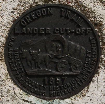
I saw Pronghorn Antelope, Mule Deer, and a very large White Tail Jackrabbit. In the evening Coyotes howled from somewhere to the north. I visited South Pass City, an 1860s gold rush town and now a state historic site. Many original buildings have been restored and house interpretive displays. There are mines and ditches, etcetera, in the areas in and near the town. Plus, I bought chips and soda, and browsed the hiker box. Today's route crossed the Oregon Trail and is coincident with the Seminoe Cutoff of the California Trail for some distance. After many days of cold and rain, I was overjoyed to find warm, dry weather and a nice swimming hole in the Sweetwater River. My skin felt tingly clean for the rest of the afternoon. The sky generally had about 50% white clouds, but trailing off the Wind River Range was a long tail of black cumulonimbus clouds.
Miles: 28 1209
Camp: 4 miles before Upper Mormon Spring
Tuesday, September 10, 2013
There were many Pronghorn, and sometimes they scratched an impression in the soil and defecated and urinated in the scratched area. In other scat news, I saw feral Horses, and the very large piles of scat the stallions make by repeatedly returning to the pile and adding to it. I saw a Horned Lizard and a Garter Snake. The trail in the morning was on the Oregon Trail and the Seminoe Cutoff of the California Trail. There was a long, heavy morning rainstorm, and it was windy, gray, and chilly all day.
Miles: 33 1242
Camp: ½ mile before Haypress Reservoir
Wednesday, September 11, 2013
I saw many Pronghorn and feral Horses. An American Badger was digging up the roots of small Sage bushes. Several small Horned Lizards had been squashed on sand roads. Perhaps they had wiggled under the sand to hide. That might work for predators but with heavy trucks, it might be ineffective. Several Jackrabbits with white tails and black tipped ears let me approach within 5-10 feet before bounding off to great distances.
Miles: 29 1271
Camp: 6 miles after A&M
Reservoir
Thursday, September 12, 2013
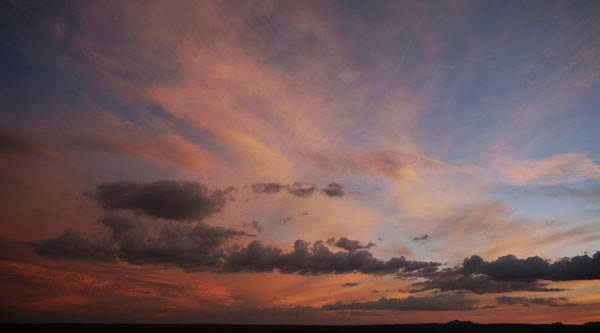
The rain last night was torrential and never stopped. Pools of water were everywhere this morning. Slimy mud made every ascent and descent a slippery experience. Occasionally, globs of clay accumulated under my boots. Rain and stiff, cold winds continued.
Along the way, I invited two Horses, two Antelope, two Jackrabbits, two Coyotes, two Cattle, and two lizards to join me in leaving the desert, but they saw I didn't have an ark and refused.
The last 20 miles of trail into Rawlins closely parallels highways. I decided fighting mud and hypothermia to have nearly a full day of hiking next to a busy highway was stupid. I hitched into Rawlins.
After 10 cold, wet days, my super 12 day food supply plus the supplements from South Pass City were down to 2 sausage sticks, 1¾ pounds of sunflower seeds, and 1 pack of potatoes.
Over the last 3 weeks, it's been raining and raining. Even a day that I remarked on as dry was bracketed by rainy nights. So I was usually wet, often cold, and increasingly stinky. I had thought that reaching Rawlins would be the end of it. But with the ground saturated from weeks of rain, and heavy precipitation over the last couple of days, much of the eastern Rockies in Colorado is experiencing flooding problems. Some communities had almost 12" of rain in 24 hours, where 15" in a year might be normal. Parts of I25 into Denver are closed, and the bus routes to Birmingham are through Denver. So the rain adventure will continue...
Miles: 20 1291
Motel: Rawlins
Friday, September 13, 2013
Last year, there were many semi tame Pronghorn living in Rawlins. Whereas in the wild, they run when I am as far as a mile away, in town I was able to shoot photos from twenty feet. So they were quite tame for Antelope. This year they are gone. In their place Mule Deer are wandering the neighborhoods. I think they are no tamer than in the wild, gauging by how closely I can approach. Perhaps they have moved to town only recently. But why have the Pronghorn left?
I boarded the bus and rode east as far as Cheyenne, Wyoming. All highways south towards Denver were closed at the Colorado-Wyoming state line due to flooding in the Denver/Boulder area. We waited for hours in a hotel lobby as Greyhound decided what to do. Every hotel in Cheyenne was sold out. We reboarded the bus and returned west to stay in a motel in Laramie. But hey, I got a free burger and fries, and a free motel room out of the deal.
Saturday and Sunday, September 14 and 15, 2013
A long bus ride got me to John's / Mother Nature Son's place near Birmingham, Alabama.
North of Denver, all of the rivers were raging with brown water, and all the floodplains were inundated. But the high water lines indicated that the floods had gone down six feet or more in some places.
Boots
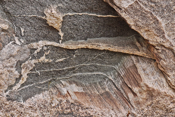
This year on the PCT, one pair of Merrell Low Cut Moab Ventilator lasted me the 1200 mile hike and perhaps had a few hundred more miles left in them. CDT miles are a little tougher, and though they did not fail, a pair of Moabs was completely worn out during this trip. The sole was worn through on the heel of the right boot, the uppers were wearing through in several places, and the shoe laces were starting to wear through. The insoles of both pair of boots needed replacement halfway through, so perhaps they are good for only 600 miles or so.
Trip Highlights and Comments
Glacier National Park
Glacier had some great scenery. Getting there on the train, hitching and resupplying were fairly easy. On the downside, they have a backcountry campsite system which is pretty inconvenient for long distance hikers. And any trail within a few miles of a trailhead was so packed with dayhikers that walking at a normal pace was impossible. The scenery is not all that different from less crowded places. So all in all, Glacier is not among the places I long to visit again and explore more thoroughly.
Bob Marshall and Scapegoat Wildernesses
The Bob Marshal Wilderness Complex also had some great scenery. But much of the CDT route was in areas burnt ~20 years ago, leaving standing dead forests, and burnt again in recent years, leaving blackened what managed to recover from the earlier fires. The area is heavily used by horses, leaving much tread worn a foot below the surrounding ground, and with an inch or more of dust in the tread. It would be great to find some of the less impacted areas of the wilderness complex, but the CDT route itself is not one I would strive to repeat.
Butte Area
The swing east and south around Butte was rarely offensive but never outstanding. Most of it had been clearcut at one time or another, leaving stands of one tree species and one tree diameter. Such monotypical forests don't usually harbor much interesting wildlife. I didn't walk the Anaconda Cutoff, but the only positives I've heard from other hikers are that it's shorter, easier to resupply, and has several bars. So the Butte area is another part of the CDT that I don't plan to revisit.
Anaconda-Pintler Wilderness and West
I felt that the Anaconda-Pintlar Widerness was a true gem. It was full of beautiful streams and lakes in a steep, high, rocky setting. The scenery, camp spots, and probably the fishing were outstanding. It's on my A List. Furthermore, the hike to Darby or Chief Joseph Pass and beyond was very enjoyable.
Leadore to Yellowstone
From Leadore on to the Yellowstone area, the trail passed below the high country of several ranges. I suspect that if I had plenty of time to explore that high country, I would love the spectacular scenery, the Bighorn Sheep and Mountain Goats, and the fossil hunting. But I might need more time than long distance town to town techniques allow to properly explore the high country. I would need to do more research, but this might be a trip to do with a car.
Yellowstone National Park
Yellowstone is certainly worth visiting. The issue is that it's hard to get reasonable permits. So maybe if I arrived after Labor Day, the permits would be easier to get. Or if I had a car, I could get permits a day in advance, and go hike in the surrounding national forest lands in the meantime. Certainly, I want to thoroughly hike Yellowstone, the question is how to do it.
Wind River Range
This is another A List spot. Great lakes, streams, scenery, geology, and etcetera abound, and the range didn't seem crowded. Presumably, I would be off the Highline and Fremont Trails, and so the crowds would be even less.
Great Basin
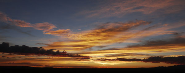
I think I would have enjoyed the Basin segment more if it had been dry at least half the time. I like deserts and the hardy plants and creatures who live there. Geology and history don't get buried in bushes, so you can walk out and look and wonder at them. Maybe with a car I would like to go to various spots and take 2 or 3 day hikes.
| Resupply Towns | |
|---|---|
| Mile | Town |
| 0 | Waterton |
| 105 | East Glacier |
| 279 | Rogers Pass / Lincoln |
| 346 | MacDonald Pass / Elliston |
| 391 | Champion Pass / Anaconda |
| 437 | Homestake Pass / Butte |
| 497 | Highway 274 Anaconda Tough Hitch |
| 591 | Chief Joseph Pass 43 |
| 713 | Bannock Pass / Leadore |
| 901 | Mack's Inn |
| 948 | Yellowstone |
| 1253 | Sweetwater Station |
| 1310 | Muddy Gap |
| 1397 | Rawlins |
|
Large Store Small Store or Restaurant |
|
| Resupply Towns | |