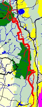
| Bureau of Land Management |
| Department of Defense |
| Forest Service |
| Fish and Wildlife Service |
| National Park Service |
|
|
Pre Hike Thoughts
I'll walk from Kennedy Meadows to Mono Lake. From my 2003 PCT hike, I remember this as the most spectacular part of the Sierras. I'll follow a route often off of the Pacific Crest Trail, including following the Kern River Canyon in the south, then the Steve Roper Sierra High Route. I'll resupply in Mammoth around the 13th of June. I'll leave the Sierra High Route at Steelhead Lake and hike down Lundy Canyon to Mono Lake, and walk a few miles on its western shore about the 18th of June.
After years of hiking long distance trails with guidebook maps that cover only a thin strip along the trail, and are often close to illegible, I've found a better alternative for this trip. The Inyo National Forest publishes an atlas of all the 7½' topographic maps of the NF. For the Sierra High Route, it contains all but the northern two and southern two maps. The northern two maps (Buckeye Ridge and Matterhorn Peak) cover the trail along Horse Creek to Twin Lakes, so navigation would not require a detailed topo map, and I'll leave the SHR before that anyway. The southern two (Marion Peak and The Sphinx) concern the climb up from the Kings Canyon Trailhead, and I won't need these since I'll be joining the trail from the PCT rather than starting at that trailhead. I'll follow various forks of the Kern River north from Kennedy Meadows, and one map is missing for this approach, Mount Kaweah. But the route shown on this map is a straight walk up a trail along the Kern River, so again, navigation will not require a detailed topo map. I'll also have maps in my iPod, and in my GPS, so there's plenty of maps and redundancy. I will really enjoy having legible topo maps covering a corridor stretching miles to either side of the route, and being able to study what I see in the distance.
Friday, June 1st, 2012
10 Day Mammoth Lakes Weather: No Precipitation, actual weather 95% clear
Route: US395 (Bus, $25), Kennedy Meadows Road (Hitch), PCT
Trail Condition: PCT: excellent, half dozen blowdowns, no difficulties.
Miles: 11
Camp: Junction PCT Haiwee Trail 37E01, T20S R35E Section 36
The bus dropped me at US395 and Kennedy Meadows Road. I walked up a bit and met a couple.
Me: Are you two PCT hikers? May I hitch with you?
Them, Dejected, Sarcastic: Go ahead, we've been trying for over 24 hours!
Me: No traffic?
Nobody stops!
Just then a car pulled off 395...
Me, half joking: Stick out your thumb, that's your ride!
The car pulled over...
Holy Moley - You're our good luck charm!
That's the second fastest hitch I've ever gotten!

There were probably 50 PCT thruhikers hanging around the Kennedy Meadows Store. It was fun to talk with them a bit. It will be fun to meet them again when my route coincides with the PCT. Many had heard of the Roper Sierra High Route and wanted to hear about my plans. Some liked my topo map idea and photographed some off PCT routes they planned to scramble. I had ice cream, soda, chips, and a burger, so I walked out as tanked up as I would at the best of town stops.

The PCT was nice. There were a few prickly pear and many pine trees in an otherwise chaparral ecosystem. Many lizards darted away at my passing. The water was excellent. There were several dead stands from old burns. A wildfire was upwind somewhere. Coyotes Canis latrans howled in the evening. Night brought a nearly full moon.

Saturday, June 2nd, 2012
I saw a half dozen Mule Deer Odocoileus hemionus, a Black Bear Ursus americanus sow and cub, and heard a Red Tailed Hawk Buteo jamaicensis calling for a while. The old buildings at Brown Cow Camp were fun to poke around. Some old gear was laying about. Afternoon winds again brought wildfire smoke. Yesterday and today have been so hot that the glue that held the Vibram sole onto my Raichle leather mountaineering boots melted and failed. I feel the boots will fail completely before I get to Mammoth. So I think I need to go over Trail Pass to Lone Pine and either return to Mammoth, where I have more boots, or buy more in Lone Pine. What a shame. I brought these because they have never failed me in the most extreme hiking environments. I can't explain this incident. I'll start the walk out in the morning.
Weather: Clear
Route: PCT, 35E10
Trail Condition: PCT: excellent, 35E10: some blowdowns, brush, and hard to follow areas. Pretty good after Hessian Meadow
Miles: 20 31
Camp: Strawberry Creek, T19S R35E Section 5
 Snow Plant
Sarcodes sanguinea
Snow Plant
Sarcodes sanguinea
These bright red plants are quite a contrast to the dark greens and browns of the shady forest areas where they grow and bloom in spring. They are native to the Pacific Coast States, and their growing season is limited to a short while in the spring, during or just after the melting of the snow. They tap into mycorrhizal fungi which in turn have a mutually beneficial relationship with tree roots, usually pines. The fungus provides water, nutrients, and pathogen protection to the tree roots, and in turn receives fixed carbon from the tree. The snow plant parasitizes this system, taking sugars photosynthesized by the tree. The snow plant cannot photosynthesize its own sugars, as it has no chlorophyl or other photosynthetic pigments. What we see above the forest floor is the inflorescence, usually all bright red, including flowers and bracts, which are similar to leaves and have hairy edges. |
Sunday, June 3rd, 2012
I walked over Trail Pass and hitched to Lone Pine for new boots. Along the way I saw a black bear and a hawk being harassed away by a small bird. I bought boots, had dinner, hitched back to the trailhead, and got in some walking. It was quite a long day.
Weather: Clear
Route: 35E10, 35E06/Mulkey Meadow, 35E04/Trail Pass
Trail Condition: Before Mulkey Meadow: some blowdowns, brush, and hard to follow areas. Pretty good in and after Mulkey Meadow
Miles: 17 48

Monday, June 4th, 2012
I took the PCT north to the Wallace Creek Trail, and down that to the Kern River. Both gorges were deep and impressive, with nice whitewater. I found a mule deer skull with horns attached. This means the buck died in the rut season.
Weather: Evening light intermittent rain
Miles: 18 66
Trail Condition: Good
Camp: Junction of Wallace Creek Trail and Kern River Trail

Tuesday, June 5th, 2012
I ascended the Kern River to its source, Lake South America. I saw a bald eagle Haliaeetus leucocephalus and a lizard. In the outlet of Lake South America were perhaps 10 14 inch trout, but they were too wary of me to allow close study or photography. There were several nice waterfalls and lots of interesting ice. It was cold enough last night to freeze pond surfaces and cause frost heave in mud. From Lake South America, I proceeded north to Harrison Pass, but found it too risky, so proceeded a few miles south, east, then, gaining the PCT, north.
Weather: Clear, Cold
Miles: 17 83
Camp: South of Forester Pass
Trail Condition: Kern River Trail: good until river mile 159, indistinct to Harrison Pass, Harrison Pass: A snowfield covers the switchbacks at the top of the north side of the pass. It has alternate icy and weak layers and kicking steps or cutting steps with an adze does not result in satisfactory strong steps. I felt the runout was unacceptably steep and rocky. The rock wall was rotten and covered with dirt and rock debris, so climbing around the snowfield on rock wouldn't work. There were no other boot prints approaching the south side of the pass. I decided to go back and use Forester Pass. The afternoon sun was shining on all of the Harrison Pass snowfield, so it may melt out in a week or two. PCT: excellent


Wednesday, June 6th, 2012
A trail crew was hiking south to Forester Pass: Thanks for the great trails! I saw two Mule Deer Bucks at separate locations, then 7 does at Arrowhead Lake, where there were also Yellow-Bellied Marmots Marmota flaviventris. I had quite a bit of nausea and acid stomach from altitude from Glen Pass onward, but camping and resting helped. On my 2003 PCT thru hike, I was in this area on the 25th of June, and there were more and bigger snowfields than there are now.
Weather: Clear
Miles: 21 104
Camp: Dollar Lake
Trail Condition: PCT: excellent, Forester Pass: on the south side, no snow patches present any difficulty. Even the permanent patch at the top has receded so hikers can walk past on the soil trail surface. On the north side are many snow patches, but none present any serious risk or difficulty. Glen Pass: on the south side, no snow patch presents any difficulty. On the north side, the uppermost patch was well consolidated and easy to walk on. All lower patches were weak, perhaps from afternoon sun, and plunge stepping produced more postholes than successful steps. The sun illuminated all on route snow patches at both Forester and Glen Passes, so fields should shrink rapidly.

Thursday, June 7th, 2012
I saw two mule deer and a few marmots. From my 2003 PCT thruhike, I remembered just bits of the trail and scenery, mostly the passes. The area I walked this afternoon and in the coming days is near much of my personal hiking history. To the east are Brown, Green, and Thunder and Lightning Lakes. When I was a kid I learned to backpack making many trips up that chain. Pete and I used to hike into the Palisade Glacier area, also to the east. Jim and I once walked up the South Fork Kings River, continuing north on the PCT, going cross country through the pass 1/4 mile south of Venacher Needle, and looping back to the start. We also once walked over Bishop Pass, north along the PCT, and out over Piute Pass.
Weather: Clear
Miles: 27 131
Camp: Above Upper Palisade Lake
Trail Condition: PCT: excellent, a few blowdowns. Neither Pinchot nor Mather passes had any risky or difficult snow patches.

Friday, June 8th, 2012
The off trail section of the Sierra High Route was great. There was excellent scenery, and neither the rock climbing nor the snow work were difficult. I never took my ice axe off my pack. I saw several doe mule deer after reaching the Bishop Pass Trail and the PCT.
Weather: Clear
Miles: 18 149
Camp: Big Pete Meadow
Route: PCT to Lower Palisade Lake Outlet, Unnamed Pass to Headwaters of Galcier Creek, Potluck Pass, Barrett Lakes, Knapsack Pass, Dusy Basin, Bishop Pass Trail, PCT
Trail Condition: PCT: excellent, a few big blowdowns in La Conte Canyon. Bishop Pass Trail: other hikers reported steep snow over trail higher than my route, passable by kicking steps, otherwise good.


Saturday, June 9th, 2012
There were many frogs in Wanda Lake. Considering my altitude issues, I decided to stay on the PCT after Evolution Lake. The SHR there stays well over 11,000 feet for what might have taken a couple of days, and considering my experiences on this trip, I would have felt pretty sick. I walked for a while and camped with Jesus, a PCT thruhiker and former AT and CDT thruhiker. Talking with him was fun. I saw a few deer.
Weather: Clear
Miles: 23 172
Camp: Aspen Grove, San Joaquin River
Trail Condition: PCT: excellent, a few blowdowns. Muir Pass: Well consolidated snow, no postholing.
 Sierra Nevada Frog Population Reduction
Frogs populations in the Sierra Nevada have significantly decreased over the last few decades. Some possible causes include predators, diseases, higher water acidity, pesticides, and increased ultraviolet B radiation. Trout have been introduced to most high lakes in the Sierras. Before introduction, no fish were present in 99% of lakes over 7000' due to impassible waterfalls, etcetera. Trout eat the same insects that frogs do, severely reducing food available to frogs, and also eat small frogs. An aquatic fungal pathogen, Batrachochytrium dendrobatidis, (Chytridiomycosis, Chytrid) is also a major challenge to Sierra frogs. The fungus causes thickening of the skin, to as much as 40X normal, disrupting the balances of electrolytes. Potassium and sodium levels can become sufficiently depleted to cause cardiac arrest and death. Frog populations also suffer in dry years, when some of the water bodies in which tadpoles are developing dry up, killing off a substantial portion of the population. Some changes have been noted in water PH and harmful pesticides and products of pesticide breakdown have been found. Frogs have permeable skin to absorb oxygen from water, and so too absorb chemicals from water. Dust from the San Joaquin Valley blows into the Sierras and is a source of pesticides, herbicides, and fertilizers. Sierra frogs are a major food source for Western Terrestrial Garter Snakes Thamnophis elegans, and their numbers too have declined. |
Sunday, June 10th, 2012
I saw a lizard, and a few deer, marmots, and trout. There were some mosquitoes. I left the PCT to ascend Hilgard Branch on 29E08 towards Lake Italy. Tomorrow I'll resume the SHR there.
Weather: Clear
Miles: 17 189
Camp: Hilgard Branch
Trail Condition: PCT: excellent, a few blowdowns. Selden Pass: no difficult snow. 29E08: Little used and often indistinct, many blowdowns, only one other set of bootprints since winter

Monday, June 11th, 2012
I sprained my left hand after stepping on a rock that shifted and losing balance. There were fresh small cougar tracks in the snow above my camp, and a garter snake slithered away on my ascent of Laurel Creek. The route was interesting and technically easy. Gabbot Pass had snowfields continuing 3/4 miles north. The trails were little used, often indistinct, with blowdowns and overgrowth - and quite steep. Mono Creek was too deep and swift to ford, but I bushwhacked to some nearby downed logs and crossed on them. Beyond Lake Italy, except for the Mono Creek Trail, there were no other boot prints from this year.
Weather: Clear
Miles: 18 207
Route: Lake Italy, Gabbott Pass, Mills Creek Trail 29E22, Mono Creek Trail 29E01, Laurel Creek Trail 29E21
Trail Condition: All Trails in Poor Condition, Many Blowdowns
Camp: Rosy Finch Lake

Tuesday, June 12th, 2012
Weather: Clear
Miles: 15 222
Route: Tully Lake, Fish Creek Trail, PCT, Duck Lake Trail
Trail Condition: Many Blowdowns on Fish Creek Trail and PCT
Camp: Duck Lake

Wednesday, June 13th, 2012
Weather: Clear
Miles: 5 227
Route: Duck Lake Trail
Trail Condition: some Blowdowns
Camp: Mammoth Lakes

Thursday, June 14th, 2012
Many mosquitoes, some interesting animal tracks in snow.
Weather: Clear
Miles: 15 242
Route: Mammoth Pass Trail, Postpile, Soda Spring, 25E03, 27E17, Superior Lake, Minaret Lake, Cecile Lake
Trail Condition: Blowdowns cleared on Mammoth Pass Trail and past Devils Postpile to Soda Springs - Many Thanks! After that, many blowdowns due to big winter storm this year.
Camp: Cecile Lake

Friday, June 15th, 2012
I walked to the north end of Cecile Lake and looked down on Iceberg Lake. Mostly iced over, it had steep, icy snowbanks running right into the lake on all sides. No way was I going down there. I went back, then down Minaret Creek Trail 26E21, then north along the John Muir Trail 25E03 as far as Shadow Lake. The mosquitoes were atrocious. There was not a moment of peace. Looking at the map, I decided the rest of my hike was meadow-ish, and would therefore be loaded with mosquitoes. I decided to call the hike and head back to Mammoth. I headed east on trail 26E14, following it, 26E15, the PCT, and the Reds Meadow Road south, planning to cross Mammoth Pass. But Eric and Bill offered me a ride and turned out to be working on a Pacific Crest Trail Association Trail Crew. So I volunteered for a day or two and had elk spaghetti for dinner.
Weather: Afternoon grey clouds, thunder, and a tiny bit of drizzle.
Miles: 24 266
Trail Condition: Many Blowdowns on Minaret and John Muir Trails, trails thereafter cleared.
Camp: Reds Meadow

Saturday, June 16th, 2012
We worked south from Reds Meadow to Deer Creek. This section had already been cleared of blowdowns, and we primarily worked problems associated with tree rootballs. For example, if a tree had been uprooted by the wind, and had ripped the trailbed right out of the ground, we might have to cut up the ball of roots and refill the giant hole left behind, or if a big ball of roots were lying atop the trail, we might have to winch / drag them out of the way. There was a lot of work with shovels, axes, saws, pry bars, and grip hoists. I found a trash stash including a new bear canister.
Weather: Afternoon clouds
Miles: 12 278
Trail Condition: Clear, and better by the time we left.
Camp: Reds Meadow

Sunday, June 17th, 2012
Bill and I rode north and west from Agnew Meadows surveying trail conditions and clearing Blowdowns to Ediza Lake. We left a couple of messy blowdowns in place between Shadow and Ediza Lakes after my sprained left hand and old right shoulder injury wouldn't let me pull the crosscut saw any longer. I was a full day anyway.
Weather: Afternoon clouds
Miles: 16 294
Camp: Reds Meadow

Monday, June 18th, 2012
We cleared the driveway to the government pasture near Reds Meadow, packed up and headed home.
Miles: 1 295
Kern River and Sierra High Route Planning Table |
||
| Trail Name |
Miles | Comments |
|---|---|---|
| Kennedy Meadows Store To Lake Mary: 188 Miles 7½' Map: Craig Peak 115 |
||
| Pacific Crest Trail | 16 | South Fork Kern River, Crag Creek |
| Cow Canyon To Lake Mary: 172 Miles 7½' Map: Monache Mountain 112 |
||
| Hessian Meadow 35E10 34E12 | 16 | South Fork Kern River |
| Tunnel Meadows FS Station To Lake Mary: 156 Miles 7½' Map: Kern Peak 107 |
||
| 34E10 | 8 | Golden Trout Creek, Columnar Basalt near Volcano Falls |
| Soda Spring To Lake Mary: 148 Miles 7½' Map: Kern Lake 106 |
||
| Kern River | 26 | Sequoia Trees near BM6397, Bristle Cone Pines Kern River Mile 159-160, Follow Cairns near Lake South America |
| Lake South America To Lake Mary: 122 Miles 7½' Map: Mount Brewer 95 |
||
| Trail | 9 | Trail over Harrison Pass and along East Lake |
| Junction Meadow To Lake Mary: 113 Miles 7½' Map: Mount Clarence King 90 |
||
| Bubbs Creek Trail | 2 | |
| Join PCT in Vidette Meadow To Lake Mary: 111 Miles 7½' Map: Mount Clarence King 90 |
||
| Pacific Crest Trail | 32 | Glen Pass, Rae Lakes, Woods Creek, Pinchot Pass, South Fork Kings River, Mather Pass, join Sierra High Route |
| Leave PCT/John Muir Trail northwest of Palisade Lakes To Lake Mary: 79 Miles 7½' Map: Split Mountain 80 |
||
| Cross Country Dusy Basin | 11 | Potluck Pass, Lake 11603, Bishop Pass Trail |
| Join PCT/JMT at Le Conte Ranger Station To Lake Mary: 68 Miles 7½' Map: North Palisade 79 |
||
| PCT/John Muir Trail | 13 | Muir Pass, Evolution Lake |
| Leave PCT/JMT at Darwin Bench To Lake Mary: 55 Miles 7½' Map: Mount Darwin 71 |
||
| Cross Country John Muir Wilderness | 42 | Goethe Lake, Desolation Lake, Lake Italy, Mills Creek, Laurel Creek, Fish Creek |
| Join PCT/JMT at Tully Hole To Lake Mary: 13 Miles 7½' Map: Bloody Mountain 46 |
||
| PCT/JMT | 6 | Lake Virginia, Purple Lake |
| Leave PCT/JMT at Duck Lake To Lake Mary: 7 Miles 7½' Map: Bloody Mountain 46 |
||
| Cross Country John Muir Wilderness | 7 | Duck Lake Mammoth Creek |
| Lake Mary, Mammoth Resupply 7½' Map: Crystal Crag 45 |
||
| Mammoth Pass | 5 | Duck Lake Mammoth Creek |
| Devils Postpile From Lake Mary: 5 Miles 7½' Map: Crystal Crag 45 |
||
| PCT | 5 | Devils Postpile |
| Minaret Falls From Lake Mary: 10 Miles 7½' Map: Mammoth Mountain 34 |
||
| 27E17, Cross Country, Trails | 44 | Ritter Range, Lewis Creek, Rafferty Creek |
| Join PCT Tuolumne Meadows From Lake Mary: 54 Miles 7½' Map: Vogelsang Peak 21 |
||
| PCT | 1 | |
| Leave PCT Tuolumne Meadows From Lake Mary: 55 Miles 7½' Map: Tioga Pass 11 |
||
| Cross Country, Trails | 15 | Gaylor Lakes, Fantail Lake |
| Leave SHR, Steelhead Lake From Lake Mary: 60 Miles |
||
| Lundy Canyon (24E01, 2N01, 3044, 4WD Roads) | 14 | Lake Helen, Lundy Lake |
| Mono Lake, Danburg Beach From Lake Mary: 74 Miles |
||
| Beach | 5 | Mono Lake Western Shore |
| Lee Vining From Lake Mary: 79 Miles |
||
| Trail Name |
Miles | Comments |
The Gear I Used |
||
| Things I Wore | Comments | |
|---|---|---|
| Short Pants | ||
| Short Sleeved T-Shirt | ||
| Long Sleeved Shirt | ||
| Sun Hat | ||
| Raichle Leather Boots | For kicking steps and postholing Failed, replaced in Lone Pine | |
| Wool Ankle Socks | ||
| Underwear | ||
| Panasonic G1 Micro 4/3 Camera | 45-200 Lens, 14-45 Lens, assorted filters, bag, etcetera | |
| Wallet | ||
| Notebook and Pen | ||
| Garmin 450T GPS | SHT Track Loaded, Has Topo Map | |
| iPod Touch | For writing this journal | |
| Things in My Pack | Comments | |
| 7½' Map Book | ||
| Flashlight | 1 AA Cell Aluminum LED | |
| Key | ||
| Aspirin, Tylenol, Vitamins | ||
| Lip Wax | ||
| Sunscreen | ||
| Glacier Glasses | ||
| 2 Pair Reading Glasses | ||
| Wilderness Permit | ||
| Compass | ||
| Cigarette Lighter | ||
| Eating Gear | ||
| Spoon | ||
| Water Bottle | ||
| Steripen | UV Water Sterilizer | |
| Potable Aqua | Backup Chemical Water Sterilizer | |
| Bear Barrel | ||
| Hygiene | ||
| Toilet Paper | ||
| Toothbrush, Paste, and Floss | ||
| Sleeping Gear | ||
| Silnylon Tarp and Groundsheet | ||
| Sleeping Bag | ||
| Foam Pad | ||
| Backpack | ||
| Trigon Deva | ||
| Plastic garbage bag | To keep gear dry | |
| Ice Axe | ||
| Clothing | ||
| Wool Socks | ||
| Rain Jacket | ||
| Rain Pants | ||
| Heavy Gaiters | Postholing | |
| Fleece Shirt | ||
| Fleece Pants | ||
| Fleece Balaclava | ||
| Spare Batteries and chargers not required due to short trip duration. | ||